

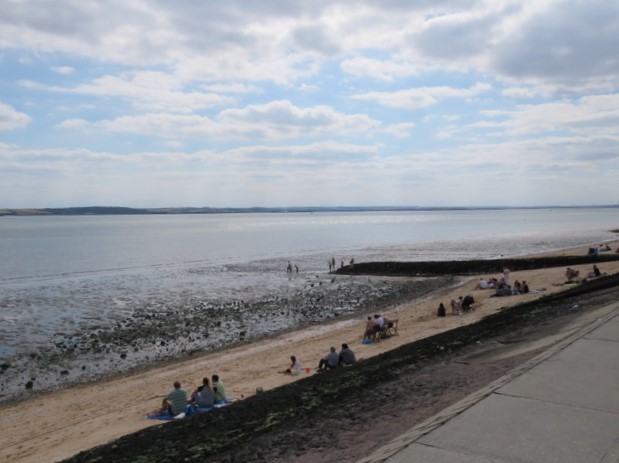
Mudflats at low tide, Leigh-on-Sea
And so we come to the last of these blogs on the River Thames’ journey: from a hole in the ground in Gloucestershire to where it meets the North Sea. The journey was immensely enjoyable to walk – many times in the London sections – and fun to write about, although I have taken my time over it. Part one was posted in May 2020!
This one’s a little different to the others: not so much a walk along a particular stretch as a few visits. First, it’s Dartford and Gravesend – Dartford for the bridge, Gravesend as it was nearby and historically interesting. Next it’s Canvey Island, based on a trip in April 2016, the primary motivation to pay homage to the great rock’n’roll band Dr Feelgood. And finally Leigh-on-Sea and Southend-on Sea. It’s here where the Thames becomes the North Sea – and I’d never been to Southend before and was curious to see what it was really like.
So let’s get going with a trip to the North Kent coast…
Dartford to Gravesend
From Erith you can see the Queen Elizabeth II Bridge in distant outline. I was keen to take a closer look, which was why I took the train to Dartford in March this year with my friend Dave. I’m not quite sure why he agreed to come, given that the bonus element was Gravesend, but he did! Maybe it was the promise of a Hawksmoor steak in Borough back in London afterwards that did it. Anyway, we met at Waterloo East station and made the trip to Dartford station. Only takes 45 minutes.
We weren’t exploring the town today, as the aim was to get down to the Thames and along to the bridge. The bit we did see was indentikit modern English town. But Dartford does have an interesting history, not least the fact that its name comes from when the Romans were building a road from Dover to London – Watling Street – and needed to build a bridge over the River Darent. It’s only 18 miles from London, and was an important stop for travellers to Canterbury and the Continent in medieval times. It may also have been a place of rebellion. It lays claim to being the home of the Peasants’ Revolt leader Wat Tyler in the 14th Century.
It is a bit of a trek down to the Thames – we took nearly 45 minutes, walking through industrial estates alongside the Darent and then down a road through the reclaimed marshes. The Dartford Badlands, I thought. Various settlements here and there – a caravan site, a clay pigeon shooting range, a model aircraft airfield; but mostly bleakness. With a certain beauty, but you could imagine some gangland scores being settled out here.

Dartford Public Slipway
The Darent


First glimpse of the bridge
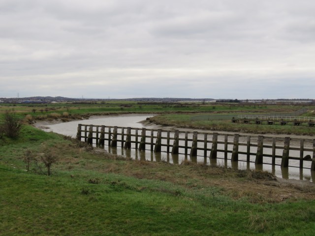
Anyway, we made it to the Thames without incident and went over to look at the Dartford Creek Flood Barrier. It opened in November 1982 and is designed to modulate the tidal flow from the Thames during particularly high tides. It protects Dartford from flooding, as well as nearby Crayford, which lies on a tributary of the Darent, the River Cray. There is a path over it, but it is not accessible to the public. In fact there is no crossing over the Darent before Dartford itself. This means that anyone walking along the coastal path has to walk into Dartford and out again, adding over an hour to their journey. I imagine this will change in the future, especially that there is a newly designated coastal path stretching from Woolwich in London to the Isle of Grain in North Kent.

Mouth of the Darent

Dartford Creek Flood Barrier
The Darent nearing the Thames
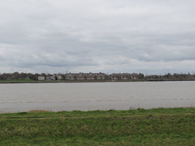
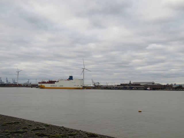
From the mouth of the Darent it takes about half an hour to reach the bridge. On the opposite side is Purfleet and then Thurrock. The shore is lined with docks and visiting ships.
Think this is the Royal Hotel, Purfleet


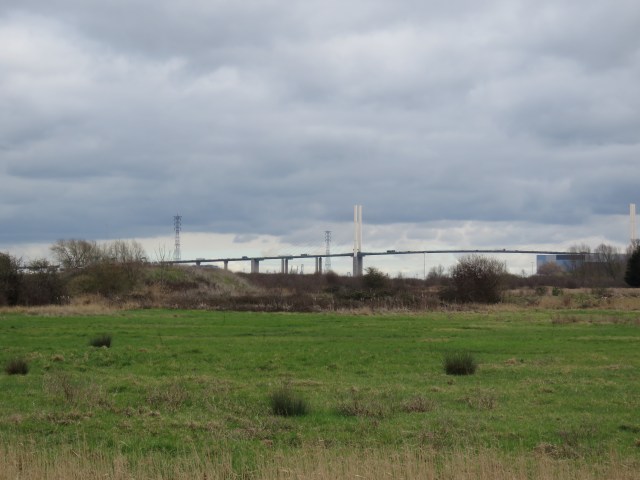
The bridge is part of the Dartford Crossing – there are also two tunnels. Except when there are high winds and the bridge is closed, the bridge is used for southbound traffic and the tunnels for northbound. The west tunnel opened in 1963, the east tunnel in 1980. The bridge began construction in 1988 and opened in 1991. The crossing connects the north and south sides of the London Orbital, the M25, via the A282. It is the only road crossing of the Thames east of Greater London and is heavily congested, even though it is a toll road. The bridge is a stunning piece of architecture. It’s a suspension bridge and was designed by a German civil engineer called Hellmut Homborg.


From the bridge we walked along the river to Greenhithe, which had a pleasant riverside street. We stopped at a pub called the Pier Hotel for a beer then decided the 6-7 miles we had already walked was enough and we caught a train to Gravesend.
Some views on the way to Greenhithe.


A kestrel hovers above its prey

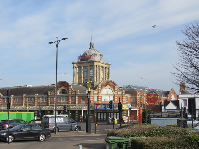
My overall impression of Gravesend was that it was a bit neglected, down-at-heel. For example there was a long Georgian terrace leading from the river to the clock tower – itself an impressive sight – where a lot of the buildings seemed to be covered with dust. Quite a few looked disused. That said, there was plenty of interest to see in the town.

Gravesend Clock Tower, modelled on Big Ben
Given its position on the Thames, Gravesend has a long history as a maritime and military centre, and the Port of London Authority still has its headquarters there. Back in 1380, during the Hundred Years War, it was sacked and burned by the Castilian Fleet. It was later heavily fortified, and the remains of various forts can be seen in Fort Gardens, down by the river. There is also a range of cannon and anti-aircraft guns, the latter dating from the Second World War. The oldest building in Gravesend, Milton Chantry, is also in Fort Gardens. It was built in the 14th century as a chantry chapel, where people prayed for the souls of the dead. It was connected to a hospital for lepers and housed a number of priests – until Henry VIII took it into Crown hands. Later it became a private residence and then a tavern, before being built into the military fortifications. After the Second World War it was converted into a local history museum.


Milton Chantry
There are a couple of short but elegant piers on the river and a ferry that runs between Gravesend and Tilbury, another significant docks in the modern age.

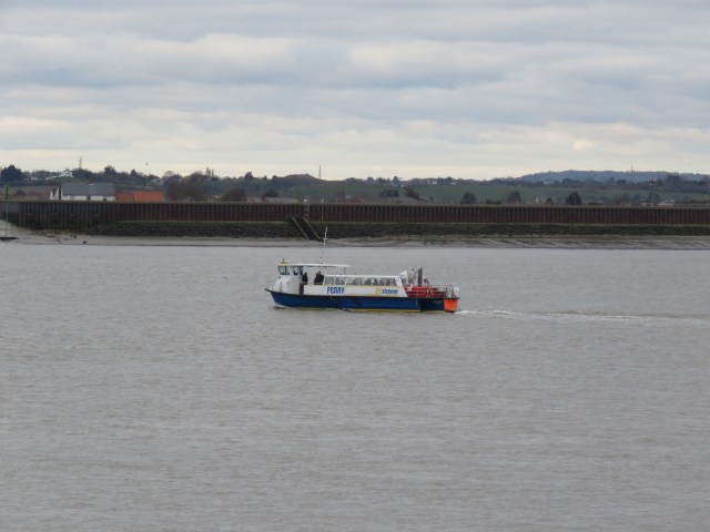
Heading for Tilbury
Tilbury Docks
One of Gravesend’s oddest historical connections is that the renowned native American Pocahontas died there. Born in 1596, she was the daughter of a prominent chief, Powhatan, in what is now Virginia. She was captured and held for ransom by English colonists in 1613. She was encouraged to convert to Christianity and was baptised as Rebecca. She married a tobacco planter John Rolfe in 1614 and had a son, Thomas, in 1615. The Rolfes travelled to London in 1616 and she became a celebrity in English society. They set sail for Virginia in 1617 and stopped in Gravesend, where she died of unknown causes. She is buried in the grounds of St George’s church, in the centre of the town, although the exact location of the grave is not known today. There is a monument to her in the church grounds.
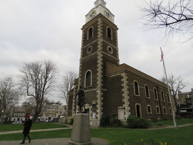
St George’s church – Pocahontas and Dave in foreground!

Canvey Island
Canvey Island is in Essex, a few miles west of Leigh-on-Sea. It’s barely an island, separated from the mainland by often narrow creeks. The nearest station is Benfleet; trains run from Liverpool Street. My sole visit, with Kath, Jon and Maggie, was in August 2016. We walked a full circuit of the island, which was around 16 miles. Travelling clockwise, the walk down to the beach and entertainments on the south coast was interesting; the latter half, often ploughing through narrow tracks between bushes, was quite arduous, especially in the August heat.
Looking over to Leigh-on-Sea


There is evidence that the Romans occupied Canvey Island, notably some remnants of salt mines and fragments of pottery and glassware which suggest that there may have been port facilities of some kind. From the Saxons onwards the main use of the land was in farming, and in particular sheep. The island has always been prone to flooding from the North Sea tides and in the 17th century Dutch engineers were brought in to construct sea defences. Some of them settled on the island, which explains why some of the street names are Dutch.
From the Victorian era onwards, Canvey became popular as a holiday resort and became more developed. A casino was built in the 1930s and other entertainments thereafter. The Labworth beach café has had its up and downs, but has been restored and is a splendid example of art deco architecture. The holiday industry suffered from competition from cheap package holidays from the 80s onwards, but there are still ranks of mobile homes juxtaposed with gas and petrochemical storage facilities!
Labworth Beach

The cafe

Holiday destination!
The island’s first oil terminal opened in 1937, and gas terminals for LNG opened in 1959. Various plans to build an oil refinery on the island in the 60s and 70s all came to nothing; but a very long pier was built for the purpose. It was never needed and sits there as a rather magnificent white elephant.


That white elephant
In February 1953, huge floods overwhelmed the sea defences and 58 people died, including many in holiday homes. 13,000 people were evacuated. More robust sea walls were constructed around most of the island after that. They are very evident as you walk around.

A few views from the second half of the walk.


As I mentioned at the beginning of the blog, Jon and I were keen to visit to pay homage to Dr Feelgood, who were from Canvey island, and see the place where they took the photos for the cover of their classic album Down by the Jetty, released in 1975. That album revolutionised my and my metal-loving friends’ musical taste – and the way we wanted to look. Short sharp songs, scruffy jackets and thin ties became the order of the day. That set us up for the advent of punk a year later. The Feelgoods truly were pioneers, guitarist Wilko the master of the staccato riff. We’re not quite sure we managed to locate the exact location of those iconic photos, but we did have our picture taken in front of a mural on the sea wall down by the beach.
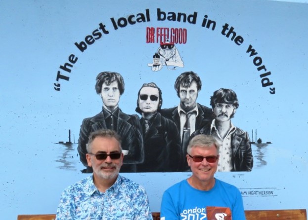
Jon left, John right
Leigh-on-Sea to Southend-on-Sea
Dave, Jon, Tony and I took a train from Fenchurch Street to Leigh-on-Sea one morning in February this year. We managed to pick a gorgeous sunny day, which made a real difference to the trip. I don’t think any of us had actually caught a train from Fenchurch Street before, so that was quite exciting in a nerdy sort of way.

I felt a tinge of nostalgia as we passed through Laindon and Basildon stations: my Gran used to live in Laindon for many years after she was moved out of Willesden in north-west London. I used to spend time there in the school summer holidays as a teenager. She lived on a featureless housing estate with very few amenities, but I managed to amuse myself. Indeed, I did my Business Studies A Level project in Basildon M&S. The lunches were great! It’s solid West Ham territory too, the Essex hinterland, which gives me a strange affinity for the place.
I wanted to visit Southend for a sense of completion to this Thames journey, it being where the river ends and becomes the sea. And I’d never been before. As with Canvey Island, I associated it with a crucial band in my musical development, Eddie and the Hot Rods. The Rods were contemporaries of the Feelgoods’ and also played rock’n’roll, but even faster! I played one of their songs, a cover of Bob Seger’s Get Out of Denver, before every A Level exam I took in the summer of 1977. It was on an EP called Live at the Marquee which remains one of my most treasured records.
Southend’s history seems fairly obscure before it developed as a seaside resort in the 19th century, with the coming of the railways. Like so many resorts it thrived until people started going abroad more on cheap packages. It developed its service industry and was headquarters for the Access credit card company. Tourism kept going – it’s convenient for a day trip out of east London and is a commuter town. The Fenchurch Street Line was known for some time as the Misery Line, but you don’t hear that so much these days.
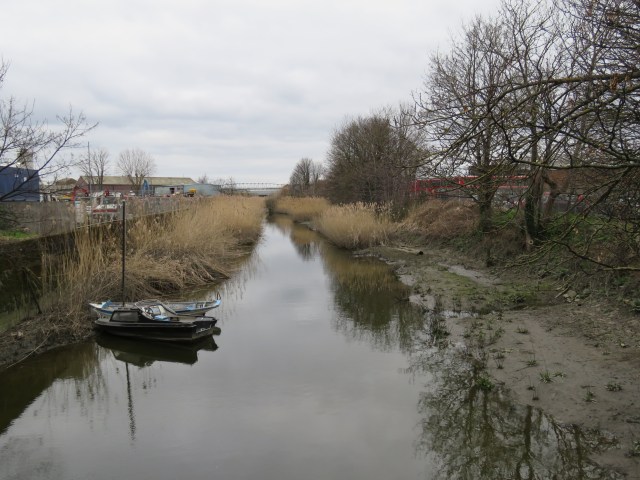
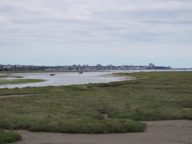
We got off at Leigh and headed down to the estuary. The tide was out, to reveal glistening mudflats in the sun, dotted with stranded boats, silhouetted when you looked in the direction of the sun. On the shore below us were rows of cockle sheds – they are farmed round here. I think oysters are too – they were certainly prominent in the restaurants and bars which lined the cobbled seafront street. Very tempting to stop for a snack, but we had a lunchtime booking in Southend. Leigh used to be a fishing port, and it looked as if there is still some activity, but the port silted up a long time ago. It has reinvented itself as a resort and culinary centre.

Cockle sheds


The walk into central Southend covered around three miles, and ran alongside the railway. On the other side of the railway there were some smart and interesting houses, some quite modern in design (photo). We passed areas called Westcliff and Clifftown, where it looks like there is a lot of money. We speculated that it might be a combination of retirees and wealthy traders and bankers working in the City of London – a fair number of them hail from Essex. I guess we all expected Southend to look a little run down, another faded seaside town. But not at all, at least by the seafront. It looked like there had been a lot of recent development.


Just before Westcliff, at Chalkwell, there is an obelisk-like pillar out to sea. Clearly visible at low tide of course. Known as the Crowstone, until 1857 it marked the seaward limit of the jurisdiction of the City of London over the Thames. The jurisdiction now lies with the Port of London Authority, though its remit extends considerably further into the North Sea. Meanwhile, I will happily take the Crowstone as the point where the Thames meets the North Sea.


The place was buzzing as we neared the famous Southend pier, the longest in the world. It was half term week and the amusement park was in full flow.


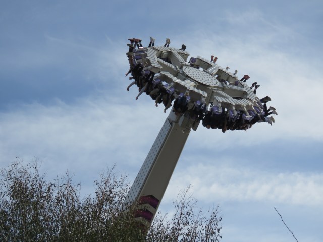
Some people think this is fun!
We didn’t have time to go along the pier, as we were heading along the Eastern Esplanade to a restaurant on the beach called Billy Hundred’s Fish’n’Tapas. Just past the pier we passed the Kursaal, which is now closed. It was one of the earliest amusement parks, built in the early 20th century. I remember it as a rock venue in the 70s and 80s. Indeed there was a pub rock band called the Kursaal Flyers. It functioned more recently as a bowling alley and casino. They ceased operations in 2019-20. It seems a shame that such an iconic building lies empty – it doesn’t seem in keeping with the general revitalisation of the seafront.

The Kursaal
We had half an hour to spare before lunch so we popped into a big pub called the Castle Hotel, which was ornate and packed with snooker/pool tables and dartboards as a seaside pub should be. And then it was time for Billy Hundred’s. It’s just a small beach café, but the food and service was outstanding and very reasonably-priced. We started with some large Leigh Shore G&Ts and shared a couple of bottles of a fresh Verdejo. To eat we had a range of seafood and vegetable dishes, all done in interesting ways. With sides of chips of course – it was the seaside. The sun blazed through the plastic sheeting, making it feel like summer. An unexpected treat.
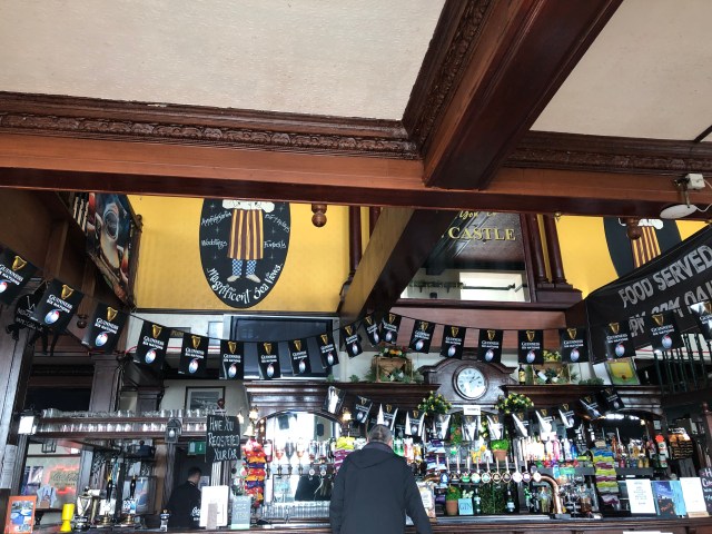
Castle Hotel

Billy’s from the beach
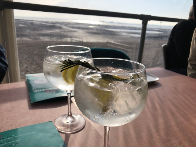
Those Leigh Shore G&Ts – complete with samphire
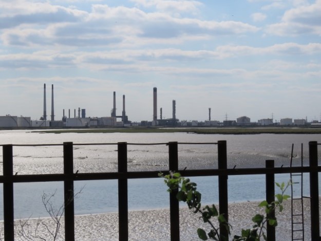
I popped out during the meal to take a few photos of the pier from the beach, as well as the one of Billy’s. And across the estuary you could see the refineries on the Isle of Grain. I went there once in the early 80s when I was at BP, as part of a course learning about other parts of the business than our own (I was an economist). Fascinating place – the scale and complexity. I also remember there were a few rather dirty sheep munching away on the surrounding grass. Apparently they were employed for the task as they couldn’t risk mowers causing sparks and causing an explosion.


This one taken after we left Billy’s. Sea coming in
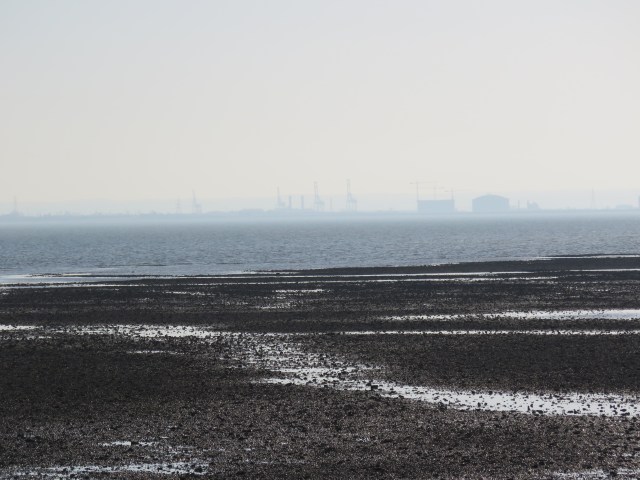
A grainy shot of Grain
We lingered in Billy’s rather longer than planned and didn’t leave ourselves enough time to visit the Beecroft Art gallery, which sounded promising. Next time… there must be a next time. We did have time to witness a glorious sunset from the Royal Terrace, above the seafront. A fitting end to a trip that greatly exceeded our expectations.
Some parting shots.


Superb final sunset photo , suitably closing out the end of an epic blog and wonderful journey.
It would be neat to have a booklet made of it. I’ve seen worse guides to the Thames Path.
Thanks Dave, and glad to have shared some of those journeys in your company, including the wilds of Dartford! I’ve wondered about trying to publish the series, though it might be quite expensive to produce, with all the photos. Might need some brutal editing – not my style, as is evidenced by the blogs!
Just took me the five weeks to get round to this, but I enjoyed it hugely.
To start at the end, and that unexpectedly marvellous day in Southend is documented beautifully. It would indeed be fun to go back: my only fear is that it would be grey and miserable – and the waitress at Billy’s wasn’t there!
Great to explore Dartford, thought you did indeed have a grey day there. I do love Hellmut’s masterpiece of a bridge, the inspiration for my own slightly bizarre pilgrimage a few years ago: I saw a picture of it in the paper on a Friday night, and walked there on the Saturday. Exhausting, but fun (except for the dual carriageways). Google Maps suggests 24 miles (to Bluewater, and pizza), but I somehow managed to make it 27.
Back to your blog, and I learned more about Gravesend than I’d ever known. So that was a real bonus. I’d thought of it as fairly faceless, but the history is rich and fascinating.
On to Canvey Island, which I’ve still never visited. That got me to thinking – whatever happened to The Big Figure and John B. Sparks? The web doesn’t offer an immediate answer, suggesting that they are at least still with us? But long retired, I assume….
Last but not least, I do agree that it would make a nice publication – though as you say, the pics would need a massive edit, and production costs would be high. Colin Rogal makes these photobooks, as you know – he must have done at least ten – but they’re not cheap to buy (£50, and north of that). If you’re ever interested, I could certainly send you a link to the printer/publisher he uses.
A cheap alternative might be to produce something like a 32-page PDF, and ask a local printer to run it off as a kind of booklet?
Maybe we can chat further about that. Something for the golf course!
But thanks again for a brilliant blog – an epic tribute to the river we love so much.
Thanks for the comments, Jon. I think a Canvey Walk is definitely one for the intrepid four – most likely 2024 now. We will speak about those publication options – a coffee table classic perhaps?