
Glide gently, thus forever glide, O Thames! That other bards may see As lovely visions by thy side, As now fair river! come to me.
Those words are from William Wordsworth’s 1790 poem Lines. They were written on the banks of the Thames at Richmond, through which we pass in this seventh instalment of the Thames Journey. The tidal river, which begins at Teddington Lock, does more than glide at times – it positively surges. There is brutality in its beauty. But there is certainly beauty.
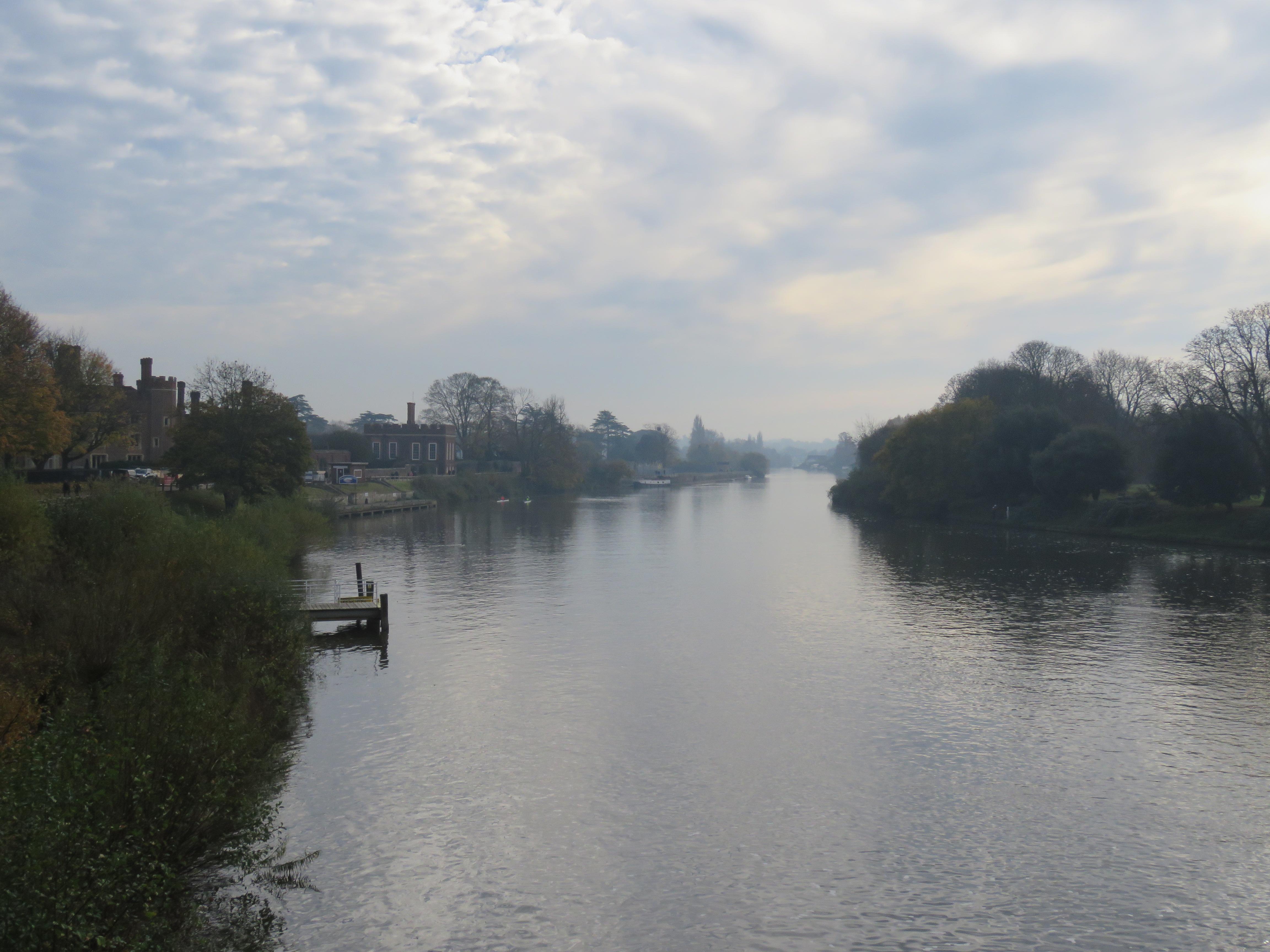
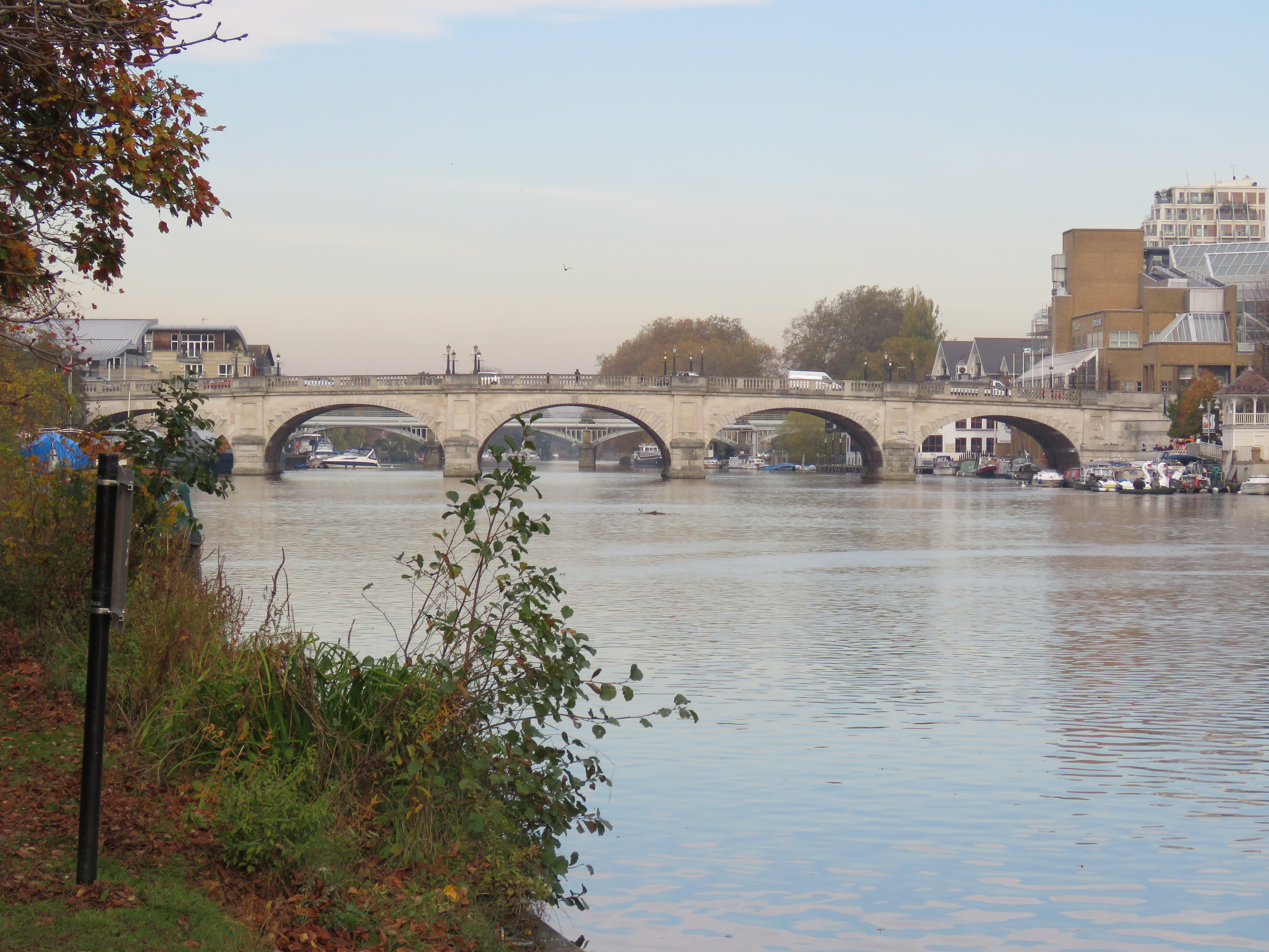
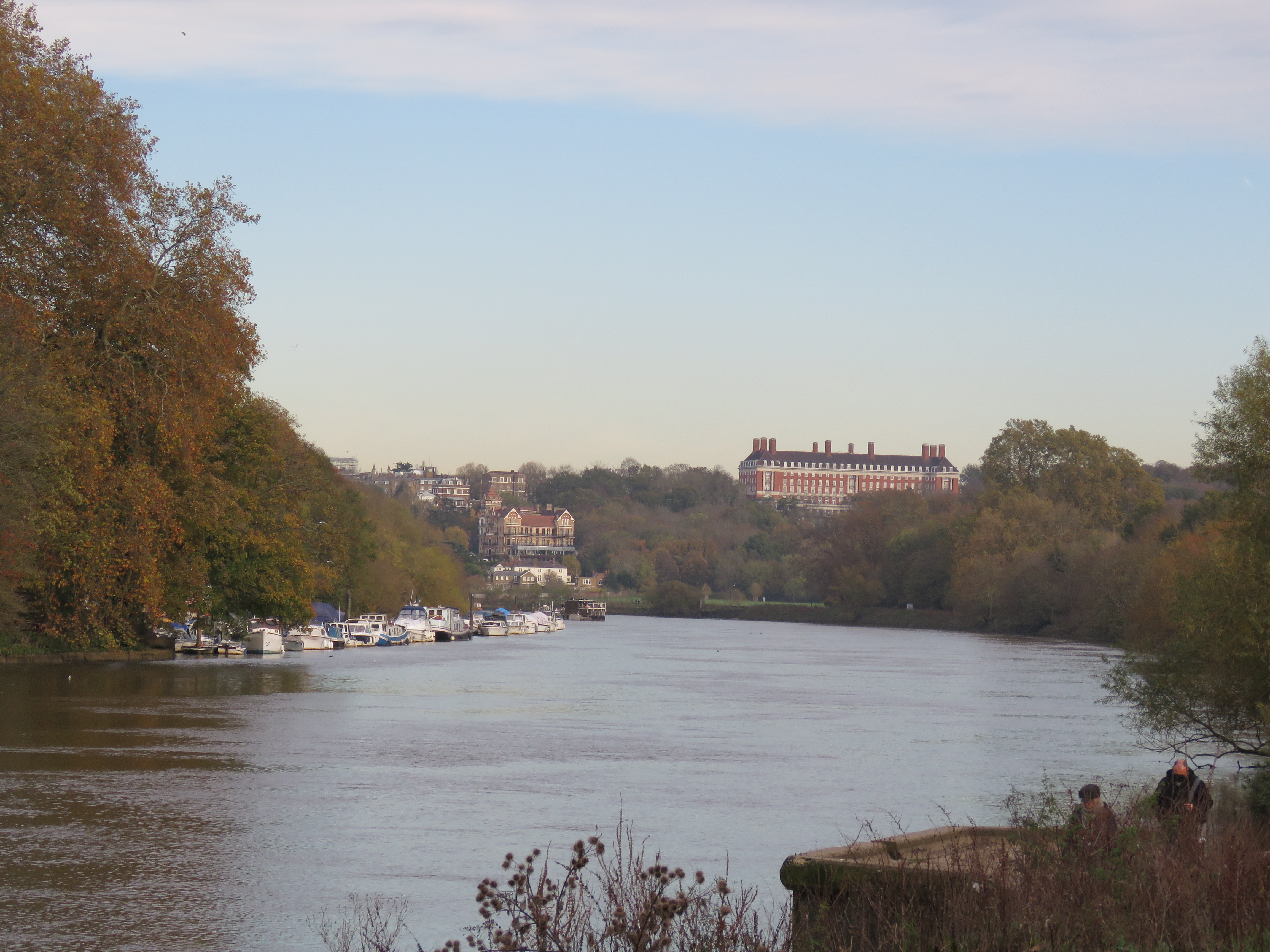
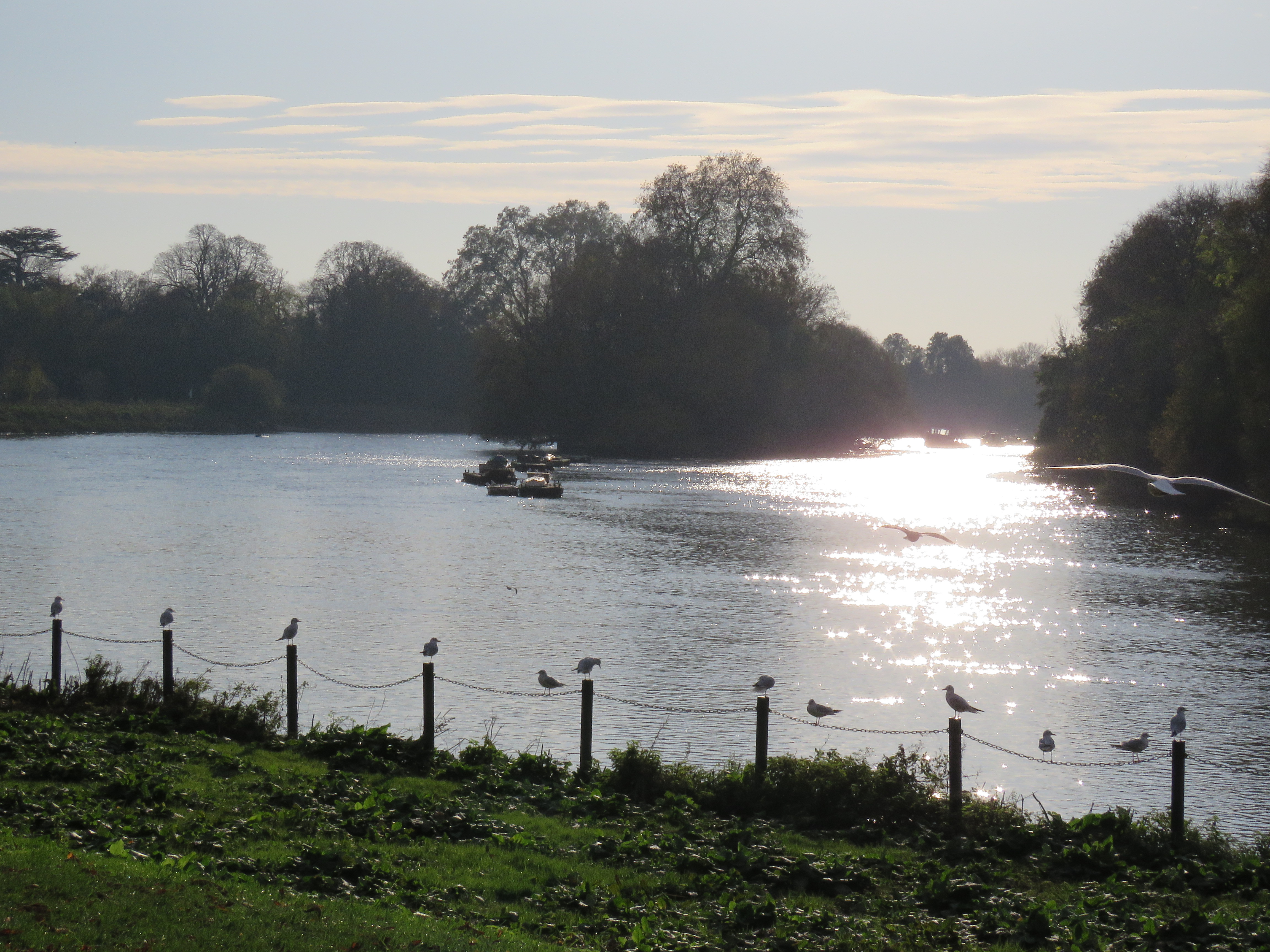
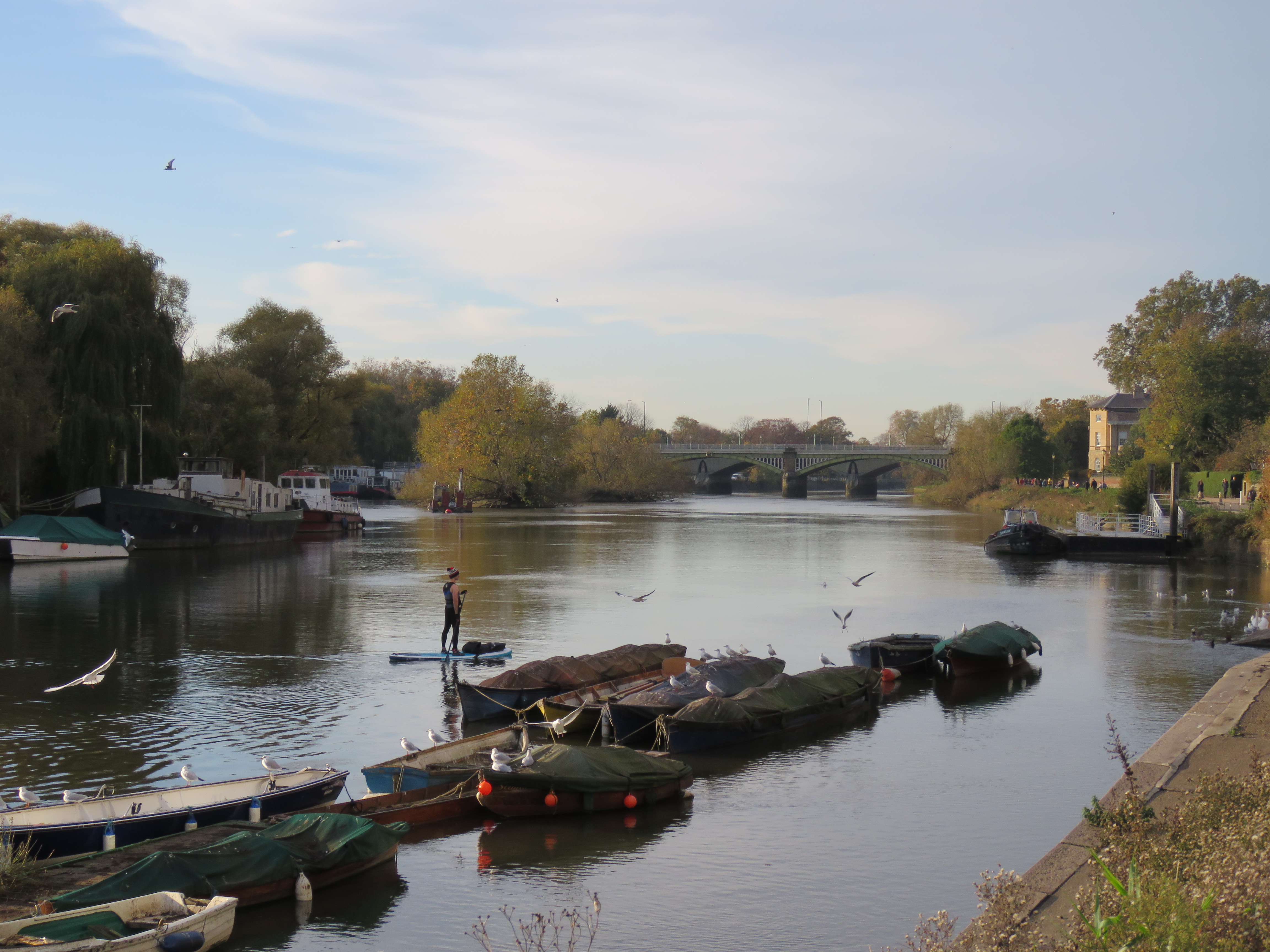
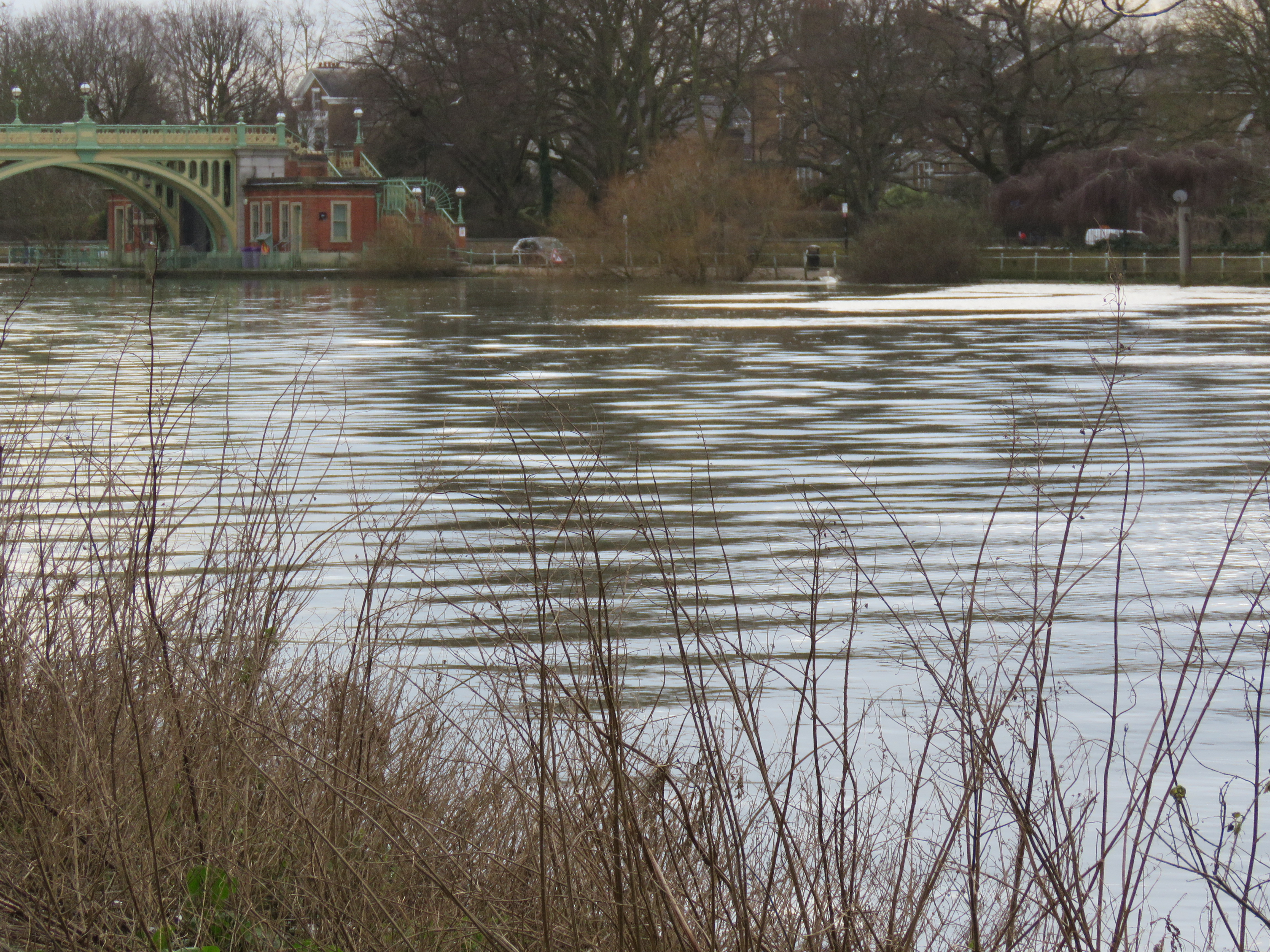
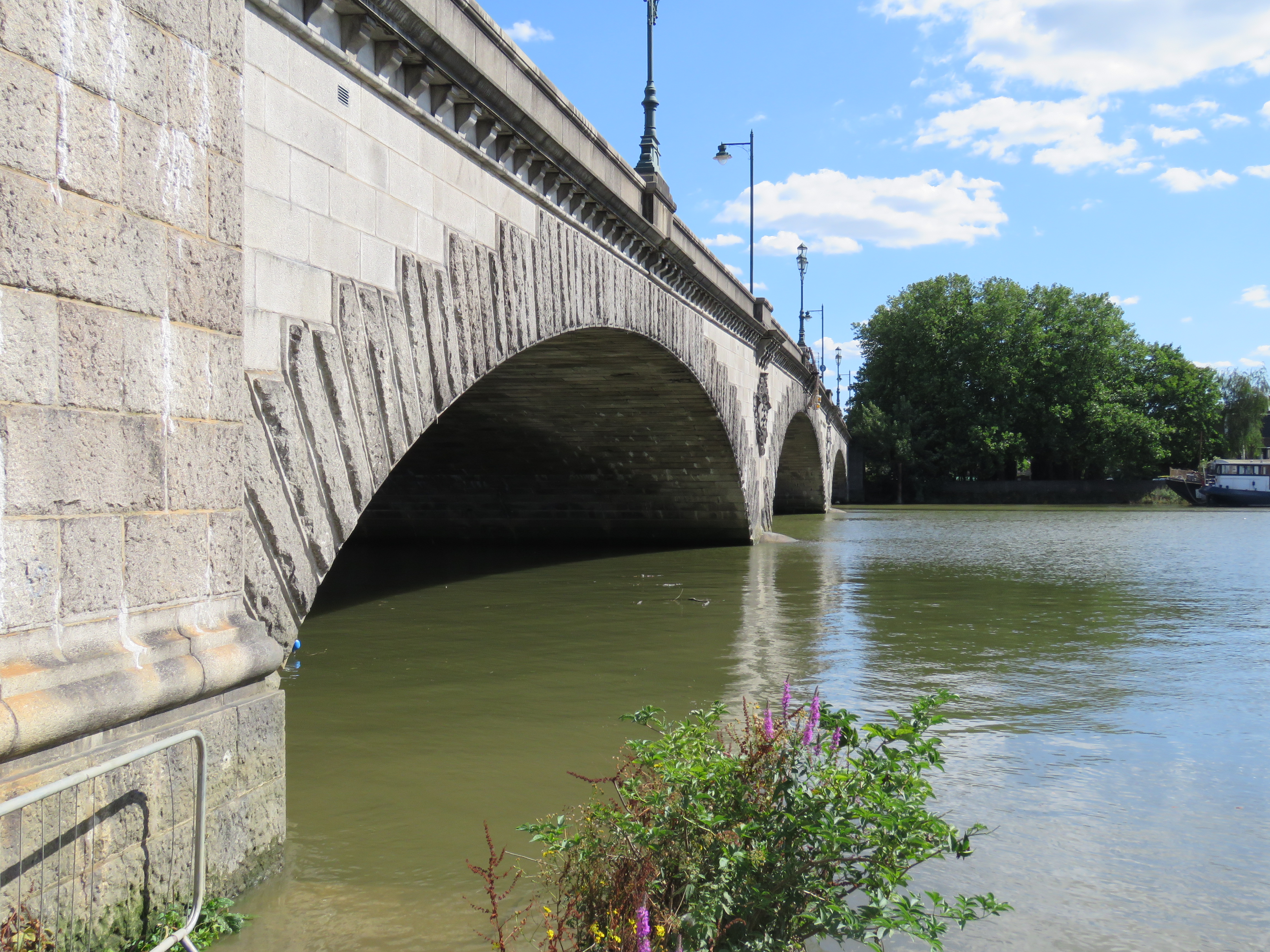
Looking downstream from Hampton Court Bridge
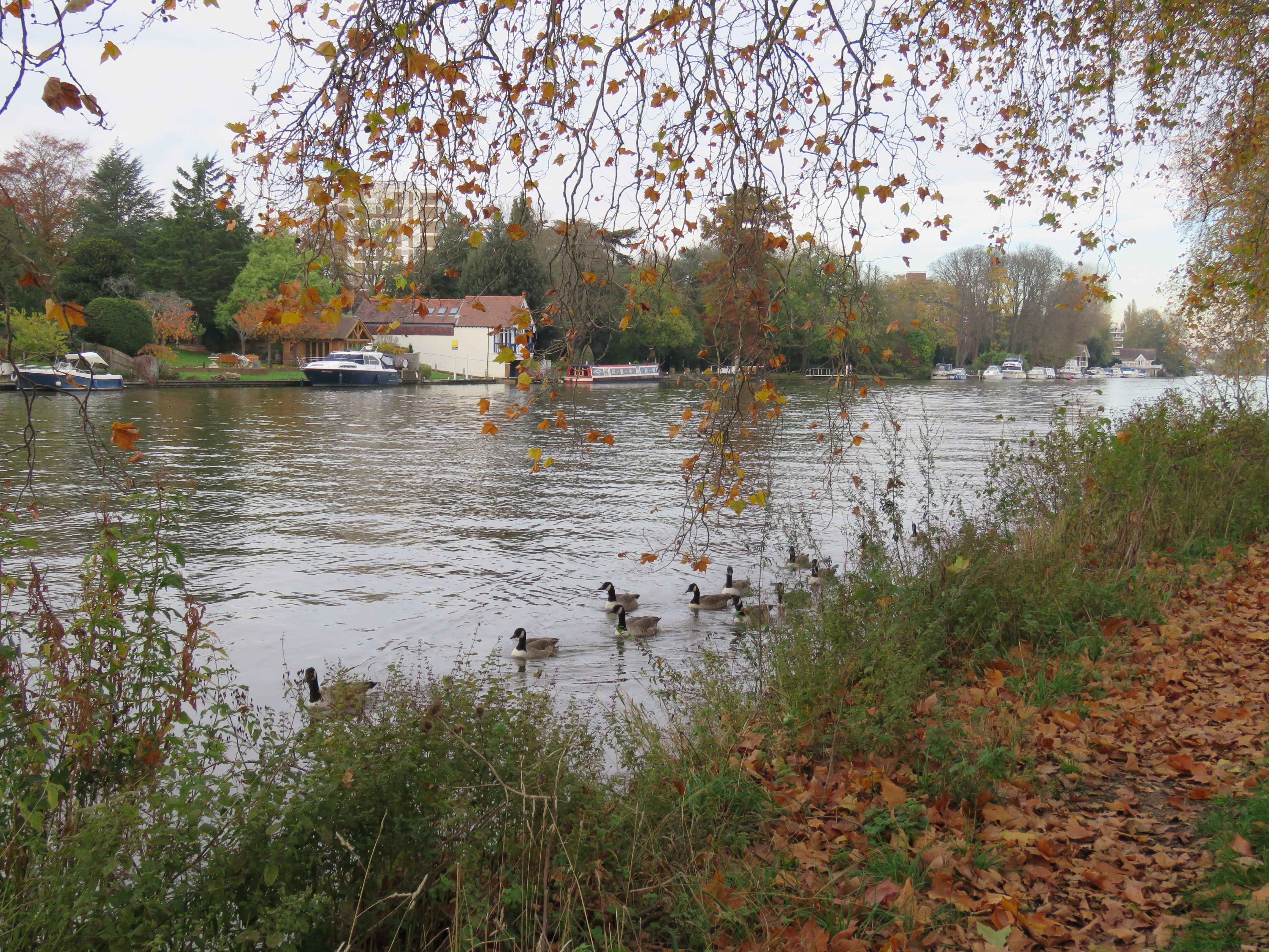
We have reached the part of the river with which I am very familiar. I have cycled and walked along its length many times over the years. For that reason, as well as the fact that I live in West London, there are many more memories and reflections that come to mind than in previous episodes. So the length of the river covered in each remaining episode will be shorter than those that went before. The journey in this section is about 11 miles. Maggie, Kath, Jon and I did walk this exact stretch one time, on 2 July 2017. We hadn’t been planning to – the intention was to get a train to Henley and walk to Marlow. But when we reached Ealing Broadway station we found that most of the trains had been cancelled. We swiftly concocted a Plan B and walked down to Kew Bridge for a hike upstream to Hampton Court Bridge. More recently – last November in fact – I did most of the walk in reverse, accompanied by my good friend Dave,(a resident of East Molesey) as far as Kingston. A lot of the photos are from that recent walk and others I have been doing in Brentford, Kew and Richmond over the last year. The Thames has been a boon in lockdown.
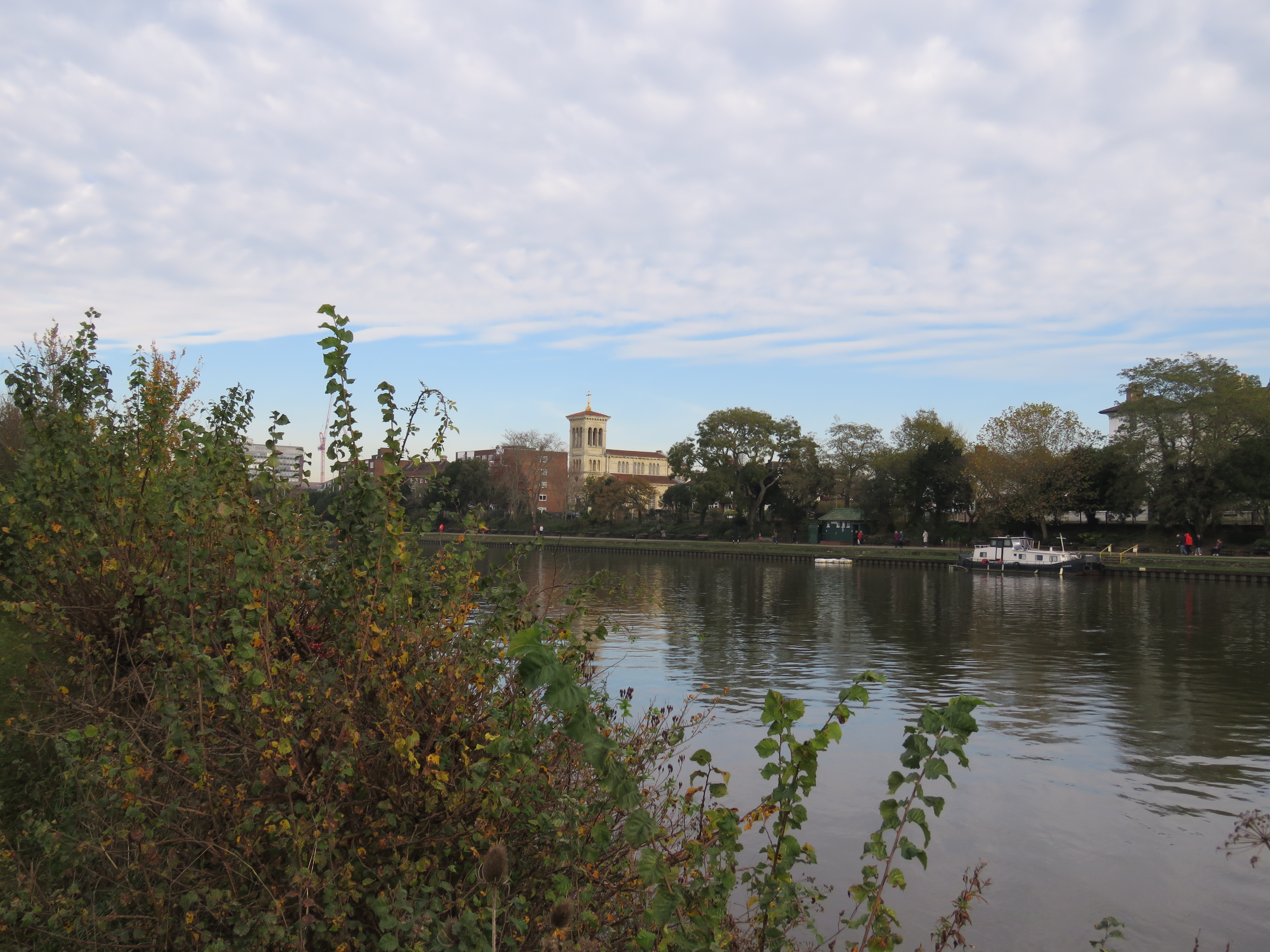
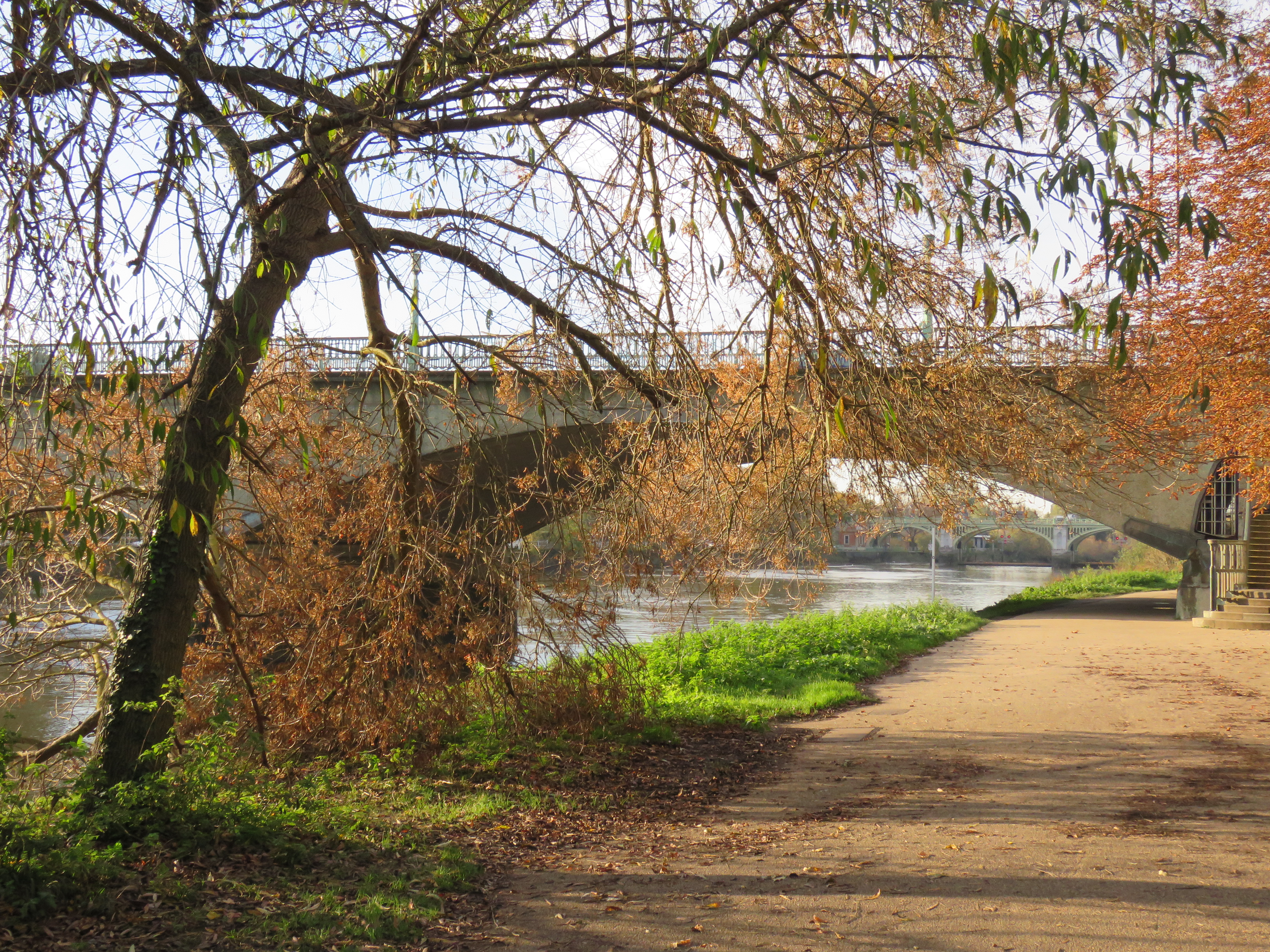
Riverside near Kew
This is a prosperous part of London, particularly on the Surrey side, which for the most part of this journey is the eastern side as the Thames snakes northward, before it lurches southward at Brentford/Kew. In days gone by, before the suburbs extended to these parts, they were holiday destinations and the site of great palaces and ornamental gardens. Hampton Court is one of course. Henry VII built his palace near Richmond, named after his earldom in Yorkshire. Richmond was merely Sheen before that. There are grand houses and gardens at Ham, close to Richmond; Strawberry Hill, Marble Hill and Orleans House near Twickenham; and Syon Park, by Brentford. And of course, the finest gardens of all are at Kew. We’ll come to some of these as we go along.
Let’s start with a few pictures of the walk from Hampton Court to Kingston. It’s interesting how a riverside location often encourages imaginative architecture. A combination of wealth and, perhaps, a sense of freedom?
Looking back to Hampton Court Bridge
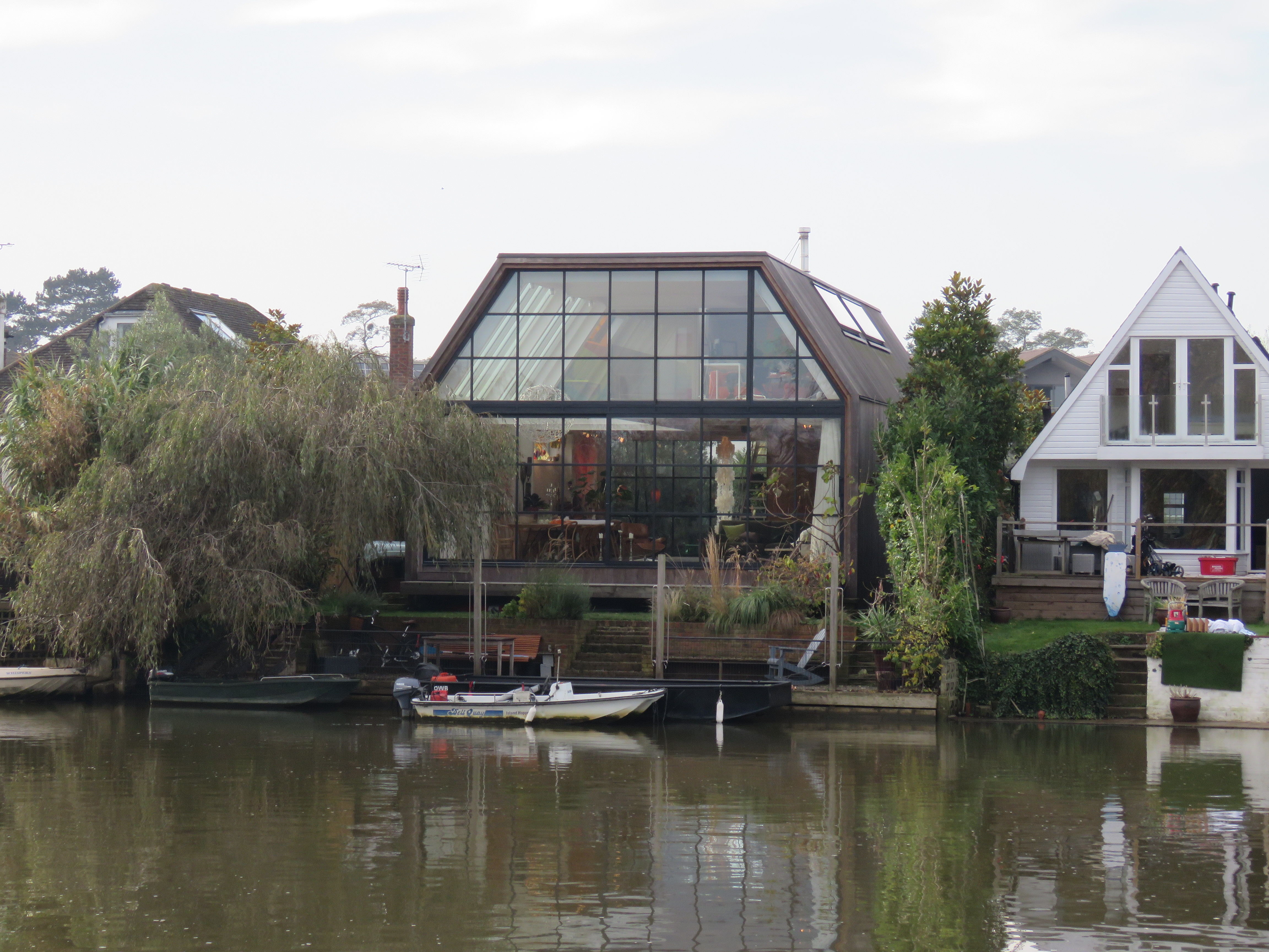
Open house
Approaching Kingston. The Italianate church is St Raphael’s
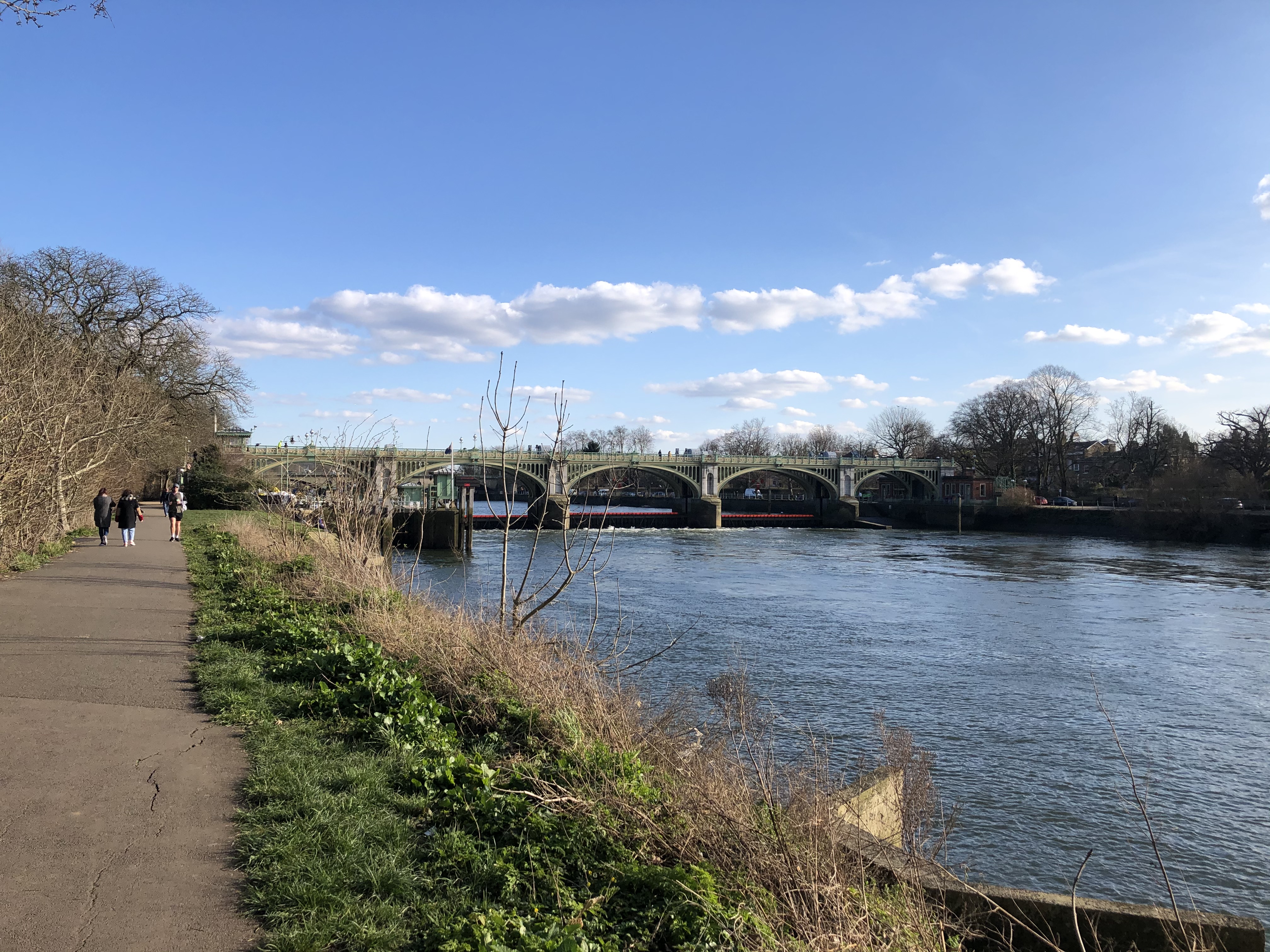
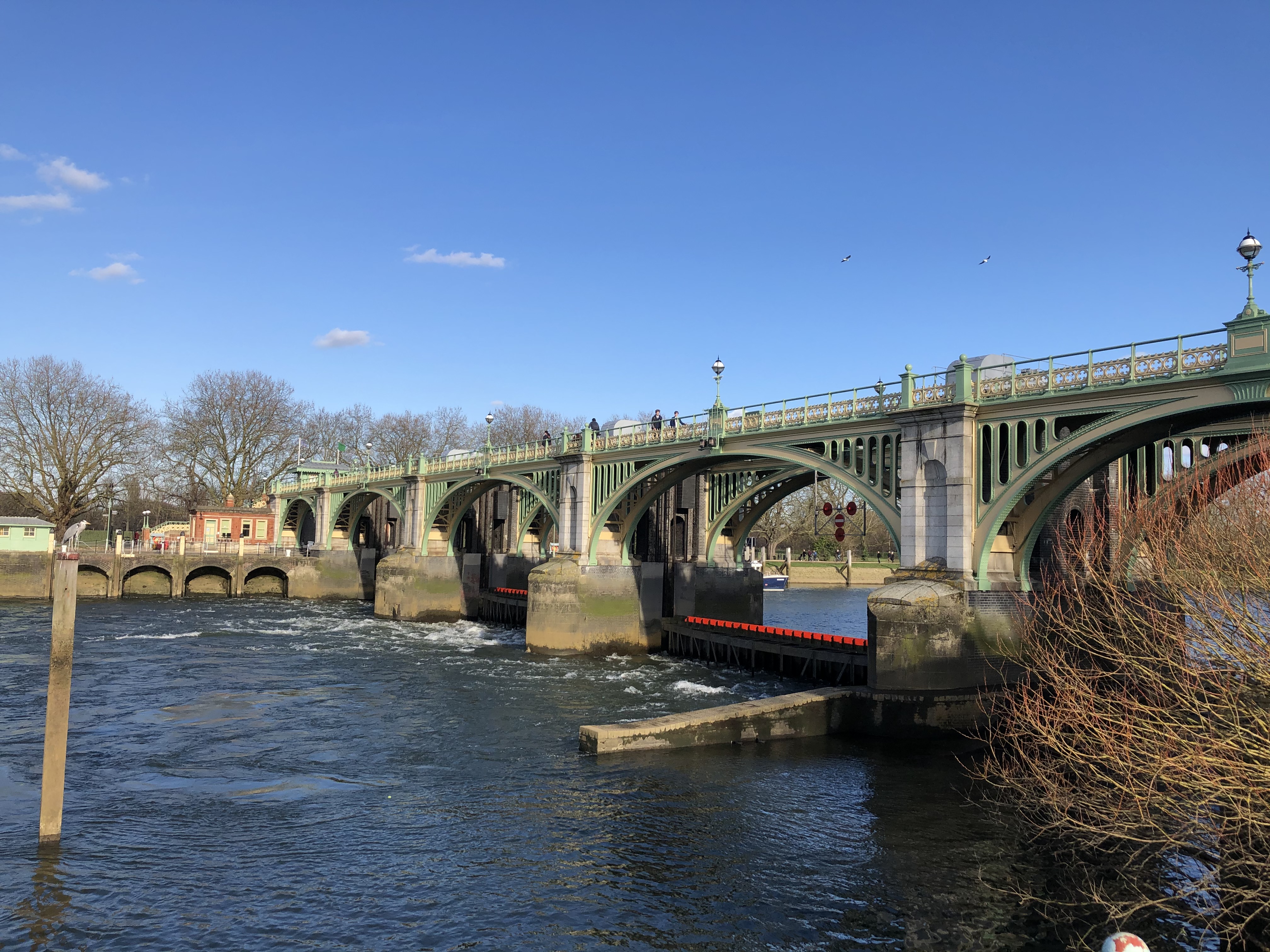
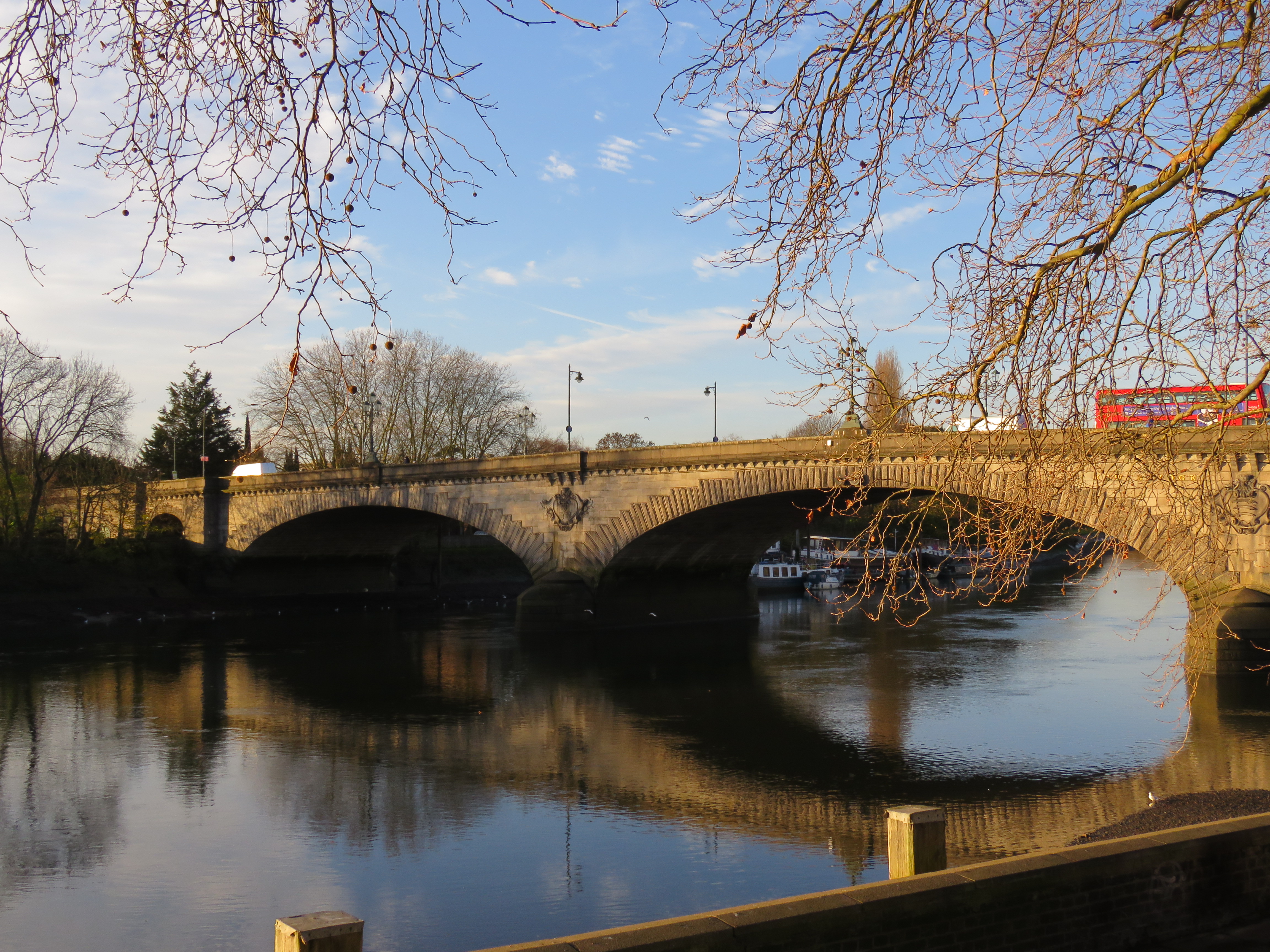
Kingston Bridge
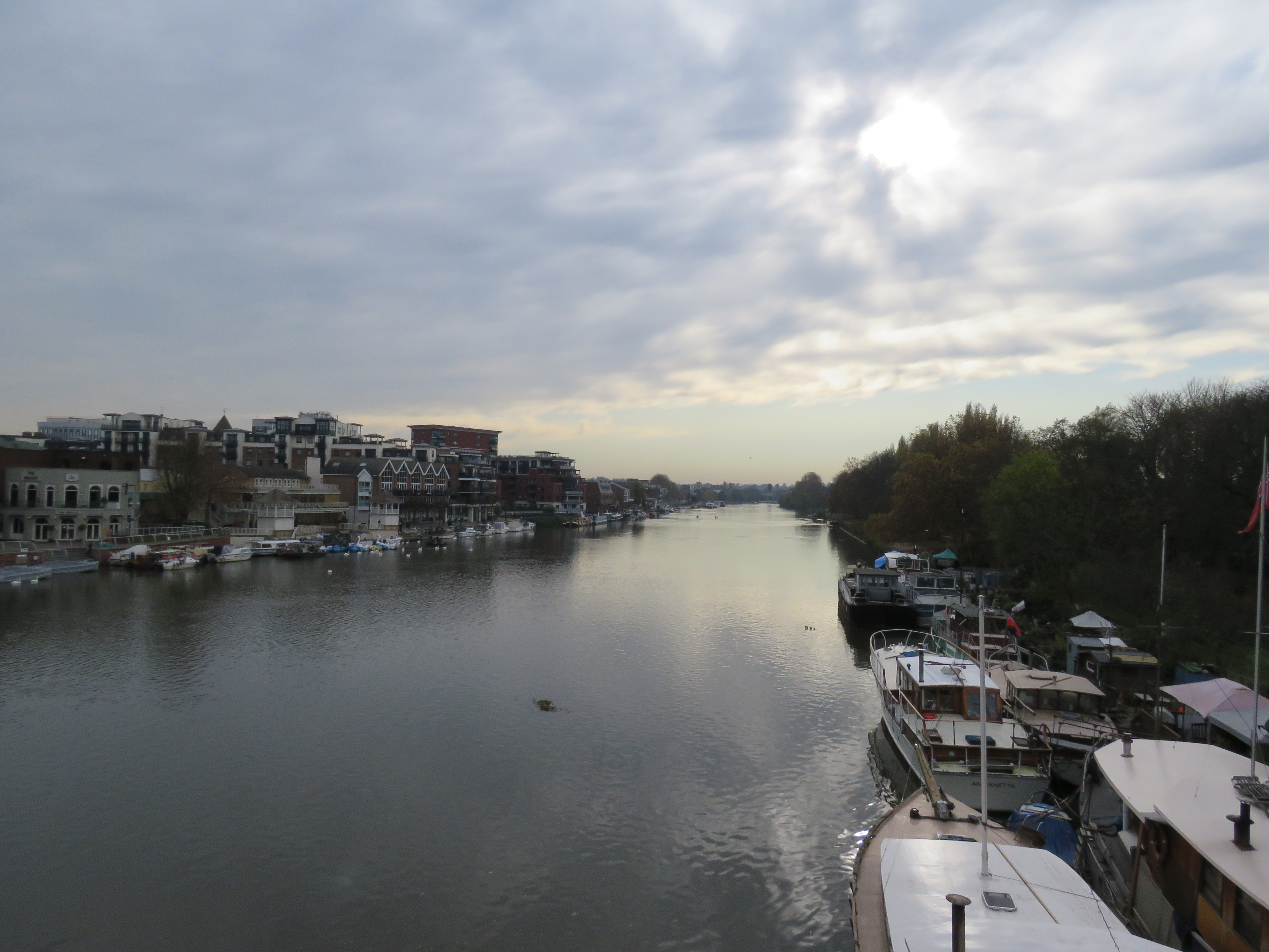
View upstream from the bridge
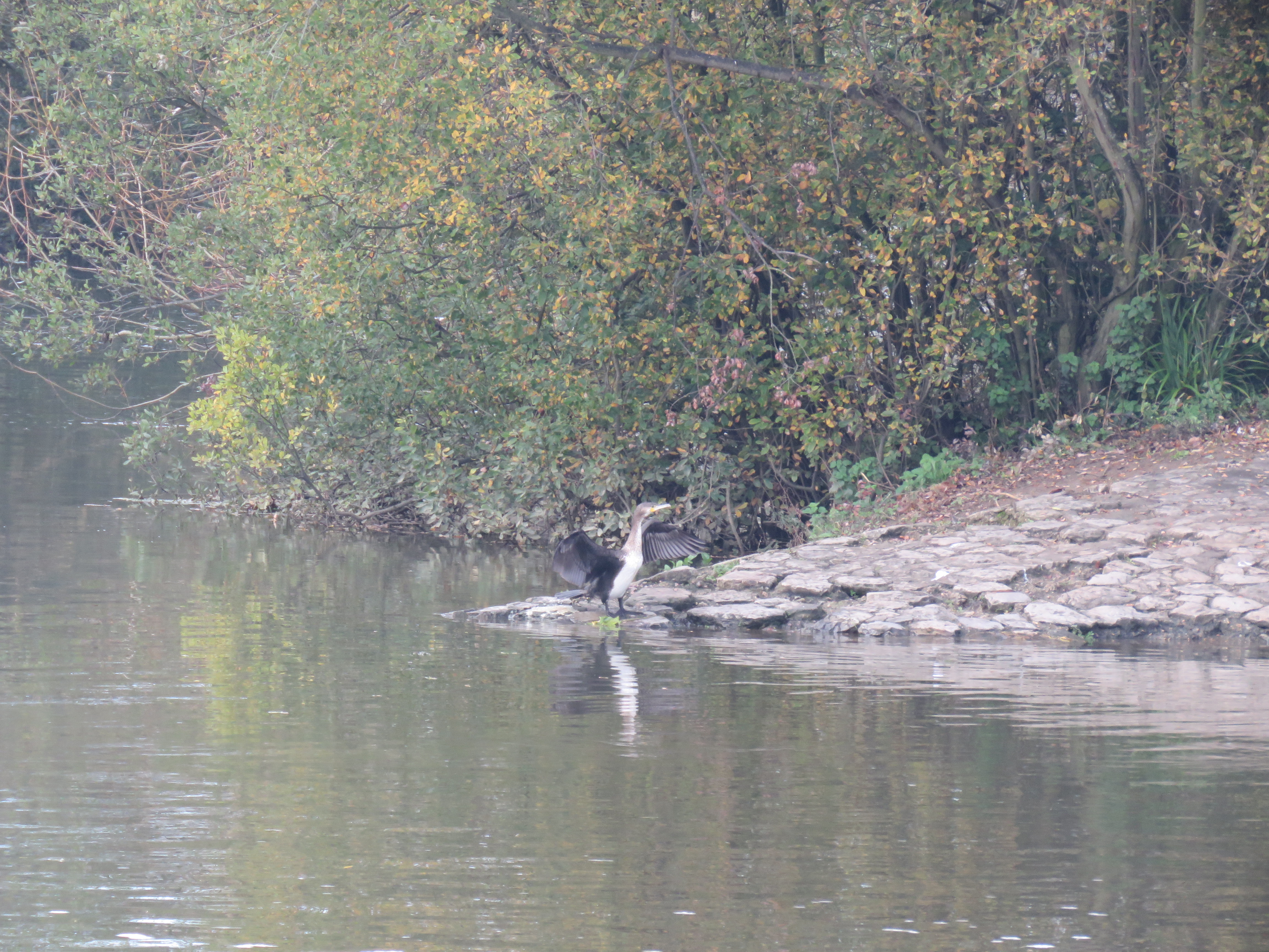
Dave and I saw a lot of cormorants on the river that day. Apparently the fishermen are now complaining that they are taking too many of the fish! The good thing is that there is obviously a plentiful supply of fish, which shows that pollution levels are much lower than they used to be.
Kingston is a bit of a concrete jungle in its centre, with a punishing one way system, if I recall from the days when I had to drive there with my son Kieran for birthday parties at a leisure centre where they could run around and shoot lasers at each other. But the riverside is serene, and like all river settlements, it is rich in history. Kingston is where they used to crown kings back in Saxon days, including Alfred the Great and the wonderfully named Ethelred the Unready.
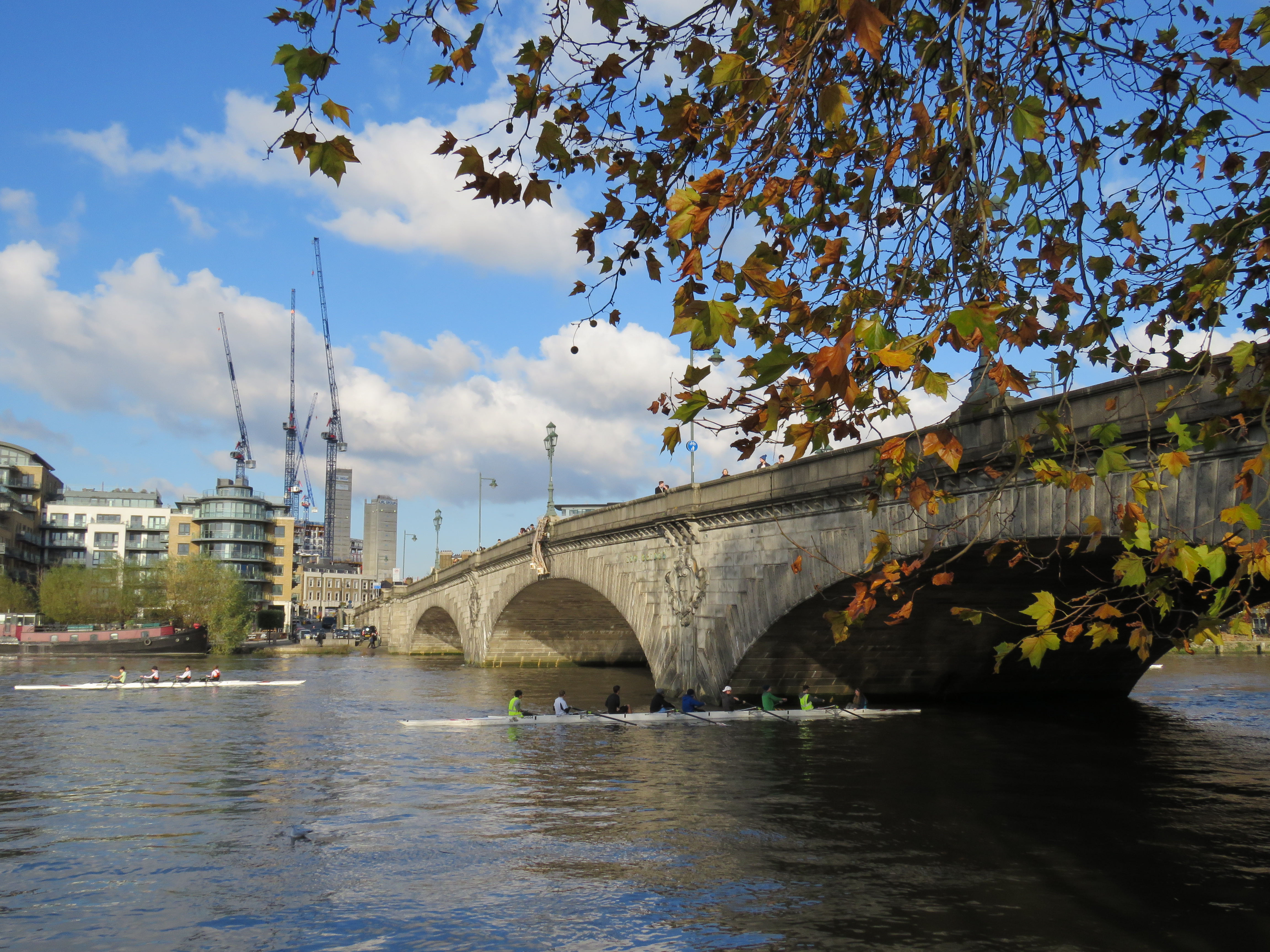
Until 1729, when Putney Bridge was opened, Kingston Bridge was the only solid crossing of the river between London Bridge and Staines. That’s remarkable. But then this area was mostly countryside with a few villages, and ferries would have been operating in many parts. A wooden bridge existed at Kingston from the 12th century. While the bridges had to be replaced quite often, having one gave Kingston a great advantage as a market town. That may be why Charles I gave Kingston a charter which prevented any other market from operating within a seven mile radius. I assume that no longer applies. The bridge was also used between 1572 and 1745 for the practice of “ducking”, whereby a beam was attached to the bridge from which dangled a chair which was used to immerse “scolds” in the river. According to Peter Ackroyd, these were women who used foul language, “nagged” their husbands or slandered other members of the community. The last victim was the keeper of the King’s Head alehouse in Kingston, who was ducked in the presence of 2 or 3,000 people. Blimey.
The current bridge was opened in 1828, replacing a bridge that had partly collapsed due to a severe frost. Prior to that there had been disputes about who should pay for the repair of the increasingly dilapidated structure. That has resonance today, as Hammersmith Bridge remains closed while the council, Transport for London and the government argue about who should pay for vital repairs, which could cost £45m.
Just downstream of the bridge, as the river runs north, lie Canbury Gardens – a respite from the concrete. There are attractive views of the river and prosperous Hampton Wick on the other side. In summer the yachts come out to play. I remember many years ago, while cycling down here, being surprised to see what looked like a regatta. Continuing the boating theme, Kingston is also the starting point for Jerome K. Jerome’s Three Men in a Boat, in which they row upstream to Oxford and back to Kingston. There have been many film and TV adaptations of the story. The one I remember affectionately is the 2005 TV series in which three comedians, Griff Rhys Jones, Dara O’Brian and Rory McGrath took on the rowing duties. Wouldn’t mind watching that again. Or maybe I should read the book!
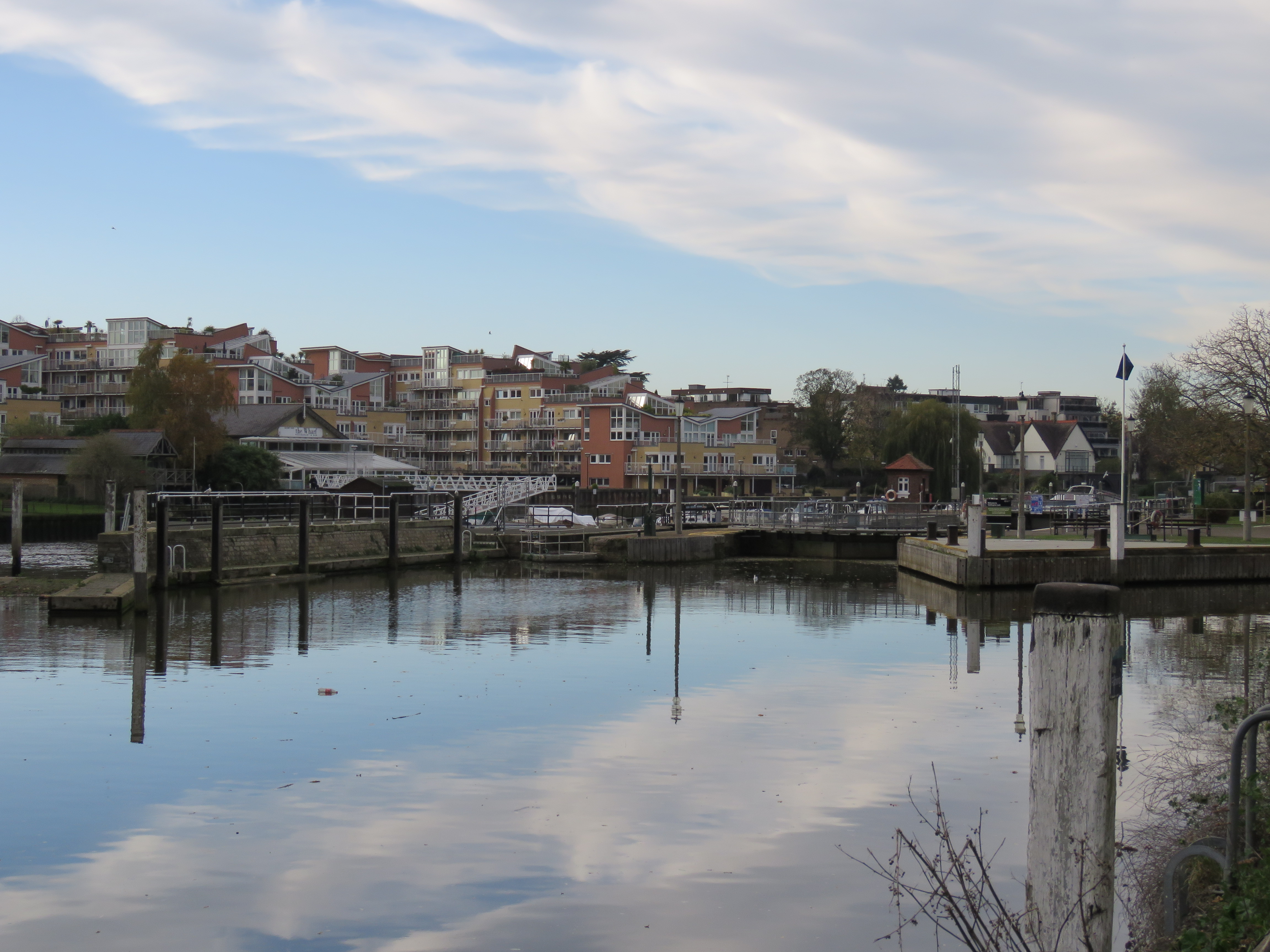
It is not long before you reach Teddington Lock, a huge complex of three locks and a weir. It marks the boundary between the tidal Thames and the rest of the river. A little further downstream there is a boundary stone that designates the boundary between the Environment Agency’s jurisdiction of the river and that of the Port of London Authority. Why this is at a different point than the tidal/non-tidal demarcation I have no idea. And I must admit I’ve never noticed the stone. I shall have to look out for it on my next venture up to these parts. The three locks cater for boats of different sizes, including one for the large barges which used to ply their trade up and down the river. The lock was very unpopular with local fishermen and boatmen when it opened, and the first lock keeper was provided with a blunderbuss – bayonet attached – to deter irate punters!
These shots are from my walk in November 2020, unless otherwise indicated.
The full works
Looking back upstream as I approached the lock
Family outing July 2017
Footbridge from the Teddington side, October 2011
And the Surrey side, nine years later
View from the bridge, October 2011
The large lock
As the river bends eastward we reach the curiously-named Eel Pie Island, with Twickenham on the north bank and Ham on the south. There are houses and streets, but no cars. Until the footbridge was opened in 1956, the island was reached by ferry. In the 60s it had a musical reputation: the Eel Pie Island Hotel was a home for the blues as well as a venue for up-and-coming artists like the Rolling Stones, the Who, the Yardbirds, Rod Stewart and David Bowie. This part of London remains a centre for blues and jazz. The hotel closed in 1969, briefly reopened, and was burnt down in 1971. The island, also known as Twickenham Ait, was named after a dish served on the island from the 16th century. Henry VIII was apparently fond of the odd eel pie – no surprisse there. The hotel was opened in 1830, and the island was a popular picnic spot in Victorian times. It is mentioned in Dickens’ Nicholas Nickelby. Today, as Peter Ackroyd wrily notes, “The island is now the insular home for a somewhat eccentric community”. I’ve never got around to crossing the bridge onto the island, but from the towpath on the Ham side in the summer, you can see and hear the parties on the balconies and the riverside gardens. Does Pete Townsend still live there? Did he ever, or was it just that he owned the Eel Pie Studios on the Twickenham bank? Never mind – I like to imagine that in one of those large houses he’s jamming with his mates still.
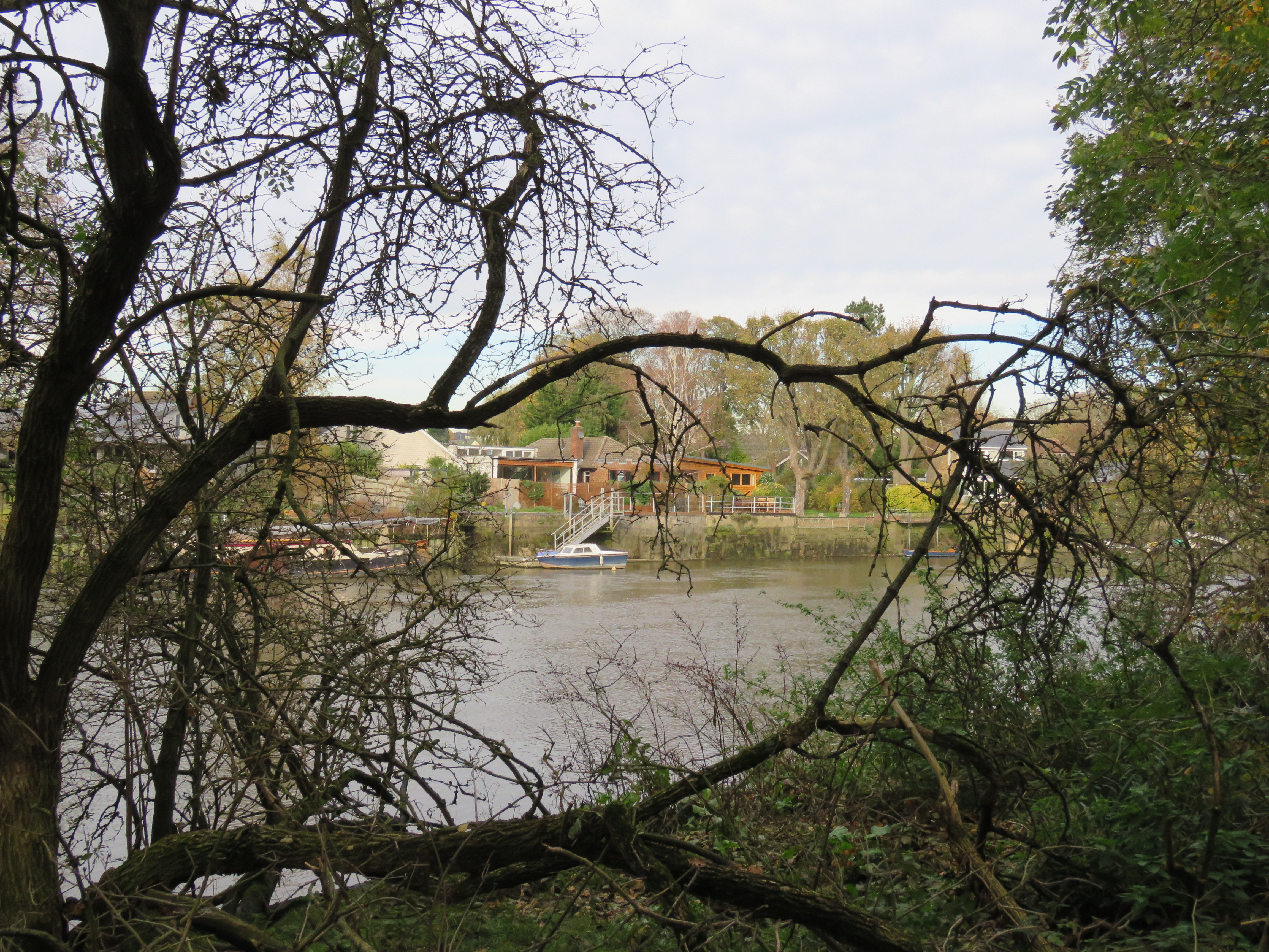
A glimpse of Eel Pie Island from the Ham side, November 2020
The Eel Pie island footbridge, Twickenham side, October 2011
The bend at the river at this point means that while Twickenham is slightly upstream from Richmond, Twickenham Bridge is downstream of Richmond Bridge. Think about it! Twickenham was first mentioned in writing in a charter of AD 704 according to Ackroyd. It may mean land by a river fork. Daniel Defoe, author of Robinson Crusoe, liked the place. Ackroyd quotes him as saying it was “so full of beautiful buildings, charming gardens, and rich habitations of gentlemen of quality, that nothing in the world can imitate it.” On the other hand, a Frenchman once remarked to one-time resident Alexander Pope, the renowned poet, “All this is very fine, but take away the river and it is nothing.” Ackroyd adds, “This is perhaps accurate.” But it’s also something of a tautology: wherever the Thames flows it defines the place. How couldn’t it?
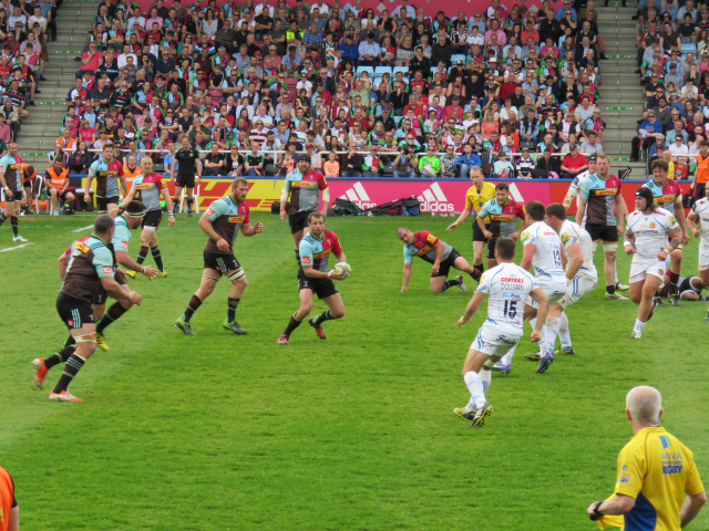
These days, Twickenham is best known for its rugby stadium and for being the headquarters of English rugby union. The stadium, surrounded by suburban housing and supermarkets and the A316 dual carriageway which morphs into the M3 and heads south-west out of London, is a rather ugly and cold brute of a building. The seats are squeezed tightly together. But when 82,000 braying rugby fans are in full voice, there’s quite an atmosphere. My favourite moments there have been watching Harlequins, the local rugby team whose stadium, the Stoop, is on the other side of the dual carriageway. They play the odd Big Match there, and won the Premiership final in 2012 – the highlight of the nine seasons when Jon and I were season ticket holders at Quins. Those seasons were lit up by the brilliant New Zealand fly half Nick Evans, who retired from playing at the end of the 2016-17 season. He’s on the Quins coaching team these days. I wrote this tribute to him on my blog at the time.
The maestro
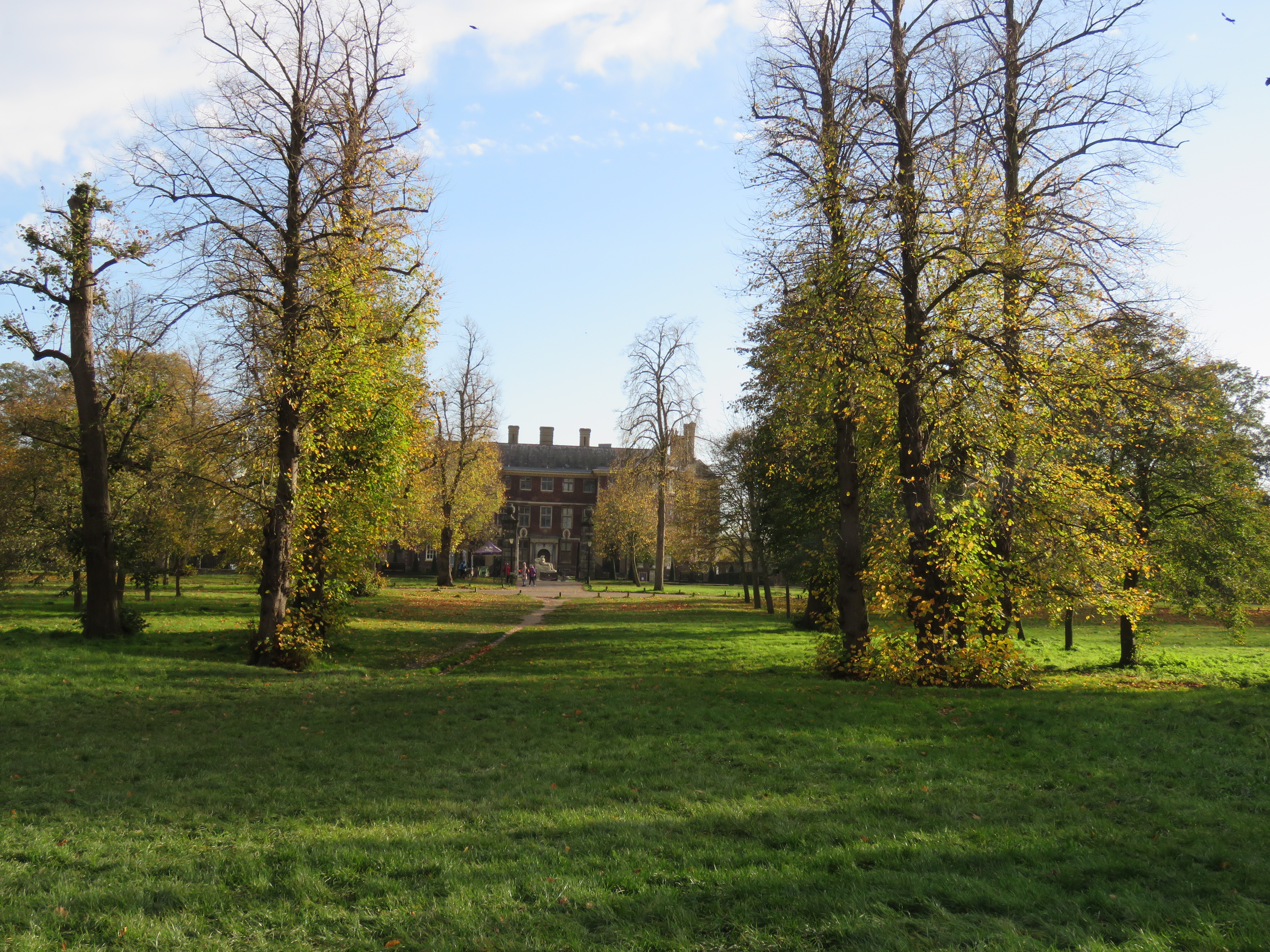
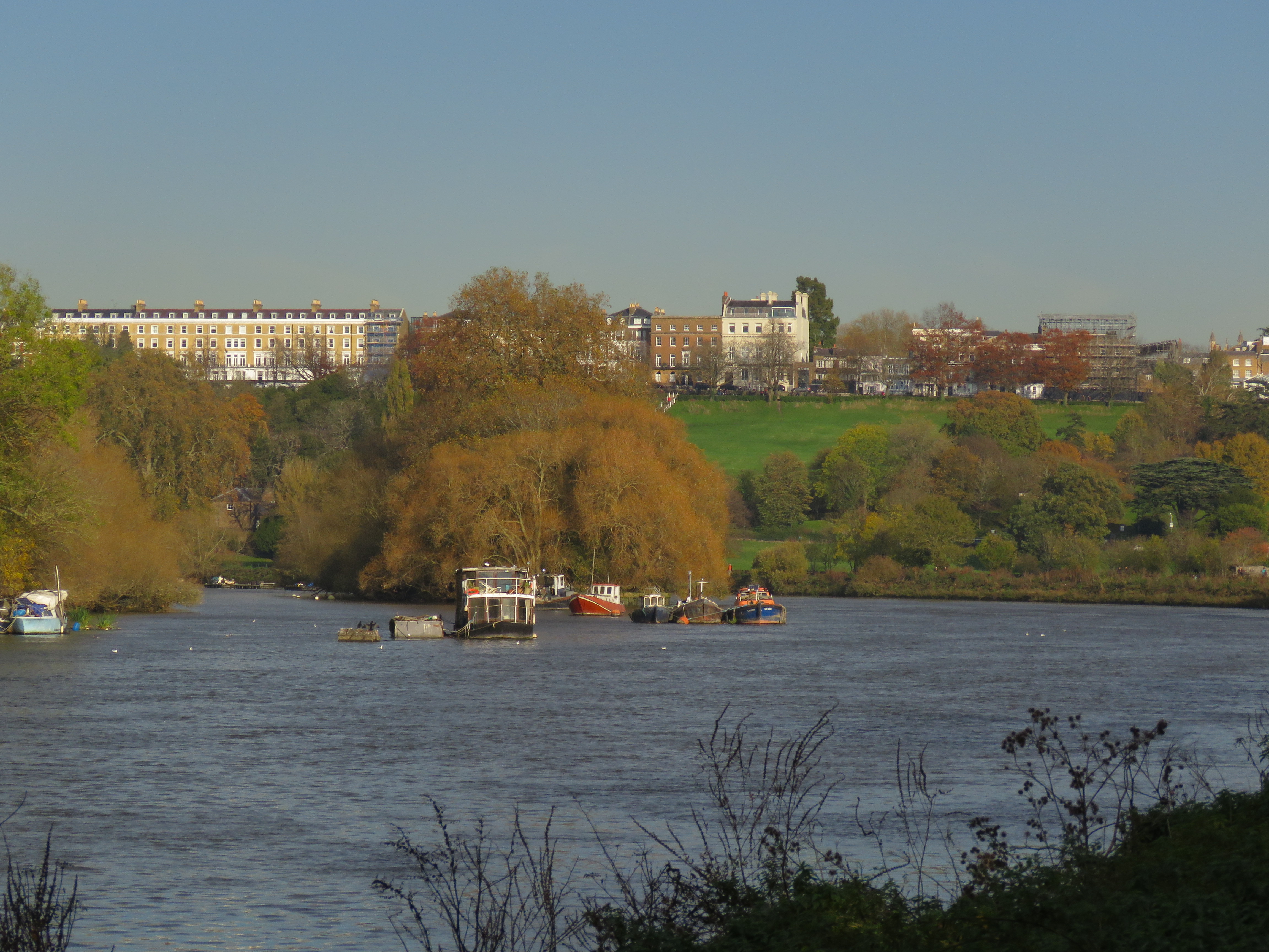
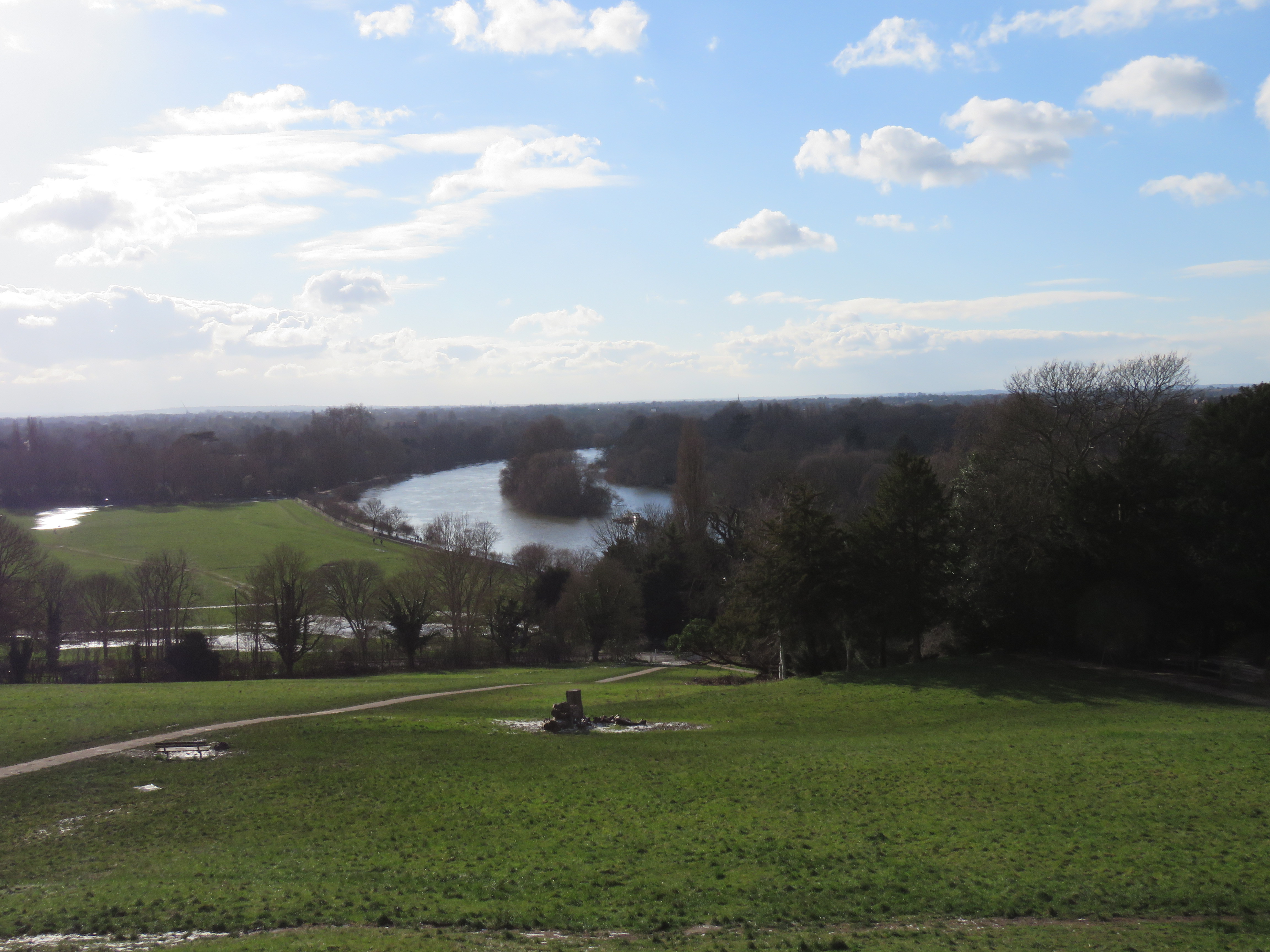
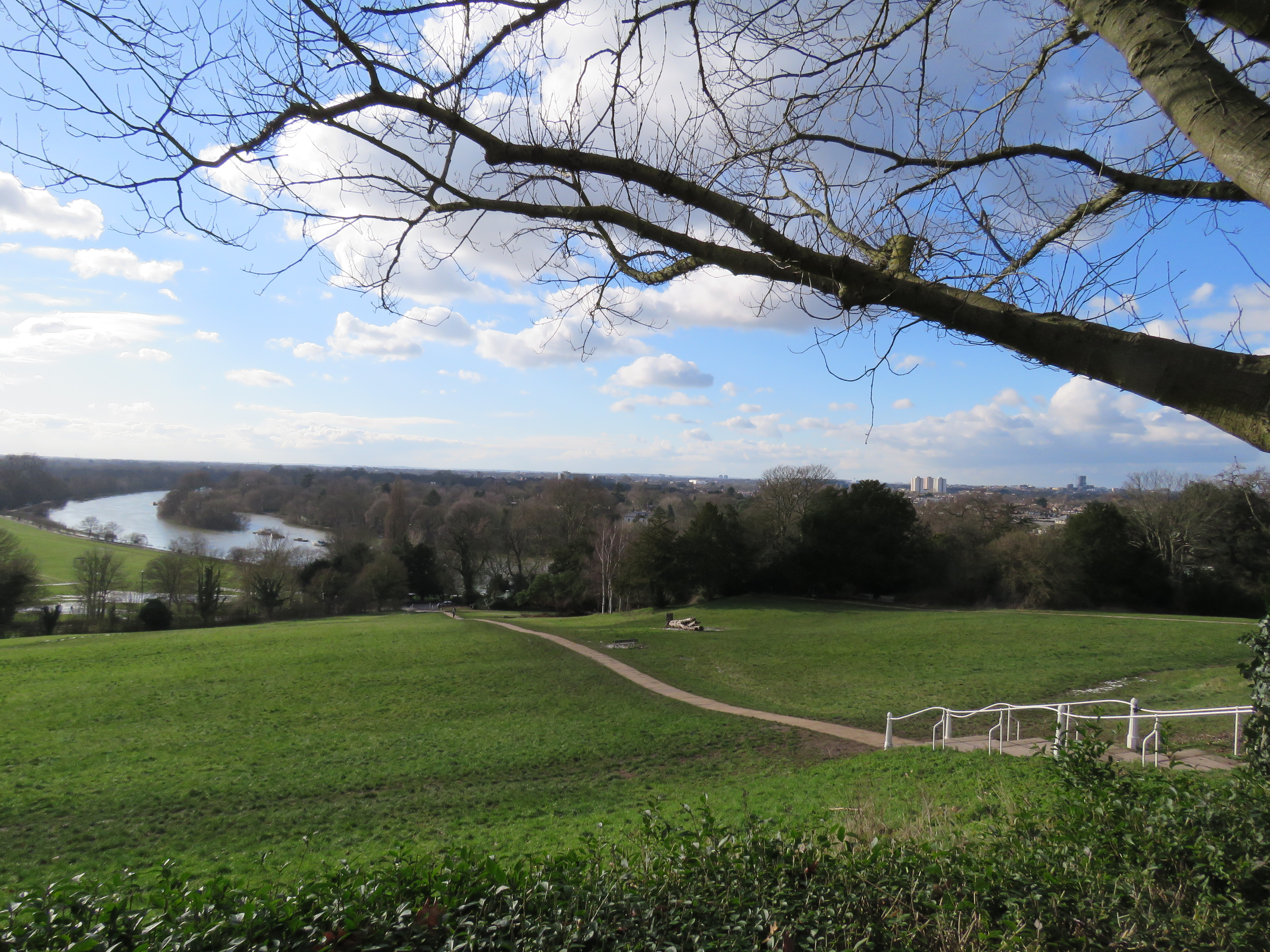
Switching to the Surrey side of the river, the approach into Richmond is truly a wondrous thing. You pass Ham House on your right and then behold the river widening and bending, lined with trees, which give way to the meadows which rise up to become Richmond Hill. The hill is lined with grand buildings, the most notable of which is the Royal Star and Garter Home for disabled military personnel. The home was built in the early 1920s – there was a hotel on the site before that – and remained in use until the early 2010s, when it was sold to developers, for conversion into apartments. The view of the river from the top of the hill is spectacular too. It was the first view to be protected by an Act of Parliament, in 1902. There is a viewing terrace, which holds a special place in my memories, as it is where, on a warm and sunny October day in 1990, Kath and I had some of our wedding photos taken. Our reception was held at the Richmond Hill Hotel, on the other side of the road.
The next few shots are all from November 2020.
The river bends into Richmond. Star and Garter, background right
Ham House
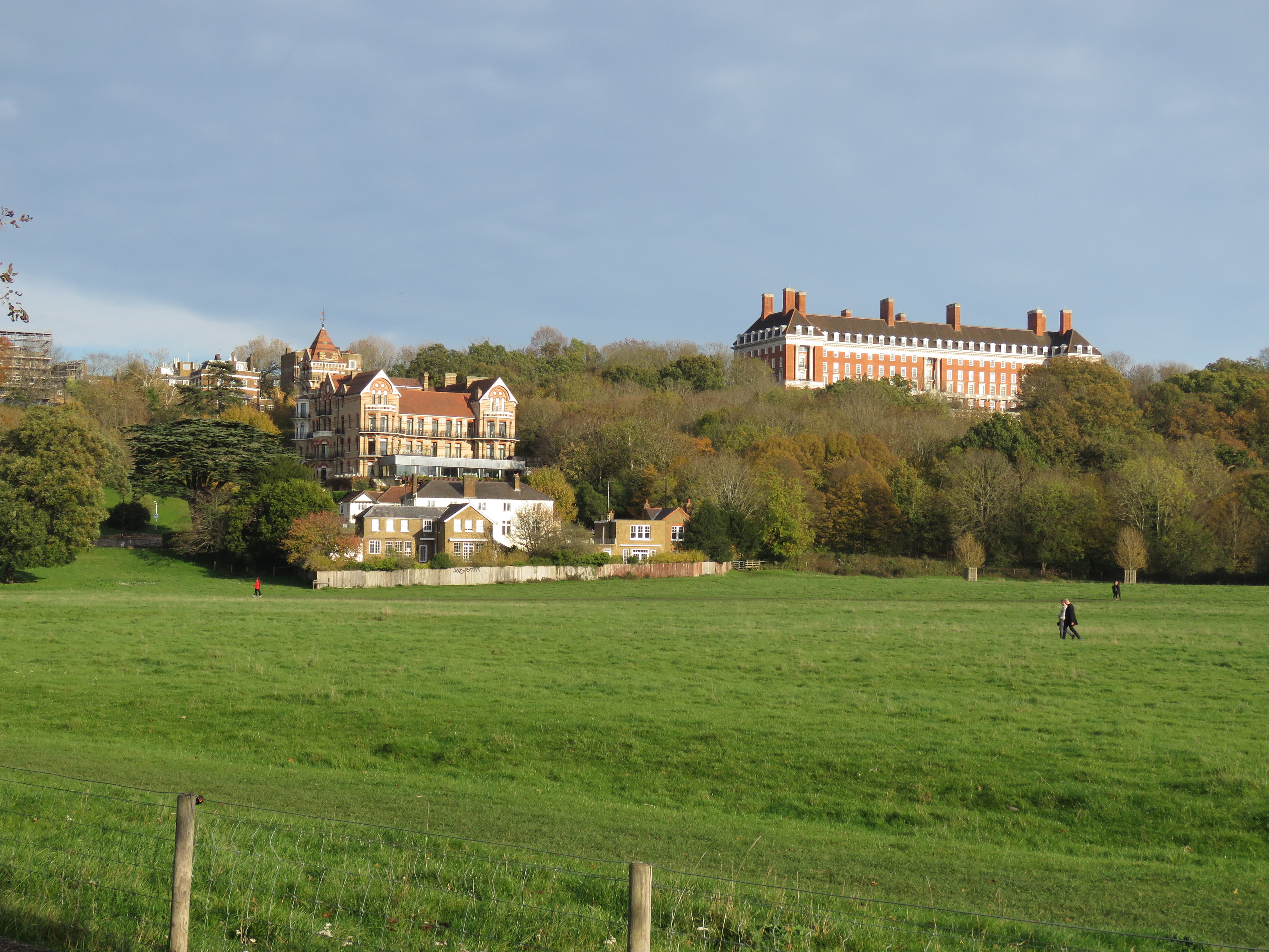
Petersham Meadow and Hotel, Star and Garter
Looking back upstream into the sun
The view from the top. February 2021.
As I noted earlier, Richmond wasn’t Richmond until the reign of Henry VII, the first Tudor king. It was known as Sheen – not to be confused with Sheen, as we know it today, beyond Kew. I suppose it was West Sheen to Sheen’s East Sheen. Where that left Kew, I don’t know. Henry VII was the Earl of Richmond – in Yorkshire. But he wasn’t a Yorkist, unlike Richard III, whom he deposed. Confused? Read on… He took the throne in 1485 and was king until his death in 1509. What Hampton Court is to his son Henry VIII, Richmond is to Henry VII. His non-London home – London was essentially the City and Westminster in those days. Kings of England lived on the site of Richmond Palace, which lies between the river and Richmond Green, from as early as 1125 when Henry I was on the throne. Richard II was the first to make Sheen his main residence in 1383. Henry VII built a new palace on the site after the wooden buildings which were there before burnt down. Mary I – Bloody Mary – honeymooned at the Palace with Philip of Spain. Princess Elizabeth was imprisoned there briefly, but returned as Elizabeth I and spent most of her time there. She died in Richmond in 1603. The Palace met its demise in 1649 when it was sold by Parliament (in the days of Oliver Cromwell) for £13,000. Over the next ten years it was largely demolished, so there is little, if anything to see today.
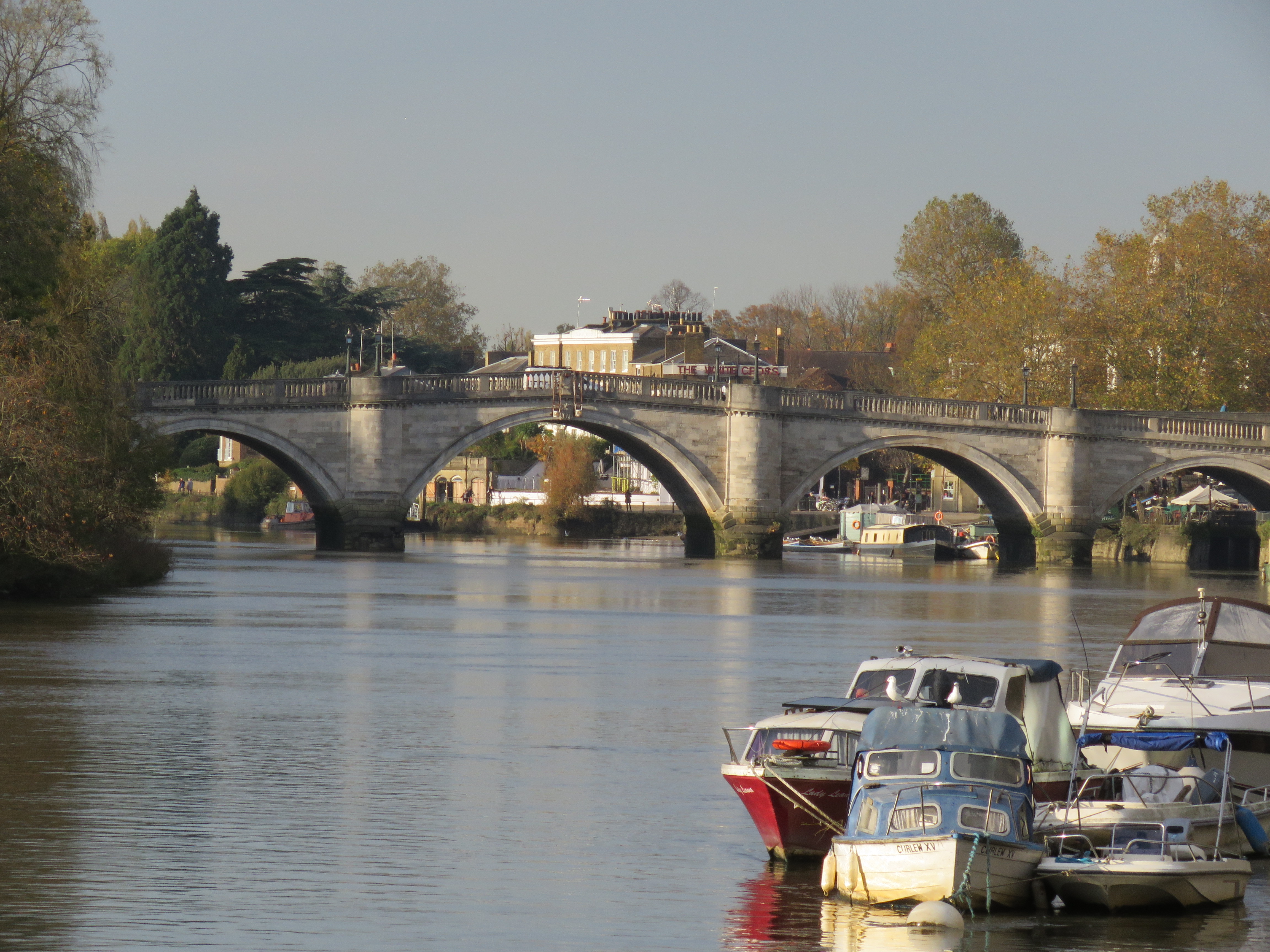
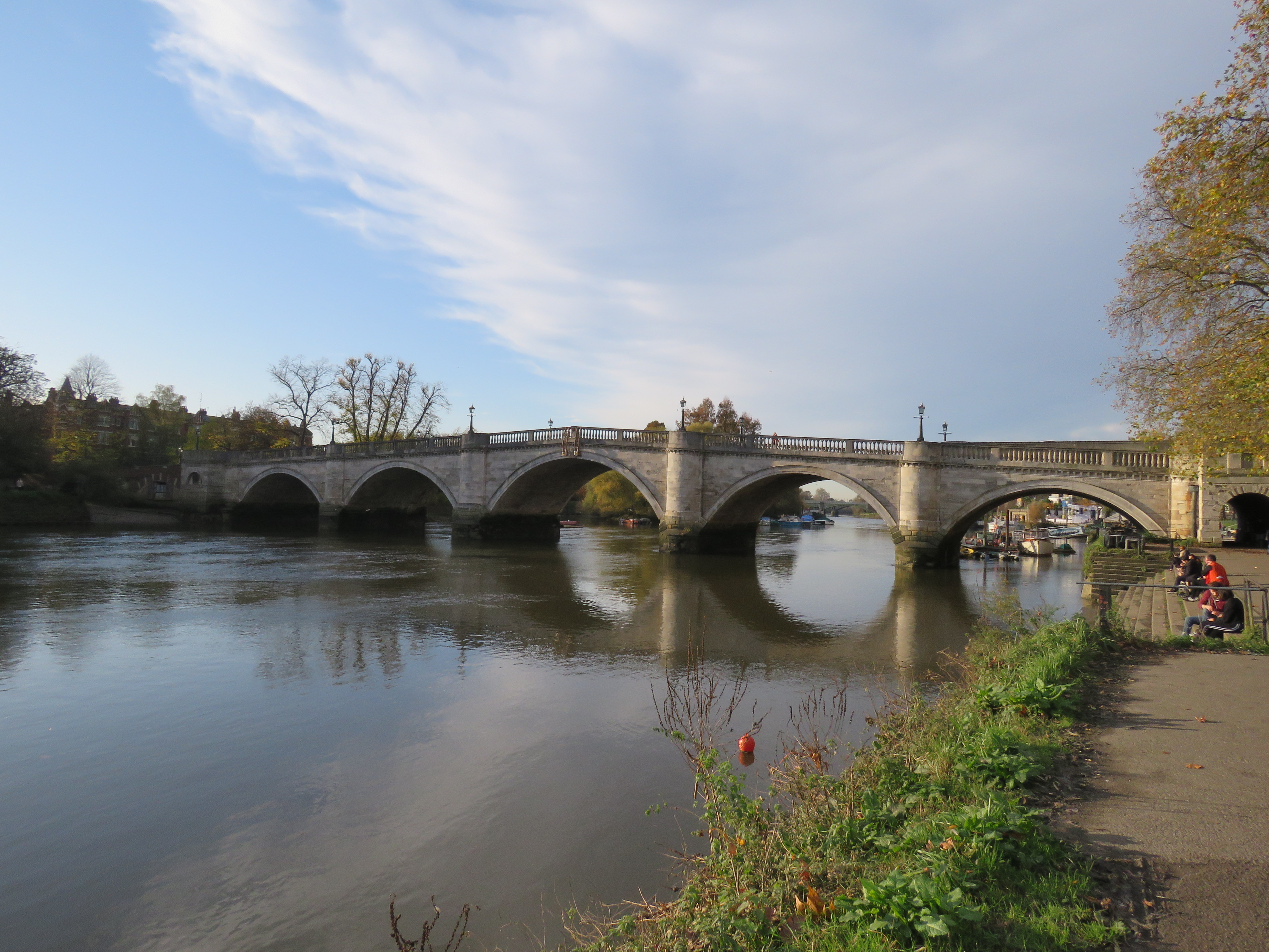
Richmond is one of the most desirable places to live in London, with house prices to match. No doubt Pope’s French acquaintance would say it was nothing without the river, and it is certainly one of the loveliest places along the Thames. The bridge is the centrepiece. It was opened in 1777, and is now the oldest surviving bridge in London. It was designed by James Paine, who went on to design bridges over the Thames at Chertsey, Kew and Walton. It is so harmonious with its surroundings – it has an understated elegance, I think. It’s often gummed up with traffic of course, but attempts to widen it have been resisted. The nearby Twickenham Bridge, which is a rather utilitarian construction, was opened in 1933, partly to take the pressure off Richmond.
Richmond Bridge in November 2020. If you look closely, you can see the White Cross pub behind the bridge – see next paragraph.
The riverside at Richmond is a great place to hang out, especially in the summer. But beware two things: it gets very crowded, and parts of it flood at high tide! The pathways down by the White Cross pub become impassable – unless you want to go barefoot, or are wearing wellies. I remember popping into the pub for a lager during a bike ride along the river a few years ago (just the one!). I locked my bike up against some railings along the river, got my pint and sat there in the sun. The river began to encroach. By the time I’d finished my drink, my bike was in six inches of water. Shoes and socks off to retrieve it!
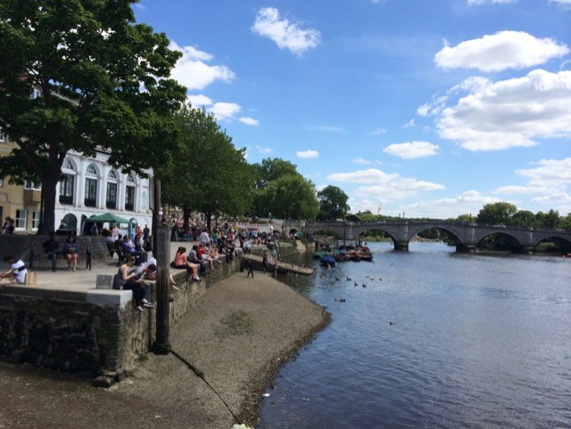
Summer scene, June 2015
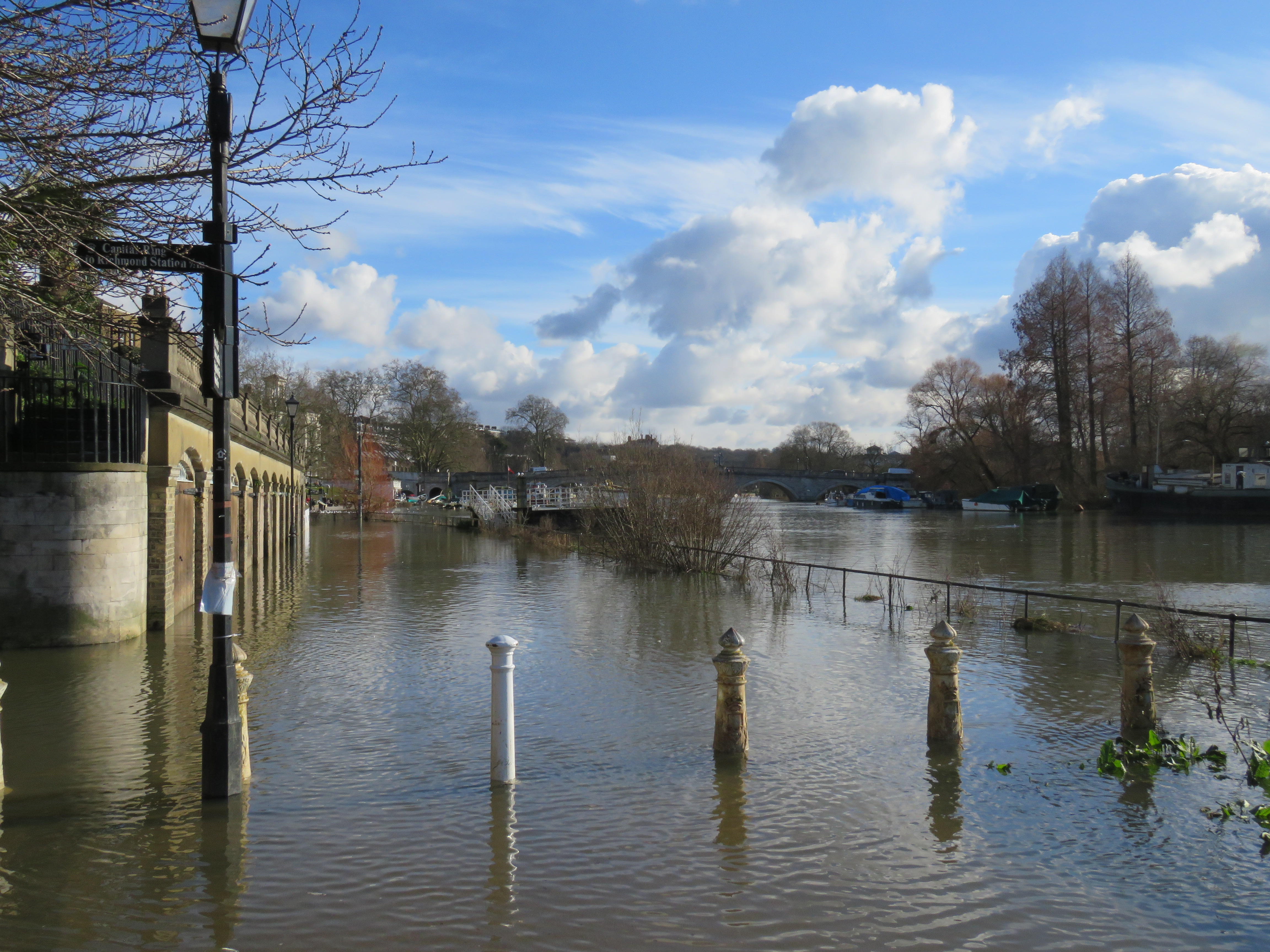
High tide, February 2021
Let’s venture over the bridge briefly, into St Margaret’s. Along Richmond Road, until we reach Sandycombe Road, a suburban side-street. Here we find Sandycombe Lodge, designed and lived in for a while by JMW Turner, the great painter. I strolled up there the other day – for the first time. I must admit I was expecting something grander – Palladian, with stucco walls perhaps. There is a certain elegance to it, despite its modesty; and I suspect the interior is where you see Turner’s artistic eye most. It’s closed at the moment of course, but I’ll be taking a look around sometime in the future.
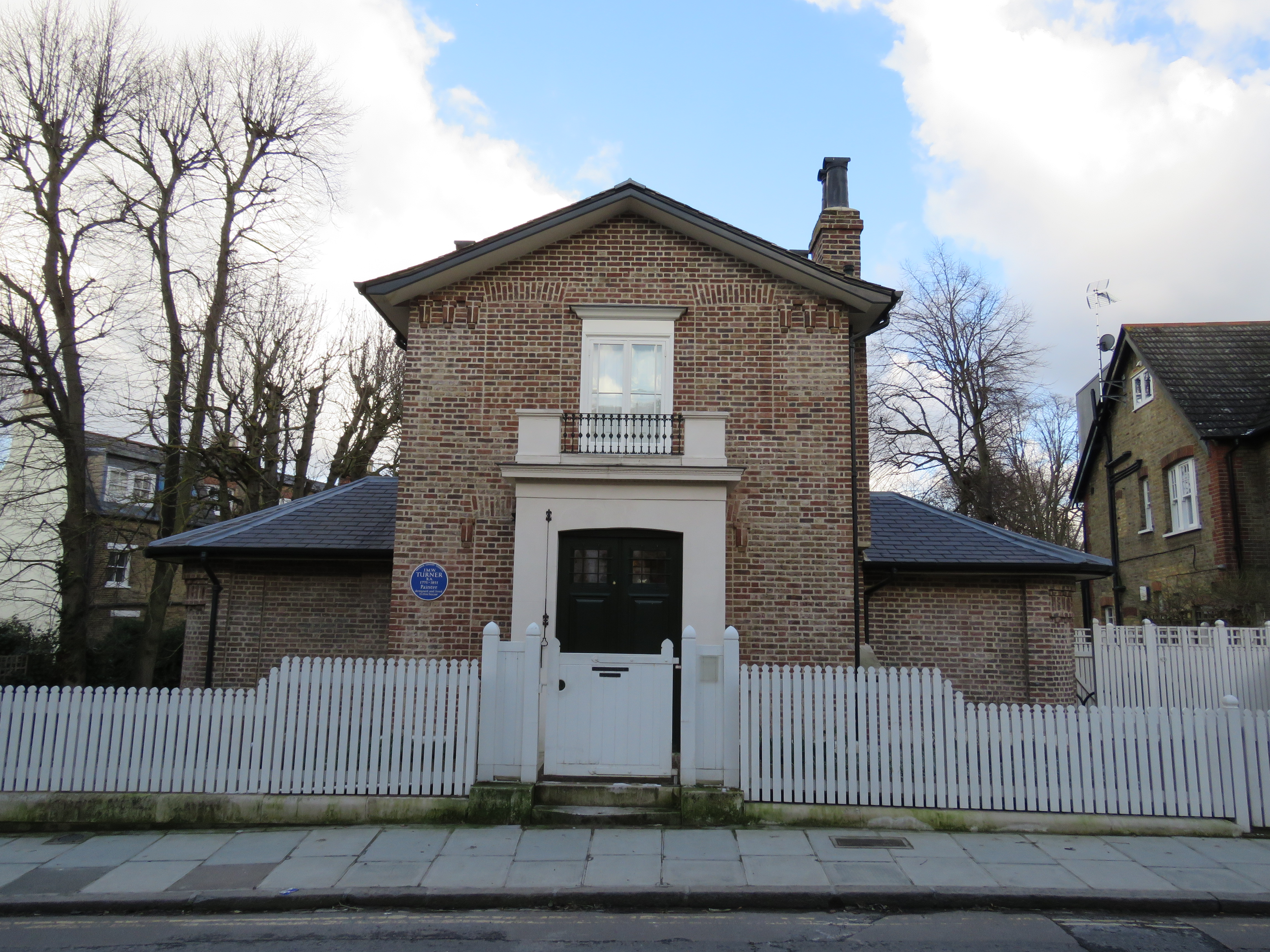
Turner is one of the great painters of the river, maybe the greatest. Ruskin said of Turner’s relationship with the Thames that, ”He understood its language.” I think I know what Ruskin meant, after watching its ebb and flow so often over the past year – and after walking its length. The river is constantly telling its story. Turner lived much of his life near or alongside the Thames: he was born in Covent Garden, a pretty rough place in the 18th century; and died in Cheyne Walk, Chelsea, rather more salubrious. At other times he lived in Brentford (where he went to school in his youth) and Isleworth as well as St Margaret’s. A river-dwelling West London lad – I can relate to that!
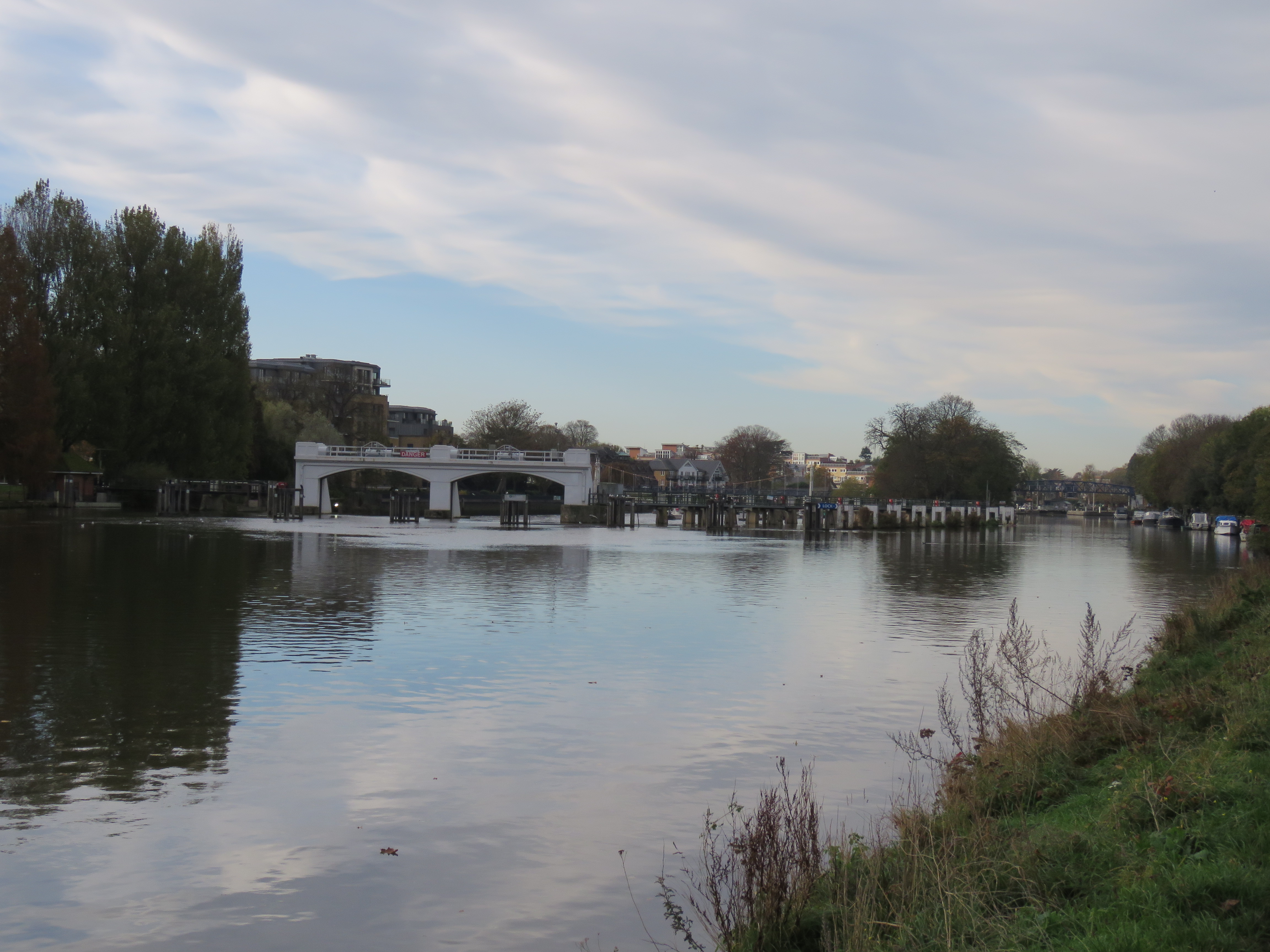
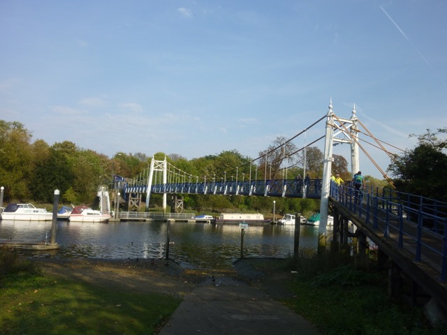
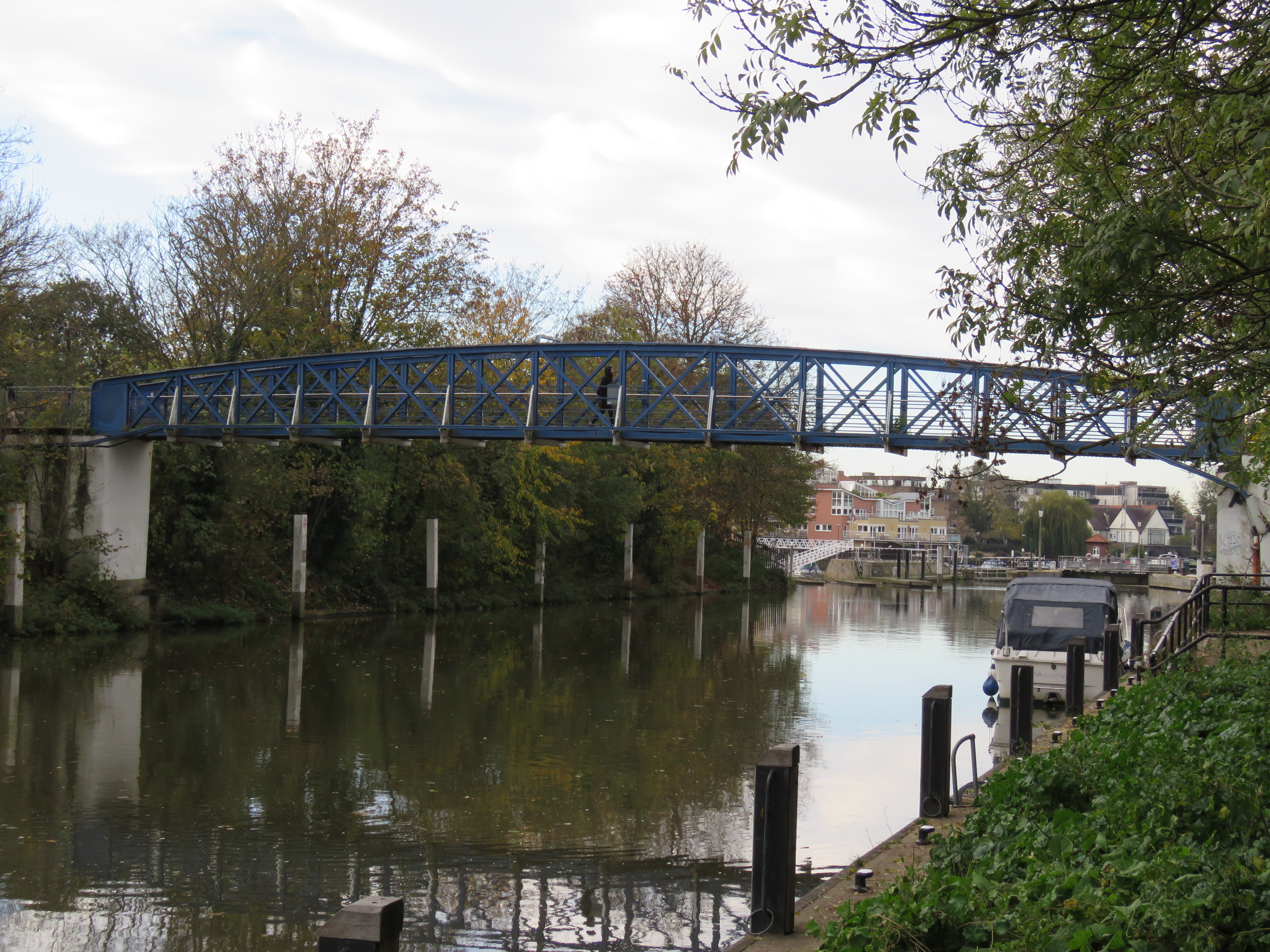
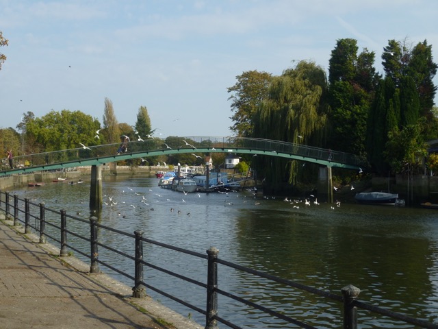
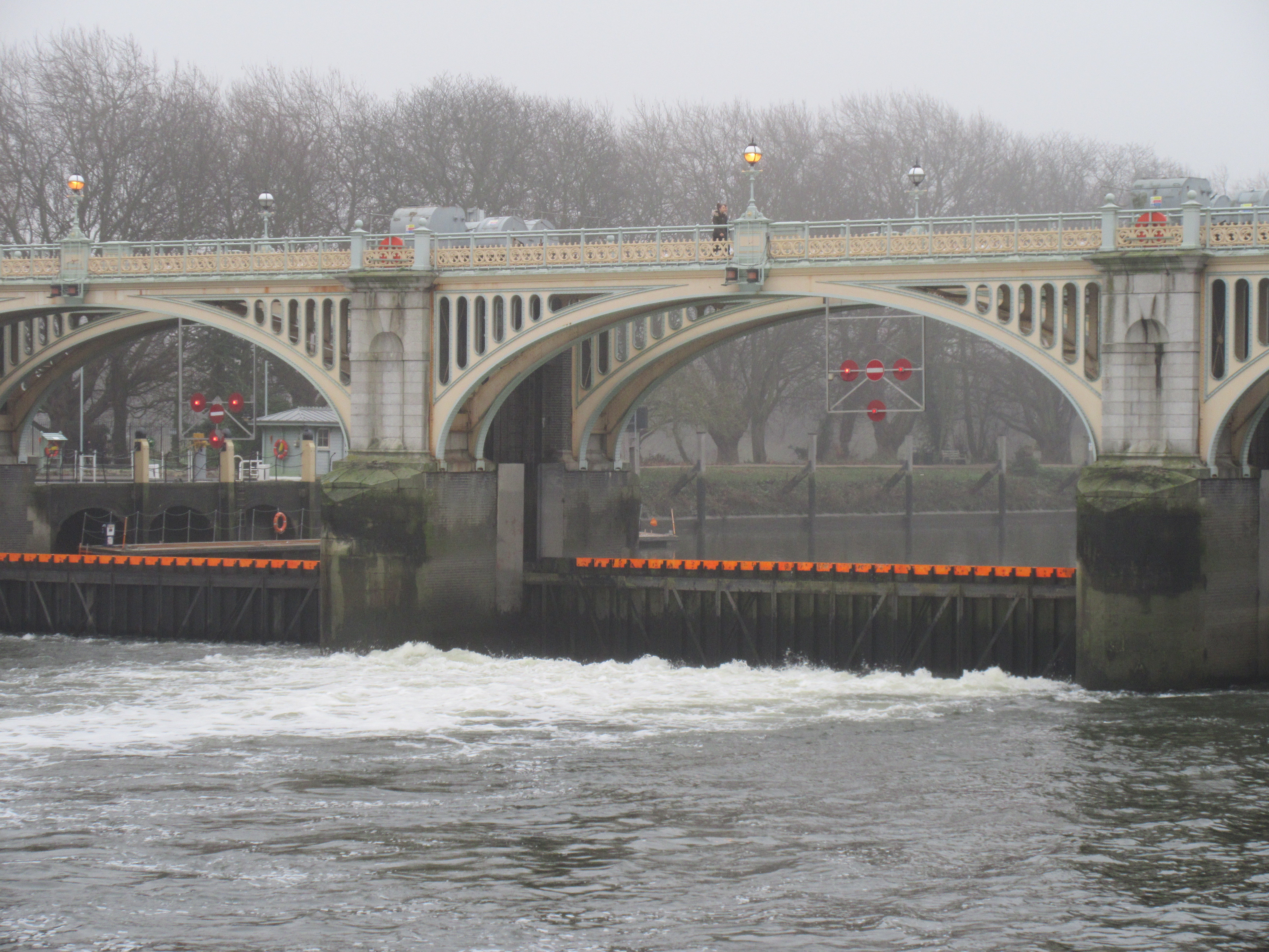
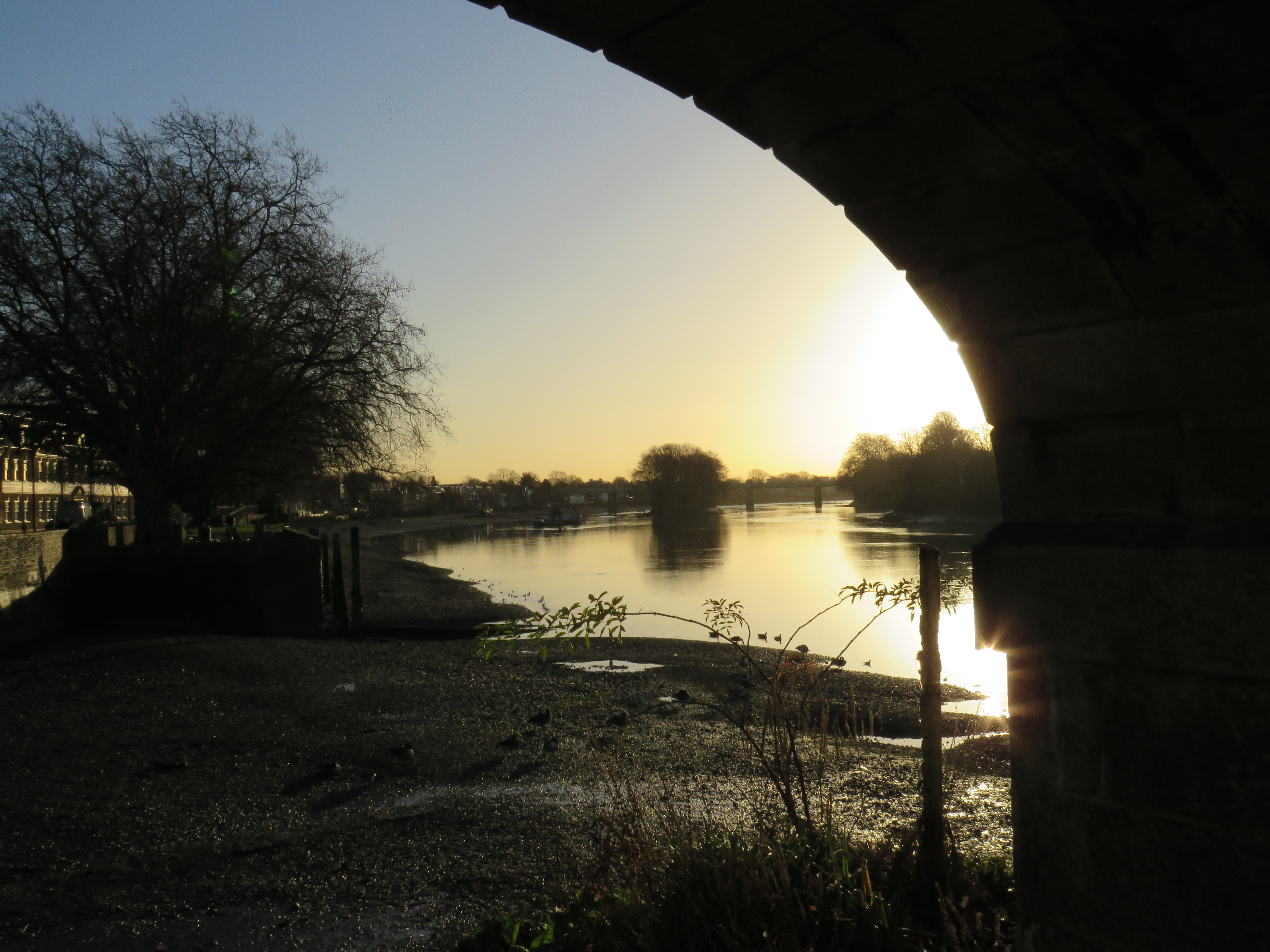
Back to the river, and a little further along – best walked on the Surrey side – we reach Twickenham Bridge, and just beyond that, Richmond Lock. It’s the last lock on the river – or the first, depending on which way you look at it. It was officially opened in 1894 by the Duke and Duchess of York. After a major refurbishment in the 1990s, it was re-opened by the current Duke of York…
The main purpose of Richmond Lock was to regulate the tidal flow so that the stretch of the river between between Richmond and Molesey (near Hampton Court) wasn’t impassable to boats at low tide. Too much of the water drained away downstream, so three large sluice gates at Richmond Lock prevent all of the water making its passage to the sea. Whether that also contributes to the flooding in Richmond at high tide, I don’t know. But it seems a possibility.
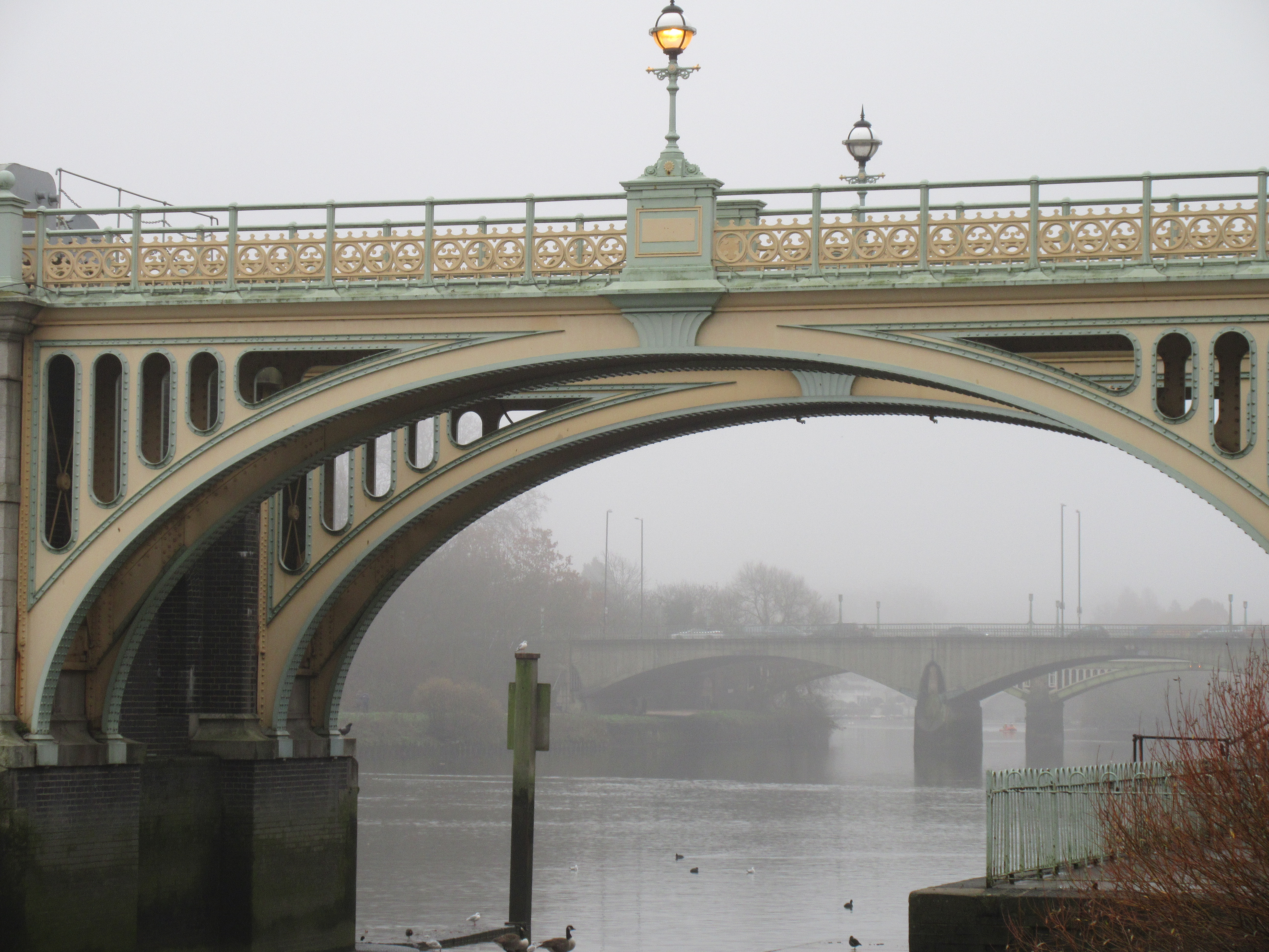
Twickenham Bridge first. Two more shots from November 2020. The first is taken from near Richmond Bridge: the railway bridge comes first, then Twickenham.
These first two photos of Richmond Lock were taken on Tuesday this week. The tide was going out, so the sluice gates were up.
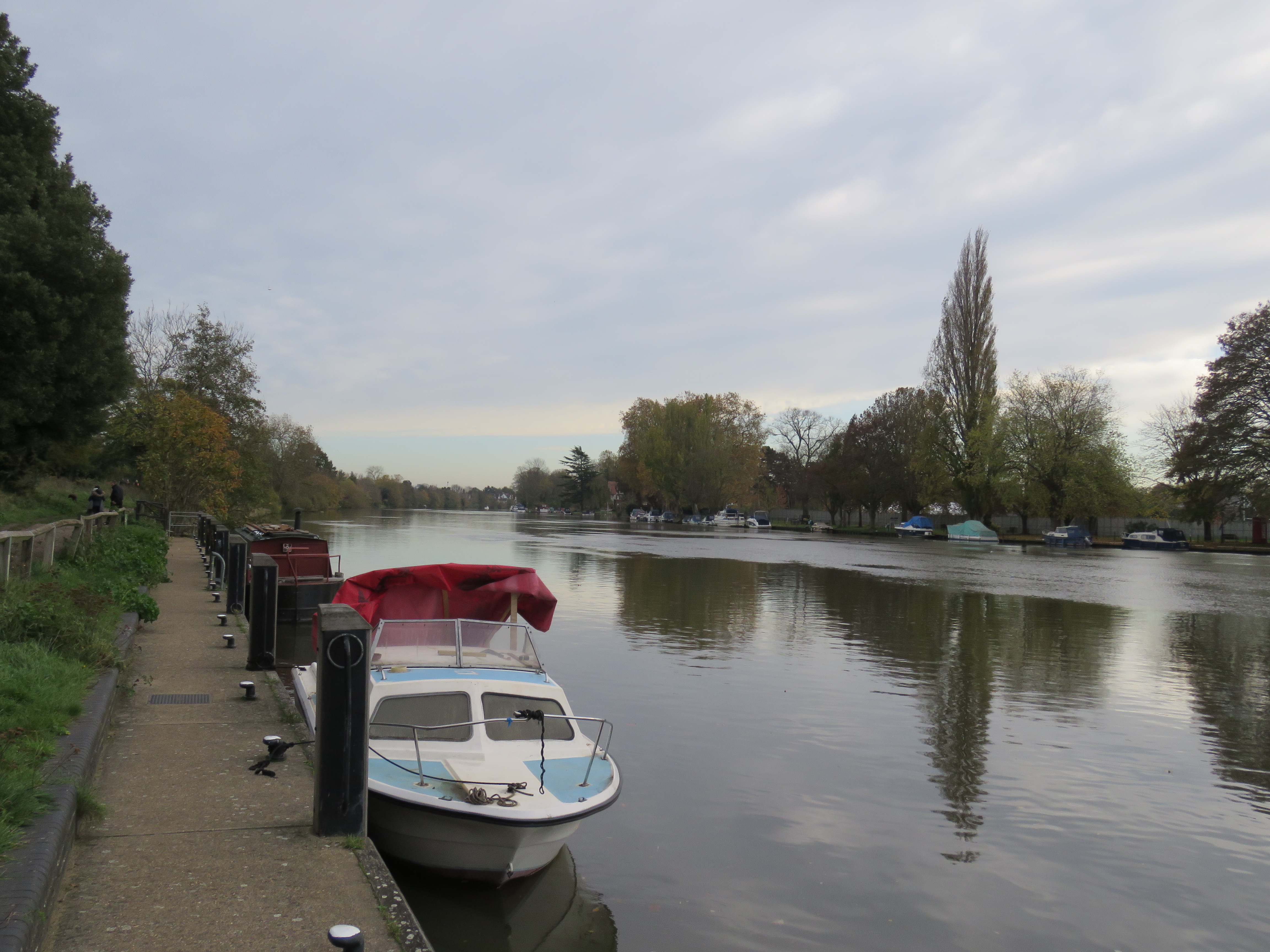
The footbridge was shut for part of 2020 for some further refurbishment. It cost half a million. But it’s back now, which is great, as it’s the point I’ll often walk upstream to along the Surrey side from Kew Bridge, before heading back on the other side, through Isleworth, into Syon Park and then into Brentford and along the Grand Union canal on the way home. It wasn’t too inconvenient to walk a little further to Twickenham Bridge and cross over there while the footbridge was closed, but the latter is much nicer. There are no cars roaring by.
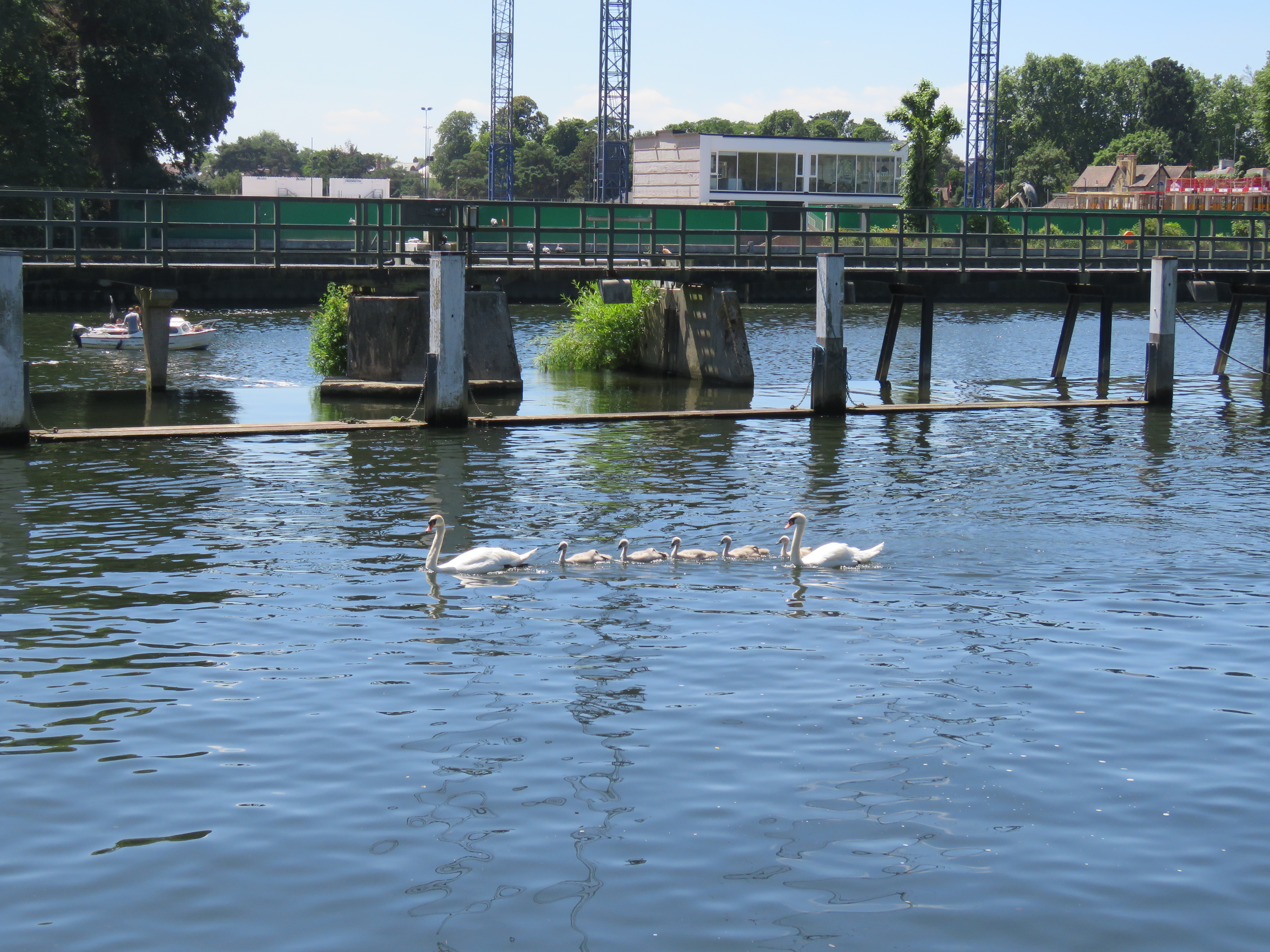
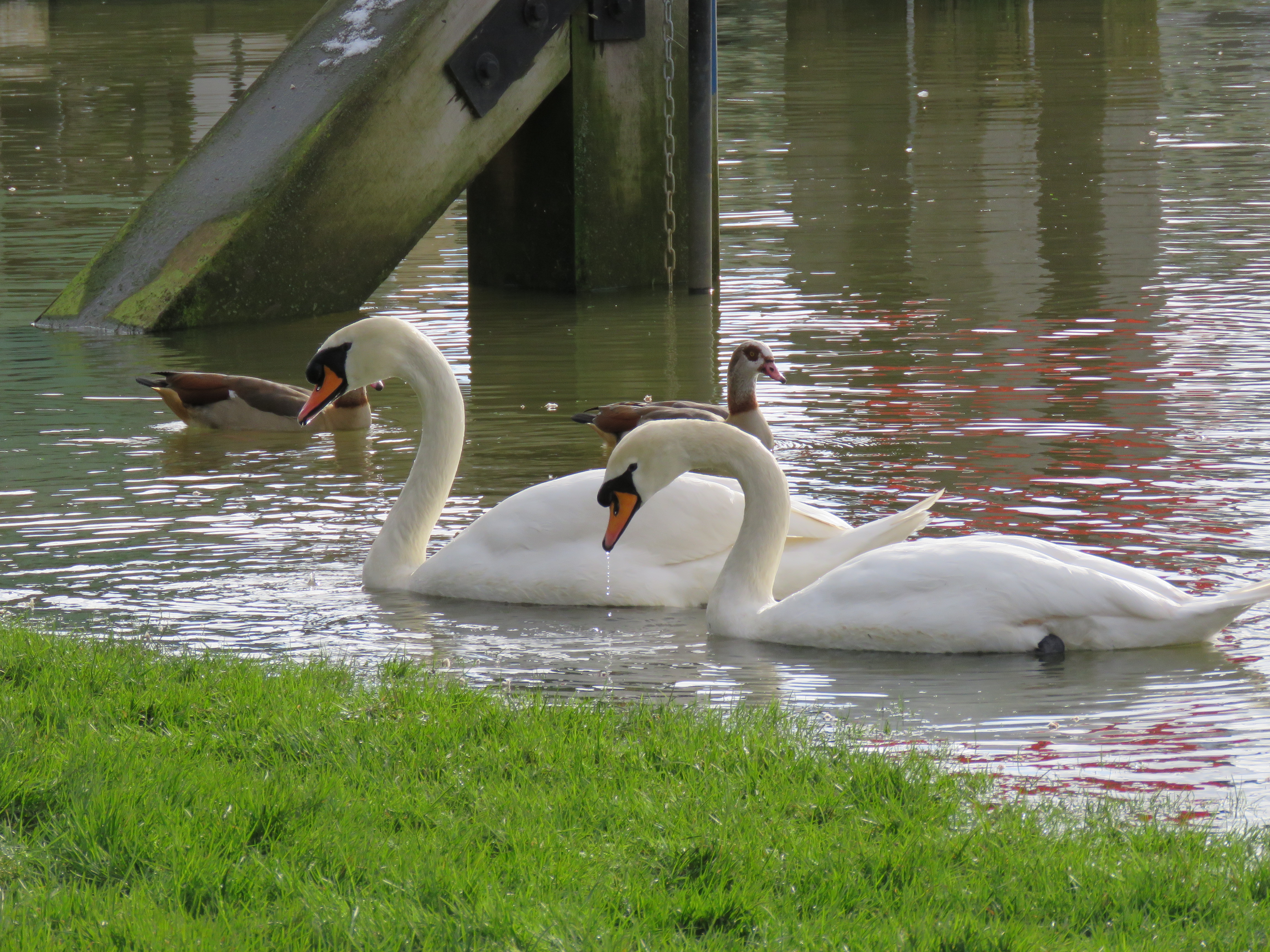
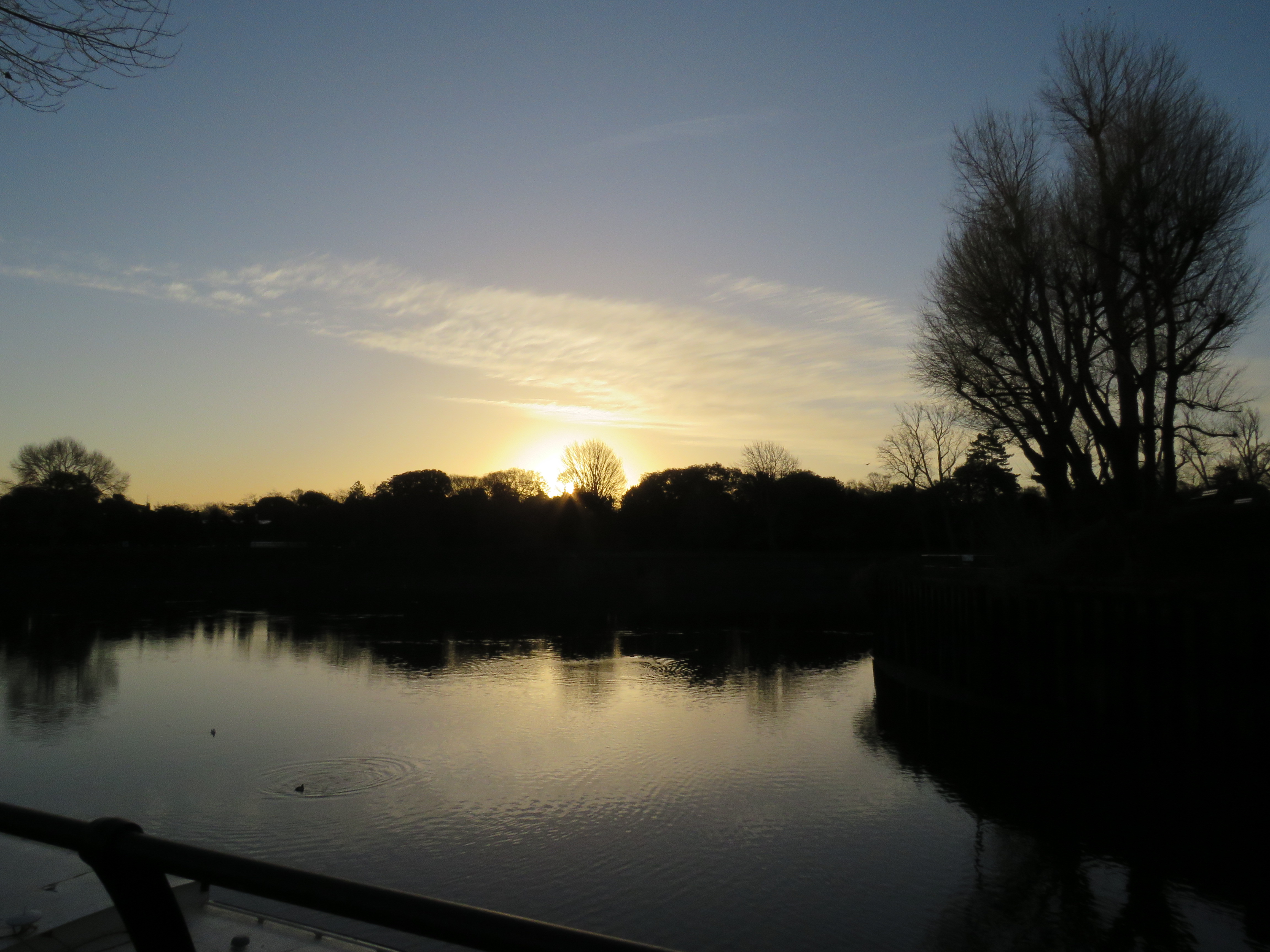
The next couple of photos are from February this year. I liked the way the water’s surface had a black and white effect as it rippled at high tide and reflected the low sun. There’s a bench I often sit at by the footbridge on the Surrey side. I get out my flask of tea and sandwiches – how old geezer is that? Still, the option of popping into the pub has been lost to us for most of the past year. Anyway, one of the swans in the photo got pretty interested in what I was eating and came close. I thought taking a snap right at that point might be ill-advised!
The next two are from a misty December day in 2016. I would have been cycling in those days.
And this photo was taken right by the footbridge one lovely April day in 2012. I’ve always liked the way it signals revival – and hope.
Before I describe some of that walk home, I’ll stay on the Surrey side, as I want to share some photos of the natural beauty along the towpath. To start we have the Old Deer Park running alongside the river, heading downstream. Back in the days of Richmond Palace, these were the palace grounds, and there were deer inhabiting them. The deer are now in Richmond Park, the palace is long gone and Old Deer Park is shared by London Welsh rugby club and Royal Mid-Surrey golf club. There’s also a monument on the towpath marking the meridian line, which was used to calculate the time before Greenwich Mean Time. In the park there’s an observatory and some obelisks, built in the time of King George III, which helped to make those calculations.
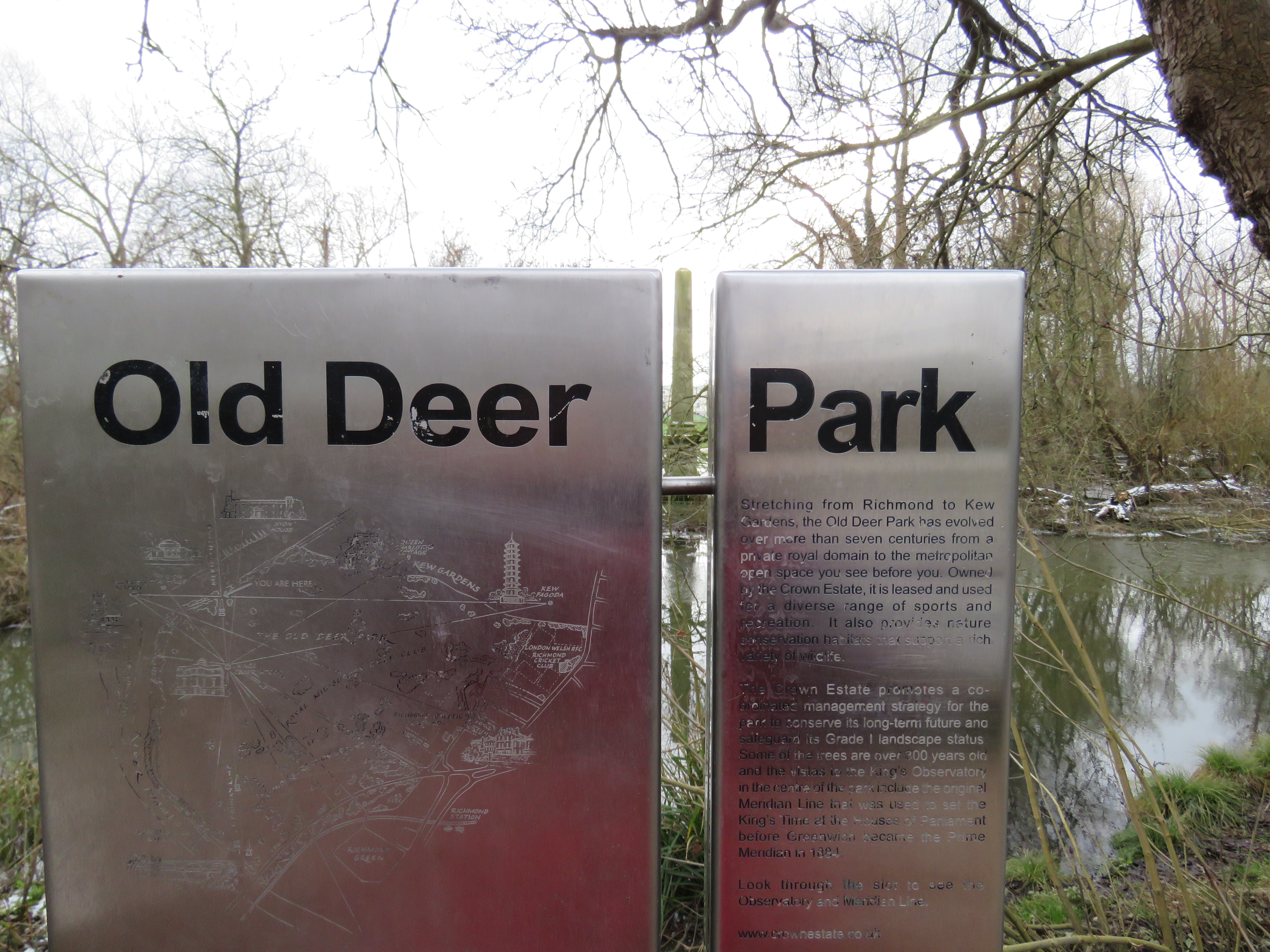
The gap marks the meridian line, with an obelisk directly in line
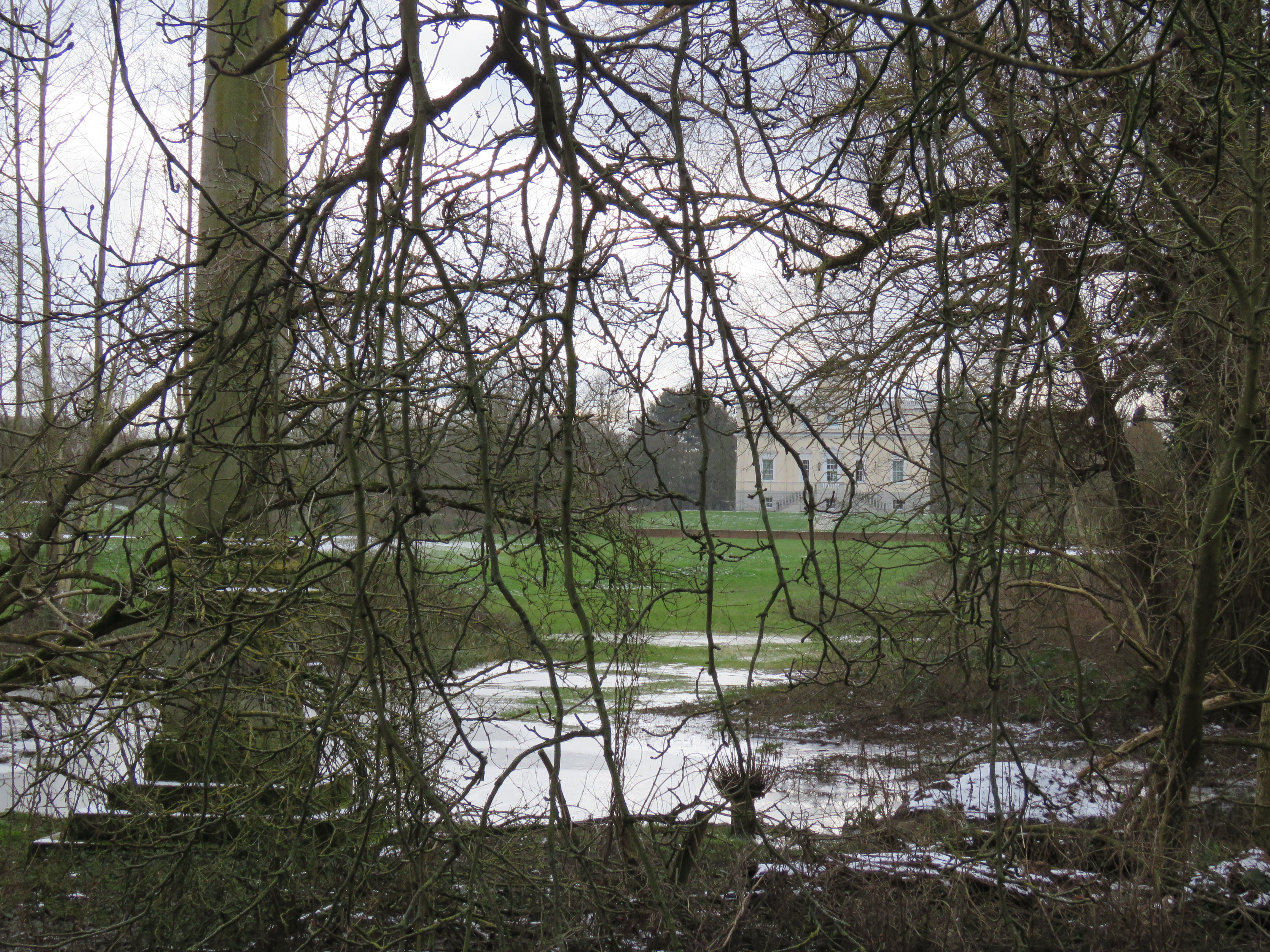
The observatory is in the background
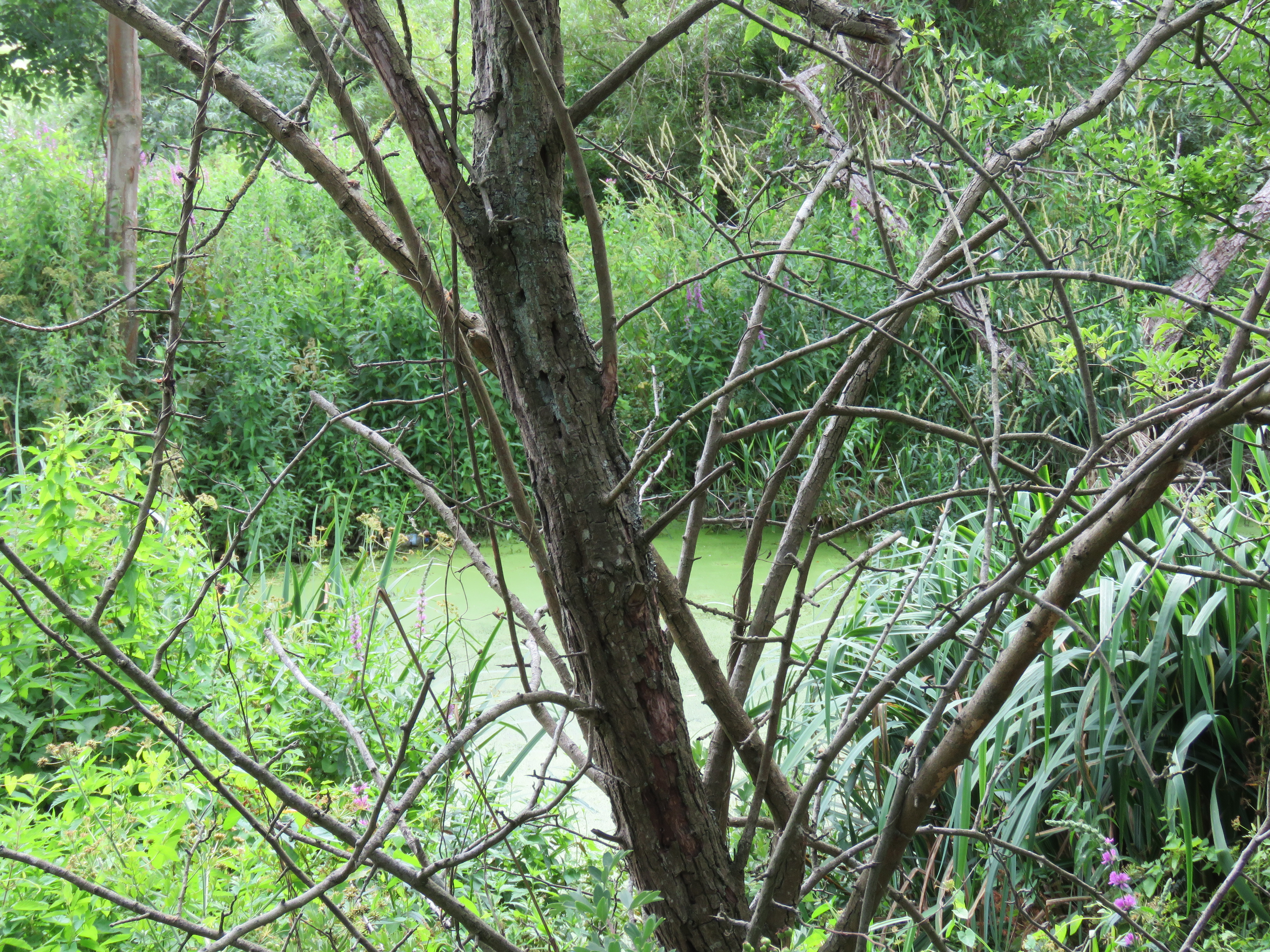
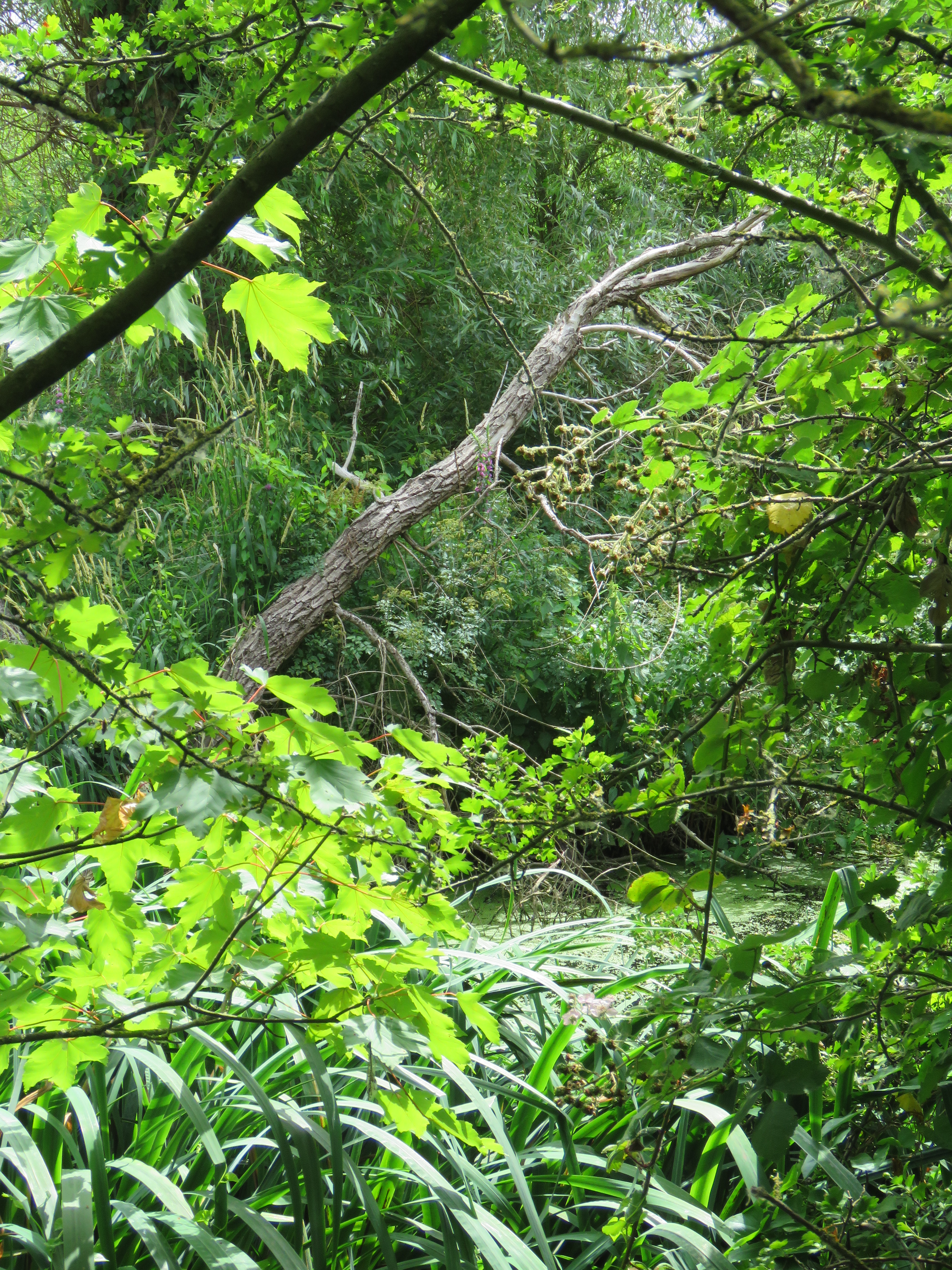
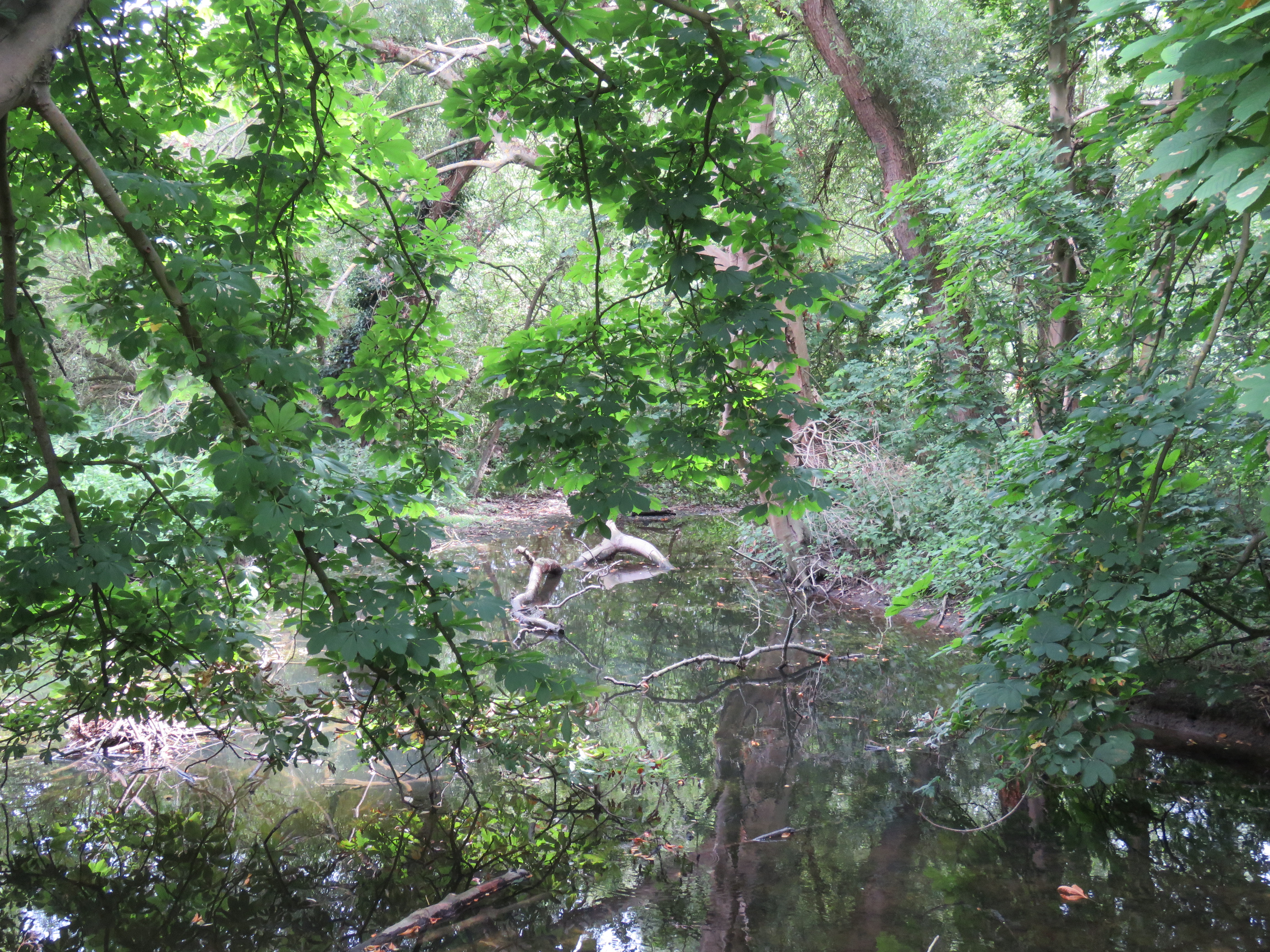
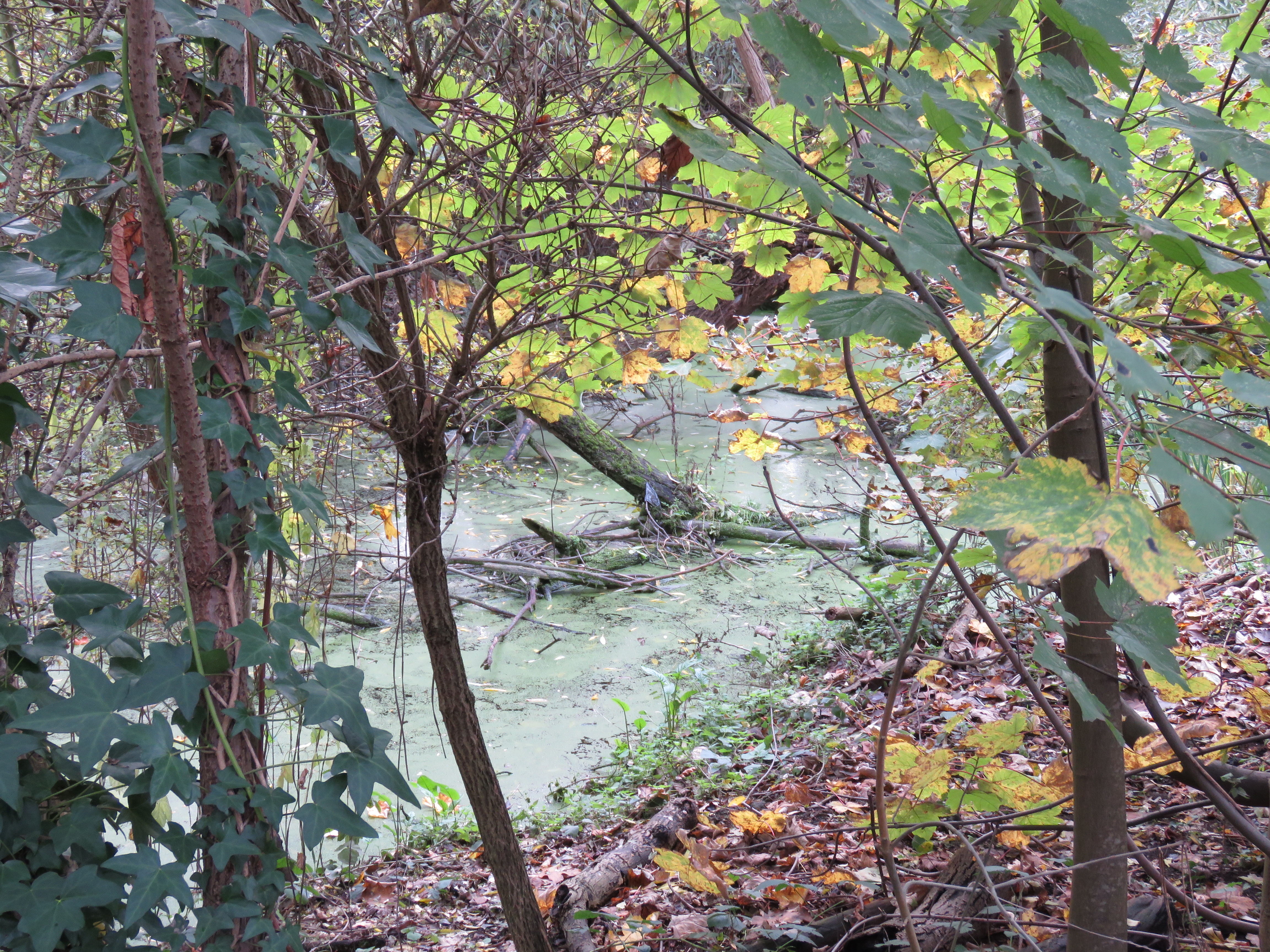
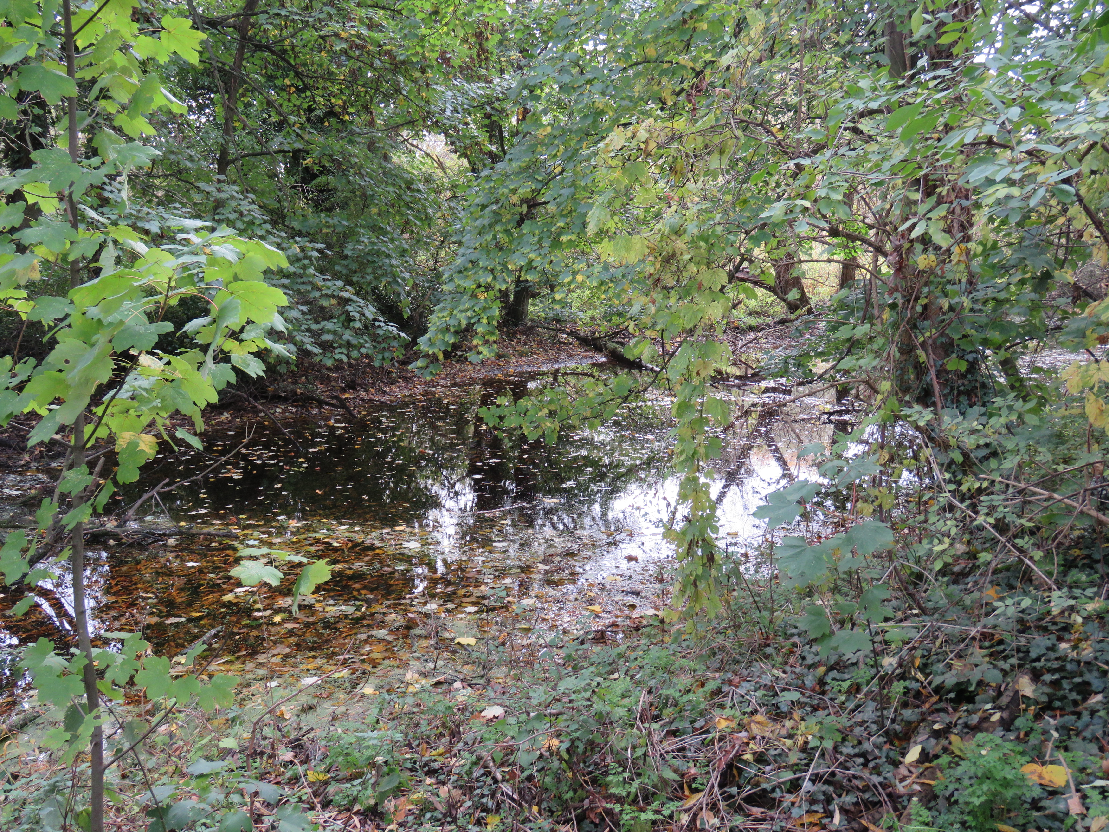
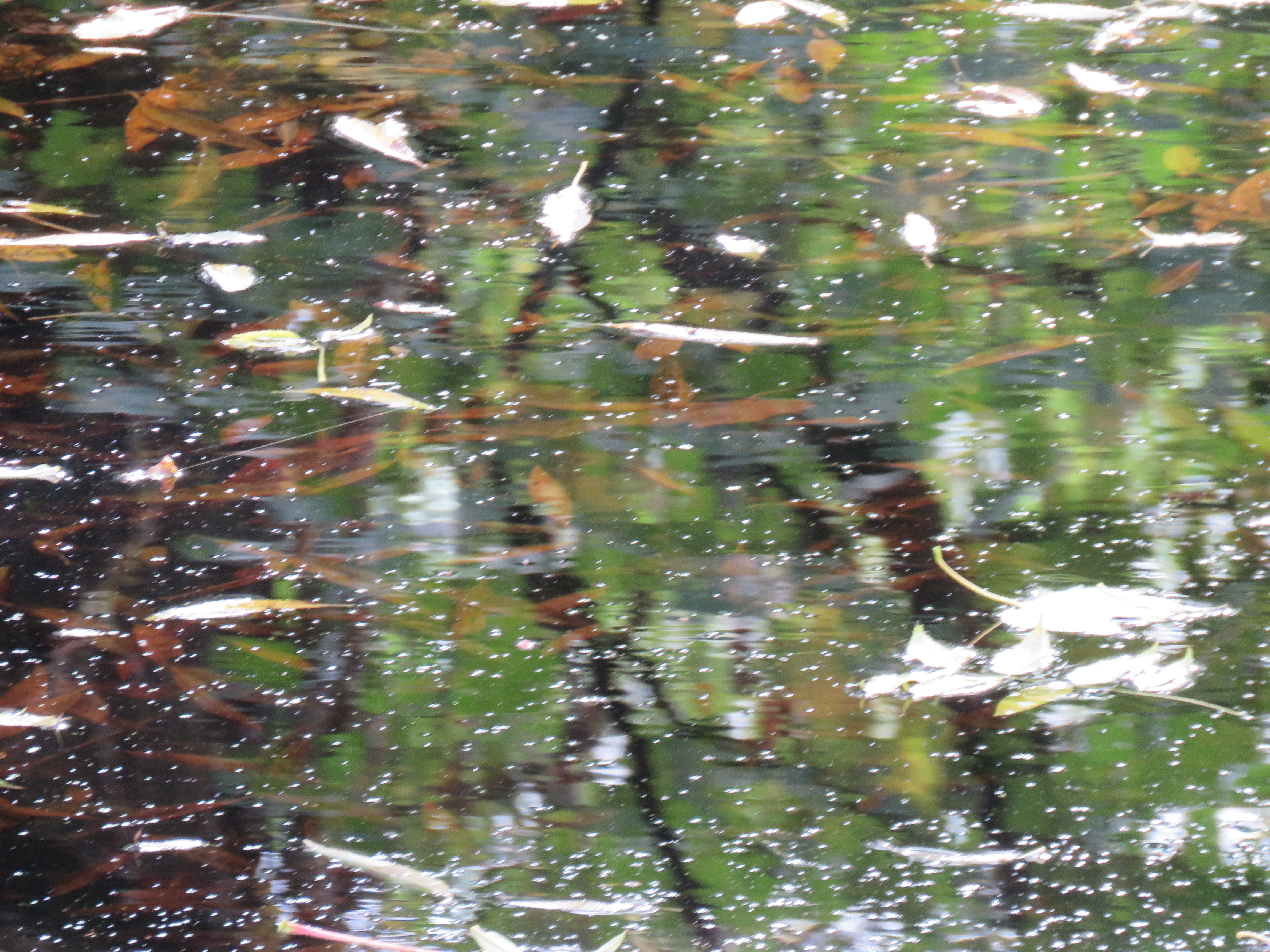
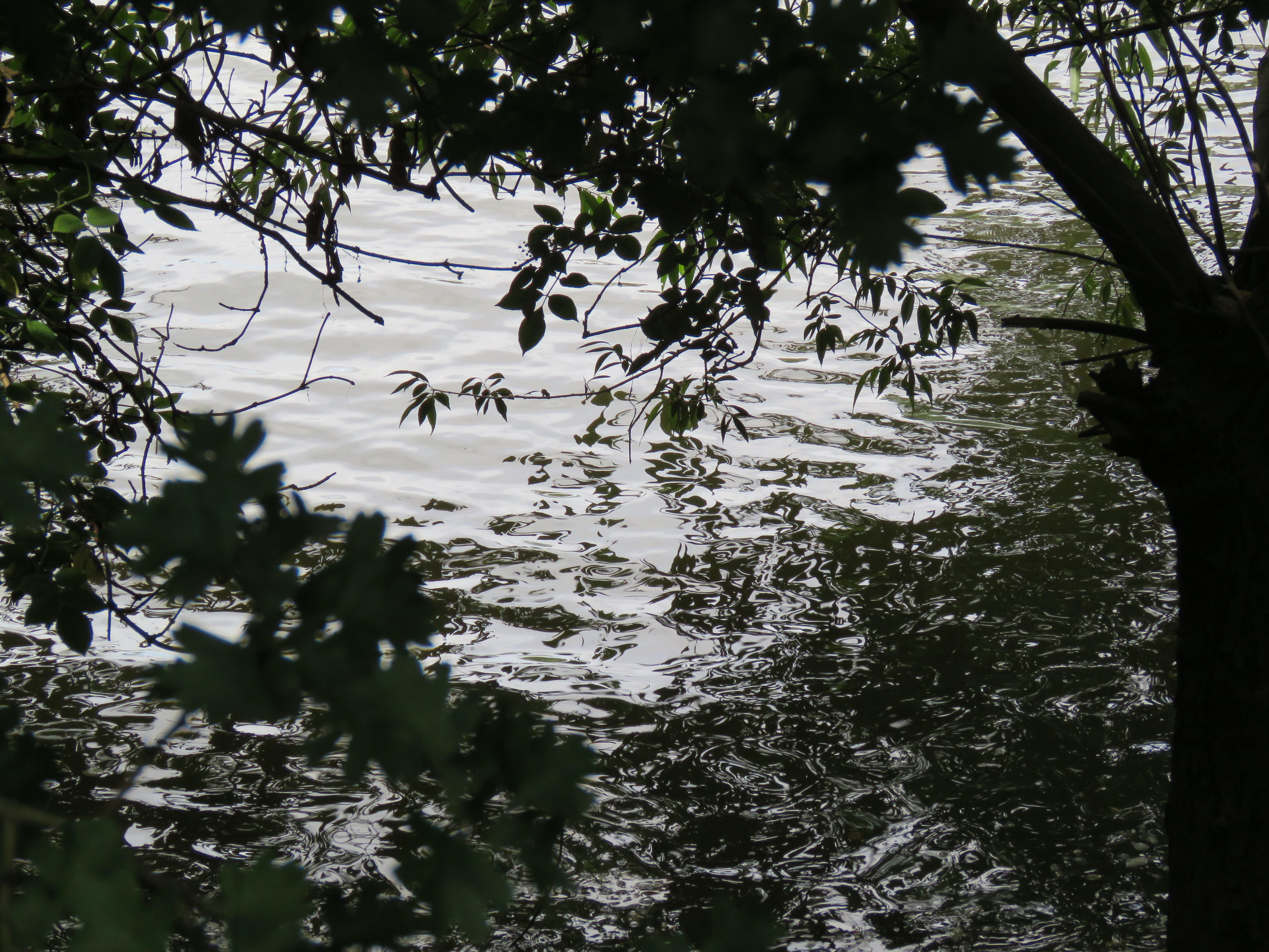
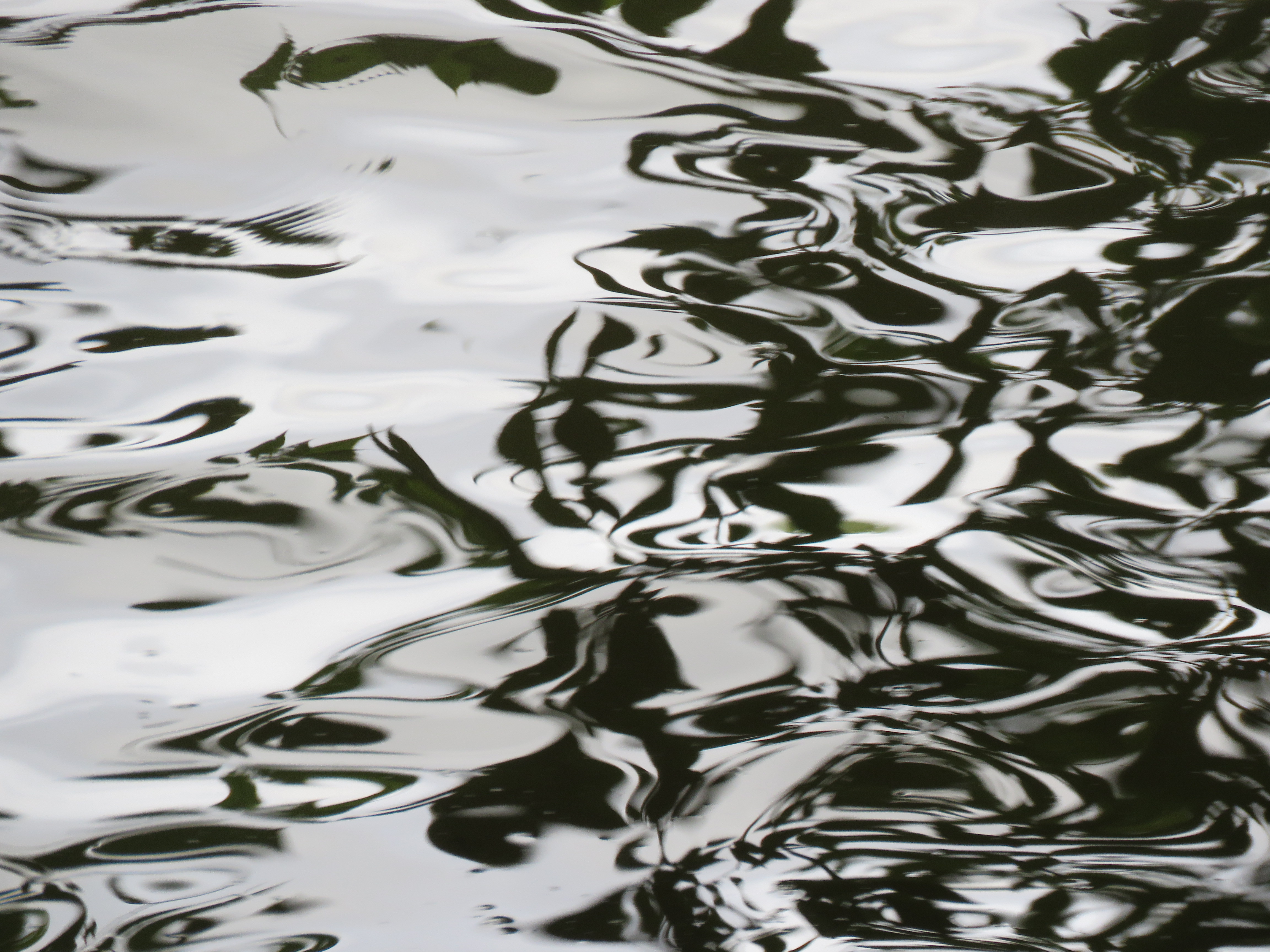
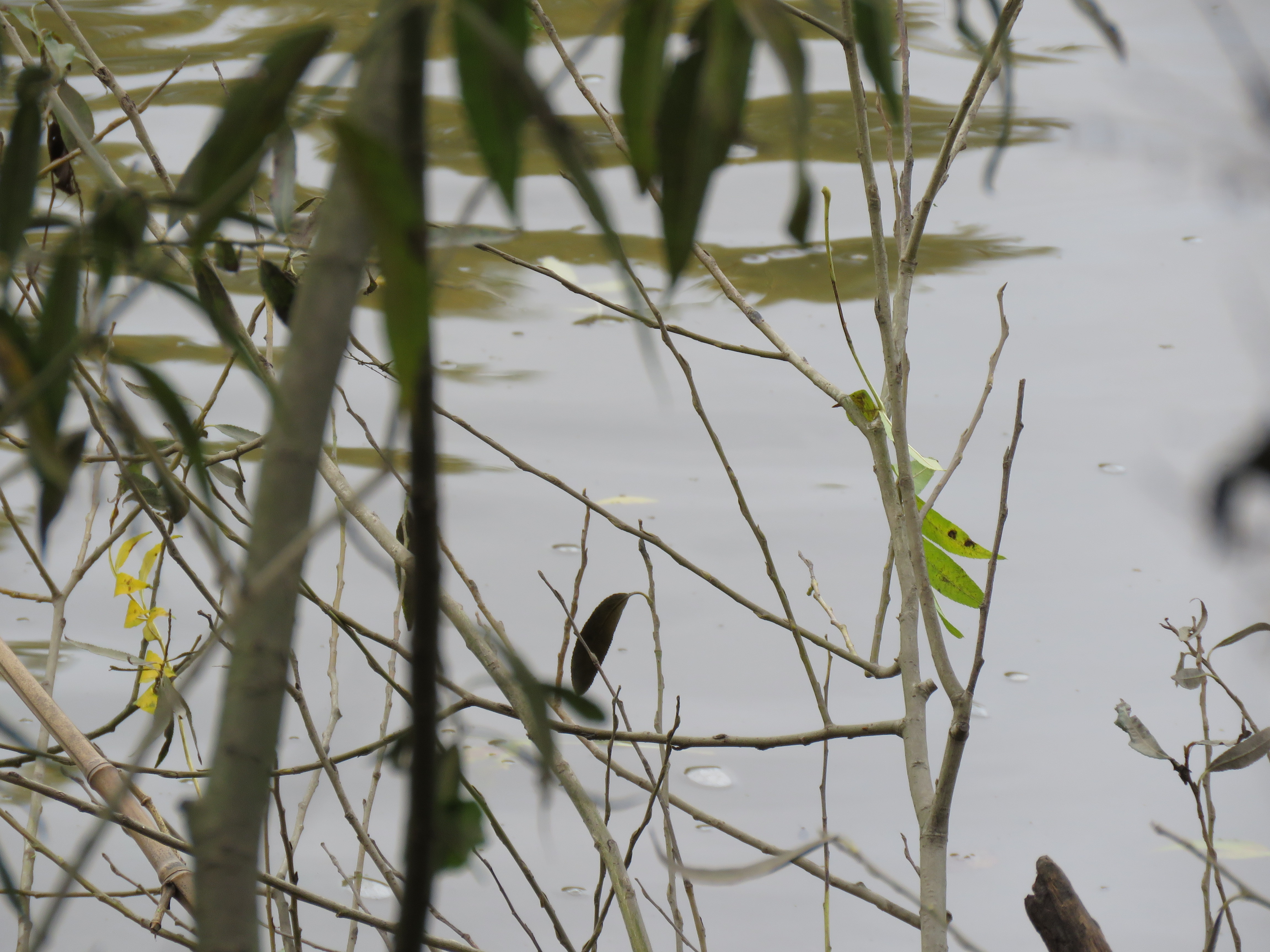
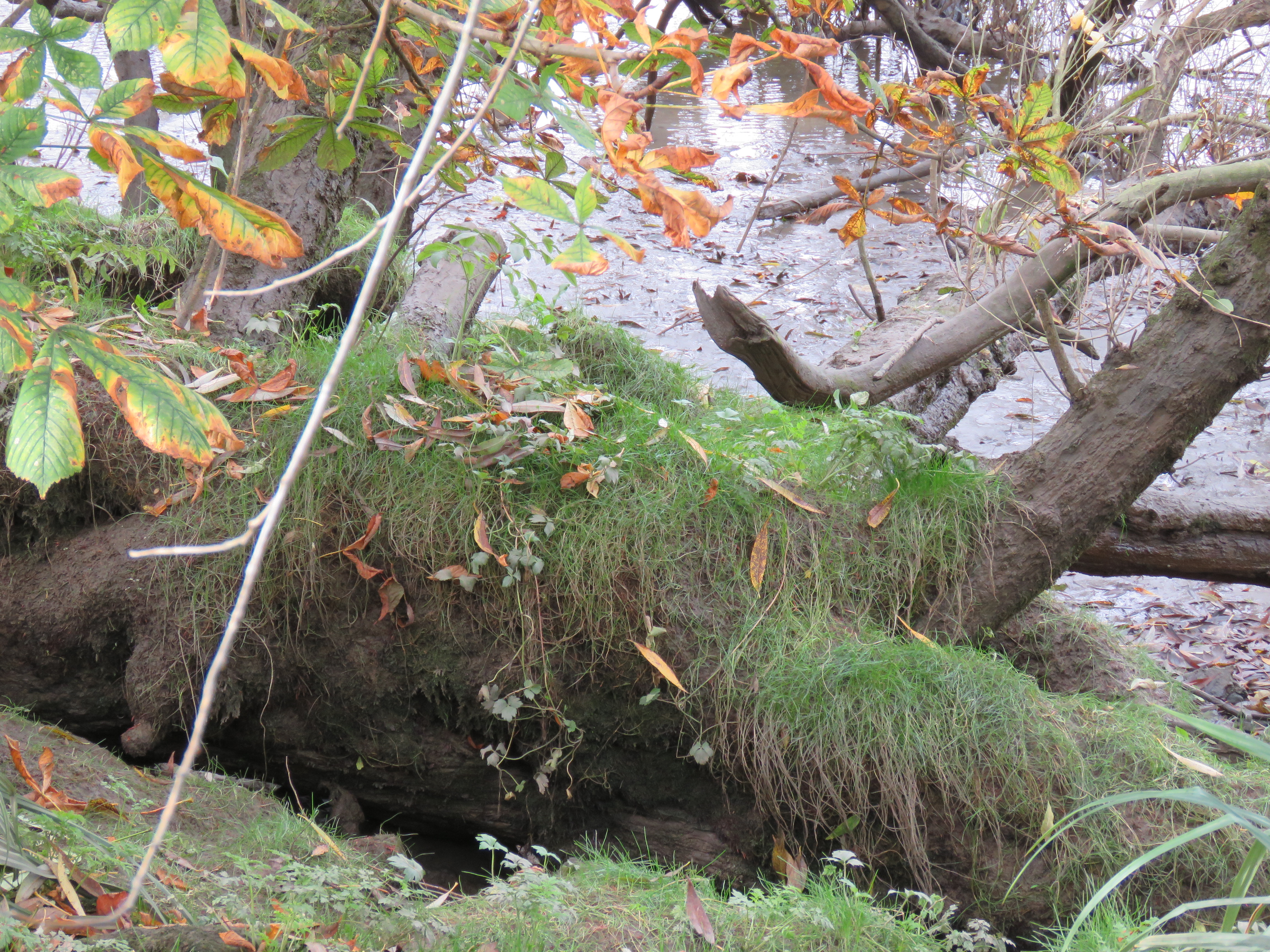
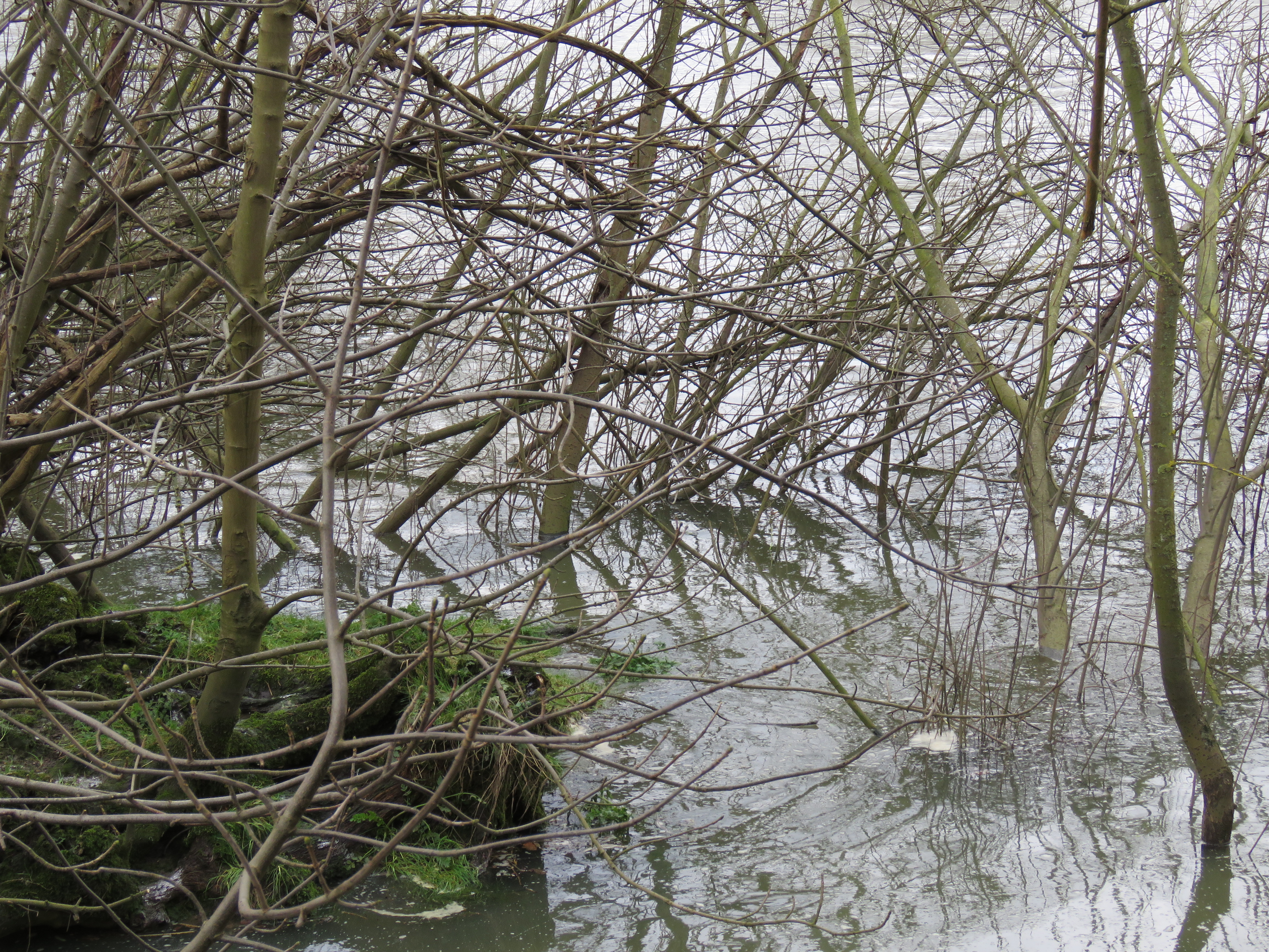
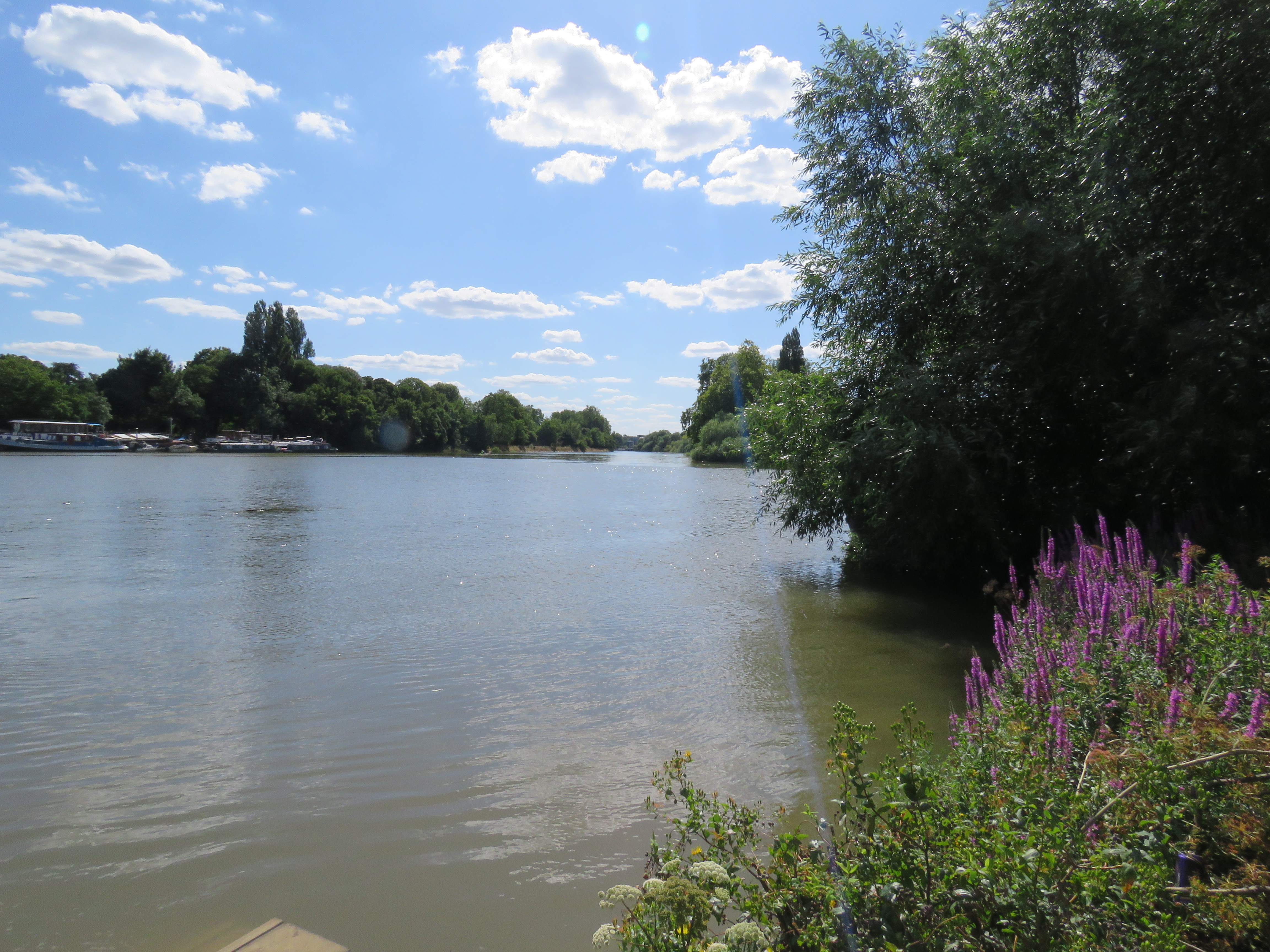
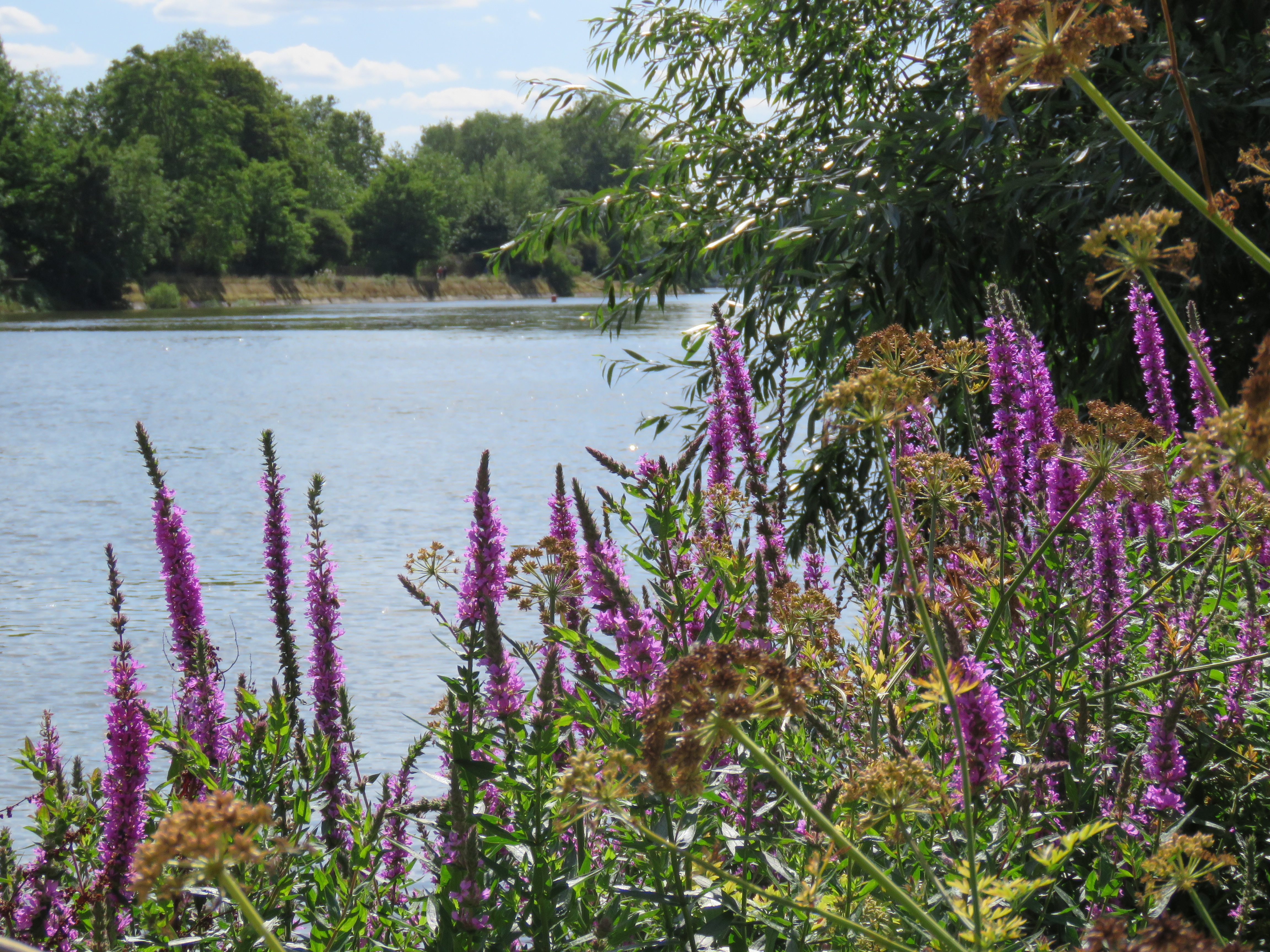
I love the riot of plant life along this stretch of the river. Between the Old Deer Park and then Kew Gardens there runs a channel of water, with all sorts of trees and undergrowth thriving in it. It is endlessly fascinating, almost jungle-like. And on the other side of the towpath, there is a lovely array of flowers on the river banks – and below the banks, revealed at low tide, a tangle of tree roots in thick mud. Not quite swamp, but the next best thing. And if you zoom your lens into the rippling water around all of this, you get the most beautiful patterns. Here are some photos to give you a sense of what I mean.
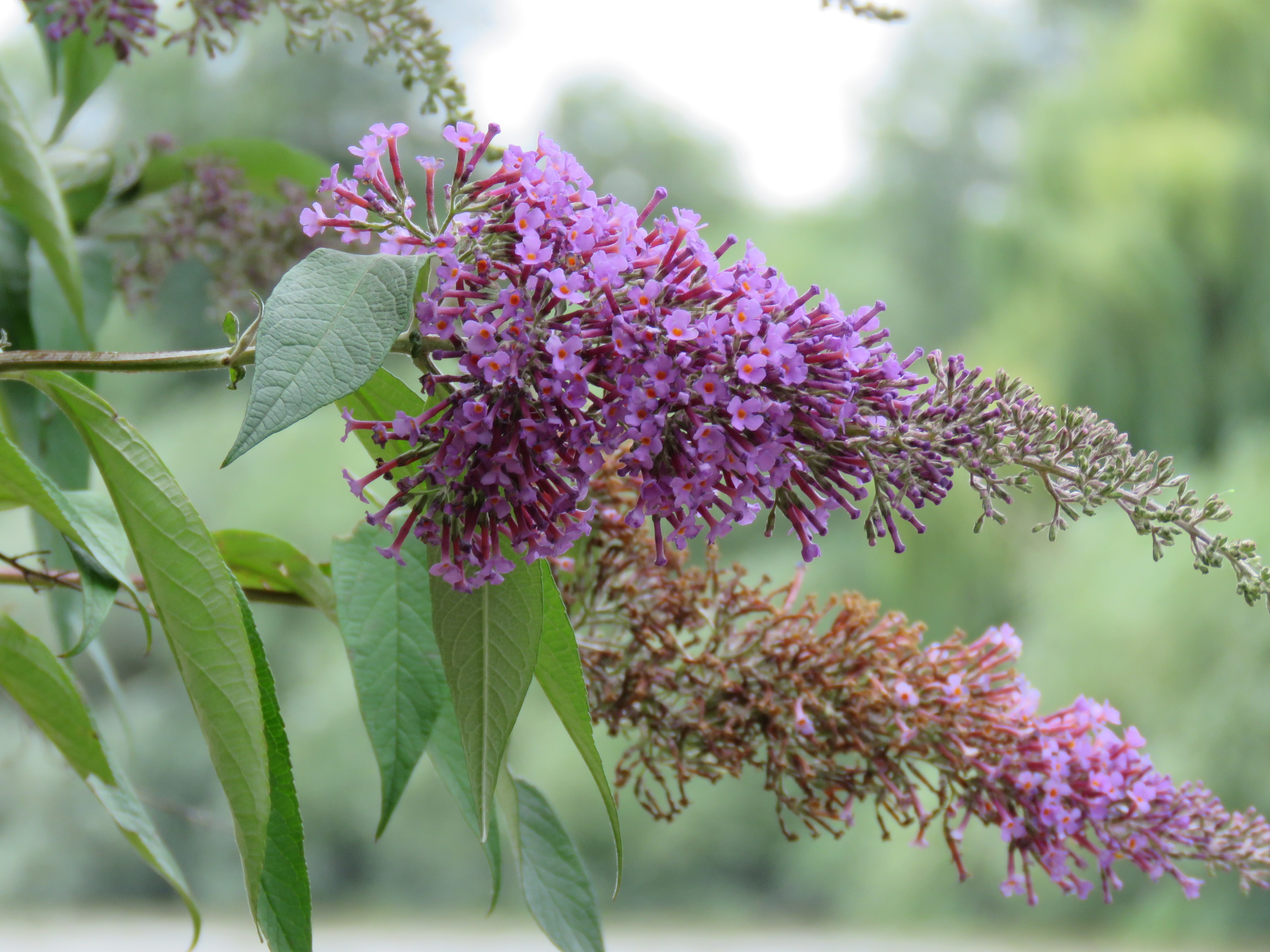
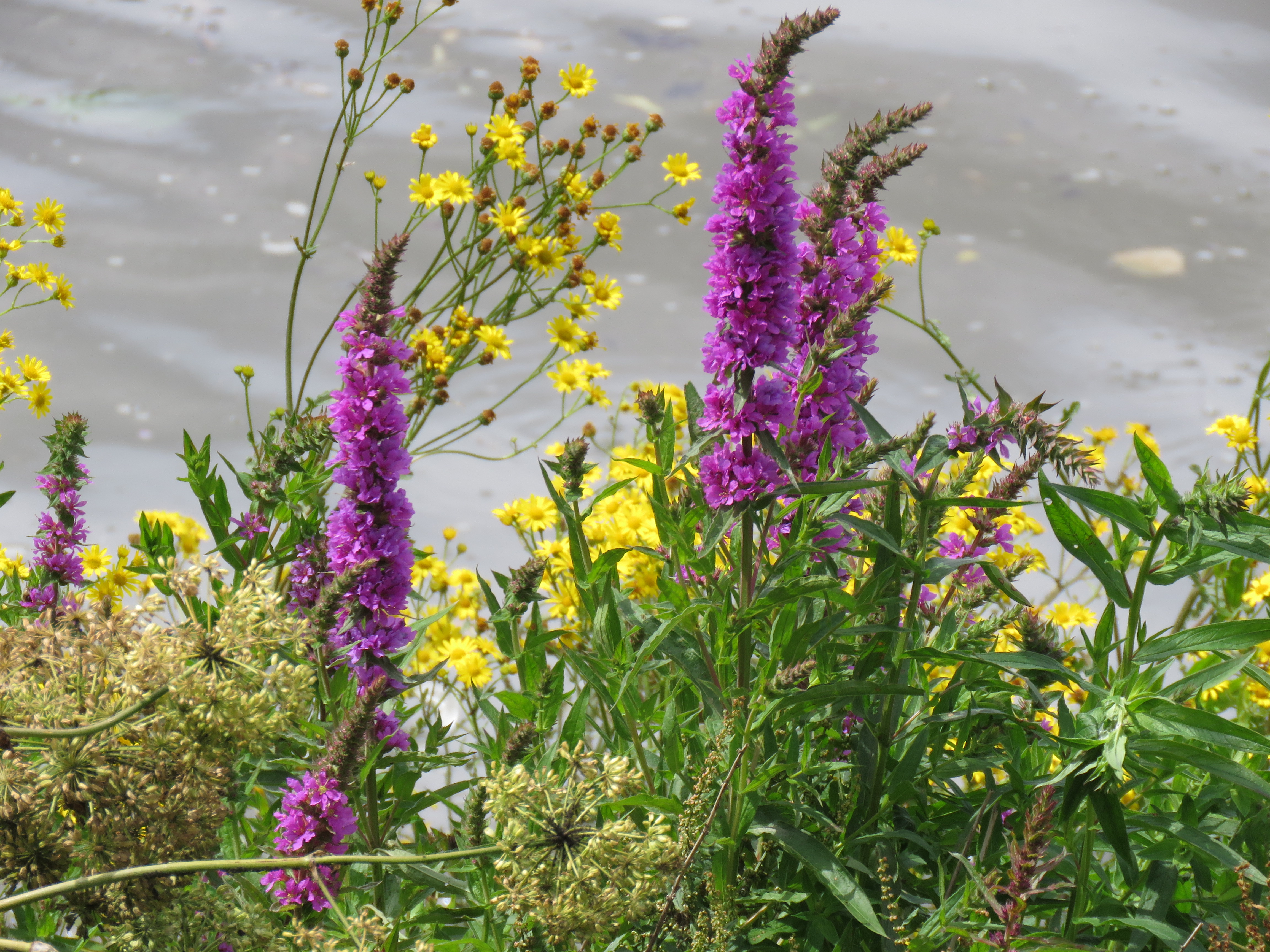
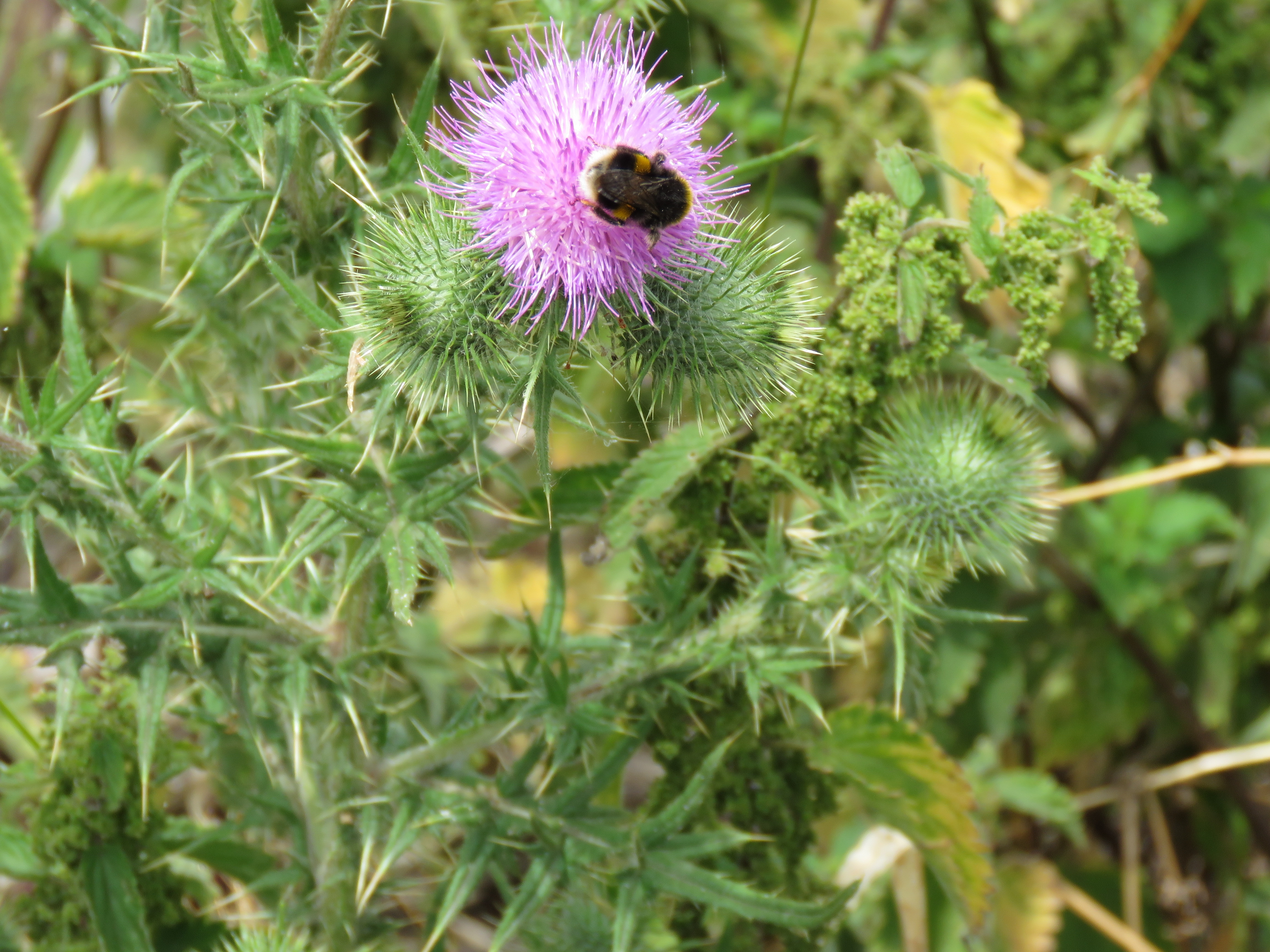
The undergrowth changes character with each passing month, as we move through the seasons.
Beginning with the lushness of summer – July 2020.
The colours of Autumn – October 2020.
The bareness of winter, with remnants of snow – February 2021.
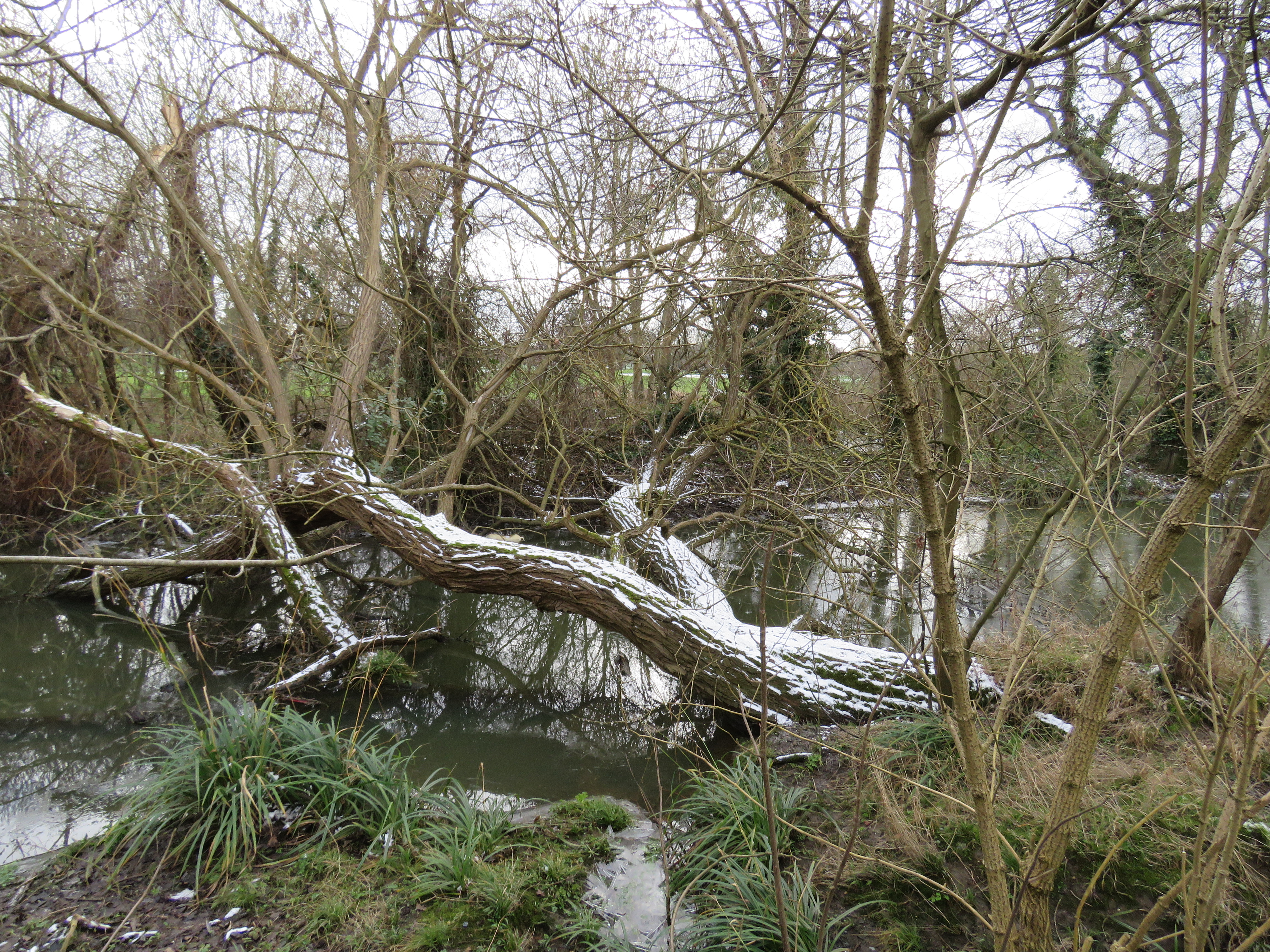
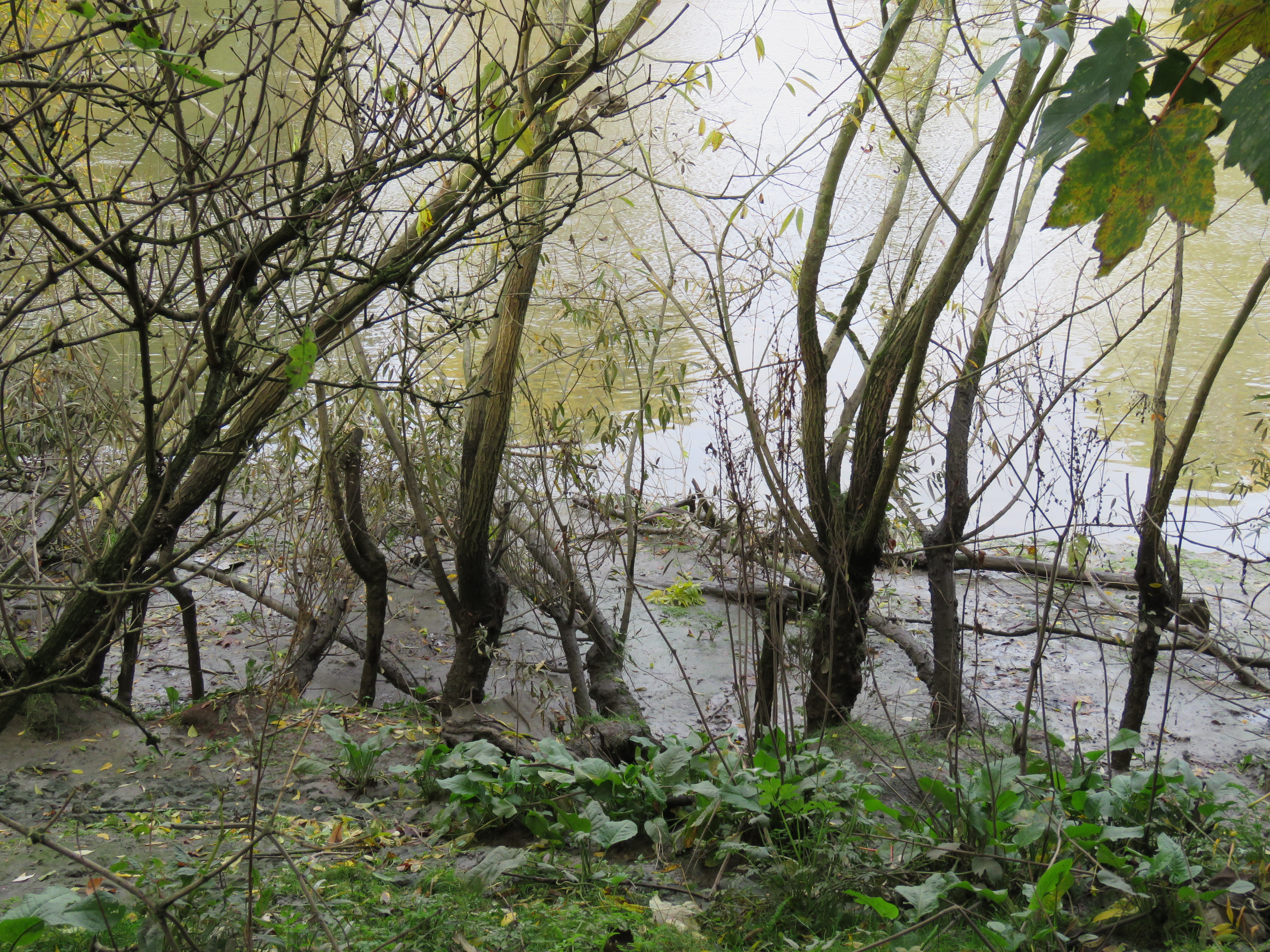
And on the river bank, a tangle of roots and branches that are often submerged.
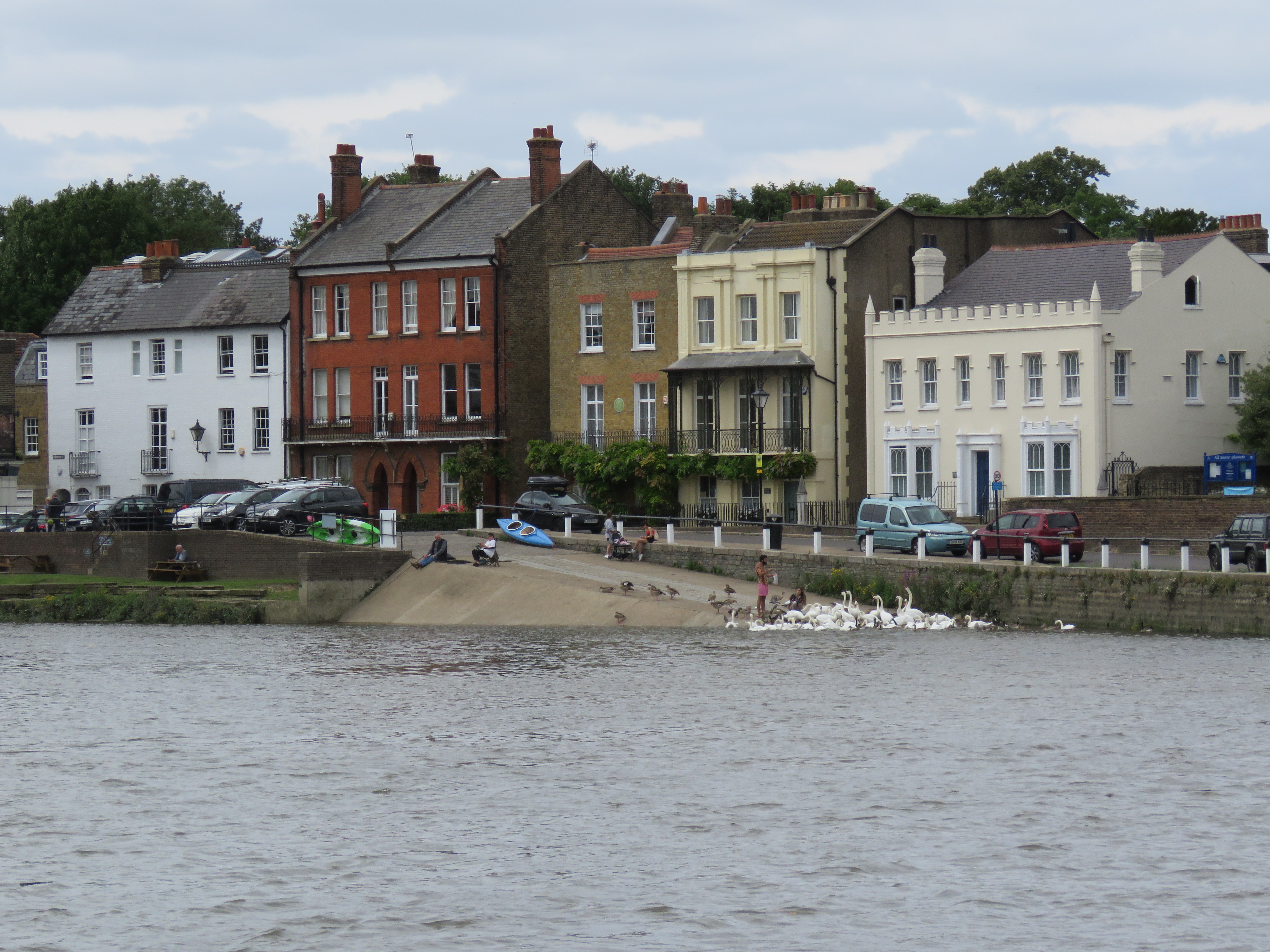
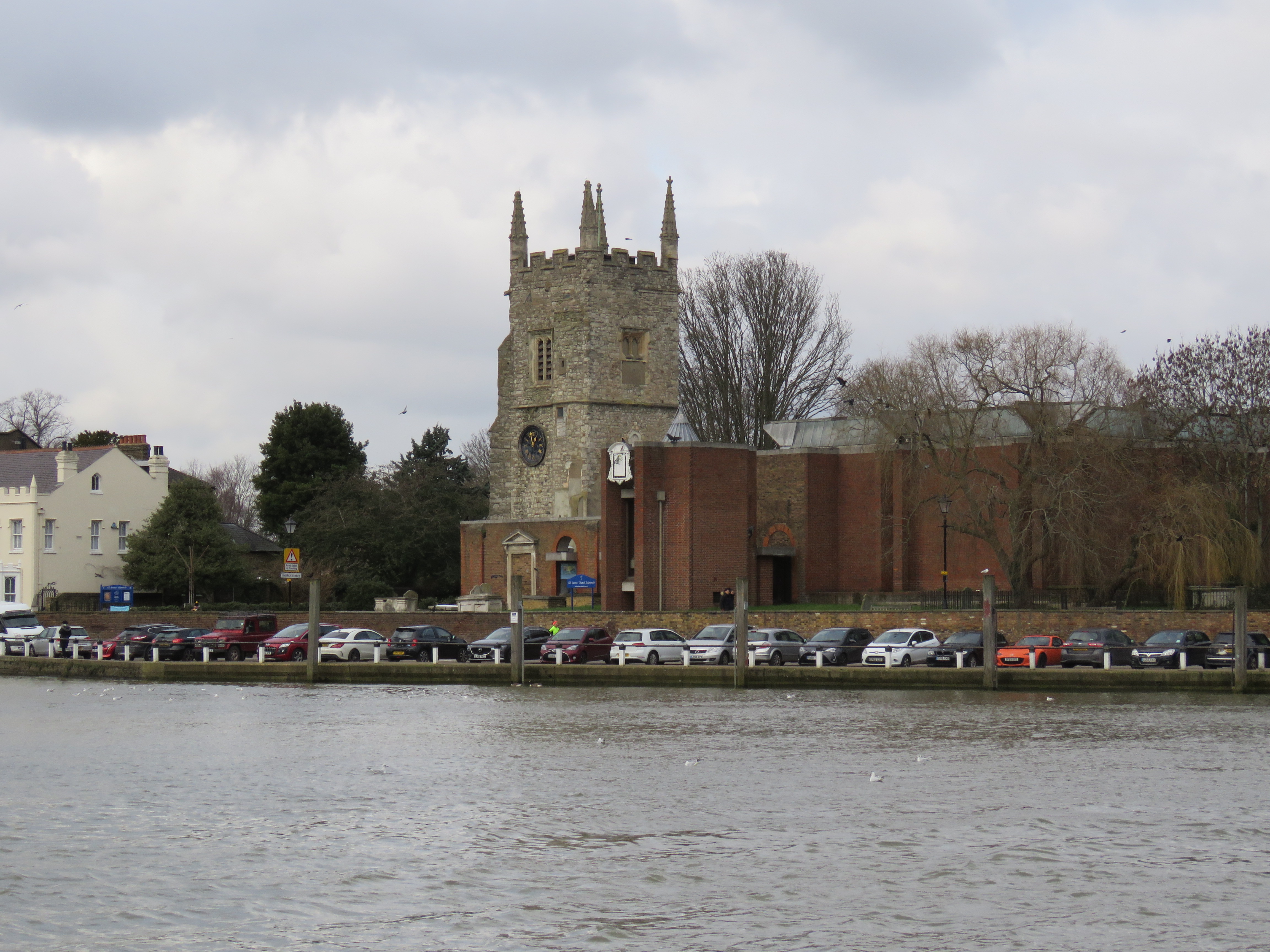
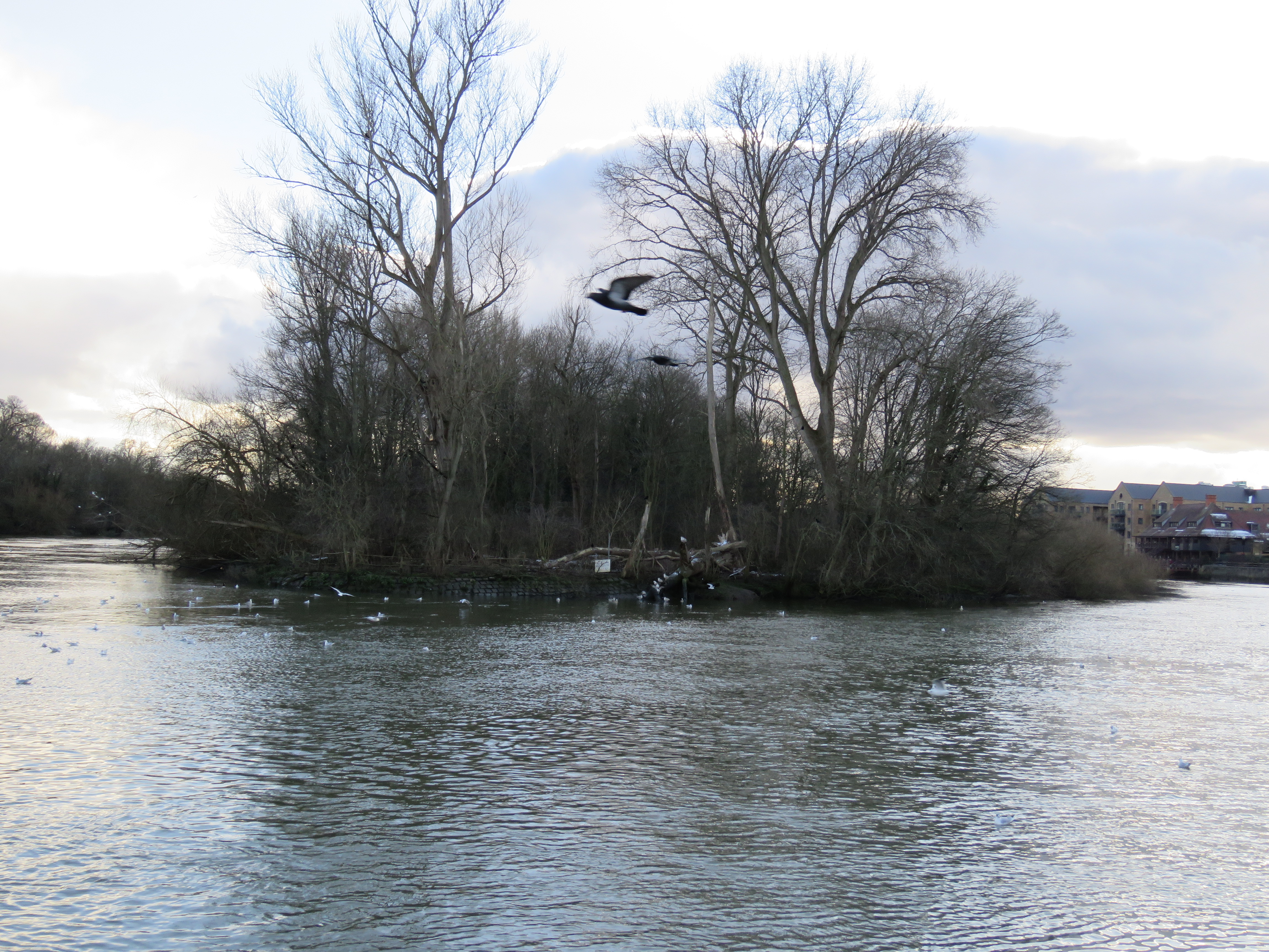
Across the river, Isleworth and then Syon Park come into view. Isleworth in general is unremarkable, but the old village, down by the river, is rather lovely. Much of the riverside is obscured by the woods on Isleworth Ait, but they relent just as the London Apprentice pub and All Saints church make their appearance. The pub is over 500 years old. Its name comes from the times when apprentices rowed up the river from the City on their annual day off. One day a year! Turner lived nearby in his thirties and was a regular. In our Quins-going days, and once we no longer needed to take the kids by car, Jon and I liked to walk to the Stoop via the London Apprentice, where we’d have a pint and watch some of the lunchtime football on the TV. The tower of All Saints dates from the 15th century; the rest of the building is modern. The waterfront here has the largest gathering of swans I have seen on the river. It’s a popular spot with families and young couples, especially at low tide, when they can walk onto the river bed to feed the birds. At high tide, on the other hand, the road can become impassable, as the river laps up against the garden walls of the church.
The best views of Isleworth village are from the other side of the river. The london Apprentice is the darker building towards the left of the picture.
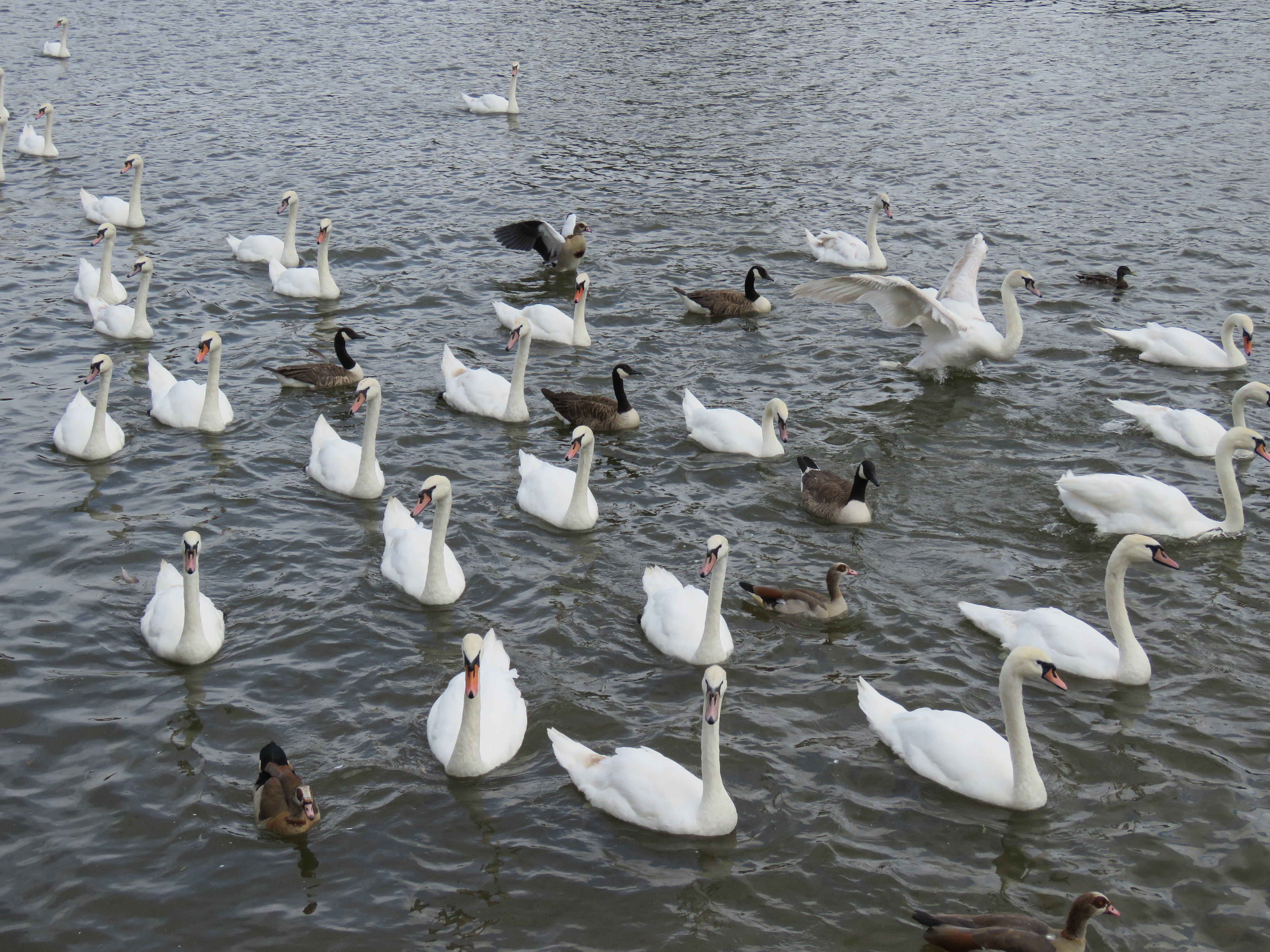
Expecting food!
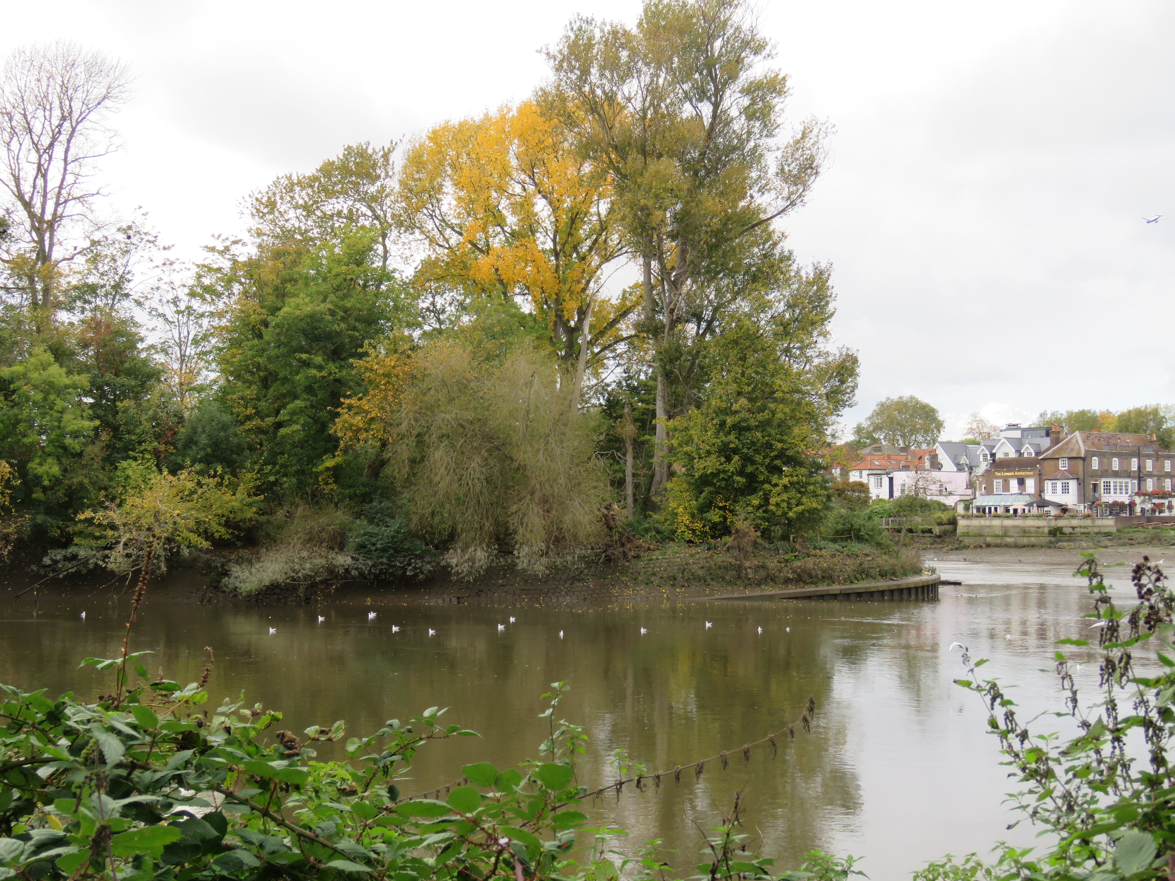
Two aspects of Isleworth Ait.
The little-known River Crane enters the Thames at Isleworth, just upstream from Isleworth Ait. It’s a river that winds its way unassumingly through Isleworth, Twickenham and Hounslow, skirting Heathrow airport and giving its name to an area called Cranford before you reach the source at Hayes, near the Grand Union Canal. It runs past both Twickenham Stadium and the Stoop, unnoticed by the match day crowds. I’ve tried walking along different parts of it a couple of times, but you never get far before the path becomes blocked, one way or another. Like many of the tributaries of the Thames in London it remains a well-kept secret.
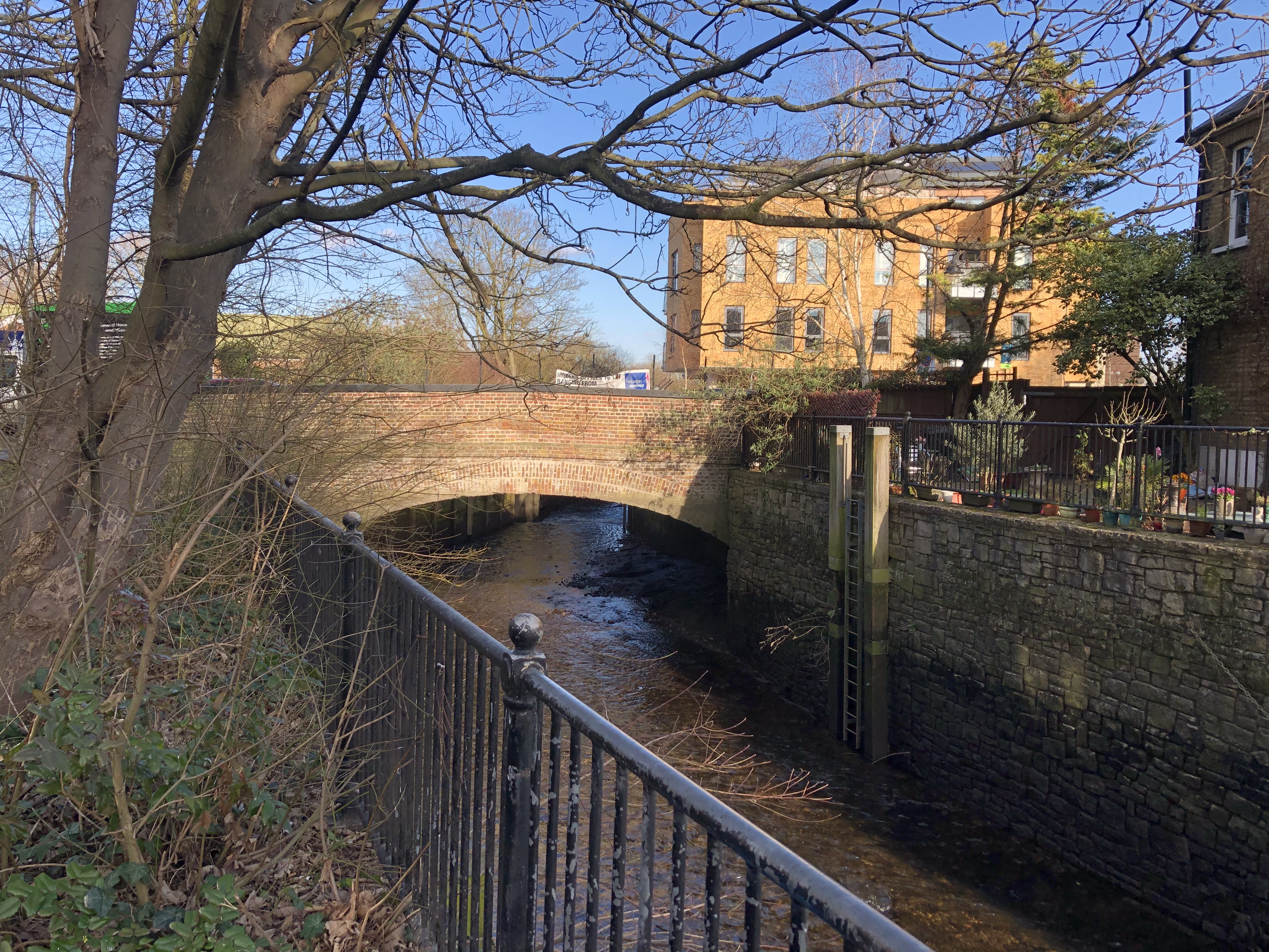
River Crane just before it meets the Thames
Just around the corner from All Saints lies the entrance to Syon Park. There’s a long straight road up to the car park and the garden centre. A meadow lies to the right of the road, with a footpath on its right. That takes you past the centrepiece of the park, Syon House. Set back in carefully tended gardens, it is the home of the Duke of Northumberland. It was built in the late 16th century on the site of Syon Abbey, which, of course, had been destroyed during the reformation. The Abbey had the last laugh though – Henry VIII’s body was kept there overnight, on its way from London to its resting place in Windsor. The coffin lid burst open that night and dogs feasted on the dead king’s bones!
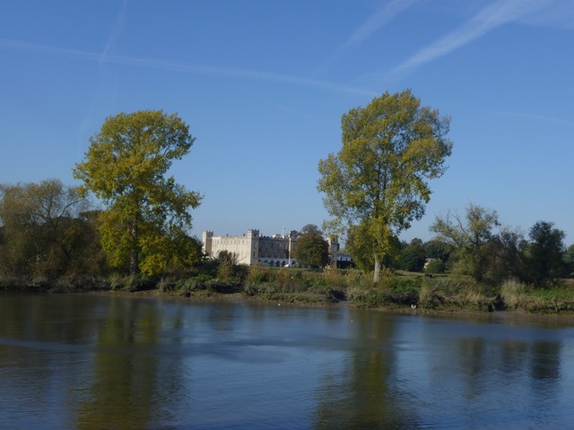
Syon House from the river
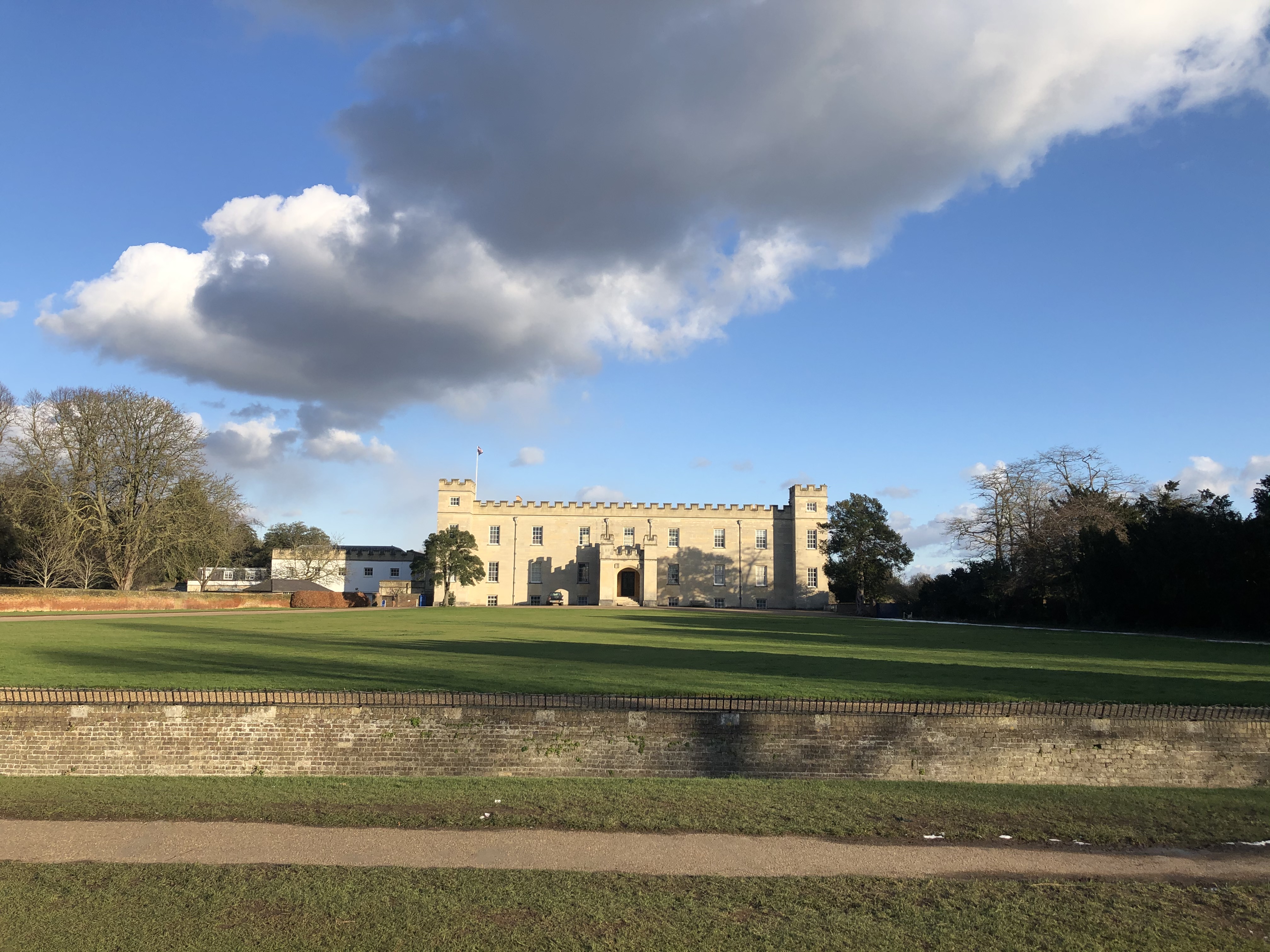
And from the park
Syon Park was also the site of Battle of Brentford in 1642 during the first phase of the English Civil War. It was around the same time as the battle of Turnham Green in Chiswick, which resulted in the Royalists withdrawing to Oxford. The Battle of Brentford was won by the Royalists, under Prince Rupert, who drove their enemies into the Thames. Another battle may have taken place in Brentford in Roman times. It is one of the points along the Thames which lays claim to being where Julius Caesar and his troops crossed the river into London during his second invasion in 54BC.
Such excitement has rarely troubled Brentford since, though the local football team is making a strong push for promotion from the Championship to the Premier League, having just missed out last season. In 1712 the poet John Gay, in an epistle to the Earl of Burlington, described it as:
Brentford, tedious town, For dirty streets and white-legged chickens known.
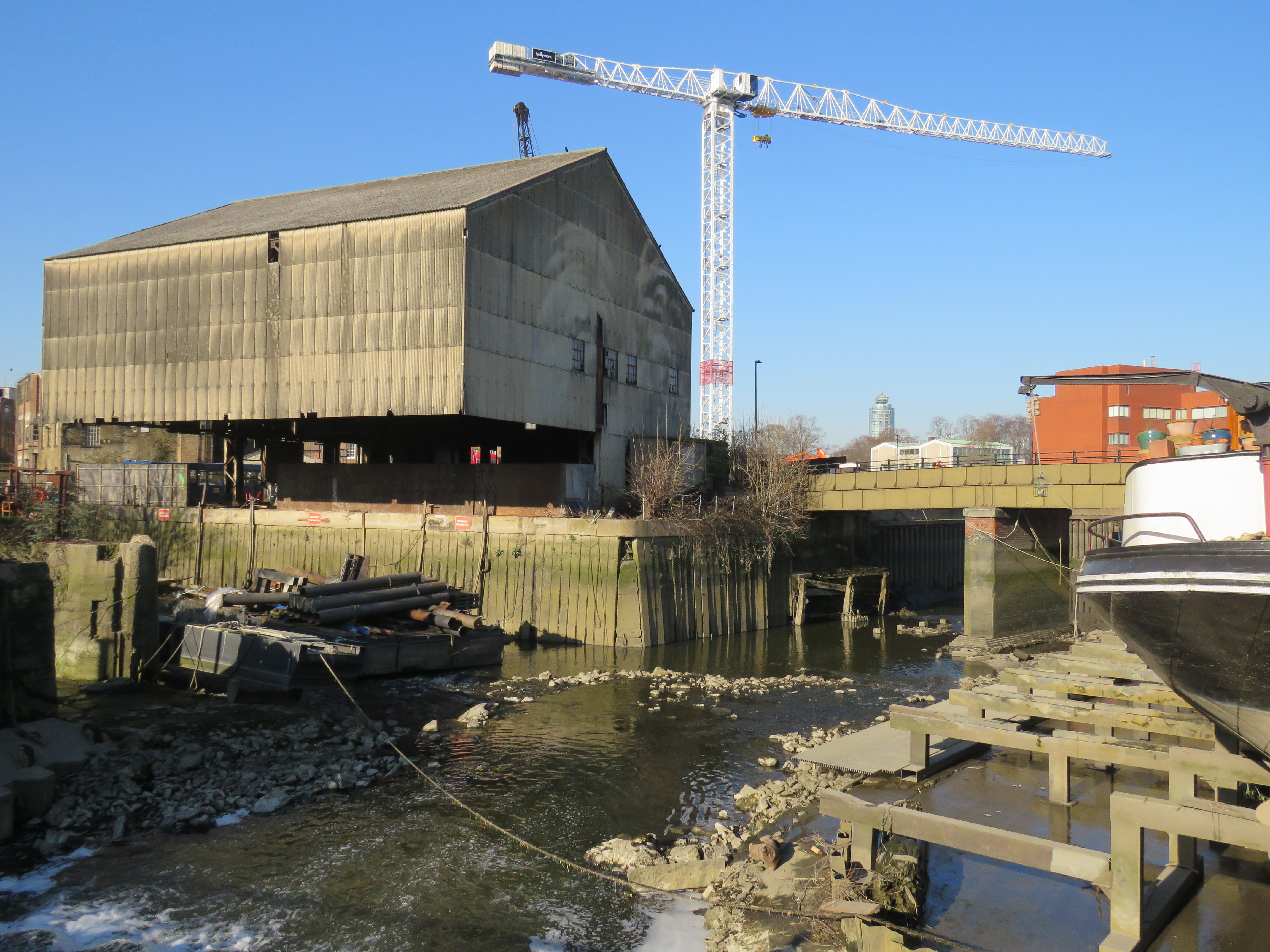
Apparently King George II liked Brentford because it reminded him of his home town of Hannover – dirty and ill-paved. There were wharves at Brentford, for trade with London, from early times. In the 17th century barges took cargoes of bricks, fruit, and fish downstream, returning with, amongst other things, horse manure for fertiliser. There was a Dung Wharf. Perhaps this contributed to the town’s reputation. A large dock was completed in 1859 and only closed in 1964. Brentford is where the Grand Union Canal meets the Thames (as does the River Brent, which joins the canal in Hanwell). It runs between Brentford and Birmingham and is connected to a number of other canals, including the Regent’s Canal in London, the Oxford Canal and the Leicester Line. The London to Birmingham line was formerly known as the Grand Junction Canal and fully opened in 1805. Brentford was able to take advantage of the trade that took place along the canal, linking that to downstream London. Of course, with the development of the railways and then the roads, that trade diminished. Brentford’s days as an upstream port were numbered.
The docks and other riverside areas today are a mixture of repair yards, warehouses, the odd pub, an artistic community located on a small island, and housing developments – lots of housing developments. These are mostly apartment blocks, often located around marinas. There is still a huge amount of building going on. The social infrastructure – the cafes and restaurants and shops – still have a way to go to match the residential developments: but the future, post-pandemic, is looking bright. What could really seal it, in my view, is a footbridge over to Kew Gardens. That could really be a boon for Brentford, and it might encourage more people to go to Kew Gardens on foot rather than driving.
If you detect some local knowledge here, a personal interest, you’d be right. This is very much local territory for me. I live in Ealing, but on the border with Brentford, which is part of the borough of Hounslow. It’s a twenty minute walk down to Brentford High Street, another few minutes to the Thames itself. I’ve always spent a fair bit of time cycling and walking in the area, but during the past year it has become an almost daily occupation. My lockdown life.
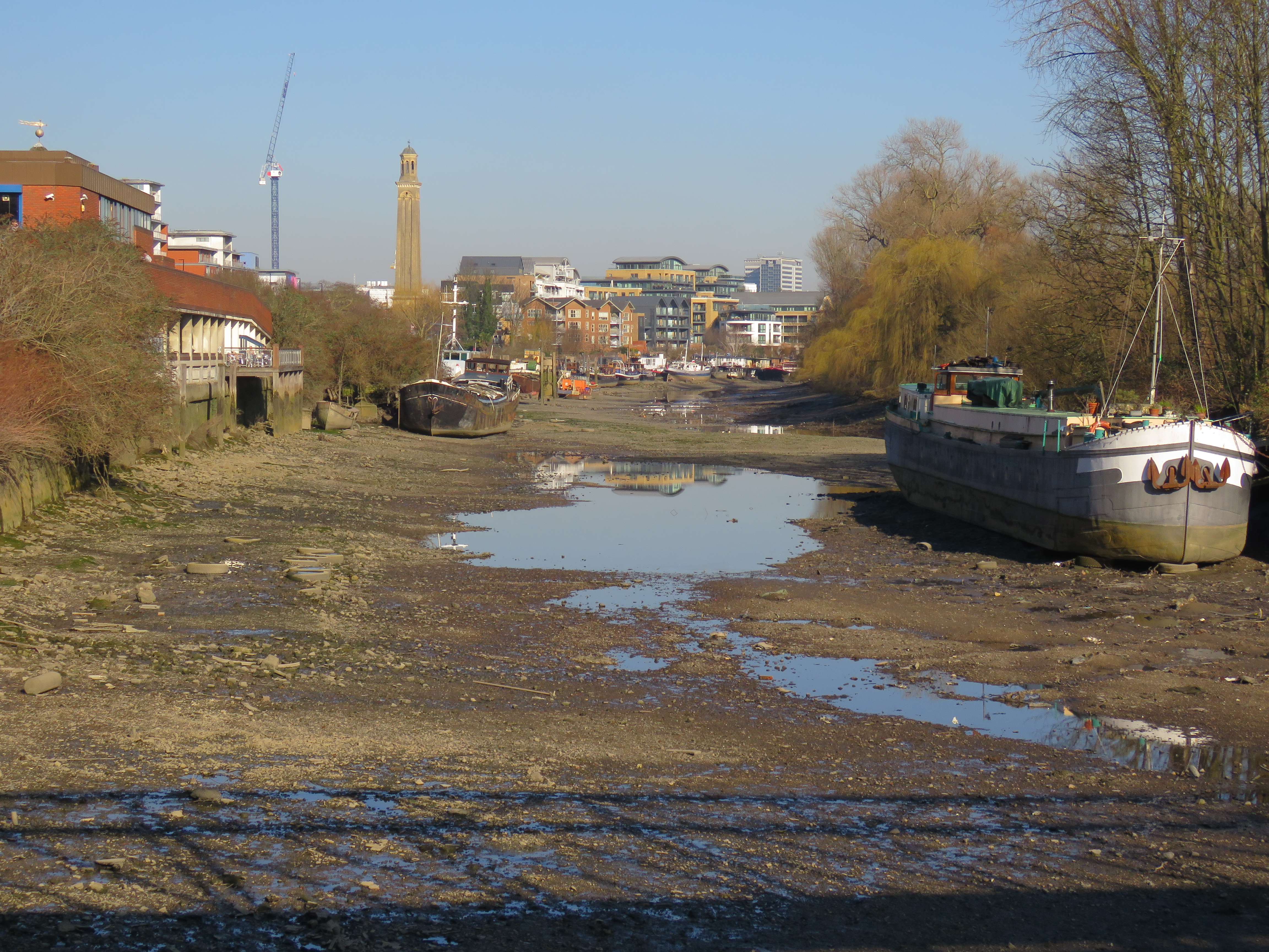
The first three photos are from February 2019, at low tide. There’s another ait near Kew Bridge – after which the pub One Over the Ait is named – and the channel on the Brentford side dries up almost completely.
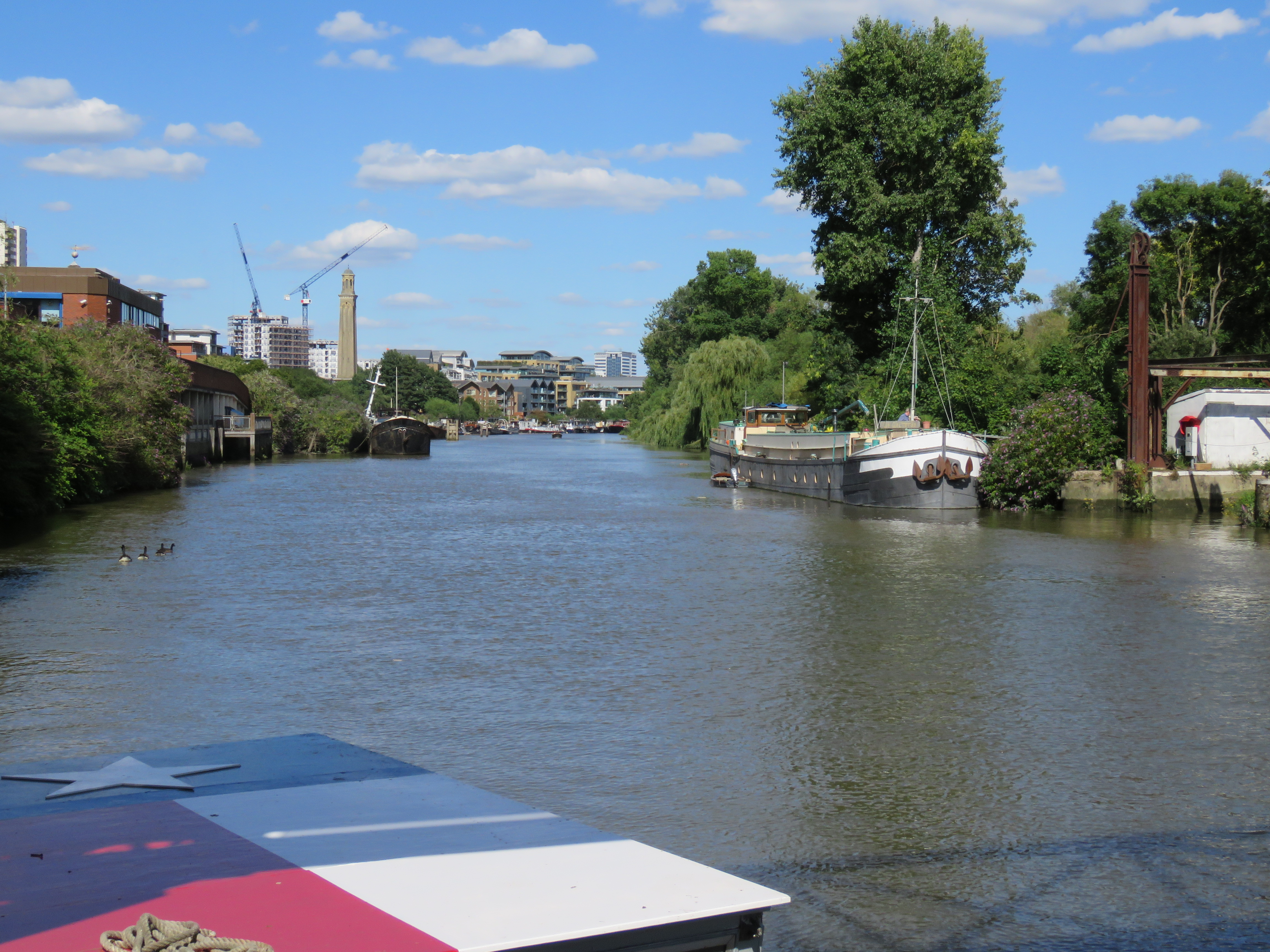
Contrast this last photo with one taken from a similar position at high tide, July 2020.
On the left of these two photos is the back of the Waterman’s Arts Centre – a rejoinder to that disparaging comment from John Gay. The Waterman’s is a centre for independent cinema, theatre, music and the visual arts. It opened in 1984, with a concert by Ravi Shankar in the theatre. Bands and DJ’s often perform in the open space that also functions as the bar and restaurant – you can get good Indian food there. The DJ Gilles Peterson coined the term Acid Jazz while playing a gig at the Waterman’s in the 80s. One of my fondest memories of the place is of the Christmas pantomimes which our kids used to love going to when they were little. Jack and the Beanstalk, Aladdin, all the usual themes. With just the right amount of ribald humour for the adults.
In the background of those last two photos you can see a tower. This was the old pumping station, which supplied water to the residents of West London from 1838 until 1944. It is now the London Museum of Water and Steam, and is a rather fascinating place. The children loved it as there is a little steam railway that goes around the waterworks. We went on that many a time!
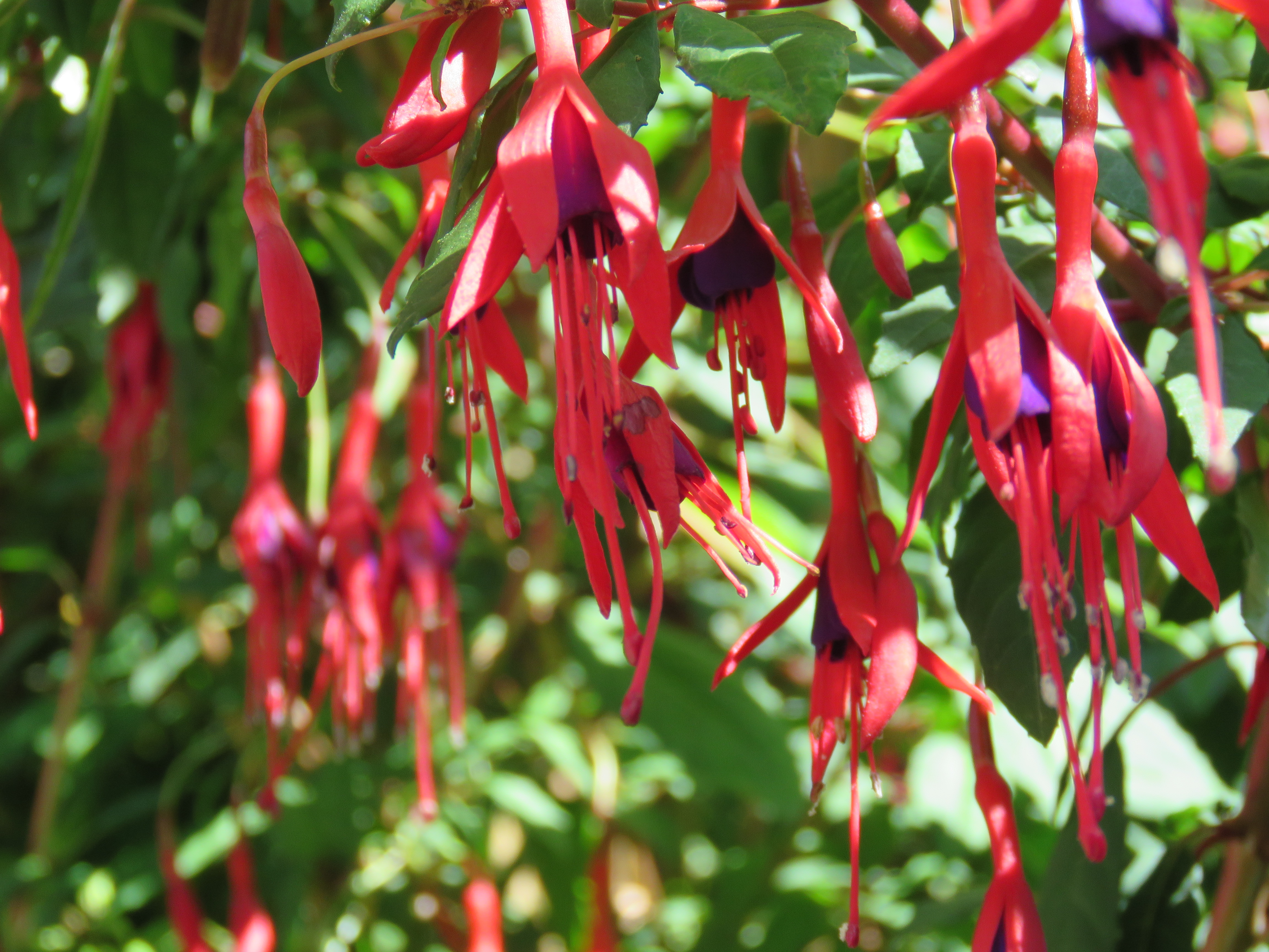
If you take the steps down from Kew Bridge on the Brentford side, there’s a lovely spot to gaze downstream. You can then take a secluded path, passing by the One over the Ait, where in summer the fuschias bloom. This caught me by surprise when I first encountered them last summer. The first three shots in this batch are from July; the last, in glaring sunlight, was taken in August.
One December day, knowing it was going to be sunny, I got up early (for me) to catch the sunrise down by the canal and the river.
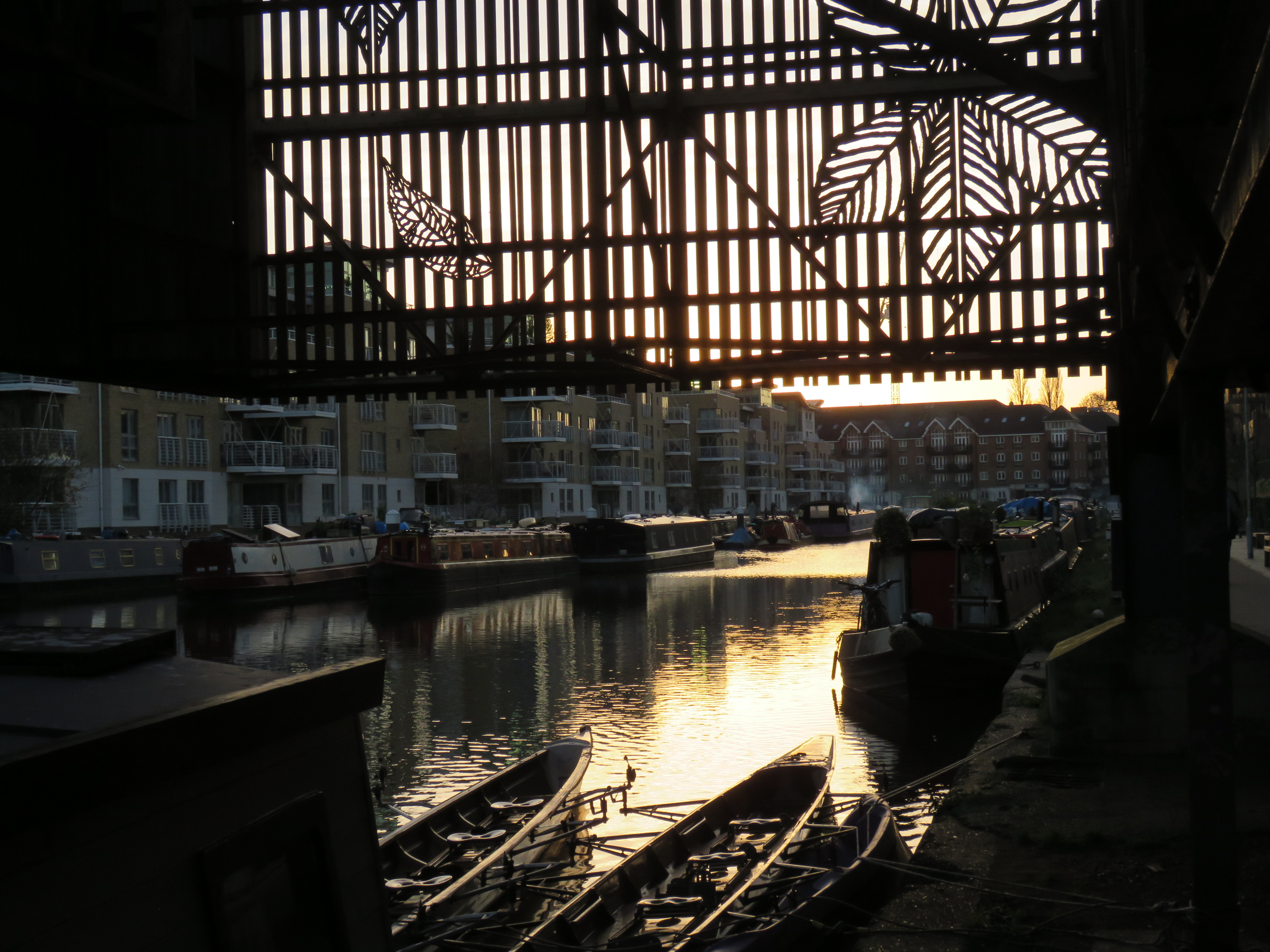
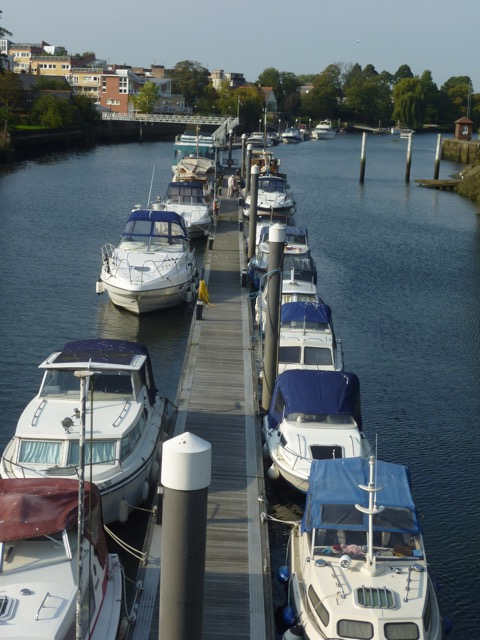
Brentford Dock Marina
This is where the canal opens out into the Thames
Hopping back over the river, but via Kew Bridge rather than that imagined footbridge, let’s linger in Kew Gardens before ending at the bridge itself. And Kew Gardens is a very nice place to linger. The Royal Botanic Gardens, to give them their formal title, were founded by Princess Augusta in 1759. Born in Gotha, Germany, she became Princess of Wales when she married George II’s son Frederick. She developed the exotic gardens which had been created by Henry, Lord Capell of Tewkesbury. The proximity to Richmond Palace meant that many noblemen had settled in Kew in Tudor times.
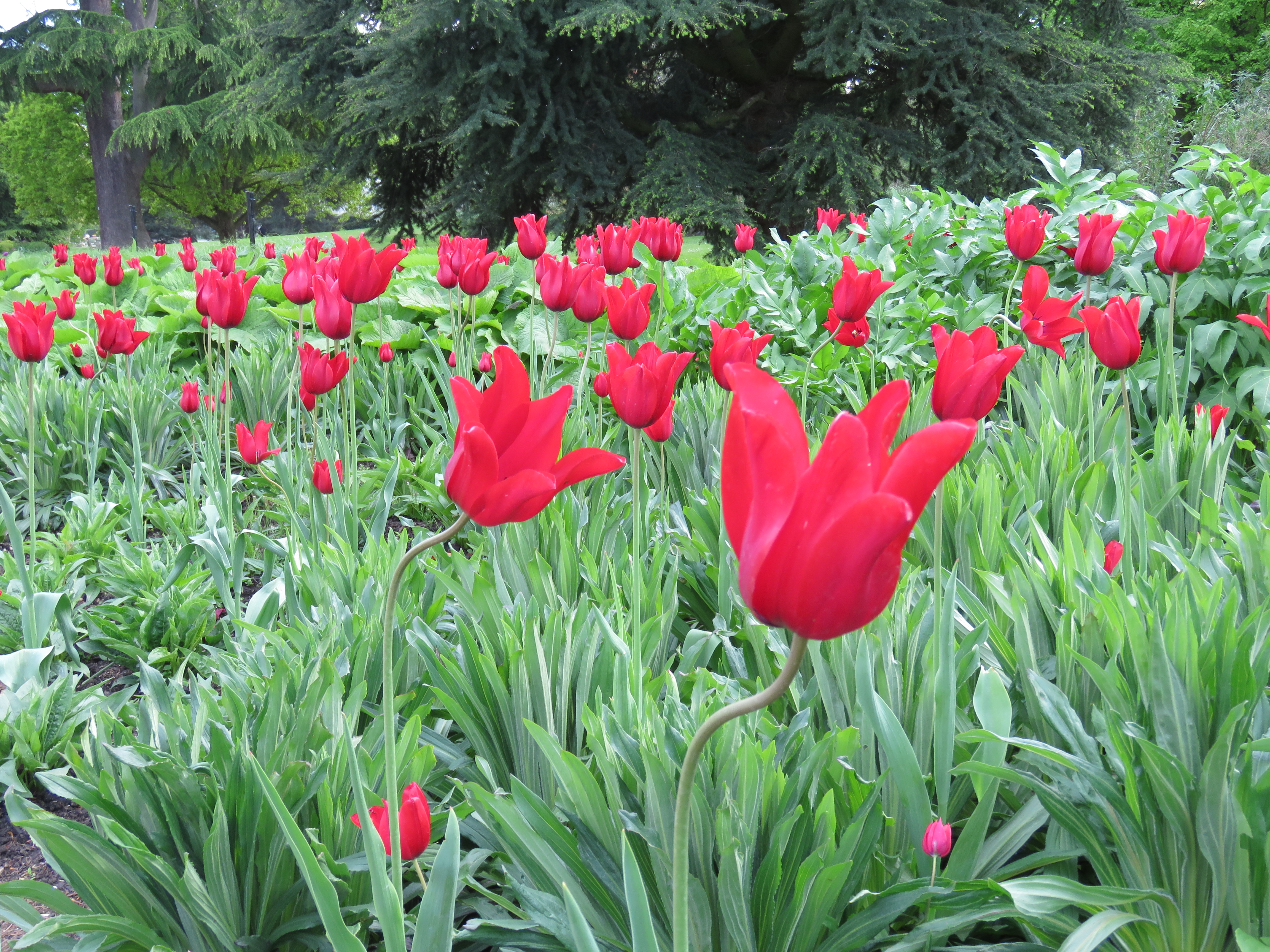
In the mid-2000s, I once had an interview for the role of CEO at the Royal Parks Agency. It went pretty well, though I didn’t get the job. At the end of the interview someone asked me what my favourite London park was. I thought about it for a moment and said, “Kew Gardens”. Thing is, it’s not one of the Royal Parks. I knew that, but thought I’d be honest. Not a good idea! Still is my favourite though: such an array of beauty – the gardens, the ever-changing, multi-hued flowers, the amazing greenhouses, the lakes, Rhododendron Dell, and the bluebells in Spring. It’s a peaceful place – no cars, bikes, dogs. It’s large enough to lose yourself in and there are facilities and activities galore if you have children to entertain. At the far end – following the river downstream – the vegetation is wilder, and that’s where Bluebell Dell is located. Swathes of violet amid the greenery – a joy to behold. I wrote a blog about the bluebells back in 2012. It followed one about my ten favourite air guitar songs of all time. That was the one where I had thousands of hits and gained a lot of new followers, after it was put on WordPress’s front page. What my metal-loving new followers made of the bluebells I don’t know. Bit like telling those interviewers that Kew Gardens was my favourite London park…
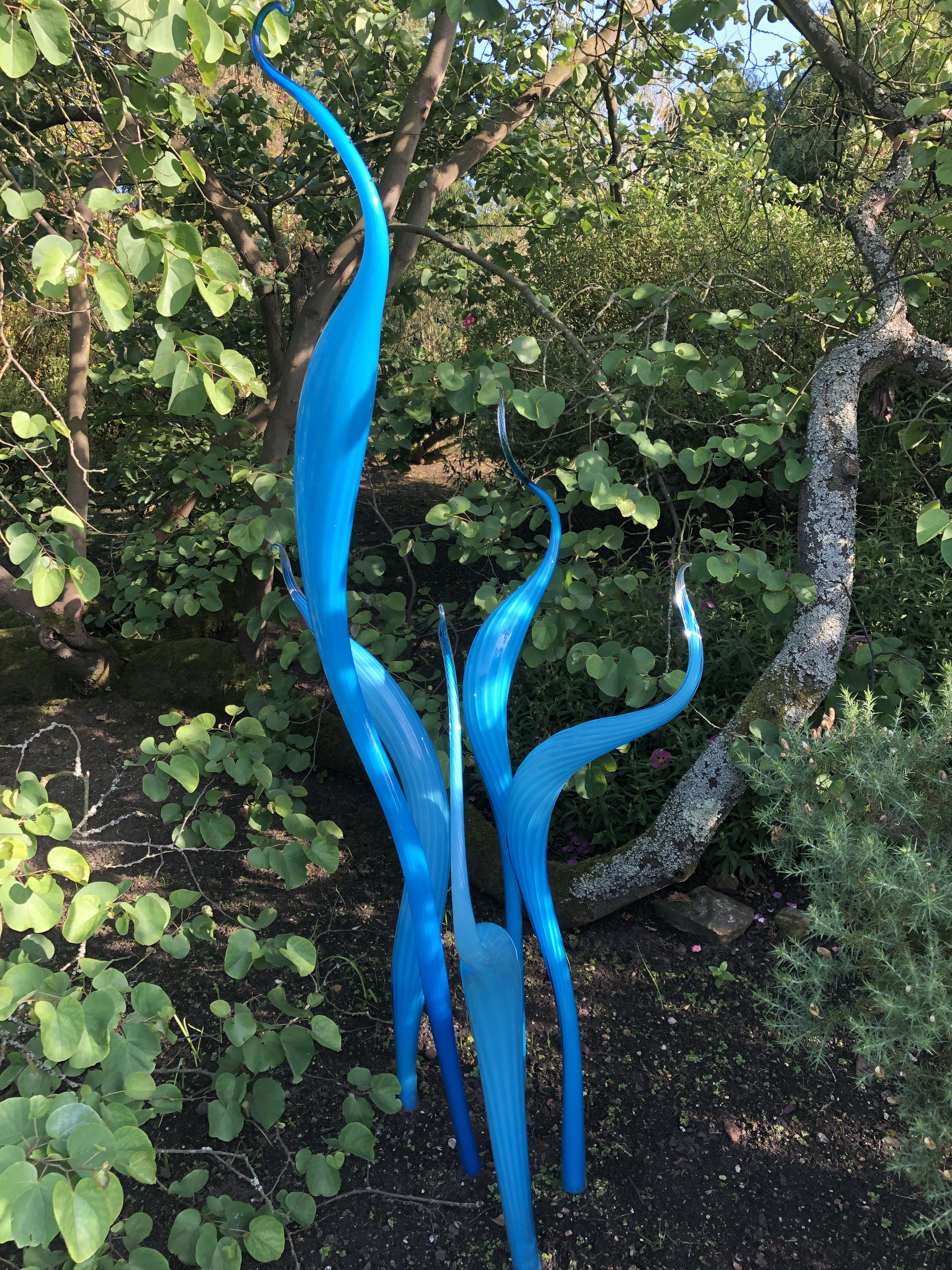
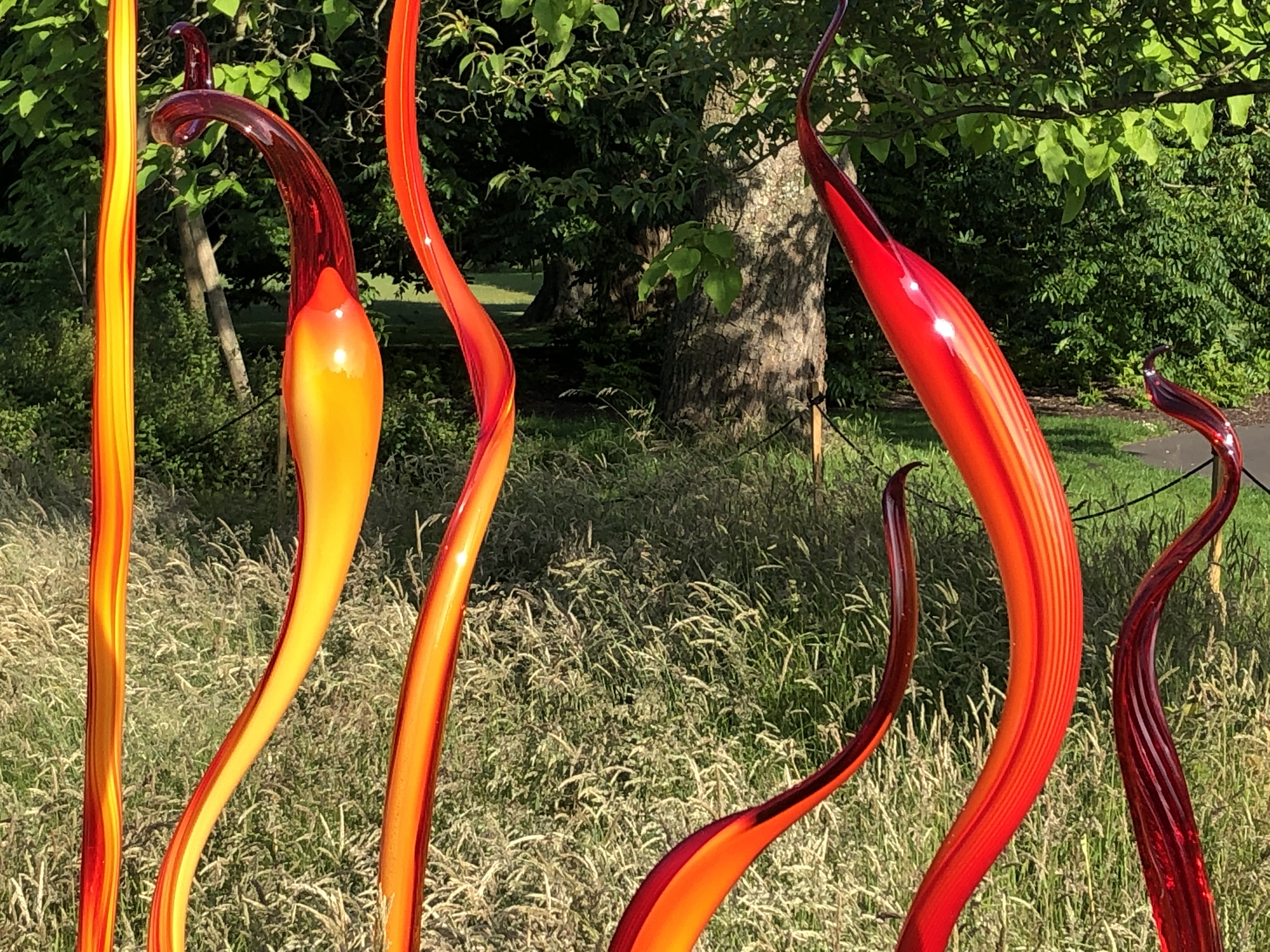
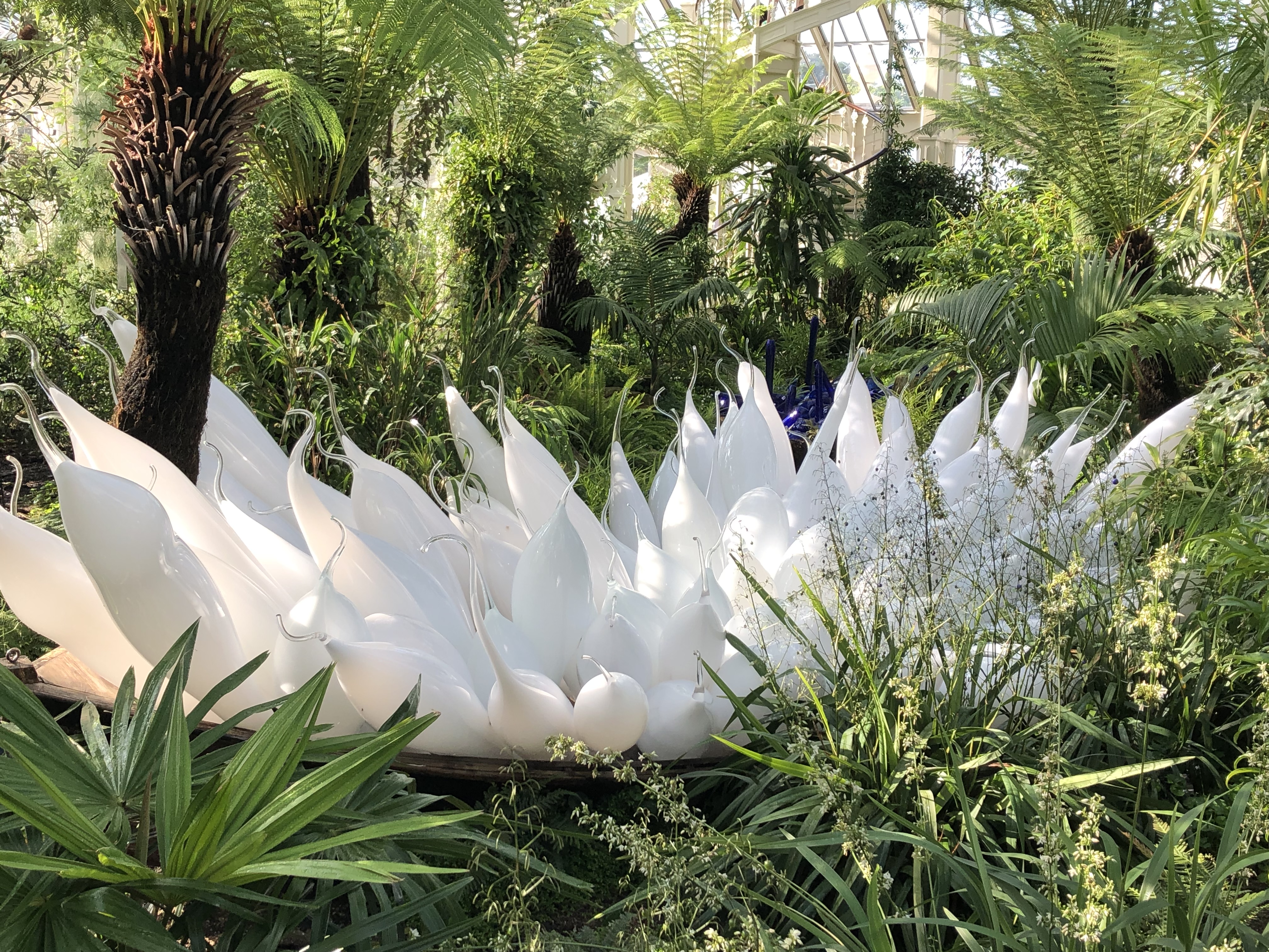
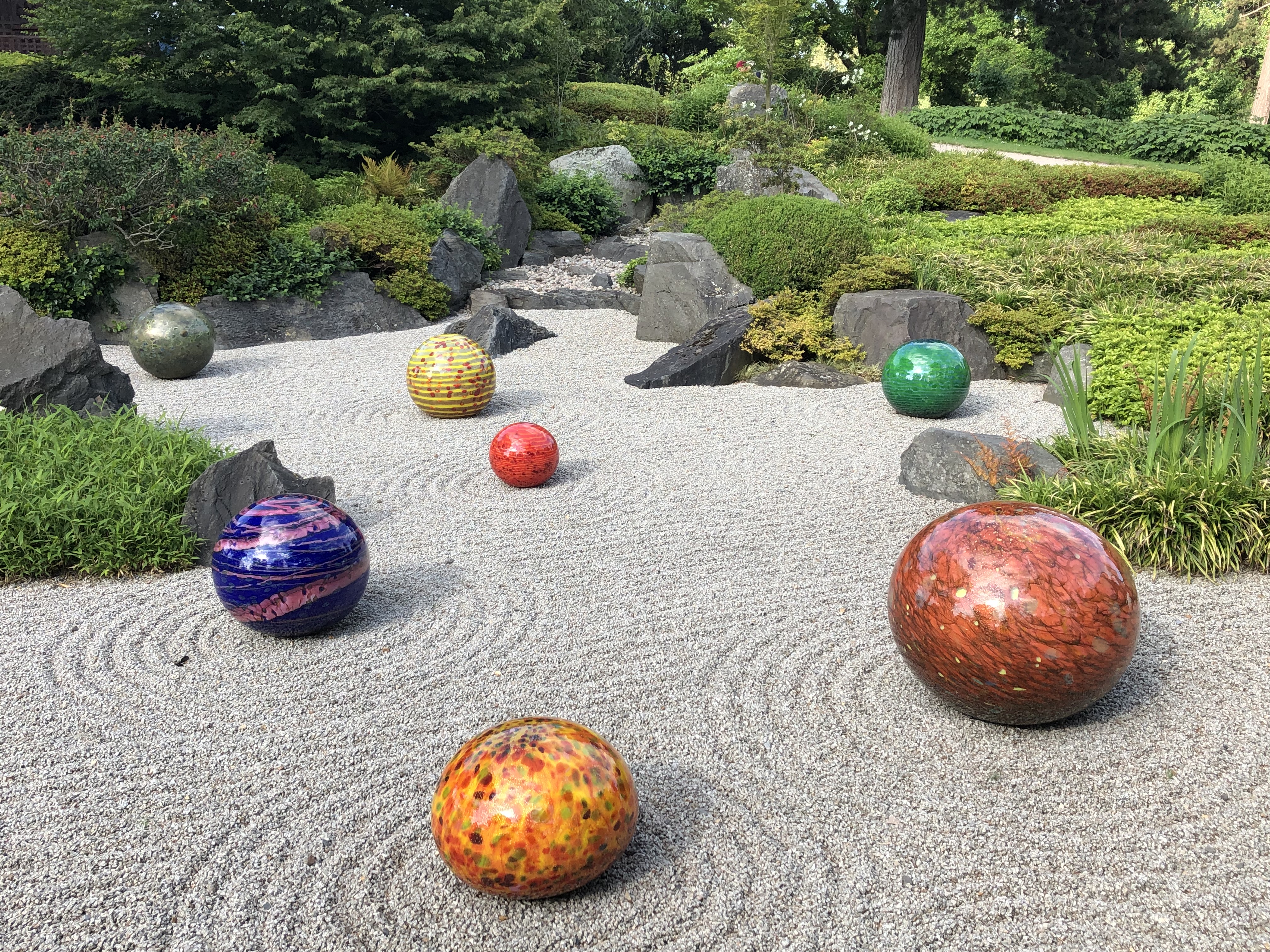
Here are one or two photos from Kew Gardens, taken over the years. The glass works are the work of the American sculptor Dale Chihuly, and were exhibited all over the park in 2019, including in the Palm and Temperate Houses. Art and nature in harmony. Always a feature of Kew Gardens – and so true of the Thames too.
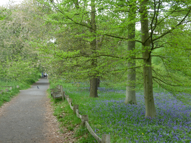
Bluebell Dell, May 2011
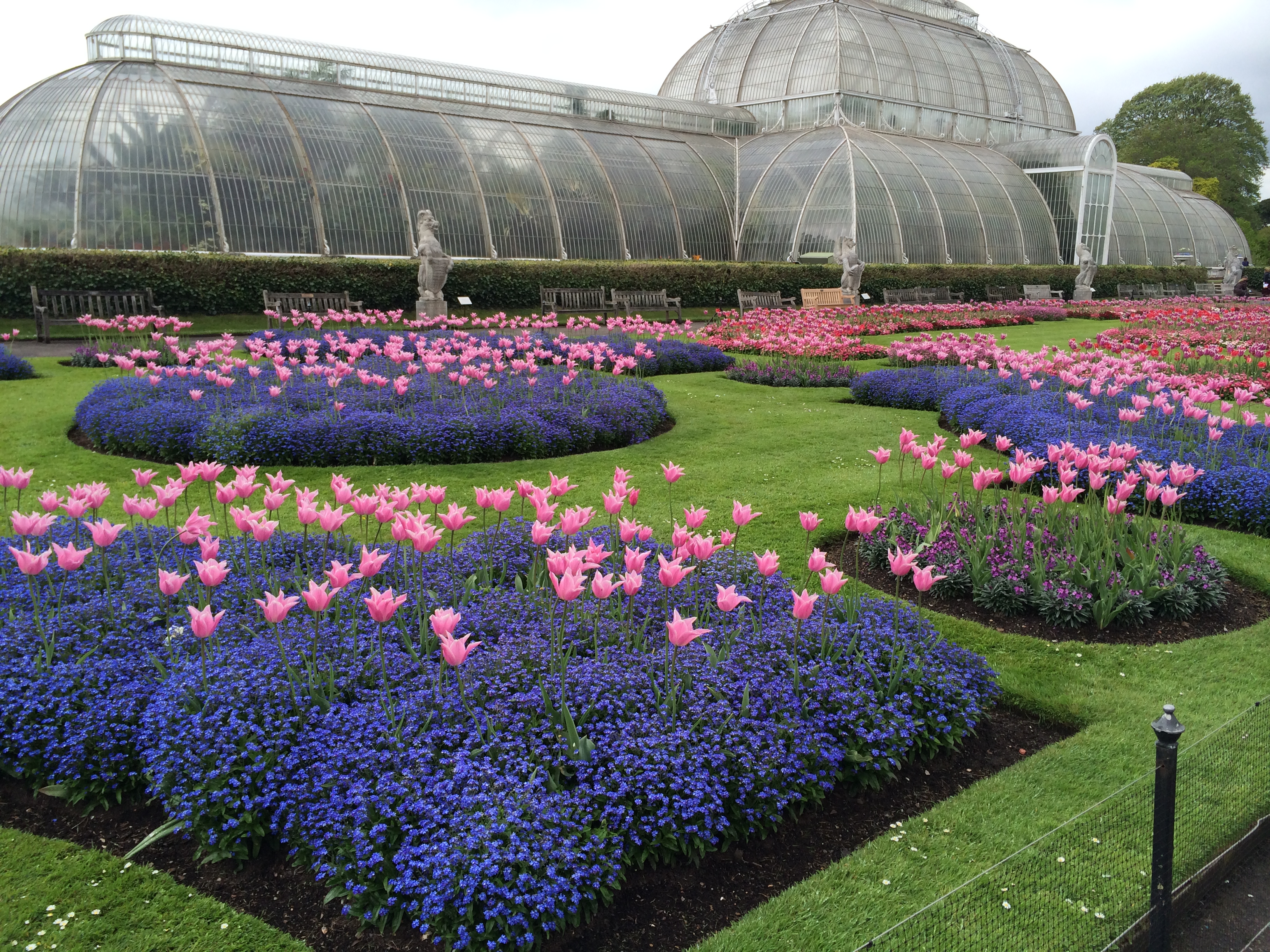
The Palm House and some rather striking flower beds, May 2015
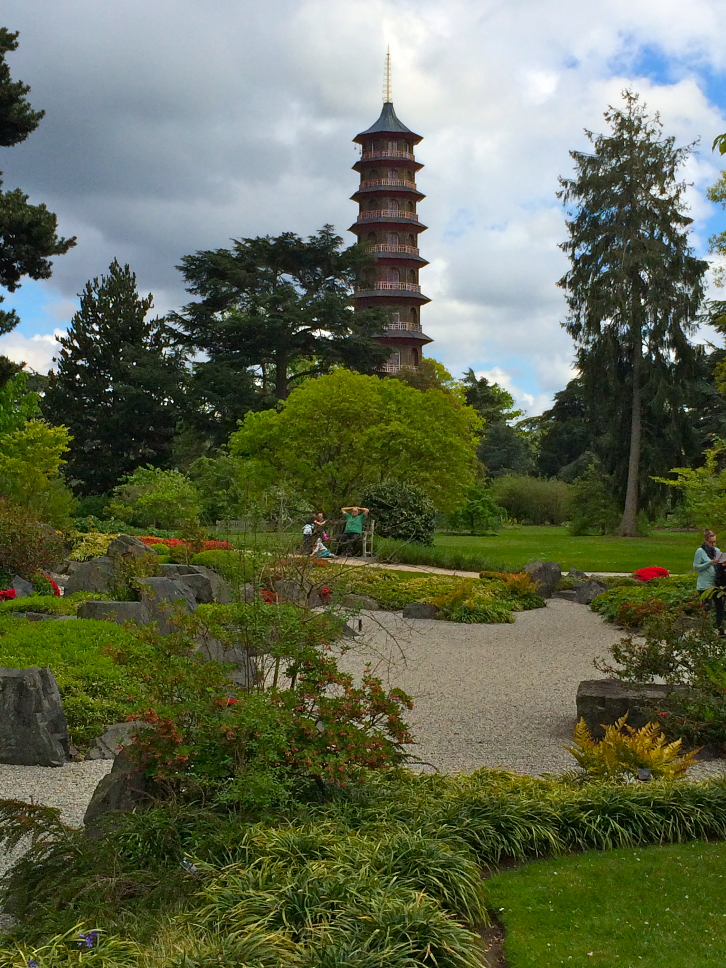
The Great Pagoda, May 2015
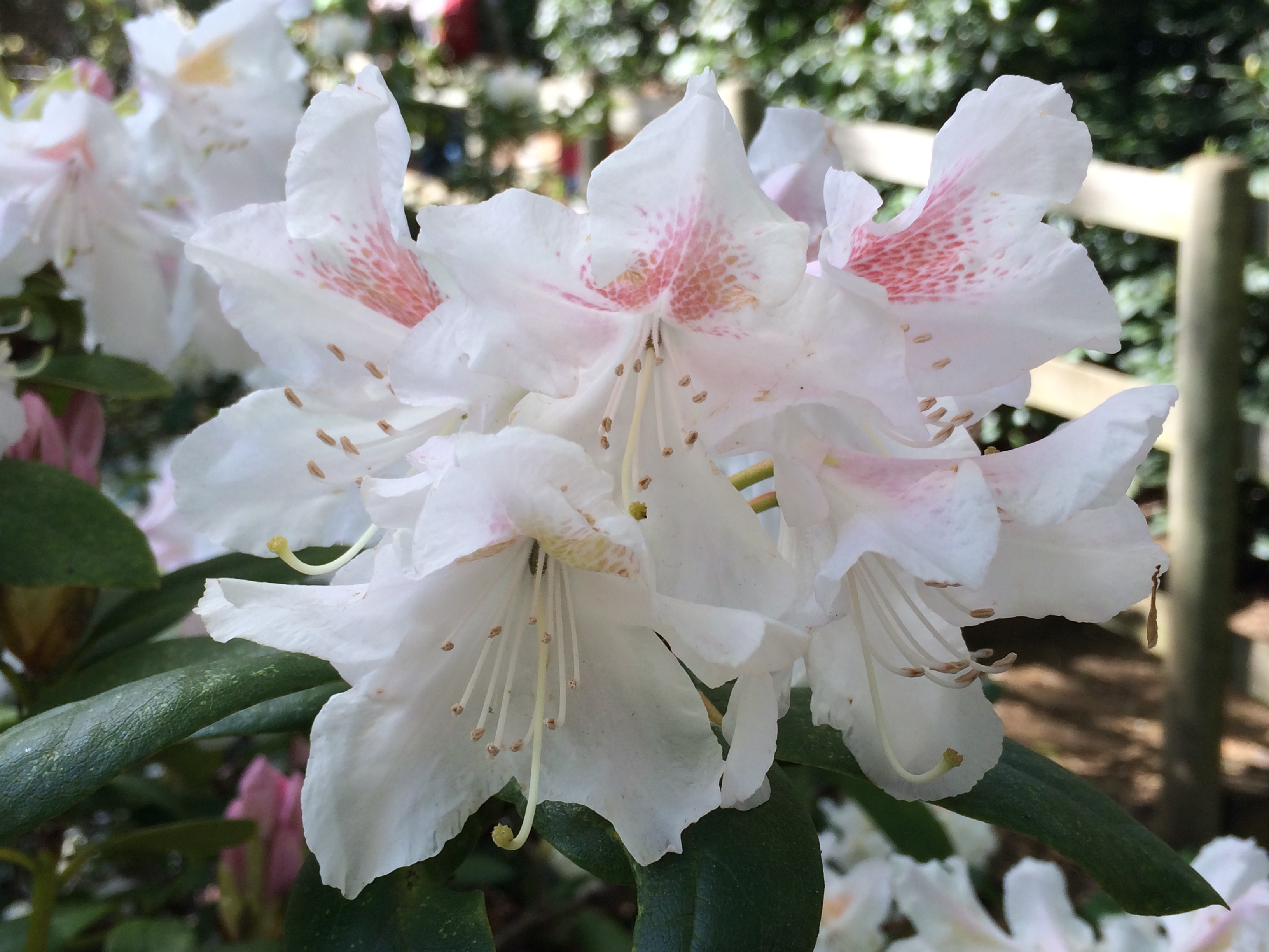
Rhododendrons, May 2015
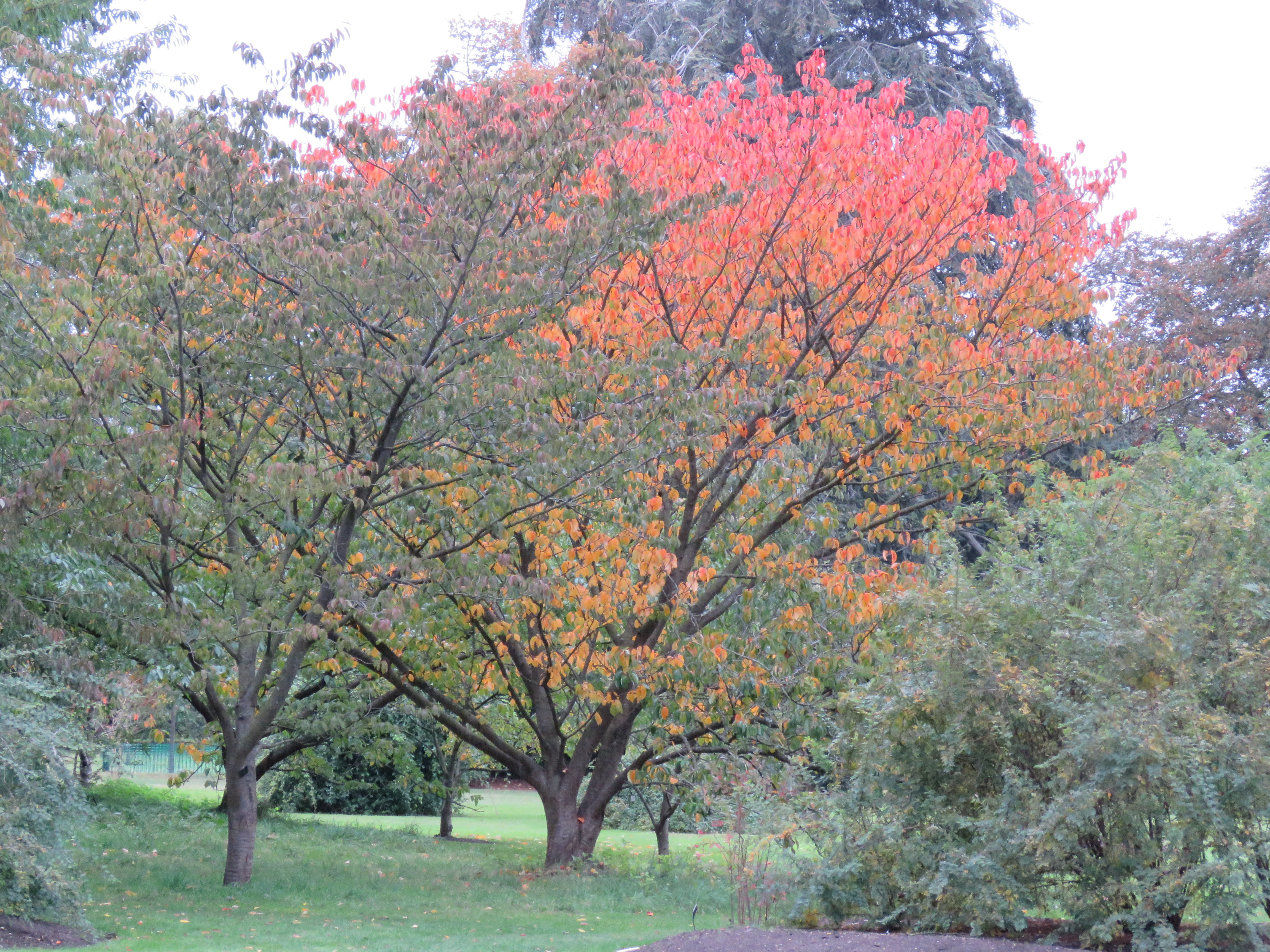
Autumn colours, October 2016
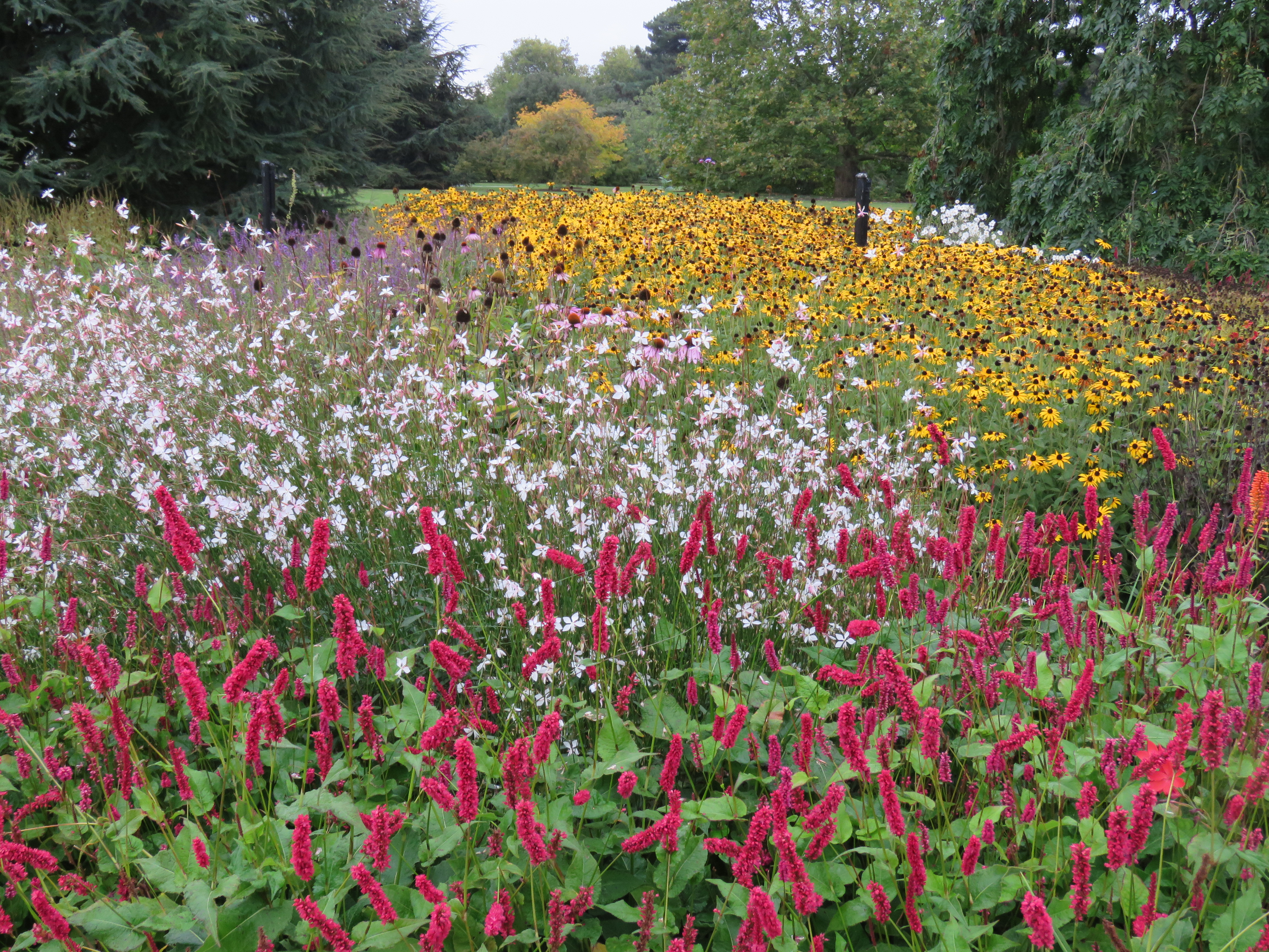
A proliferation of colour, October 2016
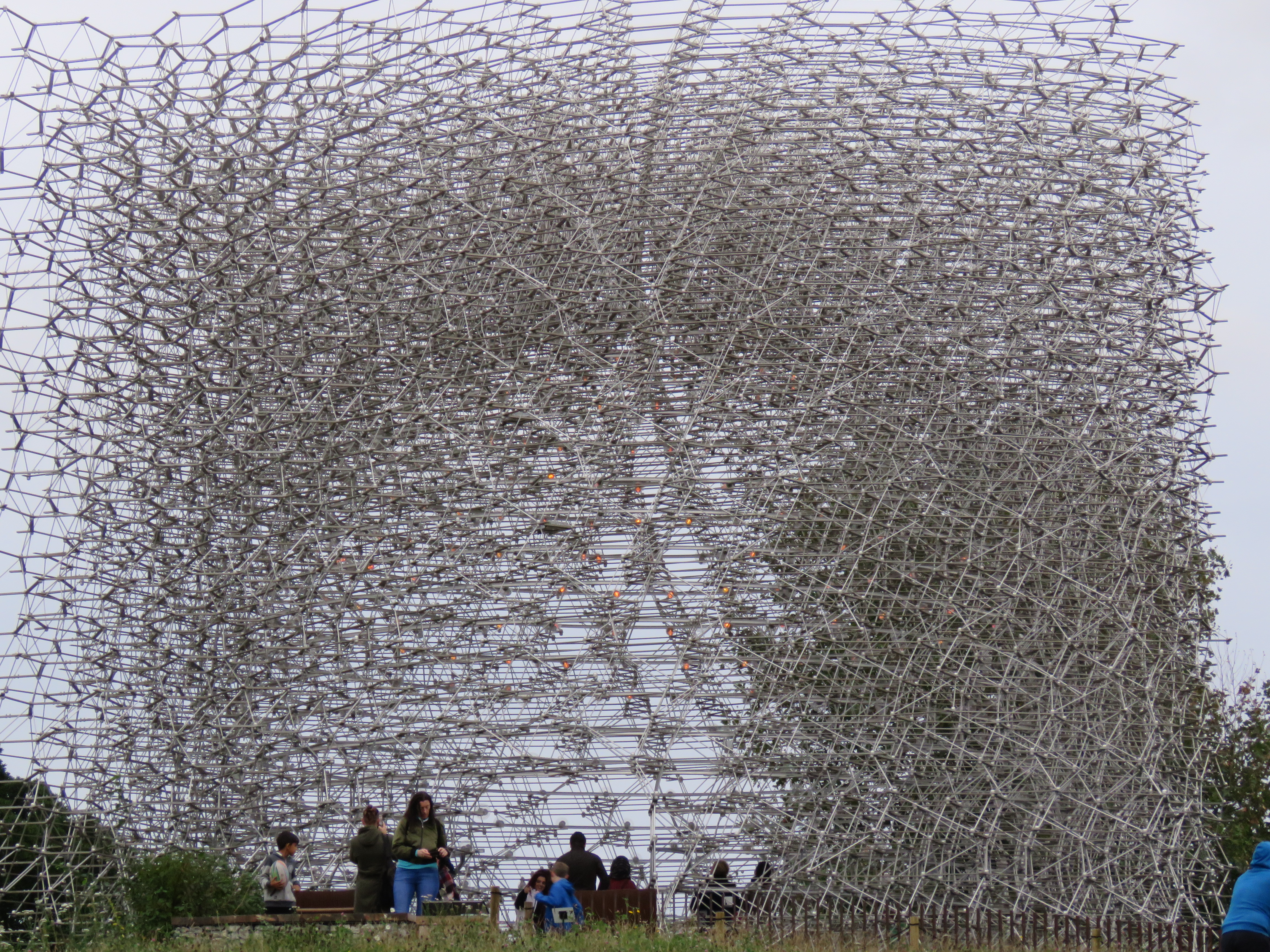
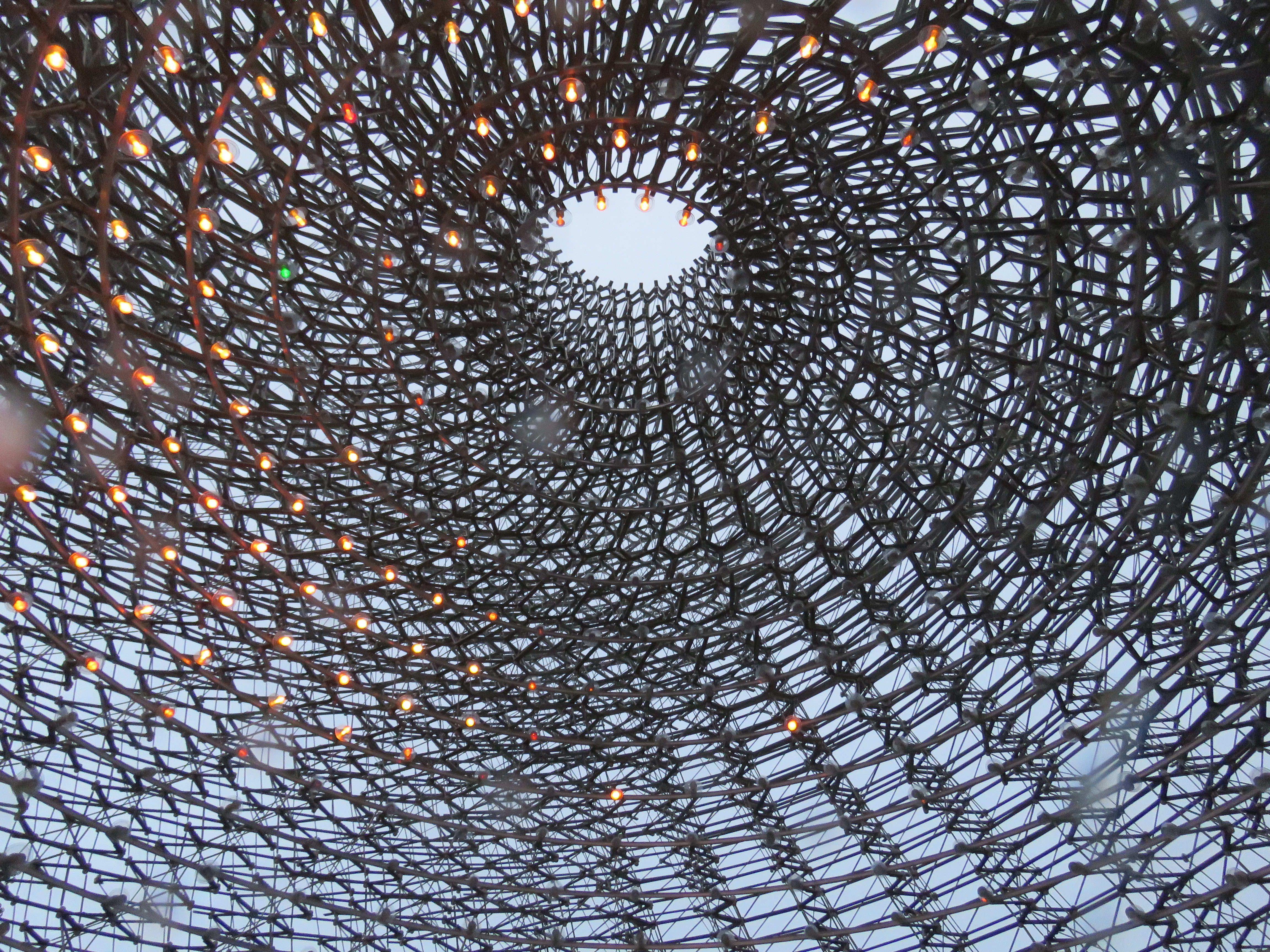
The Hive was created in 2015 for the UK Pavilion at the Milan Expo, but found its way to Kew in 2016. It hums with the sound of bees from a nearby real hive, while lights inside glow to the vibrations of the bees – in the key of C!
April 2017
The Chihuly glassworks were photographed in June 2019.
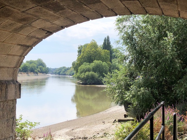
And so we reach the end this episode of the Thames journey – at Kew Bridge.
The first bridge at Kew was opened in 1759, the same year as Kew Gardens was founded. Perhaps not a coincidence. It was built by Robert Tunstall of Brentford, who previously owned the ferry that operated across the same part of the river. It’s a spot where the river is executing a 90 degree change in direction, from north-east to south-east. The current bridge was opened by King Edward VII in 1903 and was named after him. That name didn’t stick though – it’s Kew Bridge, pure and simple. The traffic is a nightmare most of the time over the bridge – the junction on the Brentford side is particularly bad. But the views of the river up and downstream are lovely, and you can walk down to the river bank for an eye level view, watching the water lapping up the steps at high tide. Sunrise and sunset can be a special time too, the snarling traffic above you forgotten.
From the Kew side, October 2011
Brentford side, high tide, July 2020
From Strand-on-the-Green, December 2020
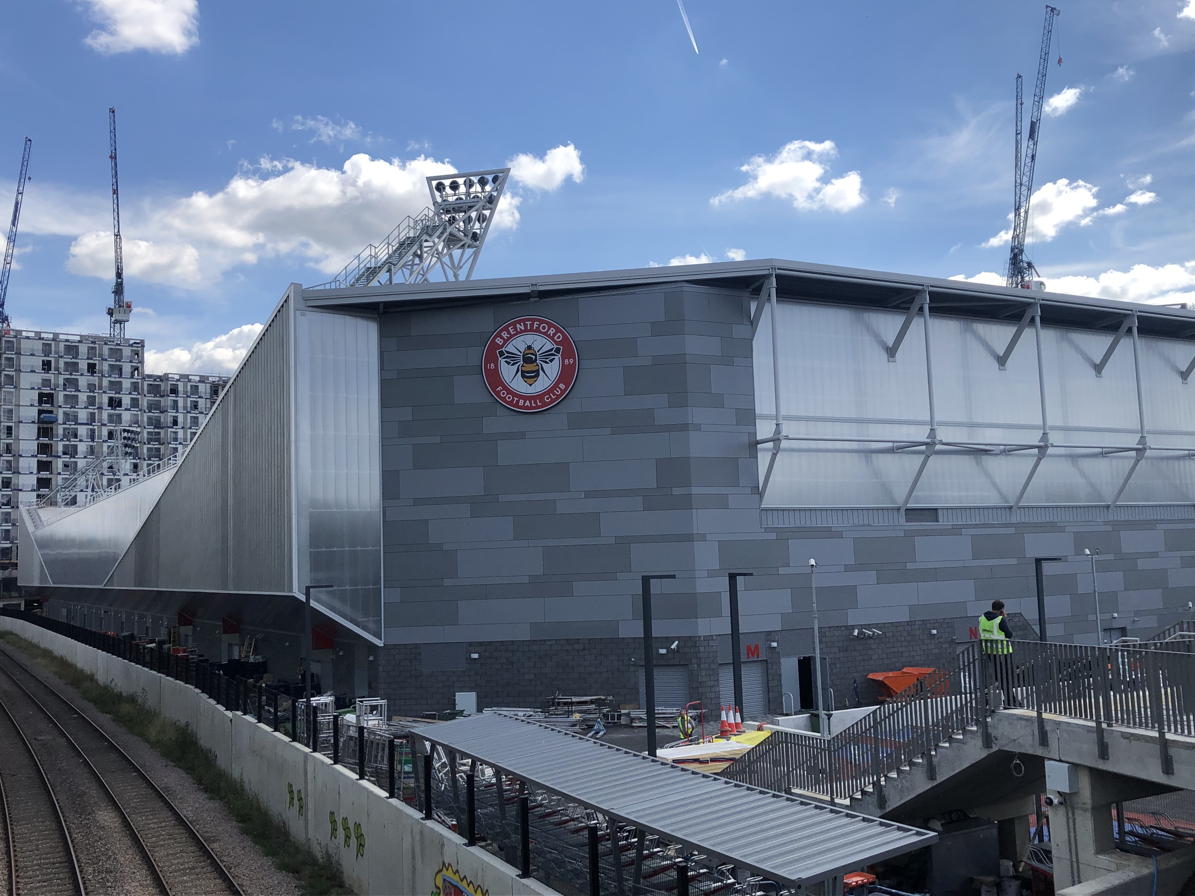
And just to finish, let’s talk about Brentford FC – the Bees – again for a moment. They have just built a new ground just up the road, sandwiched between the A204 and the A4 – the Great West Road – with the M4 flyover looming overhead. Lovely! On one level the new stadium looks like a giant version of my local Waitrose in West Ealing, but I’ve had a sneaky peak inside as I walked down Lionel Road South and it looks great. So much better than dilapidated Griffin Park, rising out of the terraced houses (though it did have a pub on each corner). The fans haven’t had many opportunities to go there yet, because of lockdown, but if they get that promotion, it’ll be a lot of fun watching them there in the Premier League. Come on you Bees!
There’ll be another football team featuring in the next leg of the journey – Fulham FC – as we travel from Kew to Putney. Coming soon…

Magnum opus.
Great pics and history.
The one of the swans is terrific.
Thanks. There are three of swans!
A very interesting read, excellent pictures.
There is a design online for a proposed footbridge between Brentford and Kew. Maybe one day it will be built.
Thanks Tony. Must look that proposal up.
I lived in Kew near the Green for 14 years and this is a familiar walk. I have fond memories of weekends arouind there and in Kew Gardens (weekdays were exhausting workdays so have less fond memories of those). Some good pictures here, thanks
Thanks for the comment. The Green is a lovely spot.
Wonderful wonderful photos and a terrific description of some of my favourite places along the Thames path. We used to live in St Margaret’s so i know the areas that you describe very well and often walked downstream to Kew or upstream to Teddington. Richmond of course is a favourite. I’m planning on walking the full Thames path in April/May once the restrictions have been lifted.
Thanks for a lovely stroll down memory lane
Thanks very much. Glad you enjoyed it – and good luck with the full walk.
I did, very much. I also learned a few snippets I did not know…like the dogs at Syon Abbey. Ewww. I knew about the coffin exploding, but not what came after 🤪🤪 terrific post
Great read, as always, John! And that first photo, that almost looks like an impressionist painting.
Thanks Ram. There was still just a hint of mist in the air that morning which gave that Impressionist feel.
Yes, great job. John. I took my time this morning with a big cup of coffee, and hugely enjoyed the tour. I thought I knew my Thames – but nothing like this! A lot of the information was new to me, whether the ducking stool, Brentford’s grimy past, or the dogs feasting on Henry’s cadaver. A real tour de force, and I love the way you’ve used images from over ten years of your wanderings.
Thanks Jon. As always the historical info came from Ackroyd, a couple of Thames walk guides and, of course, everyone’s favourite, Wikipedia.
Your photos and words are like a travelogue…I felt like I was right there in the moment! Well done!
That’s very kind, thank you!