

The start of the Wandle Trail at Waddon Ponds
The River Wandle is one of those well-kept London secrets – unless, of course, you happen to live close by. For me, until recently, it was simply a river that flowed into the Thames in Wandsworth, in south-west London. And I was a fan of Samsbrook beers, including one called Wandle; I knew the brewery was situated by the river in Wandsworth. That was the sum of my knowledge about the river until the autumn of last year – after more than forty years in London!
Over the past couple of years I’ve been walking with my old uni friends Jon, Dave and Tony around various parts of London and environs. We always end with a nice meal somewhere and usual self-cater for lunch. Delicious pork pies, quality cheeses and a bottle of Malbec often feature. Fortunately steep hills rarely do, though we did clamber up Box Hill in Surrey on one occasion – before lunch, though after a brief stop at the excellent Denbies vineyard to sample a glass of fresh English white wine. One of the most interesting walks was along the River Lea – or more precisely, the Lea Navigation channel – from Waltham Cross down to Limehouse Basin, which adjoins the Thames in East London. The success of that walk made me think that the Wandle might be a candidate for a future walk. So I researched a little and found that the river appeared to have two sources: one at Waddon Ponds, near Croydon and the other at Carshalton Ponds, south-west of Waddon. Not a part of the world with which I am very familiar, though I have been down to Croydon for a few work conferences in the past. So, walking the Wandle – or at least the first section – was a journey into the unknown.
From the two sources the river heads north-west, between Mitcham and Morden, before curving northwards, where it takes in Merton and Earlsfield – Wimbledon is not far away – before arriving in Wandsworth and eventually the Thames. Estimates of the length of the walk vary, and depend on whether you visit both sources, but I’d say it’s about 12 miles from start(s) to finish. A nice length, though I haven’t yet done it all at once.
I didn’t know whether all of the river could be walked along, so in early October last year, I went on an exploratory mission to the mysterious world of South London. I took a train to East Croydon and then a tram – my first time on that line! – two stops to Wandle Park. I found a really helpful map of the Wandle Trail online. It dates way back to 2003, but is pretty accurate; and in combination with maps on the iPhone, helped me navigate the whole route successfully. It was a short walk to Waddon Ponds from Wandle Park; and so the journey downstream to the Thames began.
I’ll describe various features of the river later, with the photos. Just to say at this point that on that first trip, having started a little later than planned and reaching Wandle Meadow Nature Park (near Colliers Wood tube station) in fading light, only to find the meadow was flooded, I gave up and headed west to Wimbledon for a pint before I went home. I returned in early November on a lovely sunny day to complete the walk, and found that it was possible to skirt the flooded area and stay on track, as the photos will show.
Returning with my friends, we split the walk into roughly the same two sections. The first, longer stretch we covered in late October; the remaining five miles we did in late January this year. We’ve had very little rain in 2022, but even so, I was surprised to see that Wandle Meadow Nature Park was completely dry. I have to say it looked much better flooded!
Most of the photos are from the two solo walks, but there are one or two from Dave, which I will acknowledge as we go along.
So let’s start at Waddon Ponds, the first of those two sources. Photos two and three from Dave.


After passing through an industrial estate, the river flows by some suburban estates, narrowing almost to a ditch at one point.

The inevitable shopping trolley shot


The Wandle flows through, or alongside a lot of parks. The first is Beddington Park. On its edge is Carew Manor. From 1381 to some time in the 1850s, the manor was the home of the Carew family, who had close connections with royalty, particularly in Tudor times. Henry VIII used to visit the manor to spend time with Anne Boleyn, when still married to Catherine of Aragon. Later he used it for “secret assignations” with Jane Seymour. Unsurprisingly, Sir Nicholas Carew was one of the King’s favourites – until he wasn’t. He was executed for treason in 1539! The manor was popular with Elizabeth I and Sir Walter Raleigh too – they used to walk together in the grounds. Sir Walter also married one of Elizabeth’s maids of honour, Elizabeth Throckmorton, who was from the manor. He did so without the Queen’s permission, for which he spent time in the Tower of London. The marriage survived the imprisonment; and when he was beheaded by James I in 1618, wife Elizabeth claimed his embalmed head and kept it in a bag for the rest of her life. The head was reunited with the body in St Margaret’s Church in Westminster after Elizabeth’s death 29 years later, although local mythology has it that the head remains somewhere in Beddington Park.
The manor was lost to the Carew family in the 1850s due to bad debts. From 1866 to 1968 it housed the Royal Female Orphanage. It is now a school for children with special educational needs.
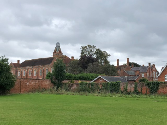
Carew Manor


Parts of Beddington Park can become flooded after heavy rain; and on both occasions I’ve done the walk the ground has been fairly heavy, so walking boots are recommended. Much of the rest of the Wandle Trail is paved or quite firm, other than the couple of places which actually become impassable as the result of flooding, requiring minor diversions.
On leaving Beddington Park, you walk along the London Road briefly, en route to the second source, Carshalton Ponds. The first branch of the river flows around the wonderfully-named Wilderness Island at this point. I think it’s inaccessible; it is certainly not part of the trail. You turn into a park called The Grove to get to the ponds, if you are walking. If you’re in a hurry you can take a short cut along Butter Hill to join the second branch of the Wandle further downstream, shortly before the two branches merge. But it’s worth seeing the source and then walking along the second branch to the confluence at the tip of Wilderness Island.

The main part of Carshalton Ponds
The river sets out from the ponds down this waterfall.

Some scenes around Wilderness Island, when the second branch flows by it, to where it comes together with its sibling. The Wandle meets the Wandle!


Confluence
The next stretch of the river is perhaps the loveliest and feels quite remote, even if at first there’s an industrial estate nearby. Thereafter, it runs along Poulter Park – not named after the Arsenal-loving golfer, as far as I am aware.


For the first half of Poulter Park you can’t see it, as you are below it, with trees and undergrowth covering the slope. Then a sign points you leftwards up the slope, away from the river. There is a path continuing along the river, which I tried briefly out of interest. it was very muddy with tangles of roots and branches to be navigated. I decided to stick to the official trail, which takes you past Tooting and Mitcham football ground. It’s a bit of a diversion, with a couple of roads involved, but doesn’t take too long.
Can’t quite remember now, but the first of these two shots was probably taken from the non-trail path before I turned back.


You return to the river at the start of the attractive Ravensbury Park. It’s a good place to stop for a lunch break, where the river briefly turns into a lake: man-made, I assume. On the first visit, on my own, I had tuna and cucumber rolls and a flask of tea. Second time, with the boys it was full pies, cheese and a tasty Catalan red wine! Photos 2 and 4 of this group are from Dave.


Not quite sure what the purpose of this was

This, however, was once a snuff grinder – there were snuff mills in the area
From Ravensbury Park, it’s over the road and into Morden Hall Park. It’s now National Trust property; but Morden Hall itself dates back to the 1770s. The Wandle trail veers from the river and heads north-west through parkland, past the wetlands and towards Deen City Farm on the other side of the tram tracks. At this point you are back along the river. However, if you take a diversion to the hall and the garden centre, with all the usual amenities, you can stay with the river. The wetlands – an area of marshland, teeming with hard-to-see wildlife – are well worth taking time to explore. There’s a board walk that takes you around the area.
Second wetlands photo courtesy of Dave.


When I first walked the trail, I was able to cross the tram tracks and head past Deen City Farm to Merton Abbey Mills. Second time around the path beyond the tram was flooded. It may have been passable with wellies, but not walking boots. So we had to walk along a path by the tram track until we reached Morden Road, and then cut back through an industrial estate, until we reached the river again, near Merton Abbey Mills. There was a nice pub there – the William Morris – with plenty of seating outdoors, so you can watch the fish rising to the surface of the river as you sup your pint. In medieval times, this area was the site of Merton Priory. Later it was a place of textile factories; today there is a craft market, with cafes and two pubs.


Merton Abbey Mills
Just beyond Merton Abbey Mills, the walking trail takes you a short distance east to an offshoot of the Wandle which is called the Pickle. It runs past a shopping centre and rejoins the main river at the beginning of Wandle Park (not to be confused with Wandle Park in Croydon!). We are close to Colliers Wood tube station (Northern Line) at this point. The park is mostly manicured, but if you enter it diagonally opposite the tube station, by a pub called the Charles Holden, there’s a path through some attractive woodland. I did this when I began the second half of the walk in early November. On the the two walks covering the first half we finished in Wandle Park. Over to Wimbledon after that – a walk of around twenty minutes to the station. Ten to fifteen more if you walk up the hill to Wimbledon Village, which we did on the group walk in late October. We went to a very good restaurant called the White Onion – highly recommended. Great food and wine, and friendly, well-informed service.


This one is taken from a bridge just as you leave Wandle Park
After Wandle Park, just before you come to Wandle Meadow Nature Park, you can walk along the river on the edge of a housing estate. I think it’s called Bewley Street. Nearby are the imaginatively named East, South and North roads. North Road gives you access to Wandle Meadow Nature Park. There is a wooden walkway over the river just below North Road, which takes you down to a meadow from where you can take a track through some bushes under North Road bridge into the nature park. In January it was closed – a paved path is being constructed, which will make the route easier.
The short walk along Bewley Street is notable for a blue plaque – not one of the official series – which commemorates the the day when Wimbledon footballer (now actor), the notorious Vinnie Jones, threw his almost as notorious colleague Dennis Wise into the River Wandle. No doubt a jape which occurred after a few pints. Both were members of the 1980s Wimbledon team which was known as the Crazy Gang. They won the FA Cup in 1988, beating Liverpool in the final. The club was only elected to the Football League in 1977, and rose to what was then called the First Division in 1986. They stayed in the top division until 2000, and after that things really started to go wrong. They’d moved out of their Plough Lane home in 1991, after the Taylor report recommended all-seater grounds for premier clubs, following the Hillsborough disaster. They shared Crystal Palace’s ground, Selhurst Park for a decade, but then the club’s owners announced a decision to leave South London and relocate to Milton Keynes. This was, unsurprisingly, deeply unpopular with the fans. By 2004 the club had been renamed Milton Keynes Dons. MK Dons play on, mostly in League One, the third tier of English football. Meanwhile, a new club, AFC Wimbledon, was formed by Wimbledon supporters. From lowly beginnings it has risen to the Football League and is now also in League One! In 2020 the club moved back into Plough Lane, completing the circle.


In October and November Wandle Meadow Nature Park was largely flooded, and impassable. It looks like a natural floodplain. However, you only have to walk briefly along North Road and then turn into Chaucer Way, which runs along the east side of the park. The views of the flooded meadows were rather lovely, and a variety of birds appeared to have made a home there. It seemed like the park’s natural state.


At the end of the park you come to a tunnel under a railway bridge, with signs pointing to Plough Lane, the home of AFC Wimbledon as described just now. Plough Lane is in an industrial area – from the river you can’t see the football ground. You’d need to take a short diversion if you wanted to see it. It’s not an opportunity I pursued!
Before you reach Plough Lane, there is a pleasant walk along a tributary of the Wandle, the River Graveney. After they come together, you are back on the Wandle again. There’s a handy viewing platform which overlooks the confluence.

The Graveney lies below the trees

Confluence – Graveney to the right

Back on the Wandle, heading towards Plough Lane
Things stay industrial for a while, and then the river flows through Garratt Park. I can’t say I really noticed this. Soon after, you are in Earlsfield, briefly coming off the river. A short distance along from Earlsfield railway station is the Wandle pub. We stopped for a drink there in January. The pub serves Samsbrook’s Wandle ale. So we were sitting in the Wandle, drinking Wandle by the Wandle!

This may be by Garratt Park!

From the pub, you walk along Penwith Road, over the river, before turning right/north into St George’s Park. This is the last of the parks on the river’s journey. It’s a long, thin park, carved by Kimber Road into two sections. It’s quite functional, but a pleasant open space. In the southern half there’s a school – Southfields Academy – on the west side. This may be why the river is fenced off – you wouldn’t want children falling in, or losing their bags on the way home. From here, as you move into Wandsworth, the river becomes rather overwhelmed by its surroundings, until a last flourish before entering the Thames. It suffers the indignity of disappearing underground for a while, as a shopping and entertainment centre have been built over it. It’s not the only waterway to suffer this fate in London. It happens to the Regent’s Canal, in Islington (shopping centre) and Maida Vale (housing); and of course the River Fleet was built over a long time ago. Only Fleet Street preserves its memory.

On leaving St George’s Park


Going underground

Re-emerging
After escaping the concrete jungle, the Wandle makes the final push towards its destination, the Thames. A short stretch skirts the Ram Quarter, once the home of Young’s Brewery and still the location for Samsbrook’s. The river then splits, divided by a causeway and industrial area. The causeway takes you to a bridge which all walkers along the Thames will be familiar with, and beyond that, a viewing point. The views out to the Thames are striking, especially as the sun sets. Downstream lies Wandsworth Bridge, and beyond that, Battersea on one side, Chelsea the other. Upstream lies Putney Bridge and just before it a railway bridge. The grounds of the Hurlingham Club hog the river bank on the north side of the Thames for a while. When the tide is low, small islands host an array of birdlife, including herons and cormorants. It’s a tranquil and inspiring scene to end the journey of this humble but fascinating river.

The Ram Quarter is to the right, beyond the housing

Causeway

A glance back upstream

First heron shot, this one on the Wandle

The Thames walkers’ route over the Wandle

The Thames comes into view


Thames, looking upstream, early October

Downstream – Wandsworth Bridge is being refurbished at the moment


Thanks to Dave for this one, from January
There is just one thing to do at the end of the journey – head through the rather soulless Riverside Quarter to the Cat’s Back pub. This pub has the distinction of being one of few in London which serve Harvey’s ales – another favourite of ours is the Royal Oak in Borough. Harvey’s is brewed in Lewes, Sussex. There are plenty of other decent pubs in Wandsworth, but this is our choice. If you are walking the Thames and heading west, next up is Wandsworth Park, followed by Putney. When I finally get back to writing up my Thames journey series, these will both feature in the next instalment.

The Cat’s Back
Harvey’s Best bitter
Cheers!

Some lovely snaps of a surprisingly pleasant walk.
Good pubs along the way too. I’m sure the beers are getting better as we get older….Harvey’s and Wandle very quaffable ales.
Epic blog, John. You should start writing guidebooks!
It’s great the way you’ve stitched together all the various strands that the Wandle takes, and the history stuff is really good too. I agree with Nick – er, Dave: we got a lot of pleasure out of some of the more unknown areas of Sarf London, and found some cracking refuelling stops along the way.
Here’s to the next one, coming up soon.
I loved reading this, John! A vicarious walk 😀