

This stretch of the river, winding its way through Wiltshire, Gloucestershire and Oxfordshire involves a walk of just under 28 miles. We did it over three days at two different times. The walk from Cricklade to a spot between Highworth and Inglesham, which aren’t far from Lechlade, was on 30 December 2016; the other two legs were the last of the whole walk, on 26 and 27 April 2019.
Cricklade to Highworth/Inglesham
We stayed overnight in Cricklade, at the White Hart hotel, after our walk from the source. Cricklade is just in Wiltshire, with the Gloucestershire border the other side of the Thames. We didn’t look around much in the mist, but while it is a quiet town these days, it has an interesting history. According to Peter Ackroyd, there are a number of theories about what the name means: it could be river crossing by the hill or stony/rocky country; it could be a derivation of Cerrig-let, the stony place where the River Churn meets the Thames; or it might be a corruption of Greeklade, which means an assembly of learned monks and scholars. It is said that Brutus of Troy arrived here in 1180 BC and established a university amongst the Britons. The story then fast-forwards to AD 650, when Panda of Mercia also established a university in Cricklade, thus beating Oxford by a few hundred years. The Romans’ Ermin Street passed through Cricklade, and King Alfred built a wall around it. It was sacked by Cnut later and seemed to slip into decline over the centuries, although in the 12th century King Henry II granted the townspeople a charter allowing them to trade in any part of the country as reward for protecting his mother Maud. By the 18th and early 19th centuries, it was known for its venality in general elections. The town had slipped into poverty. William Cobbett, journalist and MP in the late 18th and early 19th centuries, wrote:
A more rascally looking place I never set eyes upon. The labourers seem miserably poor. Their dwellings are little better than pig beds, and their looks indicate that their food is not nearly equal to that of a pig. In my whole life I never saw such wretchedness as this.
It’s fair to say that things have moved on since then! The only landmark that we did look around was the old church, St Mary’s, which dates back to Norman times. It claims to be England’s oldest Roman Catholic church, having returned to the faith in 1984, after it had been deemed surplus to Anglican requirements by the Bristol Diocese – there is another church, St Sampson, in the town.


The day’s walk was shrouded in mist. It was icy on the roads and pavements too. A day for staying nice and warm indoors. But the river was there to be explored! Throughout the day, especially the first couple of hours, there was a rather spooky quality to the surroundings –you could imagine the retreating Saxons hiding in the rushes as Cnut and his fearsome Danes plundered the area. It made for some atmospheric photos though.


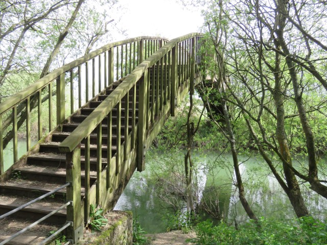
There was a stretch near the end where we were diverted from the river – I think the river bank was military territory. It may have changed since 2016, I’m not sure. Just one photo to share from this part of the journey: a lone tree in the mist. I liked this one and felt moved to try painting the scene. You can compare and contrast!


The walk petered out near Highworth. To get to Lechlade – the original intention – would have meant walking along the A361 for a few miles. That didn’t appeal, so we called a taxi and went back to Swindon station for a train to London. The Thames journey in these parts would resume a couple of years later…
Inglesham to Newbridge, via Lechlade and Tadpole Bridge
This was two days of walking, the last of our Thames journey, but early days in the river’s own journey. We stayed in a house in an attractive village called Longworth, which is a couple of miles south of the Thames. You reach the village from the river by walking up Harrowdown Hill – a lovely spot, but now notorious for being the place where the scientist Dr David Kelly took his own life in 2003, having become embroiled in the Iraq crisis. As you walk along the bridle path, through the woods, with a beautiful vista of the Thames plain to one side, it is hard to imagine the despair that he must have been feeling.

Longworth itself had a nice pub called the Blue Boar which, conveniently, was about a minute’s walk away from our house. Just up the road, too, were some rather amusing residents.

Thanks to Jon for this one!

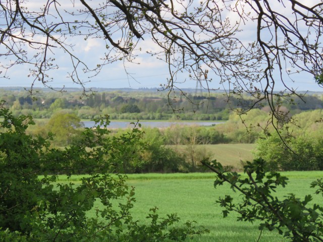
On our first day, Thursday, we walked from Farmoor upstream to Newbridge. I’ll cover that in the next blog. On the Friday we took a taxi to a spot on the river near Inglesham and headed downstream. You can only really be near Inglesham as it is a long-gone village; only a 13th century church and a farm remain. The church, St John the Baptist, has Saxon origins and was restored in the late 19th century by William Morris, the textile designer, poet, novelist and socialist. Inglesham is also where the poet Shelley and companions gave up their attempt to sail to the source of the Thames. The river here is still narrow and winds this way and that. I think it is also very shallow in places. But the scene as we arrived at the river was one of great beauty: a rich palette of greens beneath a bright blue sky, flecked with wispy cloud. It was one of the loveliest stretches anywhere on the river: a classic, modest English beauty.


I got my paintbrushes out again quite recently to depict the first of these scenes. You’ll note that there is one major difference: the tree in the centre of the picture has leaves in my version. Artistic licence… and an emergency measure when I messed up the bare branches! Too many and too thick. But, you think, it should have had leaves by that time of the year – everything else has. Perhaps the real thing was diseased, despite its dignified presence.

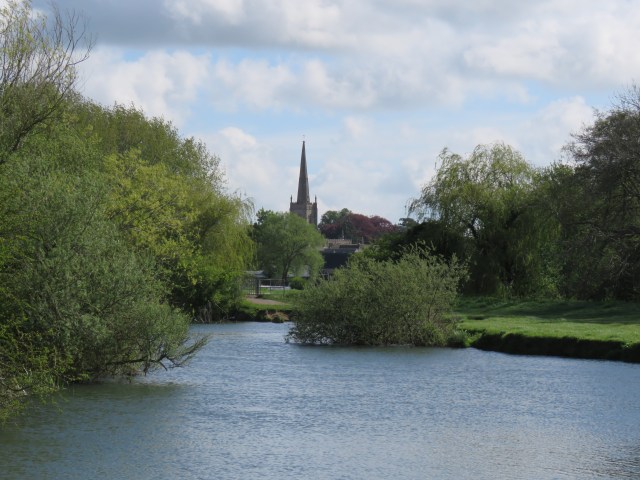
The approach to Lechlade was gorgeous, with the spire of St Lawrence’s church rising as if from the river. The church dates from 1496 and was originally dedicated to St Mary, before changing to St Lawrence at the behest of Catherine of Aragon. On Sunday, before returning to London, we stopped for some breakfast by Lechlade’s Market Square at a café called Lynwood and Co, which was very good. Outside the spire loomed above us, but being Sunday and with services on, we didn’t get to look around. Another time, perhaps.
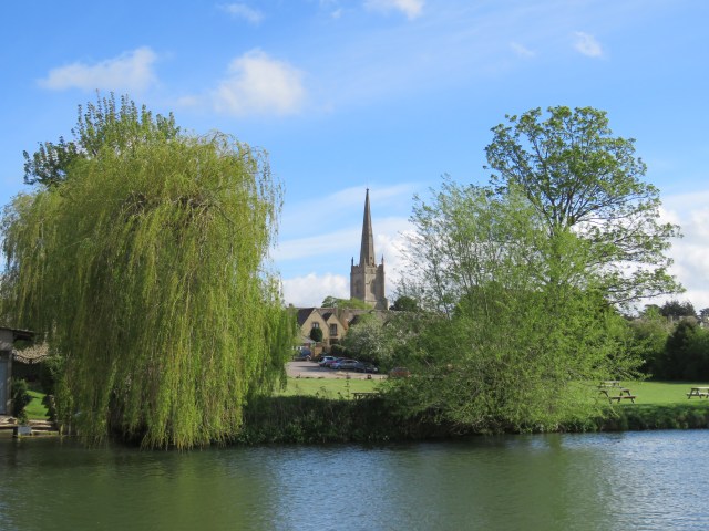

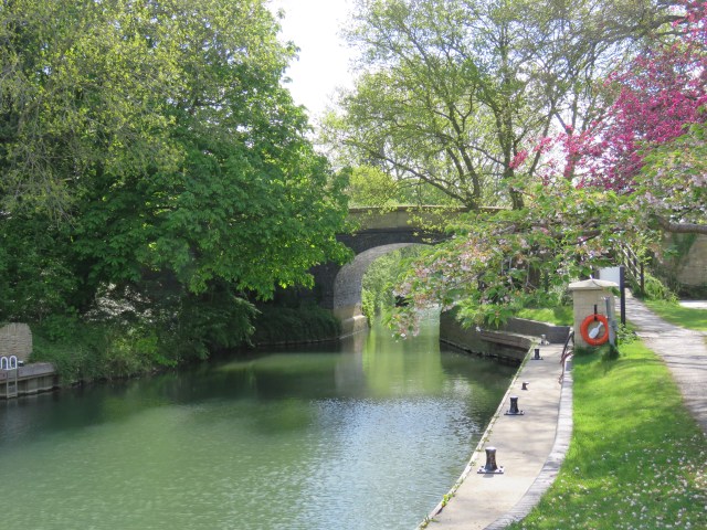
Lechlade means the wharf or crossing by the Lech, or today, Leach – the river which joins the Thames at this point. Four counties – Gloucestershire, Oxfordshire, Berkshire and Wiltshire – also meet at Lechlade, which itself is just in Gloucestershire. This is the furthest point upstream that commercial boats could travel; and in centuries past it was a thriving port, serving Oxford and London. A notable commodity that was sent down river was cheese; the stone that was used for St Paul’s dome in London was also transported from here.
Halfpenny Bridge was completed in 1793. It was made high to allow the barges to pass under it without lowering their masts according to Ackroyd, though to be honest it doesn’t look that high. Its name comes from the toll levied on walkers – except churchgoers and mourners – until 1839. It became toll-free from all traffic in 1875.

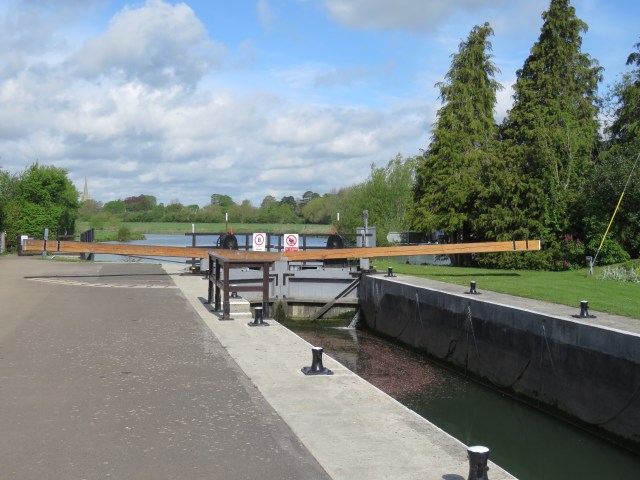
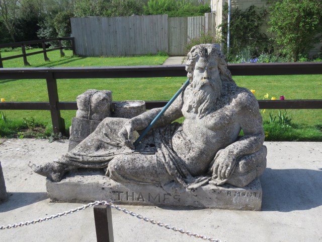
On the outskirts of Lechlade is the first lock on the river, St John’s. Today a statue of Old Father Thames rests here – it was originally situated at the source.
We passed near to Kelmscott, where the aforementioned William Morris famously lived in a manor close to the river. I don’t remember seeing it! A couple of miles further on we reached a village called Radcot and stopped to eat our sandwiches, aided by a pint from the pub, Ye Olde Swan. The original bridge here – over a side stream of the main river – is thought to have been built in AD 958, which makes it, the books say, the oldest bridge over the Thames. (That must be outside London – London Bridge, in its various guises, has been there since at least the times of the Romans.) A replacement was built around 1393 by Normandy monks who lived in nearby Faringdon. There was a Civil War battle here in 1465, in which royalist Prince Rupert fought off the parliamentary army.
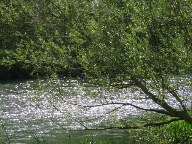
None of the next set of photos are of either of those locations. But these ones were on the way and rather lovely.


While we were in Radcot the weather turned and it lashed down for a while, but we continued onwards. As we progressed the river rippled in the wind and it seemed to be flowing faster. Our destination was Tadpole Bridge, which was in the middle of nowhere. But it did have a pub, the Trout Inn, which has rooms for those hardy walkers who like to walk from the source, or Cricklade, to Oxford in a couple of days.
The most pointless gate I’ve seen. Maybe there was a fence in times gone by.

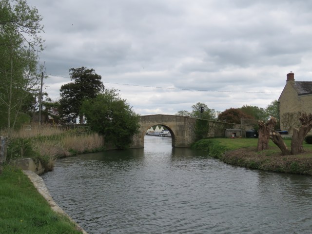
Tadpole Bridge.
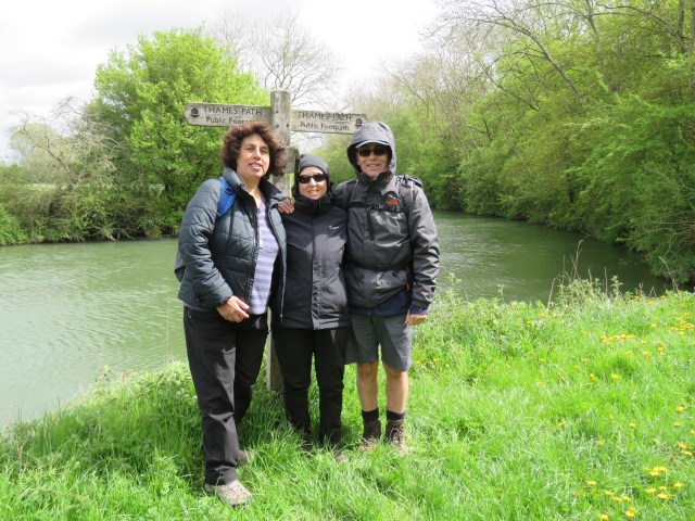
We ended our journey for the day with a pint in the Trout, returning there on Saturday morning to start the last leg of our Thames venture. This group photo was taken on Saturday by our friendly taxi driver.

We were heading for just near Newbridge, at the path leading to Harrowdown Hill. It was an incredibly windy day – the remnants of Storm Hannah – and for the most part, the scenery was austere compared with the lush greens of the area either side of Lechlade. We barely saw a soul all day.
One notable feature of this stretch was the old pillboxes, from the Second World War. The Thames has often been a border, a defence, a refuge. We weren’t quite sure why the Germans would be interested in this part of the river, but some googling in the evening revealed that it was all part of a defence plan should the Germans invade from the south coast. Territory would be yielded as far as the Thames; from there the invading forces had to be denied access to the industrial Midlands. I’m not sure the pillboxes would have offered much defence against German tanks, but I guess they had to do something to prepare for the possibility.


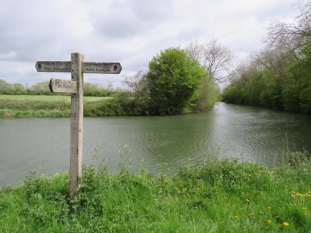
And then we reached our destination. The signpost that marked the end of our journey. We had covered the length of the Thames from the source to the estuary. 22 walks, including one around Canvey Island. Mostly downstream until Marlow, and all upstream in London as far as Hampton Court. We celebrated with a pint outside the Blue Boar; and later, a glass of champagne back at the cottage.


This blog, of course, is travelling downstream with the river, and the journey has only just begun. In the next instalment we will begin at nearby Newbridge and make our way to the dreaming spires of Oxford.

The end but not the end…
Love the pictures especially Saxon Cricklade.
And thanks for the pub references – will be nice to get back into the pubs one day.
Yes, greatly enjoyed, John. As I said yesterday, I’ll forward this to my friends John and Cherry, who have had a few one-day forays, but who plan to do some longer trips when things lighten up. I think I’ve got records of the places where you (and Dave and Fi) stayed, so I might pass those on.
I really like your narrative, and the diversity of the topics covered – Shelley, William Morris, Cnut, David Kelly, Prince Rupert, and not forgetting Brutus of Troy. I love the fact that the river is such a repository of history, and over so many centuries. Excellent blog.
Thanks Jon. I am indebted to Peter Ackroyd and “Walking the Thames Path”, published by Cicerone. I’d recommend the latter to your friends, as a practical guide when walking. Jon G had a copy while we were walking; I’ve only just bought my own copy, to help with writing this series.
Wow, it all sounds amazing and my mind is already buzzing with plans 😃😃 Thanks for all the place names, I’ll add them to my list and be sure to make time to explore them all. I’m fascinated by Domesday Book villages/towns and would love to visit a few more. The photos are again just wonderful and really give a feel for the countryside surrounding the upper reaches of this mighty river. I’m going to save this link for when I have time to make notes of the villages. My only gripe about long distance walking atm is that the majority of those marvellous old churches are closed. I recently walked The Pilgrim’s Way and could only gain access to 3…too sad. A most enjoyable read.