
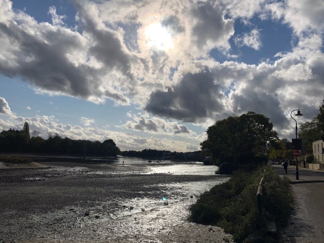
By Chiswick Mall, with Constable clouds
In the previous instalment of this journey – Hampton Court to Kew – I envisaged this piece covering Kew to Putney, a distance of around 6 miles on the river as it snakes through west London. The Thames Path in London guide gives the distance as 6 ¾ miles on the north side and 5 ½ miles on the south side. That’s quite a difference – caused by the bends in the river, and some of the diversions off river in Chiswick and Fulham. I’ve walked and cycled this stretch of the river more than any other, and Hammersmith has become something of a home from home for me. Consequently there are quite a few photos and reflections I’d like to share. Too many to take this journey all the way to Putney. So this one will end at Hammersmith Bridge and we’ll move onto Fulham and Putney next time.
This is Boat Race territory. The race, pre-covid, had run from Putney to Mortlake since 1845, apart from during the two world wars. It started in Henley in 1829 and from 1836 there were a few races between Westminster and Putney. Moving the race upstream was designed to take it away from the heavy river traffic further downstream. While the race ends at Mortlake, the crews actually disembark at a boathouse on the other side of the river, in Chiswick, just before Chiswick Bridge. I’ve only ever been down to the river to watch the race once. It’s a scrum, with a lot of drink being consumed. And you only see the boats for a few seconds. I prefer to watch it from the comfort of my sofa!
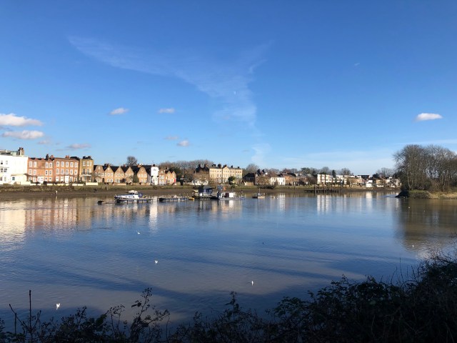
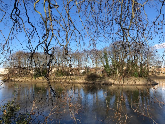
From Kew Bridge there is a towpath all the way down to Putney Bridge on the south “Surrey” side, taking in Kew, Mortlake and Barnes, as well as the renowned Wetland Centre nature reserve, a place I visited regularly when the children were young. On the north “Middlesex” side, there’s a lovely walk along Strand-on-the-Green, but then it’s a mixture of suburban streets, narrow countryish lanes and the odd bit of towpath until you get to Chiswick Mall, on the border of Hammersmith. From there the walk down to Hammersmith Bridge might just be my favourite in all of London…
But let’s start on Strand-on-the-Green. Strand means beach in German, and it’s reasonable to assume it meant something like shore by the 14th century, when it was known as Stronde. Later it became Strand Green and Strand under Green. No surprise, as Chiswick, of which it is part, was once known as the “great garden of London”. Today it is one of the more desirable parts of London to live in, with house prices to match. Peter Ackroyd speculates that Chiswick may mean cheese farm, in the same way as Keswick in Cumbria. He adds that it is: “Now best known for Chiswick roundabout.” Harsh. Chiswick House and its beautiful gardens perhaps, or even the shops, bars and cafés of Chiswick High Road. Having said that, circumnavigating Chiswick roundabout can be a traumatic experience!
These first few shots were taken an hour or so after sunrise on a glorious day last December. Getting out and about by the river was one of the few remaining pleasures after we were plunged into the gloom of another lockdown.


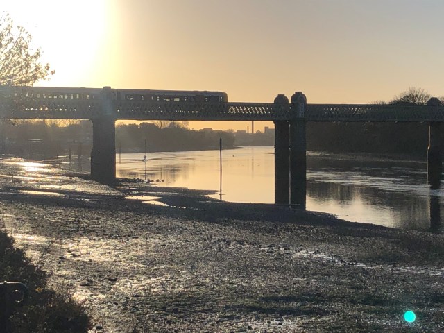
The District Line passes over the railway bridge, heading down to Richmond
And here are a couple for the animal lovers.


The next selection is from the other end of the day, in October 2020 and January 2021. The wooded island is known as Oliver’s Ait (or Eyot). Legend has it that Oliver Cromwell escaped from Royalist troops using a tunnel connecting the Bull’s Head pub to the island. The Bull’s Head is one of a number of venerable pubs backing onto the narrow paths of Strand-on-the-Green. Another is the City Barge, which dates back to 1484. Its name comes from its role as a location for winter moorings for the barges of the annual Lord Mayor’s Procession up the Thames. This event took place for 400 hundred years, the last one being in 1857. A more gruesome fact about Strand-on-the-Green is that in the 1920s, over a hundred skulls were discovered. There were similar finds in Kew and Hammersmith. The skulls dated to prehistoric times. Presumably the land around this part of the Thames was as sought after then as it is now.


Oliver’s Ait
Kew Bridge was glowing in the sinking sun on this day.

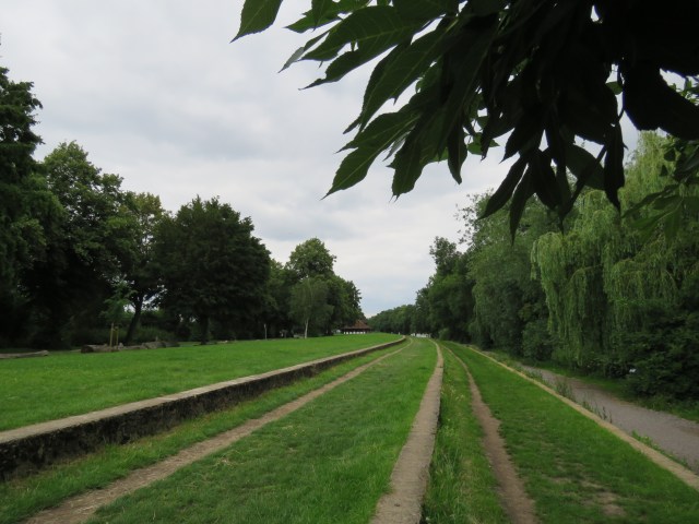
Jumping over to the other side of the river, we have a few photos taken in recent months as I walked along the towpath up to Chiswick Bridge. This is quite a tranquil stretch, though popular with walkers (and their dogs), joggers and cyclists, especially at weekends. It’s also prone to swarms of midges at times in the summer – when I used to cycle along here I’d be spitting them out as I rode along!
The heron was lurking by some boats just below Kew Bridge.


Strand-on-the-Green from the other side
Another take on Oliver’s Ait


Chiswick Bridge from both sides.


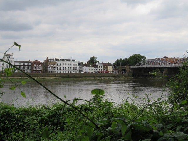
Chiswick Bridge is a relatively recent construction, having opened in 1933. It was built to help relieve traffic congestion in west London – an even more vital role at the moment, with Hammersmith Bridge still shut for major repairs – it reopened to pedestrians and cyclists, but not motor traffic, in on 17 July this year. Just beyond the bridge is Mortlake and the old brewery. Mortlake used to be famous for its weavers, many of whom were from Flanders. A number of tapestries produced between 1619 and 1703 are now displayed in Hampton Court Palace. It was also famous for its beer. The brewery was founded way back in 1487. It was acquired by James Watney and Co in 1889. At some point the brewery became known as the Stag Brewery, one of the Watney brands. Stag bitter was still being served in central London pubs when I first came to live here in 1980. Thankfully we have moved onto better things, though sadly the brewery is no more. Having survived a number of direct hits during the 1940 Blitz it met its fate when it was bought by Anheuser Busch in 1995. It switched to brewing Budweiser, which never really caught on in this country, despite a lot of advertising and sports sponsorship. It staggered on for another twenty years until AB sold the site to property developers. Plans for a mixed use development – residential, offices and a school – were refused planning permission by the Mayor of London in July, so we wait to see what happens next.

Staying on this side of the river, we soon approach Barnes Bridge, one of my favourite features on the Thames. It’s a railway bridge, which the train from Brentford into Vauxhall and Waterloo passes over. There’s a pedestrian crossing too. I always enjoy staring out at the vastness of the river and the sky as we cross – different every time, according to the weather and the hour. The bridge too takes on many different appearances – I’ve included a few favourite photos here, from over the years.
Starting with a misty scene from 2011.

The rest of the shots are from 2021, except the one with the rowers, which is May 2017.


Barnes Bridge looks like a smaller version of Tyne Bridge in Newcastle and Sydney Harbour Bridge in Australia, but it predates both by some way. Barnes Bridge opened in 1849, Tyne Bridge in 1928 and Sydney in 1932. From the bridge a raised path takes you along the river and above Lonsdale Road, also known as The Terrace in this section. It’s an attractive scene, though the traffic can be heavy. The composer Gustav Holst – best known for The Planets – lived in one of the old Georgian houses at the far end of the street. He also taught music at St Paul’s Girls’ School in Hammersmith from 1905 until his death in 1934. There are some decent pubs here too, notably the Bull’s Head (another one) which is a centre of the jazz scene in London. The food is good and it’s a nice place to stop for refreshments if you are walking along the river.
Some views from the bridge.


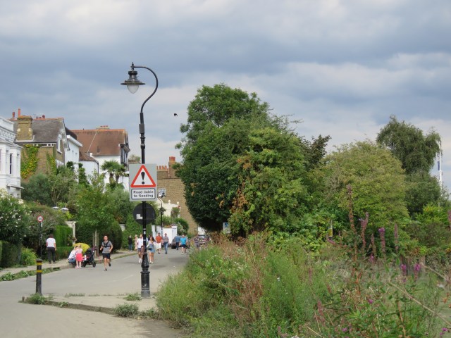
Just after the raised path ends the Thames path enters a tree-lined area which takes you all the way to Hammersmith Bridge. Clear views of the Hammersmith side are limited. I stopped cycling along this part of the path years ago, as it gets quite muddy, especially in winter. I prefer to bomb along Lonsdale Road – by my standards! – past St Paul’s Boys School with its vast playing fields, up to Castelnau, which heads up to the bridge. Except right now you can’t cross it in a car or a bus. A nightmare for local residents – the nearest road bridges are Chiswick and Putney. I remember my son playing rugby against a St Paul’s team in year 7. It was an utterly freezing February morning, in 2007. The icy winds whipped off the Thames. The boys who weren’t in the scrum were trembling in the cold. One boy had to come off because he was shaking so much. Good for the soul, no doubt.
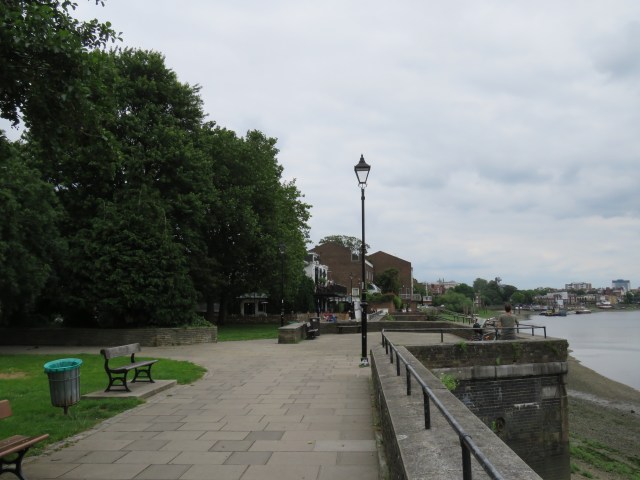
Despite my familiarity with this part of the river, it was only in December last year that I discovered the Leg O’Mutton. Tucked away between the river path and Lonsdale Road is what used to be a reservoir and is now a nature reserve, with leafy glades and marshes. There’s a lovely tranquility about it all. The lake is shaped like a leg of lamb, hence the name. The water used to serve local residents and business, but no longer. It has been reclaimed by nature. My friend Jon, a resident of Hammersmith, introduced this to me as we walked from Hammersmith to Putney, Barnes and back to Hammersmith – the Thames and its environs never cease to delight.

Going back to Barnes Bridge and crossing over, we come to Dukes Meadows. The meadows extend from Chiswick Bridge to the edge of a private estate that leads past Chiswick Pier towards Chiswick Mall. The meadows are mostly given over to various sporting activities – there’s a big leisure centre, a golf course, Chiswick rugby club, various other sports grounds and a couple of boathouses, one of which is sited next to the steps down from Barnes Bridge. The civil service has a sports ground in the area – I’ve played in a few 5-a-side tournaments down there in the past. After the boathouse there’s a promenade with good views of the Terrace on the other side of the river. There’s some parkland here, with a couple of bandstands. It’s a nice place to stop and have a sandwich and a cup of tea, sitting on the grassy steps that lead down to the riverside path. The area is very popular with picnickers in the summer. The aroma of barbecues wafts over the summer breeze. The park was opened by Prince Albert, Duke of York (and future King George VI) in 1926, after local residents twelve years earlier fought off plans for the Brentford Gas Company to build a gasworks there. An early example of middle class nimbyism?
The picnic area – sometimes
Looking over to Barnes
Approaching Chiswick pier
This brings us to Chiswick Mall: the beginning of a stretch of the river which might just be my favourite spot in London. I think of it as Hammersmith, although the first half of Chiswick Mall (looking downstream) is still in Chiswick, and hence the borough of Hounslow. Last year, when lockdown eased a little, but there were still strict social distancing rules in place, this made a difference as a cyclist. In Hammersmith and Fulham cycling along the river paths was banned, with stewards enforcing the rules. There was no such thing in Hounslow, or indeed the borough of Richmond on the Barnes side.
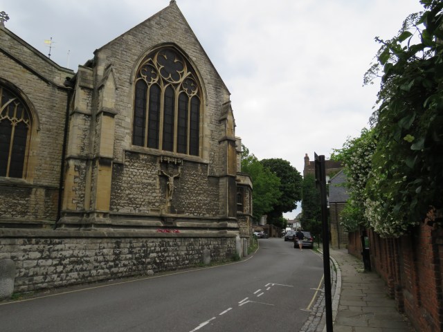
At the start of Chiswick Mall, heading downstream, you will find St Nicholas’ Church, Chiswick. The oldest part of Chiswick developed around the church in the late 12th century. The tower was built between 1416 and 35; the rest of today’s church dates from 1882-84 when it was rebuilt with money from the brewer Henry Smith, whose Fuller, Smith and Turner brewery was nearby. In the graveyard, amongst others, lie artist, cartoonist and satirist William Hogarth (1697-1764) and American artist James Whistler (1834-1903). Hogarth’s name is lent to another of Chiswick’s notorious roundabouts, which is located at the other end of Church Lane. From the tranquility of the church and the Thames to the snarling traffic of the A4 in a couple of minutes’ walk. Such is London.
St Nicholas’
A short walk along Chiswick Mall then brings us to Fuller’s Griffin Brewery, home of one of the finest ales to be found anywhere, London Pride. Not to mention the powerful ESB and many others. The brewery was founded in 1845, though beer had been brewed on the site since the 17th century. Fuller’s had long been a public limited company and extended its operations across nearly 400 outlets, primarily in the south and west of England, but the family-run brewery anchored it – until, in 2019, it was sold to the Japanese giant Asahi, Fuller’s retaining the pubs and hotels. We have seen what happened to the Stag brewery – will a similar fate follow for the Griffin? Already the house pub, the Mawson Arms, has been closed for good, following its initial closure in the March 2020 lockdown. Only a few days before that I and a few friends were there, watching the Cheltenham races on Gold Cup day. There was a valedictory feel to the afternoon – we knew lockdown was on the horizon. But it was a pub we loved to visit each year for what we call our virtual Cheltenham after breakfast somewhere in the City. And it was a place I’d pop into for a quick pint during a walk along the river. It was popular with touring groups who’d been to look around the brewery, and was the local for the brewery workers themselves. Where do they go now? Its closure felt like a gratuitous act, sneaked through in lockdown, just another small example of unfeeling capitalism in action.

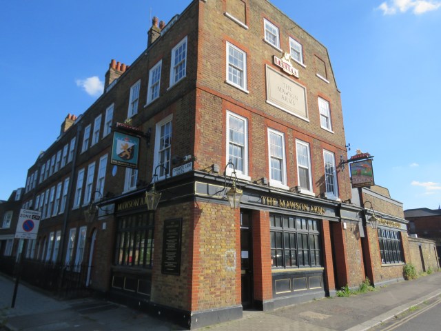
The Mawson Arms, much lamented
Chiswick Mall creates a permanent sense of wonder for me. Not just the huge, grandly designed houses with their richly planted riverside lawns on the other side of the road, but most of all the spectacular demonstration of the Thames’ tidal scale. The difference between high and low tides in the Hammersmith area is around 5 ½ metres, or 18 feet. The difference is even greater further downstream. It’s something that never ceases to amaze me, and Chiswick Mall demonstrates it very well. At low tide, the river is virtually dry all the way up to the eyot in mid-stream. At high tide, Chiswick Mall is flooded. The water can be deep enough to make cycling impossible. The photos below give you some indication of the contrast.
The two high tide photos are from March 2014. You can see more photos in lovelondonscenes 50.


May 2017 – same spot as above
The next two shots are from December 2018.


This misty scene is from November 2011.

Some of those riverside gardens.


These last three are from this month.


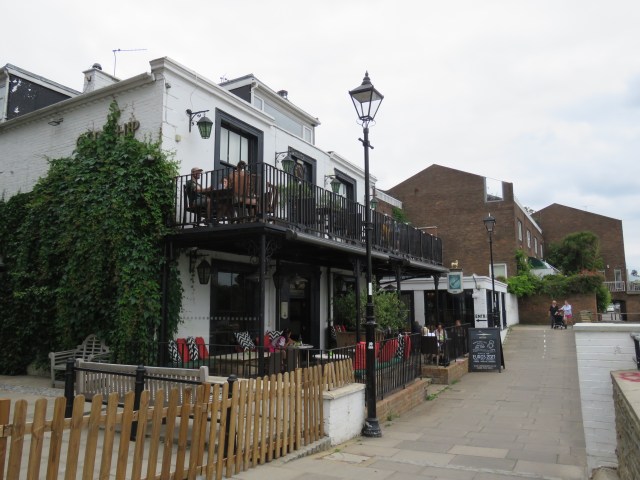
At this point the river is approaching the top of a bend: a north-east flow shifting to south-east. Along the rest of Chiswick Mall to the Black Lion pub, along the promenade past the Old Ship and then into Upper Mall, with another string of fine, if somewhat more understated houses than Chiswick Mall. No riverside lawns here, either – the street is protected from the river by a high wall. Upper Mall leads into a narrow alleyway which houses one of the best pubs around – The Dove. It’s small and has a rather cramped terrace looking onto the river, but is always worth a visit. Fullers beers, naturally. On the other side of the alley are Furnival Gardens and a promenade which takes you up to Hammersmith Bridge. Two more popular pubs, the Rutland Arms and the Blue Anchor, line the way.
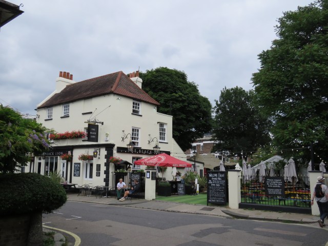
The Black Lion
Approaching the Old Ship
The Old Ship
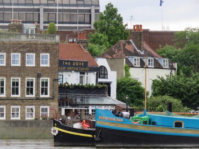
The Dove from the other side of the river, zoomed in.
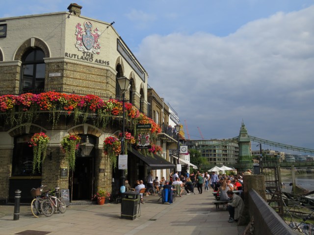
The Rutland Arms, with the Blue Anchor just beyond
View from Hammersmith Bridge
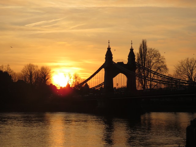
I love this stretch of the river, and not just because of the many hours I’ve spent in all of these pubs over the years. More than anything, it’s the views, especially as the sun goes down. The nature of the bend in the river is such that there are wonderful big skies to the west, and you can watch them turn yellow, pink, orange, purple, red, laced with the greys and blues of the clouds. The trees on the other side of the river and the boats on its surface are silhouetted against the glow. A good time to see all this is in the winter months, when the sun sets as early as 4 o’clock; but each season brings its own glorious perspective.

January 2016

Also Jan 2016. I think the boat might have been sinking!
The next two in the mist are from November 2011. Impressionism in nature.


Next three are from January 2019. There are more at lovelondonscenes 161.


Two from September 2019. I love the purple sky in the second. No enhancements – just the fact the photos were taken with an iPhone 8.


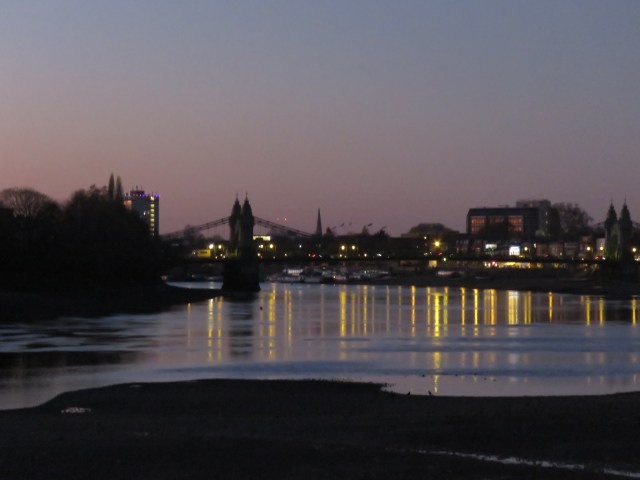
Onto December 2020.


Hammersmith is a place of many memories: of times spent with friends, of great restaurants and pubs, of walks and cycle rides, of music and drama (the Apollo, the Lyric, the Riverside, and, in the past, the Palais) and of learning (my daughters’ secondary school). It was natural that it should play a part in my novel, The Decision, and its successor, Hope Rising. They are part of a trilogy of futuristic political novels, though not quite as futuristic as I’d imagined at the time of writing, given our experiences in the last 18 months. In The Decision, the main character, the rebel leader Charlie, has to decide whether to go ahead with what is looking like a hopeless mission. He ponders the pros and cons while looking out over the river in – where else? – Hammersmith. In my imagination it was outside the Old Ship; the river here is a place for contemplation. The photo I used for the cover was taken slightly further downstream so I could get a closer view of the bridge.
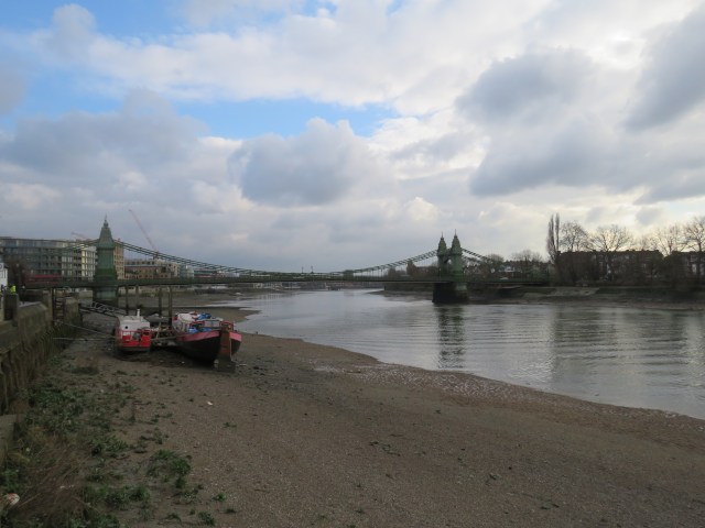
Photo used for The Decision cover – in black and white

Charlie would have been standing with his beer around here
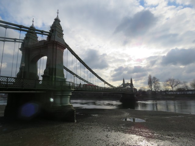
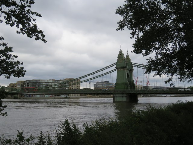
And so we come to the bridge itself. Battered and bruised; down but not out. It was the first suspension bridge to be constructed over the Thames. The first version was designed by William Tierney Clark, who was responsible also for the Thames crossing at Marlow and the great suspension bridge in Budapest, as I mentioned in part 5 of this journey. By the 1870s there were concerns about its ability to carry the increasing weight of traffic; and in 1882 it was damaged when a boat collided with it. A new bridge was constructed on the foundations of the first one – designed this time by the great civil engineer Joseph Bazalgette. It was opened by the Prince of Wales in June 1887. It has been the target of the IRA on three occasions: in 1939, 1996 and 2000. The only time the explosives detonated was in 2000; subsequently the bridge was closed for two years for repairs. It has been closed for repairs on other occasions over the years; but the recent problems seem to be more deep rooted. Cracks in the structure were identified in a major survey conducted in 2014 and the bridge was closed to traffic for a period. Further repairs were delayed by wrangling between the various bodies with an interest; but by 2019 the problems had become more serious, and the bridge was closed to motor traffic in April of that year. I can remember enjoying being able to cycle across the bridge undisturbed in the following period, but the closure to cars, buses and commercial traffic was a serious impediment to the daily lives of many people. Further structural damage was identified in 2020 after a heatwave, and the bridge was closed to all in August. The wrangling over the cost of repairs – between the local council, Transport for London and central government – continued; and it looked like closure could last for a long time. A ferry for pedestrians and cyclists was mooted; but then, seemingly out of the blue, it was announced that the bridge would re-open to pedestrians and cyclists in July 2021.
I went down to the bridge earlier this month simply to walk over it and back again. It was good to enjoy that simple pleasure which had been denied to us for many months. One of many things we took for granted until 2020, and now relish. But the pleasure – and the utility – is still only available to pedestrians and cyclists. The future for other traffic remains less certain: there have been various proposals, all with high costs attached, and no-one seems to have enough money. It seems to me that, given the importance of the bridge to the life of the capital city, central government should be stumping up the bulk of the money on an emergency basis; but of course that isn’t how it works. The latest progress, as far as I can tell, is in this update from Hammersmith and Fulham council. Obviously it is written from the council’s perspective, but it seems to have all the salient facts.
Let’s hope the bridge is restored to full functionality in the not-too-distant future. It is part of the lifeblood of west and south west London, as well as being a structure of great elegance and beauty as befits its Grade 2 listed status. It’s a gentle green in the daylight, it broods as the sun sets and the river sparkles below in the darkness. I hope the photos below capture some of that. I’ve included a painting of mine too – taking a luxuriant summer scene as my inspiration.

From The Decision photo shoot in February 2018
Feb 2018 again
June 2018, from the Barnes side
January 2019 – same as the orange sunsets earlier
November 2018
In June this year, the bridge was still closed.


Earlier this month – accessible again.


In July 2017 I took this photo, which became a painting. Took a few liberties with the colour, as you can see.


The scene revisited, June this year.


So that’s it for this instalment. Hope you’ve enjoyed the journey. Next time we will head to Putney Bridge and beyond – to the edge of central London at Vauxhall Bridge.

Looking downstream from Hammersmith Bridge, September 2021

after tower bridge nothing compairs to hammersmith bridge maybe it’s just in the wrong place ? With regards bob