
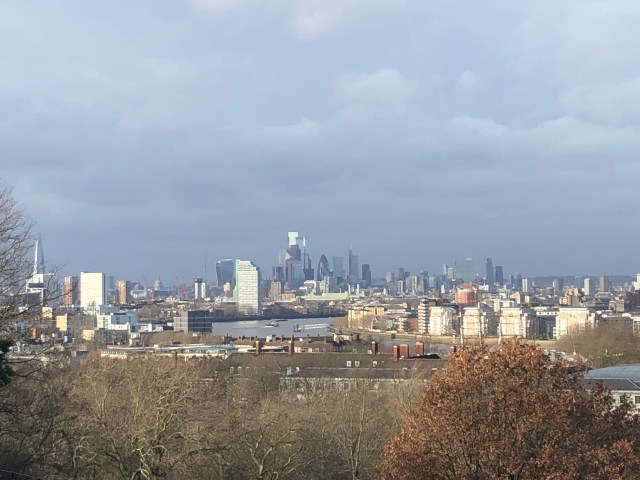
iPhone view from Greenwich Park – just squeezes the Shard in!
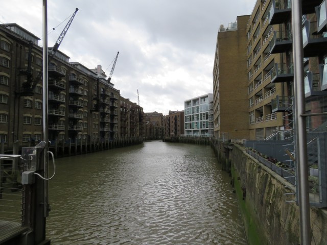
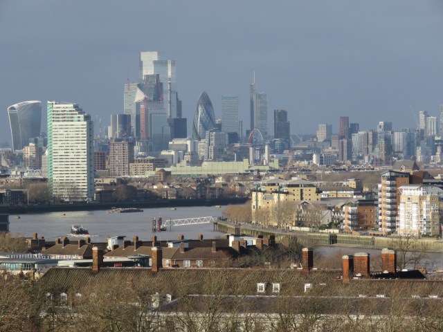
The last part of this journey took us through the historic heart of London and past many of its iconic sights. There were glimpses of the modern too, including some of the sights that we explore further in this instalment. The journey from London Bridge to Greenwich is another relatively short one, and is perhaps the section where the modern has most decisively taken over from the old, driven by changing economic circumstances and emerging new opportunities. At the heart of this change was a rapid decline in the fortunes of inner London’s docks – the Pool of London – following the arrival of containerisation in the late 60s. In essence, the docks that ran from around London Bridge and Southwark out as far downstream as East India Docks beyond the Isle of Dogs became too small for the giant container ships which quickly dominated international maritime trade. The trade shifted further downriver, to Purfleet, Tilbury and London Gateway on the Thames estuary and Felixstowe on the Suffolk coast. The wharves and quays that specialised in various kinds of products – timber, sugar, tobacco, rum, meat, tea, spices, you name it – and served as landing points for barges and the smaller boats that unloaded cargo from the larger ships, suffered the same fate as the docks. By the early 1980s an industry that dominated London for centuries and fuelled the growth of many supporting industries, including banking and insurance, was dead.
However, all was not lost. The City of London thrived as it took advantage of the relaxation of exchange controls in the 70s; and in the mid-80s the Big Bang liberalised financial markets and led to an influx of American and other international banks and financial intermediaries into the City. The Masters of the Universe had arrived, and a lot of people became very rich. This has undoubtedly boosted the UK economy, but it has also led to huge economic distortions in London, particularly in the housing market, and has heightened the inequality of income and wealth which remains a major social problem in this country. Arguably it was one of the driving factors in the vote for Brexit.
Meanwhile, the Docklands were revived with huge investment, initially driven by the London Docklands Development Corporation, formed in 1981 by the Conservative Secretary of State for the Environment Michael Heseltine. A bit of a visionary was Hezza; he went on to revive parts of Liverpool. A politician with vision – no wonder he never became Prime Minister! He was instrumental in the downfall of Margaret Thatcher in 1989; his party punished him for it and voted for John Major as their next leader. He’s still going strong today, just turned 90, and is one of the most passionate and articulate advocates of closer ties with the EU. So yes, he’s a politician I respect. And the Docklands on both sides of the river have been transformed. Residential developments along the old wharves, marinas around the docks, the Docklands Light Railway, and the behemoth that is Canary Wharf. We shall come to all of these as we take this journey.
The walk along the river is 6-7 miles, shortest on the north side because of the bends in the river. I’m going to start by popping into the City, then I’ll head over London Bridge for the Shard and other sights along the south side to Tower Bridge, before taking the same journey along the north side. The photos will hop around the two banks!
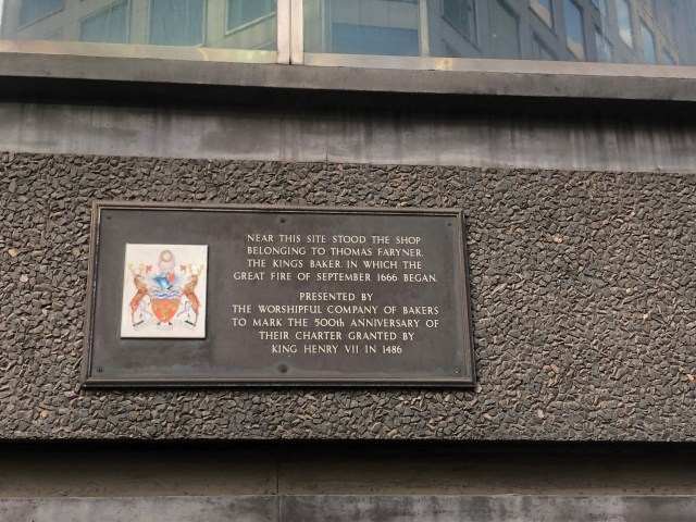
On the north side of London Bridge, tucked away behind Monument tube station, is the Monument itself. It was constructed between 1671 and 1677 as a memorial to the Great Fire of London, which raged through the City in 1666. The fire started in nearby Pudding Lane. There’s a blue plaque marking the spot, which is now the site of an unremarkable office block.
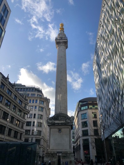
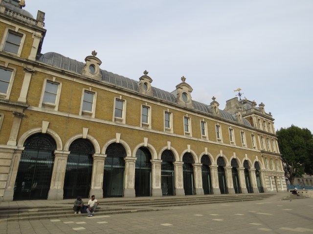
The column was designed by Sir Christopher Wren and Robert Hooke. Wren and his colleagues, including Hawksmoor, were responsible for rebuilding over fifty churches following the Great Fire, including, of course, his masterpiece, St Paul’s. And churches are where I want to start this venture into the City. Not their history, or indeed the history of the City, which is too extensive for this series, but the juxtaposition of the old and new, which is one of the fascinations of the City today. If you don’t know it well, you might think of the City as a succession of modern towers, a glass jungle. But wander the streets and you will find yourself in all sorts of ancient alleys, and come across churches which have stood their ground against the towers all around them. Then again, money and religion have always gone together – add political power and you have a lethal mix.
St Andrew Undershaft
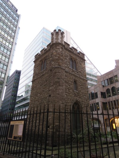
All Hallows Staining
St Margaret Pattens
St Dunstan in the East
St Paul’s from Cannon Street
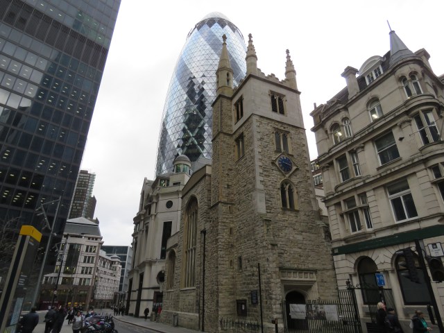
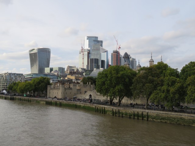
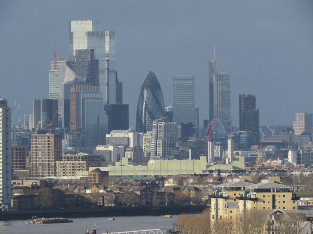
That glass jungle is pretty amazing though. Perhaps not quite as staggering as downtown Manhattan, but still an extraordinary sight – both as a skyline, and from the ground level. There doesn’t seem to have been much of a pattern or plan to the way they have sprung up – this isn’t Paris – but I still gaze in awe as I pass the Gherkin, the Cheesegrater, the Walkie Talkie and other creations, like the Lloyd’s building. They all have more prosaic street names, but I like the way we’ve given them nicknames – at least the most distinctive ones. My two favourites are the Gherkin and the Walkie Talkie, so let’s have a quick look at both of them.
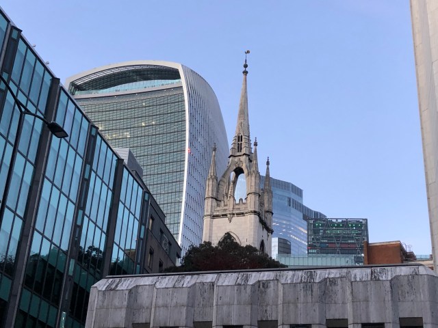
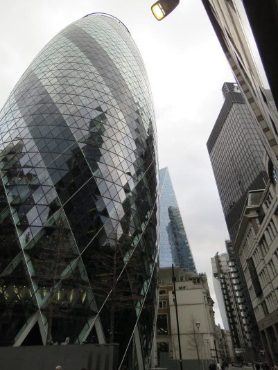
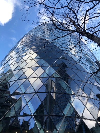
The Gherkin has perhaps the most distinctive design of all the tall buildings, but it’s not quite as tall as some of the surrounding towers (including the Cheesegrater) so you can’t always see it from the river. That depends on where you are on the bends: it’s visible from Lambeth Bridge, but has disappeared by the time you get to the Southbank. Towards Tower Bridge and beyond, it again assumes a prominent position.
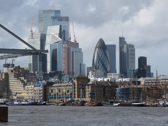
The Gherkin – aka 30 St Mary Axe – was designed by Norman Foster and opened in April 2004. It was built on the site of the Baltic Exchange and Chamber of Shipping, which were badly damaged by an IRA bomb in 1992. The design, I think, is a marvel – I can never get enough of it!
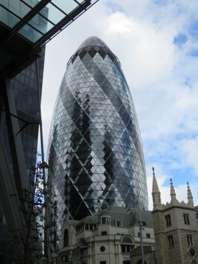
As often happens in the City, when the foundations for the Gherkin were being dug in 1995, they came across Roman remains, including the skeleton of a teenage girl. Pottery found nearby suggests she was buried there around AD 350-400. The skeleton was displayed at the Museum of London for the next twelve years; but in 2007 the “Roman Girl” was re-buried where she had been found after a service at nearby St Botolph’s church, and a memorial built above her resting place.
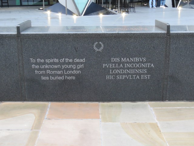
It is poignant to recall too that three people died in the Baltic Exchange bombing, including a 15 year old girl. They are very discreetly remembered on a wall on the other side of the Gherkin to the Roman memorial.
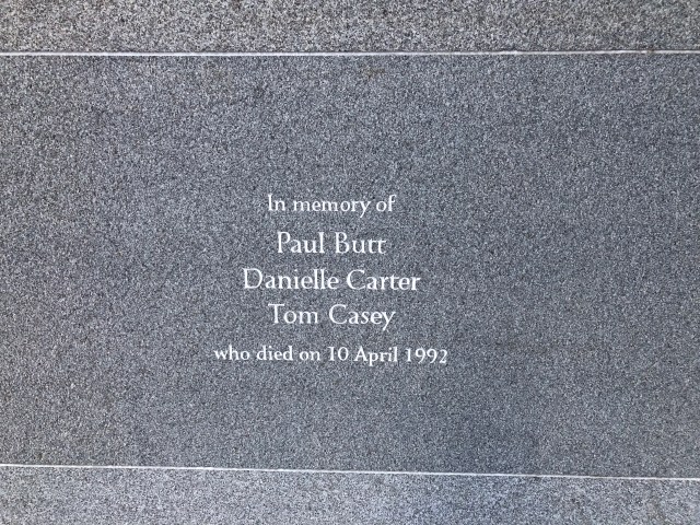
Two young women, centuries apart, whose lives ended prematurely, commemorated at this place of renewal in the heart of the City.
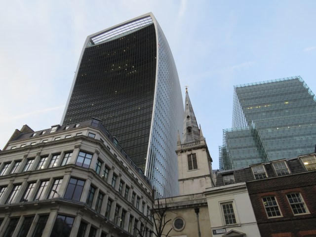
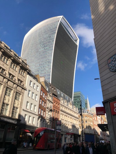
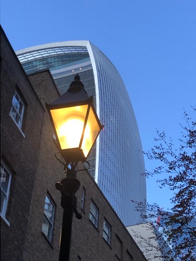
The Walkie Talkie – aka 20 Fenchurch Street – sits about ten minutes’ walk south of the Gherkin. It was designed by the Uruguayan architect Rafael Vinoly and opened in January 2015. Unlike the Gherkin, it dominates every City skyline. It’s not as tall as originally planned, as objections were raised about the potential visual impact on St Paul’s and the Tower of London. But it is still a 38 floor monster, and looms rather intimidatingly over the surrounding streets. I find it endlessly fascinating.
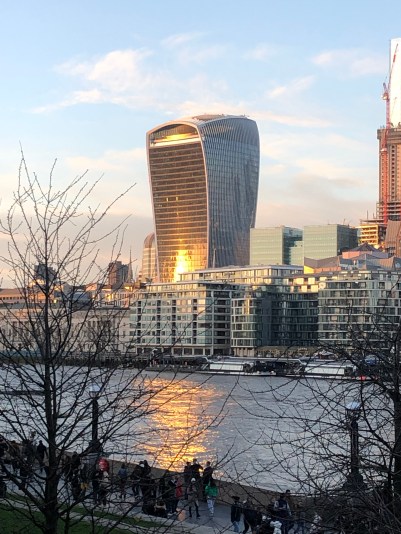
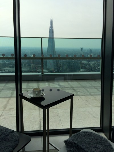
One of the attractive features of the Walkie Talkie is the Sky Garden at the top of the building. There are bars and restaurants, lots of vegetation, and stunning views of London – including a striking perspective of the Shard on the other side of the river.
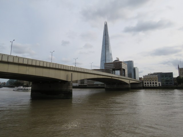
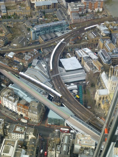
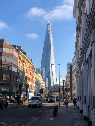
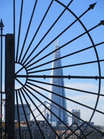
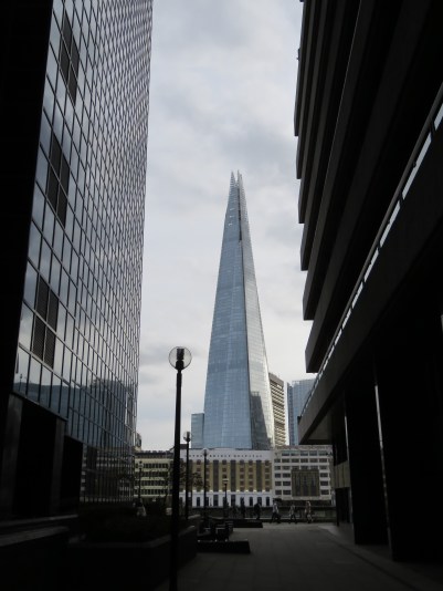
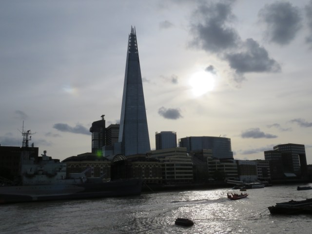
And talking of the Shard, it’s time to wander back over London Bridge, head east along St Thomas Street behind London Bridge station, to the tallest building of them all – in the UK at least. We’ve seen it a few times already, especially in the previous episode. Here are a few more photos from London Bridge and environs.

From a railway platform, London Bridge station
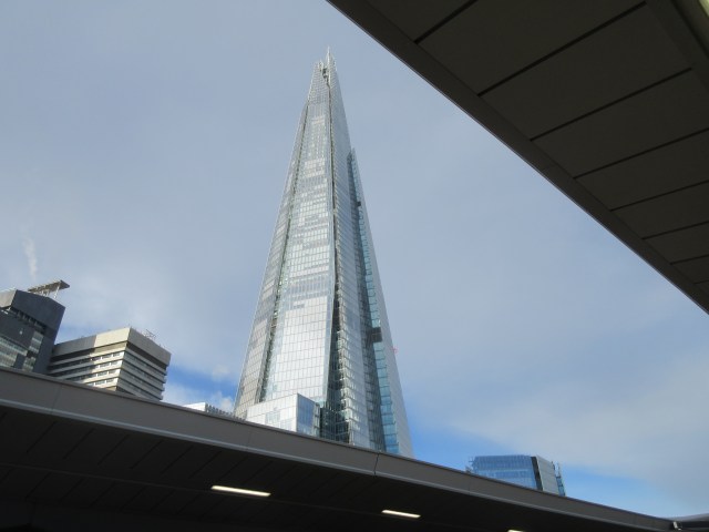
The Shard was completed in 2012, with the public viewing deck opened in February 2013. That’s on the 72nd floor! Needless to say the views are awesome – as are the lifts. It’s a while since I’ve been, but when I went, you took one lift to the 36th floor, then another to the 72nd. Both were unbelievably fast – you seem to float up in a few seconds.
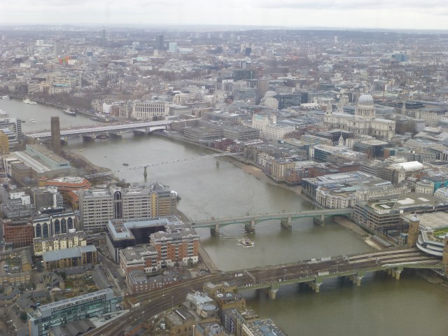
The Shard was designed by the Italian architect Renzo Piano. He was said to have been inspired by the railway lines around the site, the church spires in Canaletto’s paintings of London and the masts of sailing ships. I listened to an old BBC podcast recently, part of a series called Dream Builders, in which Piano was interviewed by presenter Razia Iqbal before an audience at the Royal Institute of British Architects. One thing I took from the interview was how much importance Piano attached to integrating the Shard with the surrounding community. (London Bridge station was redeveloped in the years following its opening.) That said, there was inevitably a lot of opposition to the building. English Heritage claimed it would be “a shard of glass through the heart of historic London”. This was not intended as a compliment, but inadvertently it gave the building its name. And now the Shard is an integral, iconic part of the London skyline, visible from so places.
From Southwark Street
From the Thames at Rotherhithe
From Dark House Walk, off Lower Thames Street
From near the Tower of London
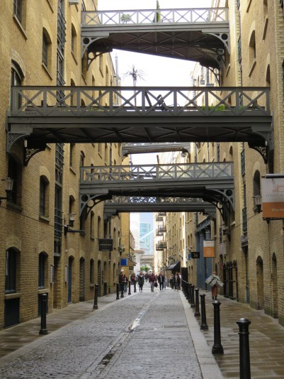
As you come to the end of St Thomas Street, take a right down Bermondsey Street and you come to a vibrant area full of cafés, bars, restaurants and art galleries, including the White Cube, a public gallery with free entry. It’s a lovely space inside and always has interesting exhibitions of modern art.
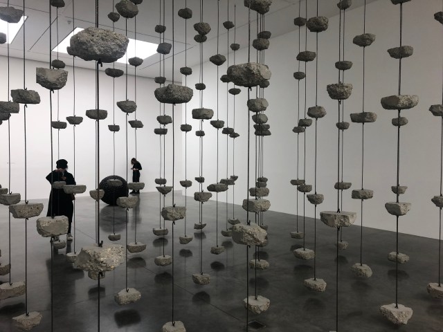
Monica Hatoum – Remains to be Seen, 2019
Haarland Miller – Imminent End, Rescheduled Eternally, 2022
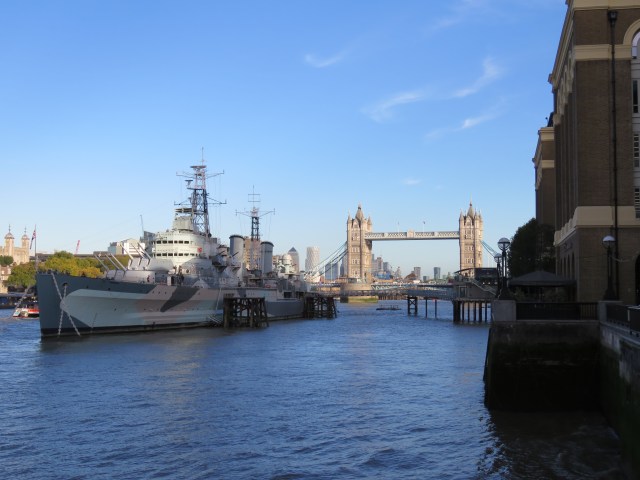
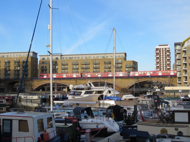
I’ll say a bit more about Bermondsey when we get past Tower Bridge, but for now let’s turn left at the end of St Thomas Street and get back up to the river, where the path is called the Queen’s Walk. At this point we find HMS Belfast, a second world war warship which is now a popular tourist attraction. Nearby is Hays Galleria, a covered area of bars and shops these days, but formerly Hays Wharf, an enclosed dock which in the 19th century was one of the chief delivery points for ships bringing tea into London.

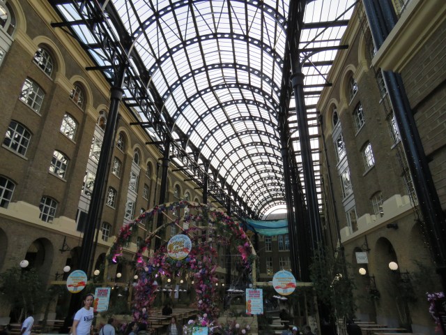
Hays Galleria
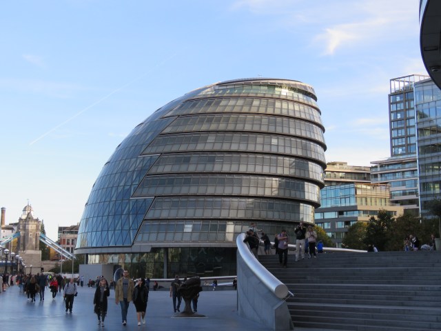
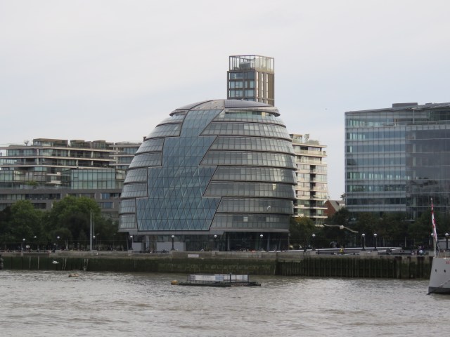
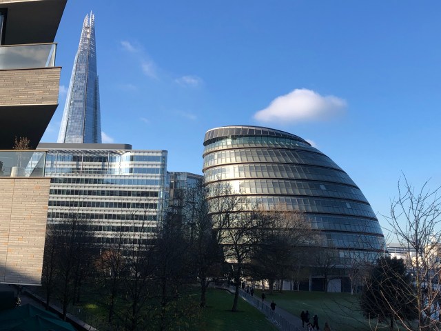
Further along, nearing Tower Bridge, we come along to an open area surrounded by office blocks with, at one end the distinctive shape of City Hall. Like the Gherkin this building was designed by Norman Foster. It opened in 2002 and housed the London Assembly and Greater London Authority administration until December 2021. Back in the mid-2000s I was a regular visitor to the offices in my guise as head of electoral policy in the Department for Constitutional Affairs. The Assembly and GLA moved to the Royal Victoria Dock in Canning Town in 2022, presumably to save money. Good for the local economy of Canning Town – that will feature in the next instalment – but a shame for the Southwark building. Hope it doesn’t just lie empty in future years.
There’s a waterfront park here which gets very busy at weekends – with tourists who’ve been visiting the Tower of London and the bridge, but also with groups of students. The Bridge Theatre looks onto the park. It puts on some excellent productions – a production of Guys and Dolls is currently pulling in the crowds. I saw a production of Julius Caesar there a few years ago, which was brilliant. The audience who were standing in “the pit” became participants in performance, acting as the crowd in various set pieces.
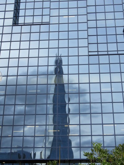
Having reached Tower Bridge, let’s now go back to London Bridge and explore the north side of the river between the two. For the most part you can walk along the riverside to the Tower of London. Before you get there, you pass some modern blocks with interesting designs. I particularly like the Northern and Shell building, for the reflections in its blue windows, including the ubiquitous Shard.
We then come to the old Billingsgate market, which in the 19th century was the largest fish market in the world. Its origins go back until at least the 16th century. The market is now located on the Isle of Dogs, close to Canary Wharf, having moved there in 1982. The City of London Corporation now plans to move Billingsgate, Smithfields (the meat market) and New Spitalfields (fruit and vegetables) to a consolidated site further east, in Dagenham Dock. This is proving controversial, but is expected to be operating by 2027/8.
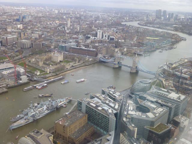
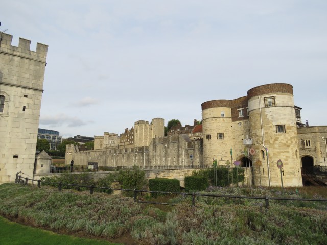
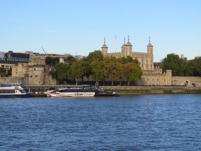
The Tower of London is our next stop. This area is always humming with visitors. But oddly – or perhaps not – I’ve never been inside. The Tower is one of London’s great attractions, furnished by a long history and just as many myths. It was first built by William the Conqueror, starting in 1078, to help subdue an unhappy native population. It was developed further by Henry III and Edward I in the 13th century. It started to be used as a prison in the 12th century, the first inmate being the Bishop of Durham, Ranulf Flambard. He escaped, as it happens. Many a rival or opponent of the monarch was incarcerated there over the centuries, and sometimes tortured and even executed. Notable prisoners included the Young Princes, the sons of Edward IV who were murdered there, probably on the orders of Richard III; the explorer Sir Walter Raleigh after he fell out with Queen Elizabeth; and would-be destroyer of Parliament, Guy Fawkes. Elizabeth herself spent time at the Tower, when her half-sister Mary was Queen. Two of Henry VIII’s wives, Anne Boleyn and Catherine Howard, were beheaded in the Tower. And so it goes on. Today the Tower is best known for housing the Crown Jewels and hosting a number of ravens, who legend has it, are the guardians of the place. It was prophesied back in the days of Charles II that if the ravens leave the Tower, it will fall.
All sounds very interesting – perhaps I should make a visit!
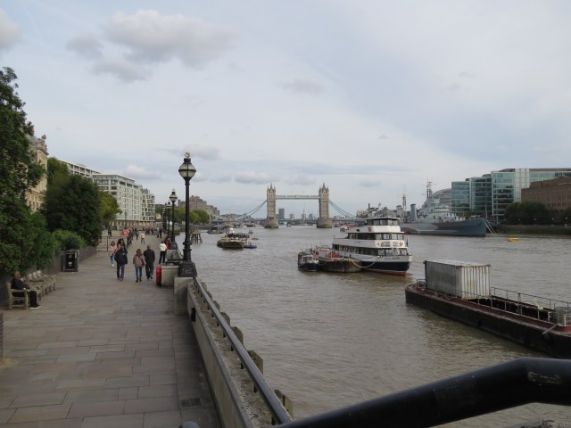
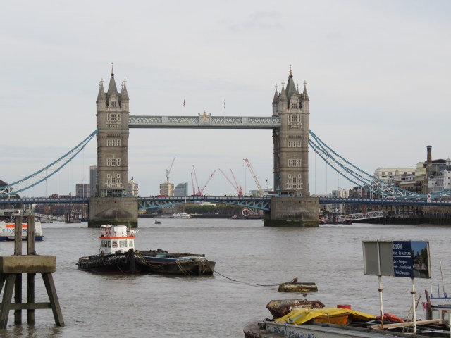
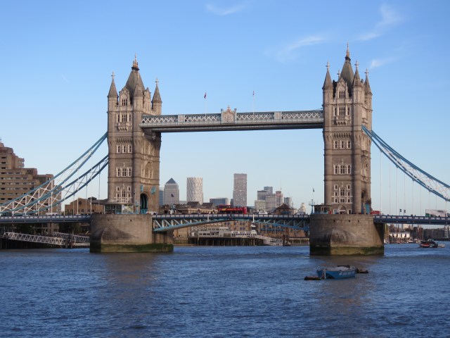
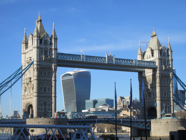
Last year Kath and I took an Elizabeth Line train to Woolwich, just after the line opened. From there we walked to North Greenwich (the Dome) and caught the Uber boat all the way back to Battersea Power Station. It’s a great trip, which features so many of the sights I’ve written about in these blogs. The boat that day was mostly carrying tourists, cameras at the ready. And the most photographed sight by far? Tower Bridge.
Tower Bridge was built between 1886 and 94, designed by Horace Jones and engineered by John Wolfe Barry. Heading downstream, it is the last bridge across the Thames before Dartford, where the M25 motorway crosses the river. It is both a bascule and suspension bridge, to get technical. Bascule means drawbridge in French. A fixed bridge couldn’t be built at street level because it would have impeded some of the tall ships heading into the Pool of London. Today, of course, there are far fewer large boats venturing any further up the Thames, but the bridge does have to be raised from time to time. I was on a walk with my friends Jon and Dave last December and our route crossed over Tower Bridge. The bridge was up when we got there, and a large queue of traffic had already formed. There were some very frustrated looking drivers – I’m not sure all were aware that this might happen. We waited for about fifteen minutes; it was a pleasant, sunny day, good for photos. No problem!
The design of the bridge is unarguably iconic. There is a suggestion that some visitors confuse it with London Bridge; indeed there is a story, probably apocryphal, that the American who bought the old London Bridge and reassembled it in Arizona thought he was getting Tower Bridge! Not everyone welcomed the design in its early days. The architect and journalist Henry Heathcote Statham wrote, “It represents the vice of tawdriness and prententiousness, and of falsification of the actual facts of the structure”; while the painter Frank Brangwyn claimed that “A more absurd structure than the Tower Bridge was never thrown across a strategic river.” I can see what they are getting at, but it is still pretty awesome.
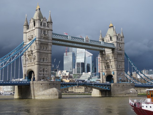
Angry sky, 24 March this year
Let’s switch to the south bank again, for the walk along the river to Deptford, just before Greenwich. We pass along the Bermondsey Wall, then into Rotherhithe, once the location of the mighty Surrey Docks; and then into Deptford. You have to come off the river at Deptford, and the walk along the streets isn’t that interesting; but you can always hop on a bus to expedite your passage to Greenwich.
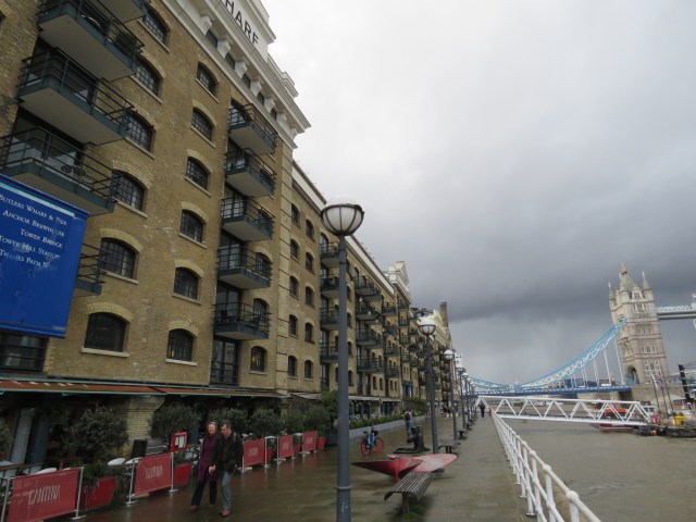
Just past Tower Bridge is Butler’s Wharf, now luxury apartments, shops and restaurants. Apart from its history as a dock and warehouse, it was a performance art space in the 70s, before falling into dereliction before the regeneration of the 80s and beyond. It’s a microcosm of the chequered history of Bermondsey.
Shad Thames
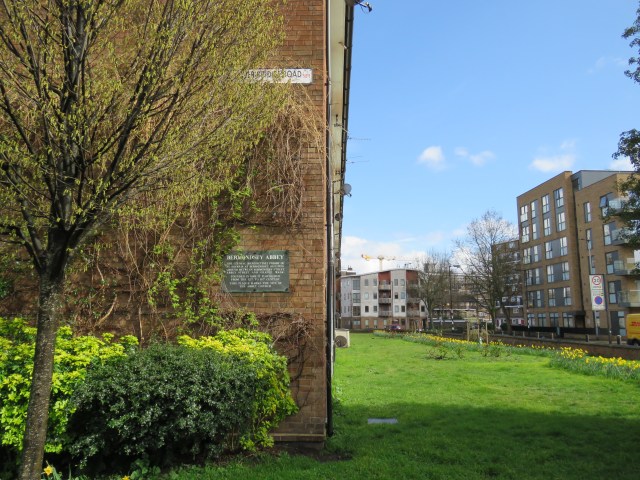
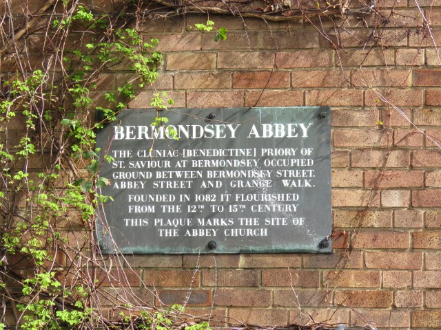
The name Bermondsey may derive from Beormund’s Island – ey denoting an island, in this case possible the high ground in a marshy area. In the 12th century the Abbot of Peterborough laid claim to the area. Bermondsey Abbey, dedicated to St Saviour, had been established in the 11th century. The abbey is no more, but if you walk down Tower Bridge Road for 5-10 minutes you come to a terrace of houses with a plaque denoting the site of the abbey church. On the other side of the road you can find St Mary Magdalene, church, whose origins date back to the 13th century, when the church served lay workers at Bermondsey Abbey.
After the Great Fire of London the area became popular with the wealthy, escaping the riskier north side. It even became a spa town for a while. But with industrialisation in the 19th century, some of London’s worst slums developed near St Saviour’s Dock, a natural inlet of the Thames, which is also the mouth of a now underground river, the Neckinger. In the 18th century pirates operated around the dock, with ships having to wait for a long time to offload their cargoes. They were easy prey; but if you were caught stealing the punishment was death by hanging by the river’s mouth. London slang for the noose included the Devil’s Neckinger – hence the river’s name. To add to the grisliness, one nearby spot, known as Jacob’s Island, is where the Bill Sikes met his fate in Charles Dickens’ Oliver Twist. It’s interesting to imagine all this as you walk past the high end accommodation with names like Java, Cinnamon and Tea Trade wharf!
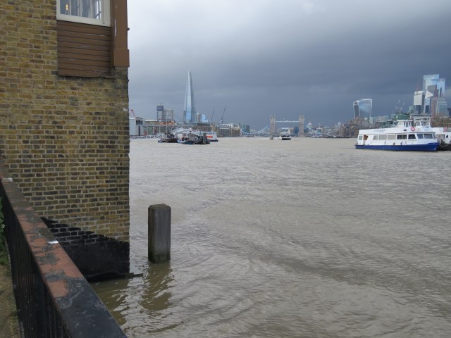
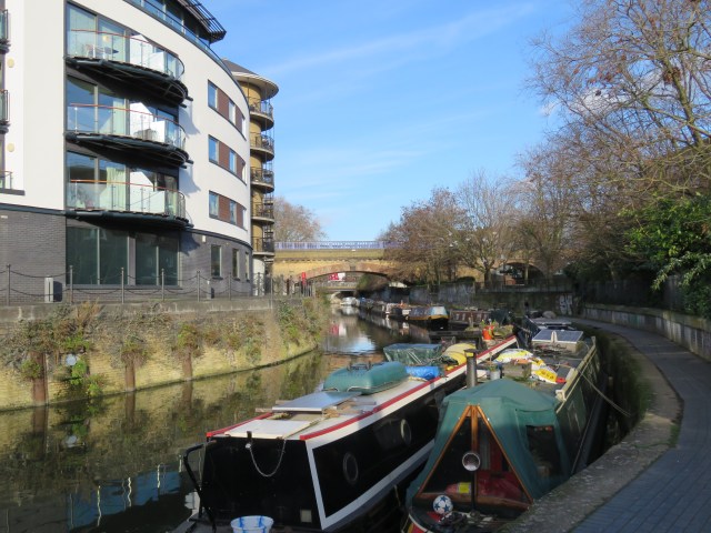
On the other side of St Saviour’s Dock, Bermondsey Wall West begins. The riverbank here is used for mooring. Some are houseboats, others look quite derelict. The views up and down the river are striking.
It is around here in 1838-39 that the artist JMW Turner is said to have painted one of his best known works, The Fighting Temeraire, tugged to her last berth to be broken up. You can see it in the National Gallery these days. The old warship had ended its service and was taken to Rotherhithe for dismantling. The image below is from the National Gallery website. You can see more Turners there – and even more at Tate Britain.
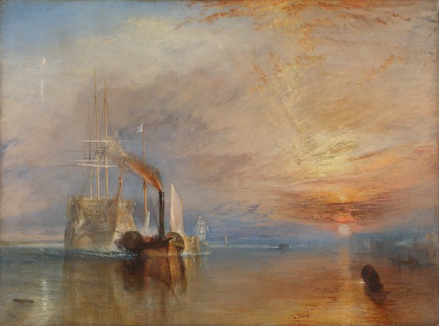
Joseph Mallord William Turner
The Fighting Temeraire
You have to come off the river for a short stretch, but resume on Bermondsey Wall East. We are now in Rotherhithe. You soon come to the ruins of King Edward III’s manor house, dating from around 1350. Nearby there’s a Victorian pub called the Angel. Some say Turner painted The Fighting Temeraire from the pub, which looks directly onto the river. In fact, at high tide the water laps onto the walls and a small wooden balcony. I popped in for a quick beer the other day, only to hear the landlord asking customers to move out of the front room as it was about to flood! Whether this is a regular occurrence, I don’t know.
High tide at the Angel
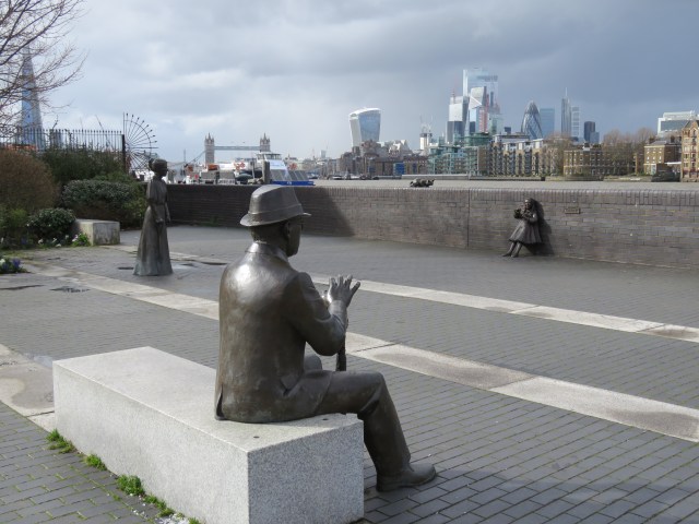
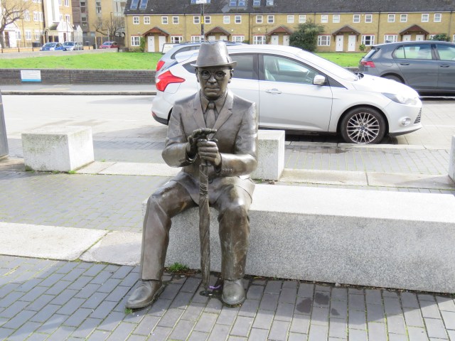
By the riverside, on the other side of the road to the manor house ruins, are four sculptures: of Alfred Salter, his wife Ada and daughter Joyce – and their cat! Salter, born in 1873, was a doctor and philanthropist who with Ada, was dedicated to helping the poor of the area. They both became influential Labour politicians in the early 20th century. Joyce died at the age of eight from scarlet fever, which was sweeping through the Bermondsey slums. The statues of Salter and Joyce, made by sculptor Diane Gorvin, were unveiled in 1991. Twenty years later Alfred’s was stolen! After a fundraising campaign, a new statue of Salter – and one of Ada this time – was unveiled in 2014.
The remains of Edward III’s manor house
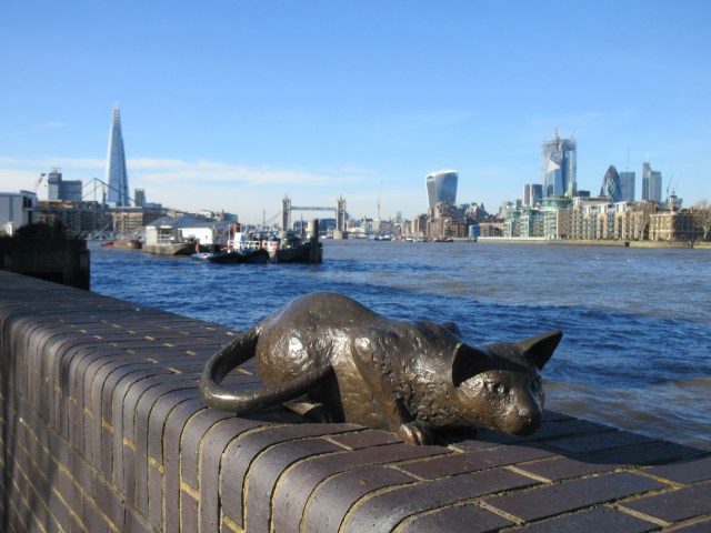
The cat back in February 2019
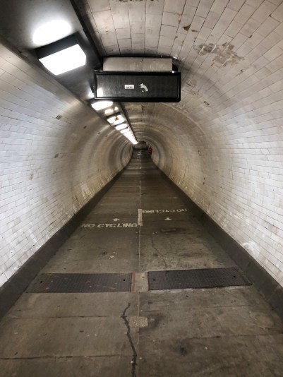
Rotherhithe is thought to mean a landing place for cattle. It has a long history of being an area of docks, with its position on a peninsula formed by the bends in the river. Just beyond the Angel we pass King’s Stair’s Gardens and reach a village-like area with cobbled streets, dominated by St Mary’s Rotherhithe. On the wall the church commemorates the passengers of the Mayflower ship, which set sail from here in 1620 on its pioneering voyage to America. There’s a rather nice pub by the river called the Mayflower, which claims to be the oldest pub on the Thames in London, dating from 1550. Just south of Rotherhithe Street is the Brunel Museum, in which you can learn about the construction of the Thames Tunnel, the first in the world to run under a navigable river. It was built between 1825 and 43 by Marc Brunel and his son Isambard. Connecting Rotherhithe and Wapping, it was initially designed for horse drawn carriages, but was soon favoured by pedestrians. It was converted into a railway tunnel in 1869 for the East London Line, now part of the Overground network.
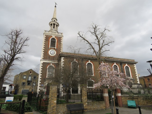
St Mary’s Rotherhithe
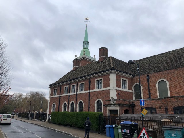
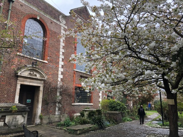
The Surrey Commercial Docks closed in 1970, and for a decade the area fell into decline. And then the regeneration began. Today, it still doesn’t take long to hit some pretty desolate places as you move away from the river, as Dave, Jon, Tony and I found when exploring SE London last year. The area around the New Den, now home of Millwall FC is one example, though the multiple railway lines, atop their arches and embankments do have a certain grandeur. Where there is water though, there is development – Canada Water, Greenland Dock for example. In another case, the Russia Dock, there is now parkland. All these places are named after the parts of the world they traded with, the Russia Dock covering the Scandinavian countries too, with timber one of the main imports. The strong connection with Scandinavia can be seen in some of the local churches. On Albion Street, a short walk south of the river, there are Finnish and Norwegian churches. A little further south, by Southwark Park, there is a Swedish church. The most striking of these is St Olav’s, a place of worship for Norwegian seamen in the past. The current building was consecrated in 1927. It served as a place of worship for King Haakon VII and the Norwegian government-in-exile during the Second World War. The King also used the church as a base for his broadcasts to the Norwegian people.
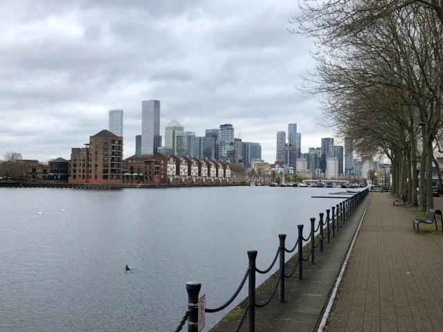
Greenland Dock
St Olav’s
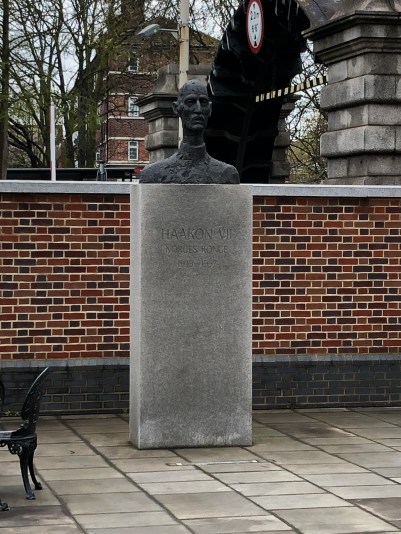
King Haakon VII
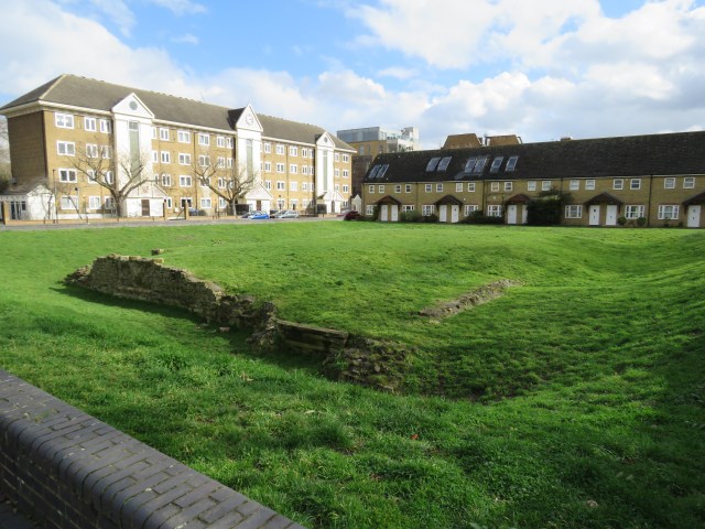
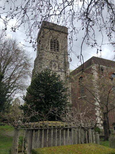
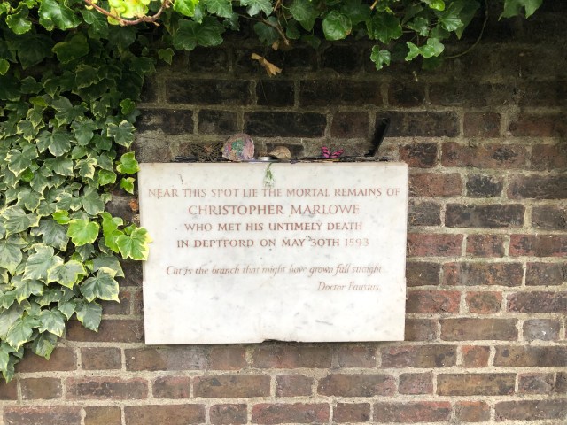
Deptford, from the 16th to 19th centuries was home to the Deptford Dockyard, the first royal dockyard. It was a major shipbuilding centre – Peter the Great of Russia studied shipbuilding there in 1698. He and his entourage stayed at a manor house, Sayes Court, and acquired a reputation for drunkenness, demolishing part of the gardens! Staying with the theme of drunkenness, the Elizabethan playwright (and possibly government spy) Christopher Marlowe was killed in a fight in Deptford in 1593. The cause of the fight has been disputed, but a drunken brawl over money is one possibility. Marlowe is buried in an unmarked grave in St Nicholas Church in Deptford. We paid a visit on our walk last year.
Deptford is named after the ford over the River Ravensbourne, known at its confluence with the Thames as Deptford Creek. Once you have crossed over the bridge, you are in Greenwich. That will be our destination; but first I want to return to Tower Bridge and describe the journey along the north side of the river.
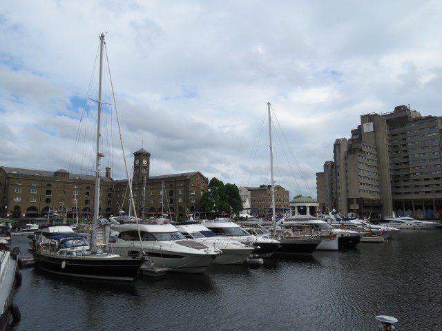
Just past Tower Bridge we come to St Katharine Dock. These were built in the 1820s and eventually amalgamated with the London Docks at Wapping, which is on the next stretch of the river. They specialised in luxury commodities like ivory, spices, coffee, cocoa and tobacco – there is a still a stretch of water called Tobacco Dock just east of St Katharine Docks. The docks were badly damaged by bombing in the Second World War and weren’t restored until the early 1960s. And then containerisation put an end to them as working docks. St Katharine Dock was redeveloped in the 1980s, and is now a marina, surrounded by apartments, restaurants and a large pub called the Dickens Inn. It gets very busy at times, so it’s one to avoid unless you are desperate!
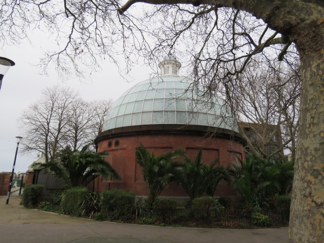
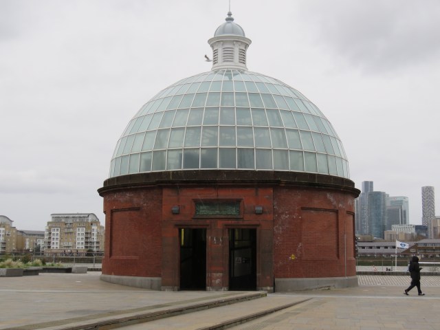
Wapping today is mostly converted warehouses, dotted with the odd café and a couple of venerable pubs, the Town of Ramsgate and the Prospect of Whitby. The latter lays claim to being the oldest riverside pub in London, an honour also coveted by the Mayflower, as we noted earlier. The area is oddly quiet, being mostly residential or offices, and you only get views of the Thames in a couple of parks along the way. When you reach King Edward VII Memorial Park near Shadwell Basin, you have to divert up to a main road rather than walk along the Thames path at the moment, as ventilation towers are being built for the Tideway Tunnel, part of London’s new super sewer. In the park there is also a distinctive domed building which houses an access shaft for the Rotherhithe Tunnel, a road tunnel. There’s a counterpart on the south side near Surrey Water.
St Katharine Dock
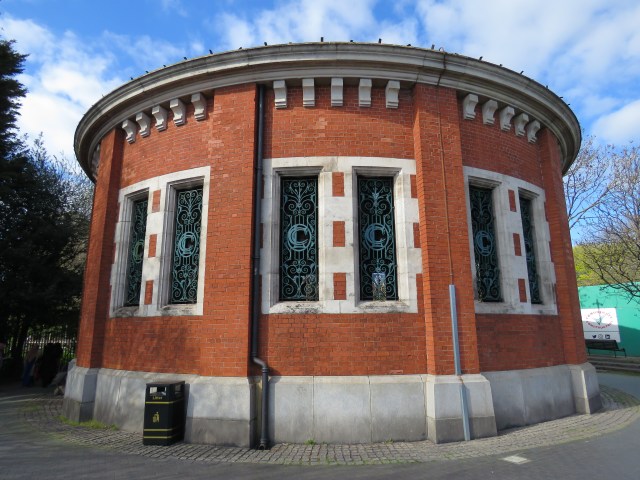
Ventilation shaft for Rotherhithe Tunnel
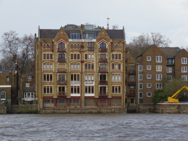
Oliver’s Wharf, Wapping
Wapping became notorious in the mid-80s for the print worker strike in which Rupert Murdoch-owned News International’s new, more automated printworks – somehow built secretly – was picketed by the Fleet Street workers. The battles with the police were second only to those of the earlier miners’ strike. In both cases the unions were defeated and never recovered.
Another 80s memory is jogged as we reach Limehouse Basin, as this is where the Gang of Four – not the Chinese one, or the post-punk band! – made their Limehouse Declaration in 1981. The four were Roy Jenkins, David Owen, Shirley Williams and Bill Rodgers, all senior Labour politicians, who broke away to form the Social Democratic Party (SDP) in response to Labour’s leftward turn. 24 Labour Party MPs joined them. They quickly formed an alliance with the Liberal Party and won 25% of the popular vote in the 1983 general election. However, our first-past-the-post system meant that they only won 23 seats, only six of which were won by SDP MPs. This was also the election where the 1982 Falklands War boosted the Tory vote. Margaret Thatcher remained Prime Minister and embarked on her battles with the unions and privatisation spree. The SDP’s fortunes never recovered and they merged with the Liberals to form the Social and Liberal Democrat party in 1988. The Social soon dropped off the name.
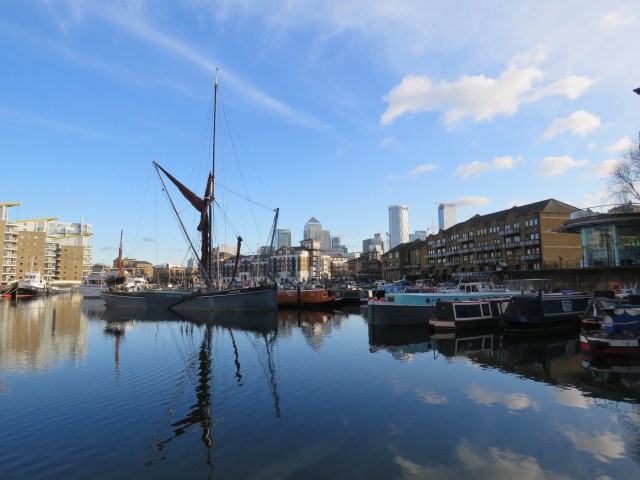
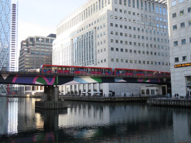
Limehouse Basin opened in 1820, and was known as the Regent’s Canal Dock initially. Two canals are connected with Limehouse Basin. One is the Regent’s Canal, which travels through East London, Islington, King’s Cross, Camden, Regent’s Park and onto Maida Vale, Little Venice and Paddington Basin, where it joins the Paddington Branch of the Grand Union Canal. The second is Limehouse Cut, which joins the River Lea. More of that in the next instalment. Back in the 19th century Limehouse Basin allowed ships that had come down the Thames to transfer their cargoes to smaller boats which could carry their loads along the canals to destinations further afield, notably wood and timber. Limehouse had been a port since medieval times, its name deriving from the lime kilns, or oasts which served the potteries in the area. It was also a shipbuilding centre. Today it is a marina lined, as usual, by apartments and restaurants and bars. There are some great views of Canary Wharf, and an arched bridge carries the Docklands Light Railway over the water.
Limehouse Cut
Regent’s Canal
Down by the river we find Narrow Street, with a Gordon Ramsay restaurant, the Narrow, just by a bridge over the channel connecting the Basin to the river. I and my friends went there in May 2021 after a walk down the River Lea. You were only allowed to eat outside at that point. The food was nice, but a chilly breeze off the Thames had us shivering! Travelling a little further east brings us to the Grapes, another old pub, which is owned by the actor Ian McKellen. Continuing along the Thames Path and over Westferry Circus we find ourselves in Canary Wharf. There are more good views as you approach.

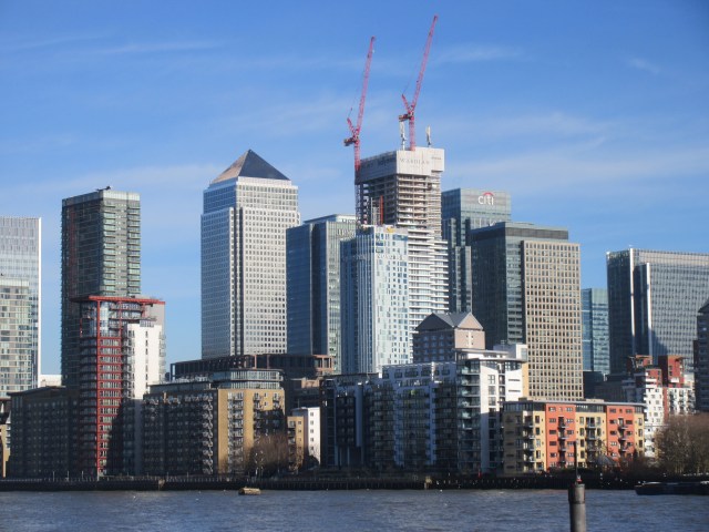
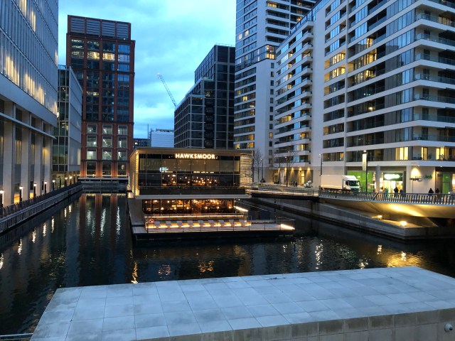
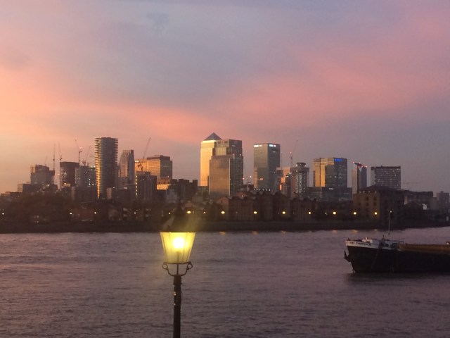
Canary Wharf is a financial centre which rivals the City of London. It has some of the tallest towers in the UK, including One Canada Square, with its distinctive pyramidal top. It was built on the site of the West India Docks, which closed in 1980. The first buildings opened in 1991, including One Canada Square. The area is spectacular if a little soulless as you wander the streets. But there is plenty to entertain you as you get to know the place, including a large roof garden in Crossrail Place. I always enjoy the elevated journey on the Docklands Light Railway here, crossing the docks, looking into the surrounding offices. And since December 2021, there has been an exciting new feature at Wood Wharf – the latest Hawksmoor restaurant, set on a floating pavilion in the dock.
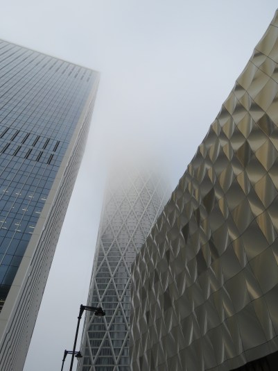
Misty morning, December 2020
Canary Wharf is situated at the northern end of the Isle of Dogs, another peninsula created by the bends in the river. If you walk south, through Millwall, down to the river, you reach Island Gardens where there are some good views of Greenwich, and an entrance to the foot tunnel, which runs under the Thames. It was opened in 1902 and is quite a fun way to get over to Greenwich – though watch out for speeding cyclists. They are meant to push their bikes along the 370 metres, but few do.
Island Gardens tunnel entrance
Tunnel entrance, Greenwich side
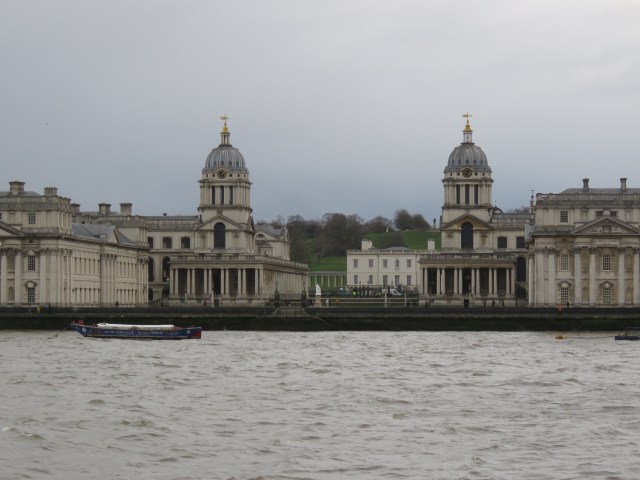
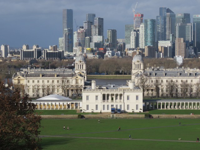
And so, we reach our last stop on this part of the journey, Greenwich. In the past a major maritime centre, favoured location for royalty and, of course the home of the Royal Observatory on top of the hill in Greenwich Park. The classic view, either from the Observatory or from the other side of the river is the Old Royal Naval College, with the Queen’s House resplendent in the background, if you are viewing from the riverside. The site of the naval college was initially home to the Palace Placentia, later Greenwich Palace, built by Humphrey Duke of Gloucester in 1443. Humphrey fell out of favour with King Henry VI and died in prison, possibly murdered. The palace was taken over by Margaret of Anjou, Henry’s wife. The palace was rebuilt by Henry VII between 1498 and 1504, and was the principal royal palace for 200 years. Henry VIII and Elizabeth I and her sister Mary were all born there. The palace was again rebuilt in the early 17th century, and this was when Queen Anne of Denmark, wife of James I commissioned the Queen’s House. This was designed by Inigo Jones and is thought to be the first classical building in England.
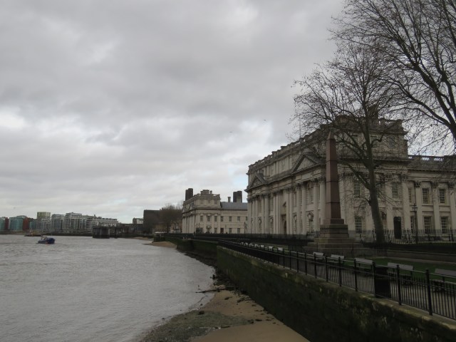
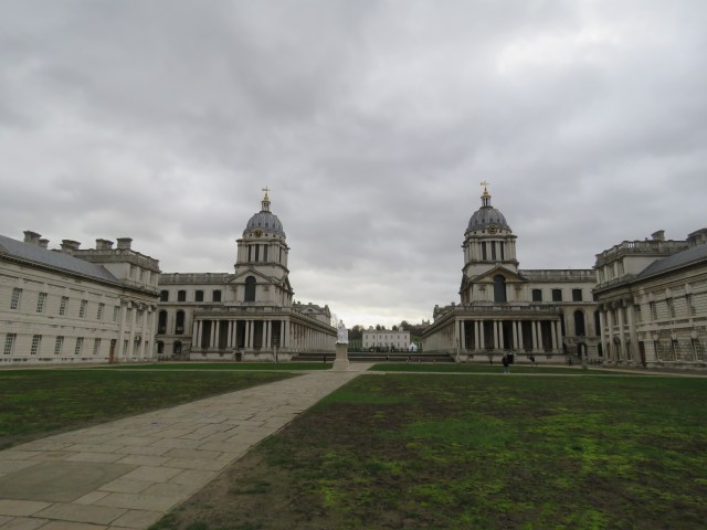
Old Royal Naval College; Queen’s House the white building in centre background
In 1660 Charles II decided to rebuild the palace again, but it never came to fruition. In the early 1690s, Greenwich Hospital, a home for retired sailors was constructed. This lasted until 1869 when the buildings were converted for use by the Royal Naval College. The Navy remained until 1998; the buildings were leased by Greenwich University a year later. The Greenwich Foundation took over ownership and in 2002, the whole site was opened to visitors, including the famous Painted Hall. The National Maritime Museum is situated nearby – there is a lot to see in Greenwich!
The Royal Observatory was built in Charles II’s reign, completed in 1676. The architect was Sir Christopher Wren (who also designed the hospital). It is home to the Prime Meridian and thus Greenwich Mean Time. There are also wonderful views of the Old Royal Naval College, the river, Canary Wharf, the Dome and in the far distance, the City of London. Arguably there are no better views in London. I paid a visit in January for the first time in a while. I found the vistas breathtaking.
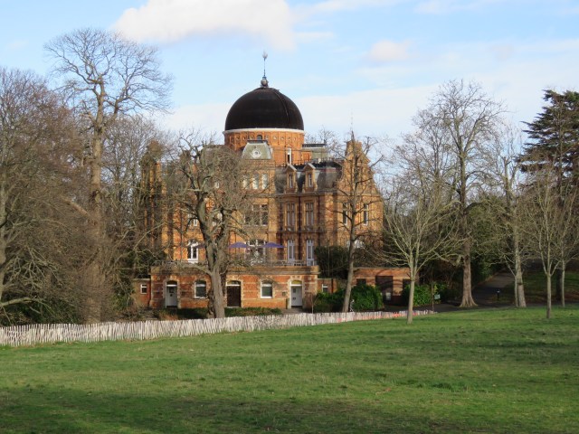
The Royal Observatory
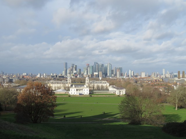
Queen’s House in foreground, Canary Wharf in background
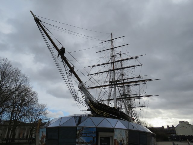
Down below, by the river, you can pay a visit to the Cutty Sark, originally a tea clipper, later used for the Australian wool trade once the Suez Canal opened in 1869. In time it became training ship, first in Falmouth, Cornwall, then in Greenhithe, further downstream on the Thames, between Dartford and Gravesend. It has been damaged by fire twice this century, but is in good shape at the moment. One of the best pubs in Greenwich is named after the ship – it is a little further downstream, beyond the naval college. A good place to stop for a beer and something to eat, after a river walk or a day trip to Greenwich.
A view from the Cutty Sark pub, November 2017
And there we end this part of the Thames journey. There’s been a lot packed into a short distance. The next episode will stretch out a bit more as we move out of London. It will take us downstream to Erith, in Kent, first stop the Dome.
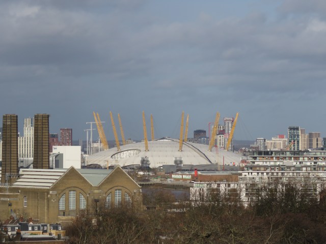
The Dome from Greenwich Park

Love that penultimate picture. Great write up with good mix of pubs and history. The Tower of London deserves a blog of its own!
That pic was of course after a rather good late lunch after our trip to the Prince exhibition at the Dome!
I have marked these posts for my visit, John! Thanks 🙂
Awesome work, John. Lots of memories from our numerous past excursions – and excellent tips for future visits. I really like the way you’ve stitched it all together: and it’s good to have a coherent photo archive too!
Oh, and a quick p.s.? I’ve never been to the Tower either. Odd, that.